-
Posts
1,320 -
Joined
-
Last visited
Content Type
Profiles
Blogs
Forums
American Weather
Media Demo
Store
Gallery
Posts posted by BooneWX
-
-
Anybody had a chance to dive in and see if obs over the Deep South are matching model runs?
-
Pumped they started a thread for Friday’s threat so the whining will dry up in the main storm thread.
-
 2
2
-
 2
2
-
-
1 minute ago, BretWx said:
HRRR trying to run the Apps again

It was looking so good until the low suddenly went poleward 150 miles in an hour.
-
 1
1
-
-
-
I know it’s strong but color me shocked if a low in Charleston produces sleet and freezing rain all the way to the mountains.
-
-
That back end band is going to thump some folks
-
 2
2
-
-
Weird. The low pressure position is significantly better but it shows worse results

-
We didn’t discuss it much but the 06z GFS didn’t blink. It’s been telling the same story for 8+ runs now.
-
 2
2
-
-
Yea I’m still not buying it but that’s more of a gut feeling than anything. I mean at Hr 32, it’s a 996 low in Banner Elk with zero signs of coastal transfer.
-
1 minute ago, wncsnow said:
We get about 6 inches before some sleet gets close
I’m no expert but looking at some of the “sleet” soundings, it sure seems like it’d still be a Snow/Sleet mix. The warm nose is there but not egregiously in our area. I imagine it’d be snowing fatties and mixing with a bit of sleet.
-
If this track shown on the short range models unfolds, have we seen anything like it?? I truly can’t recall anything remotely similar.
-
HRRR is a hell of a front end thump, that’s for sure
-
26 imby with thick clouds rolling in. Not that it’s going to matter a ton, but hopefully we can cap off any heating by the sun and stay locked in the 30s.
-
 1
1
-
-
GFS PASTE BOMB. See y’all in the morning.
-
3 minutes ago, Tyler Penland said:
Plenty of time indeed. I’ve got a weird feeling about the short range models. If the gfs holds serve, I think we’ll see the short range get a clue tomorrow but time will tell.
-
22 minutes ago, wncsnow said:
RGEM still looks similar. A bit less snow but pretty consistent.
Anybody got the clown? Mine is stuck at hr 28 for the snowfall
-
-
Don’t let any model run distract you from the fact that we were golfing and fishing 2 weeks ago. Just enjoy the moment.
-
 13
13
-
-
23 minutes ago, LiQuiDBuD said:
Yikes. I see a period of ZR and mix really close to me. Maybe that's just heavy, heavy rates that get confused with ZR/mix? Not sure if that's even a possibility, but I'm just hoping against ZR IMBY.
Edit: Oh and I wanna see ridiculously heavy rates with fatties. Goes without saying.
Sent from my Pixel 6 Pro using Tapatalk
I’ve lived in the foothills a vast majority of my life and the rule of thumb I’ve always had in most of these setups is that sleet overperforms and saves the day during a transition. Let’s hope that rule of thumb continues but I definitely think my area spends more time as snow, snow/sleet than much else. The warm nose is prevalent on the sounding but it’s not honking at Zr.
-
The trend with Zr in the Euro is highly concerning. Gives me 7 inches of wet snow and over a half an inch of ice. Cut that in half and it’s still lights out.
-
The cutoff is going to be gnarly on the east side. If you look at the town by town probabilities, it’s even more evident.
https://www.weather.gov/gsp/winter -
Beautiful deform band swinging through at 51 to put the final touches on the storm
-
 2
2
-
-
Icon is absolutely unloading on WNC at hr 42
-
 1
1
-
 1
1
-


.thumb.jpg.22bb24bdfb57466248efee282f457dd5.jpg)

2021-2022 Fall/Winter Mountains Thread
in Southeastern States
Posted
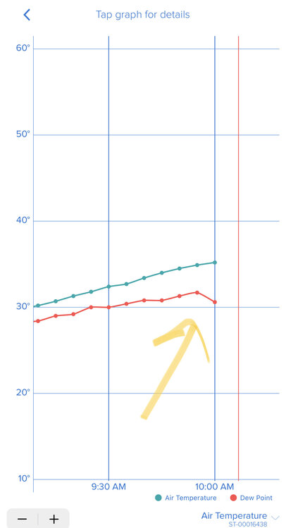
Lol my projection an hour ago is now my “1 in 10” chance.