SnowDawg
-
Posts
1,253 -
Joined
-
Last visited
Content Type
Profiles
Blogs
Forums
American Weather
Media Demo
Store
Gallery
Everything posted by SnowDawg
-
Really pulling for you guys down there and over towards Athens as well. I know I complain sometimes when a storm busts up here in the mountains cause it's been a rough couple years as far as big storms go, but I don't even know what I'd do in a complete snow drought like Atlanta is in. I think I saw the other day that at the airport they are closing in on their longest snowless streak on record.
-

2021-2022 Fall/Winter Mountains Thread
SnowDawg replied to BlueRidgeFolklore's topic in Southeastern States
Yep, nervously hoping against the windshield wiper effect with our trends this afternoon. -
2021-2022 Fall/Winter Mountains Thread
SnowDawg replied to BlueRidgeFolklore's topic in Southeastern States
Given how the discussion was worded I'm kind of shocked to find about 10 inches of snow in my hourly forecast grid. -
2021-2022 Fall/Winter Mountains Thread
SnowDawg replied to BlueRidgeFolklore's topic in Southeastern States
NAM significantly colder and drier both at the surface and mid levels at hr 84 vs the GFS just a few hours before precip onset. -
2021-2022 Fall/Winter Mountains Thread
SnowDawg replied to BlueRidgeFolklore's topic in Southeastern States
Global models starting to advertise strong wind gusts 30/40+ as well. With the paste bomb start plus some potential ice, better get those generators ready. -
2021-2022 Fall/Winter Mountains Thread
SnowDawg replied to BlueRidgeFolklore's topic in Southeastern States
Amazing setup on the Euro. Wow.... That quick transition on the low before it even got up into Tennessee was perfect. Super long duration event. I'm used to 8-12 hour storms and verbatim that has precip for over 24 hours. As always with Miller B though, I'm wary of a dry slot. -
2021-2022 Fall/Winter Mountains Thread
SnowDawg replied to BlueRidgeFolklore's topic in Southeastern States
CMC surface output more closely resembling what GFS soundings suggested it should've shown I think. -
2021-2022 Fall/Winter Mountains Thread
SnowDawg replied to BlueRidgeFolklore's topic in Southeastern States
Heck even down my way it looked mostly snow on the soundings. Like you 99 was definitely a sleet sounding, and for me 96 was iffy but i'd lean snow. -
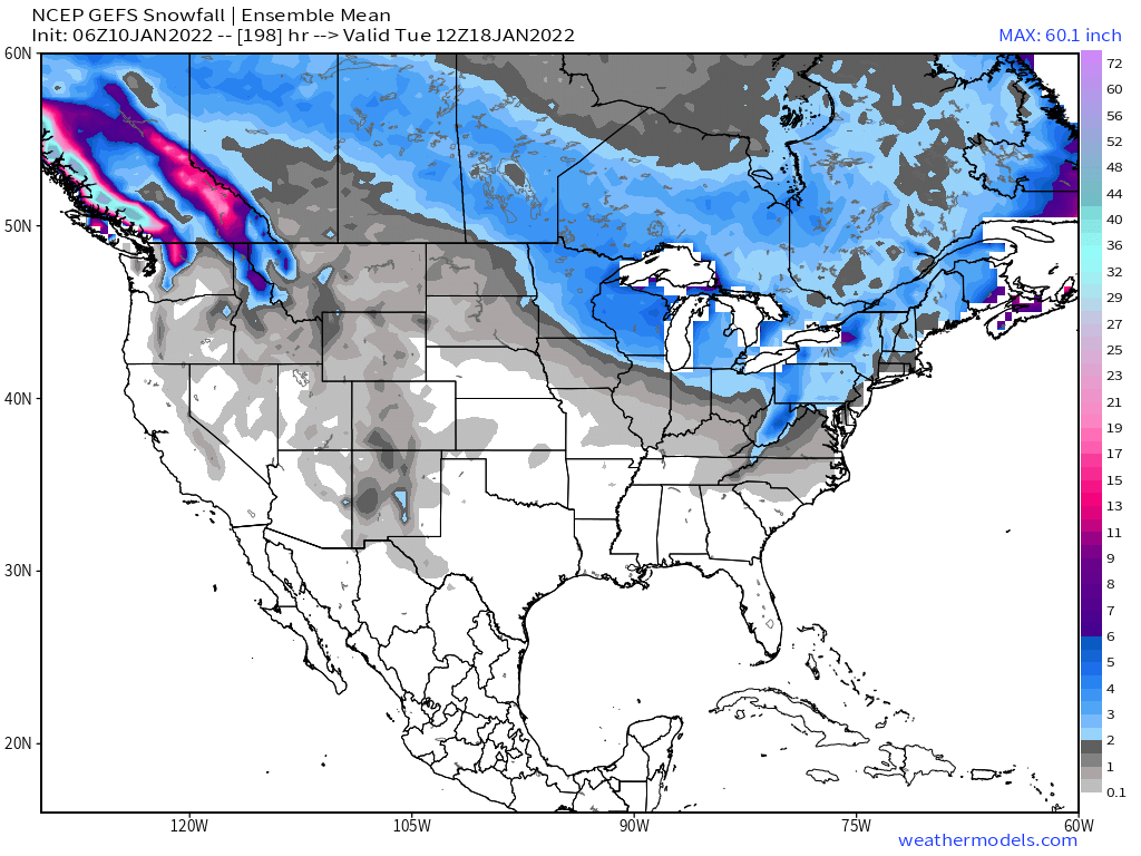
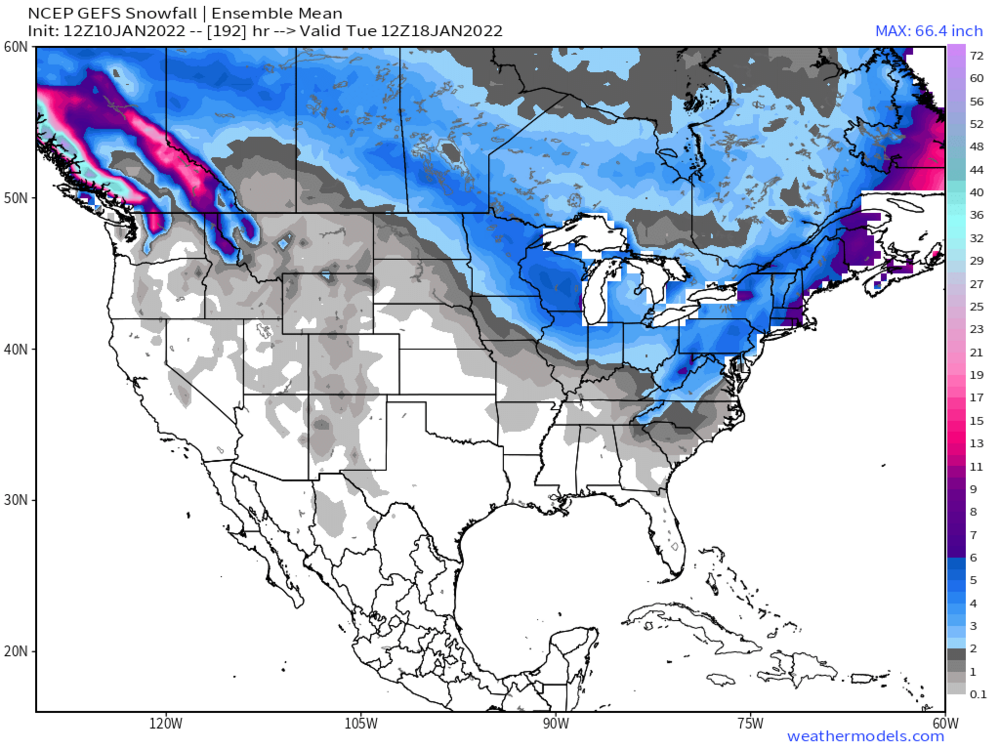
The mean may still look nice on the GEFS, but make no mistake it is quickly trending in the wrong direction too. Big time increase in members cutting west of the Apps.
-
Realistically is there anything we can look for to start reversing this NW trend? Cause right now its in absolute overdrive, that's gotta be like 7 or 8 straight runs. Went from a borderline Miller A setup to cutting west of the Apps in the blink of an eye.
-
OP GFS remains well west of the ensemble, but that being said the ensemble just keeps following it every step of the way, just lagging behind by a few runs. Eric Webb on twitter basically saying cling to the GEFS at your own peril, and the OP likely has a better handle, isn't making me feel any better about where things are heading.
-
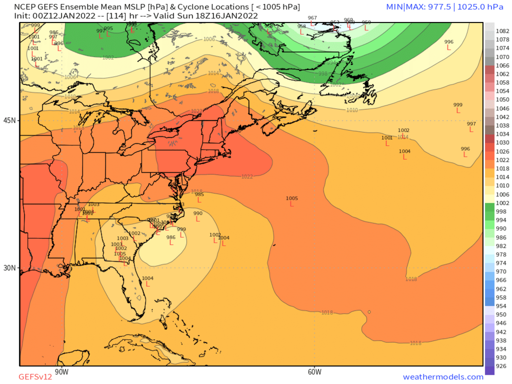
50/50 is 14 mbar deeper at hr 84 compared to 18z. That's the shortwave that got aircraft data, wonder if that's impacting it?
-
Ugh, not loving these trends today. Thought just maybe this could be a storm that I wasn't sitting right on the gradient, which is where things are heading if this keeps up.
-
CMC finally came back to life and finished its run.
-
You guys are definitely spot on about the tug north, and it seems to be coming about because of the slower timing. Yesterday I was seeing onset IMBY around 6-8pm Saturday now it's showing more 1-7am Sunday.
-
Right? I genuinely don't know how to react. Feel like I'm sitting in the bullseye but nervously waiting for the other shoe to drop.
-
I think @burgertimementioned Christmas 2010 last night and just looking through the GSP report, my untrained eyes definitely see some similarities to the GFS solution. Low track and pressure drop nearly identical, just slightly further north as currently modeled. GFS CAD is better than 2010 plus peak climo so it's colder, at least for me in N GA. https://www.weather.gov/media/gsp/localdat/cases/2010/Event_Review_Christmas_2010_Snow.pdf
-
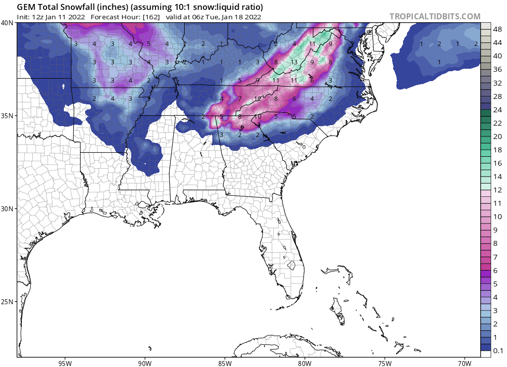
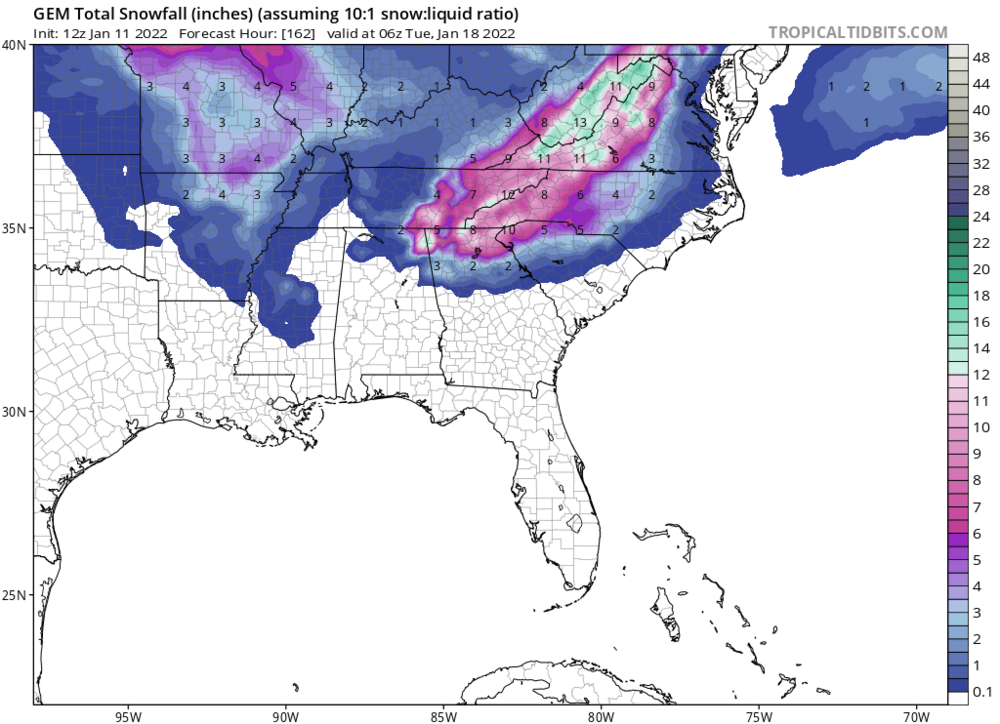
Big jump on the GEFS for the weekend. 06z vs the new 12z both out to 7AM on the 18th.

-
2021-2022 Fall/Winter Mountains Thread
SnowDawg replied to BlueRidgeFolklore's topic in Southeastern States
Guess the GFS heard your call for a monster fantasy storm. Phase a little late for us back west but that's too small a detail to get caught up in at this range. -
36 and rain/mix was as good as it got here in my corner of North GA this morning, despite the HRRR's insistence on more right down to the end.
-
2021-2022 Fall/Winter Mountains Thread
SnowDawg replied to BlueRidgeFolklore's topic in Southeastern States
-
2021-2022 Fall/Winter Mountains Thread
SnowDawg replied to BlueRidgeFolklore's topic in Southeastern States
LP has formed. Feels like maybe a bit ahead of time.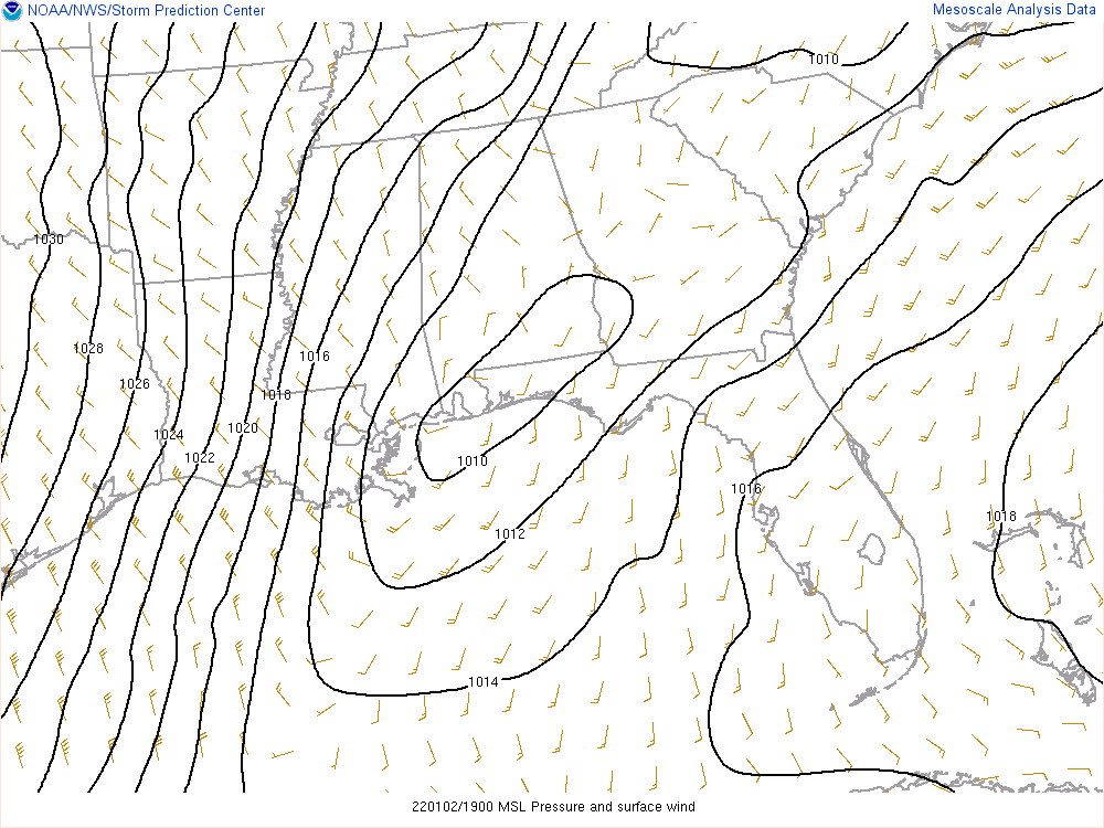
-
February 18-19 MAJOR Ice Storm Threat
SnowDawg replied to NorthHillsWx's topic in Southeastern States
It is way off on dew points though just like it was with the snow event 2 weeks ago. For me it showed a 3 pm dew point of 32, actual is 23. -
February 18-19 MAJOR Ice Storm Threat
SnowDawg replied to NorthHillsWx's topic in Southeastern States
This for sure! Remember this is what all the models, I mean every single one, missed on for our snow event. They all underestimated the dry air at the surface by a significant margin leading to a stronger in-situ wedge and a busted forecast for most of them.