NJwx85
-
Posts
19,658 -
Joined
-
Last visited
Content Type
Profiles
Blogs
Forums
American Weather
Media Demo
Store
Gallery
Everything posted by NJwx85
-
The Canadian is going to end up better.
-
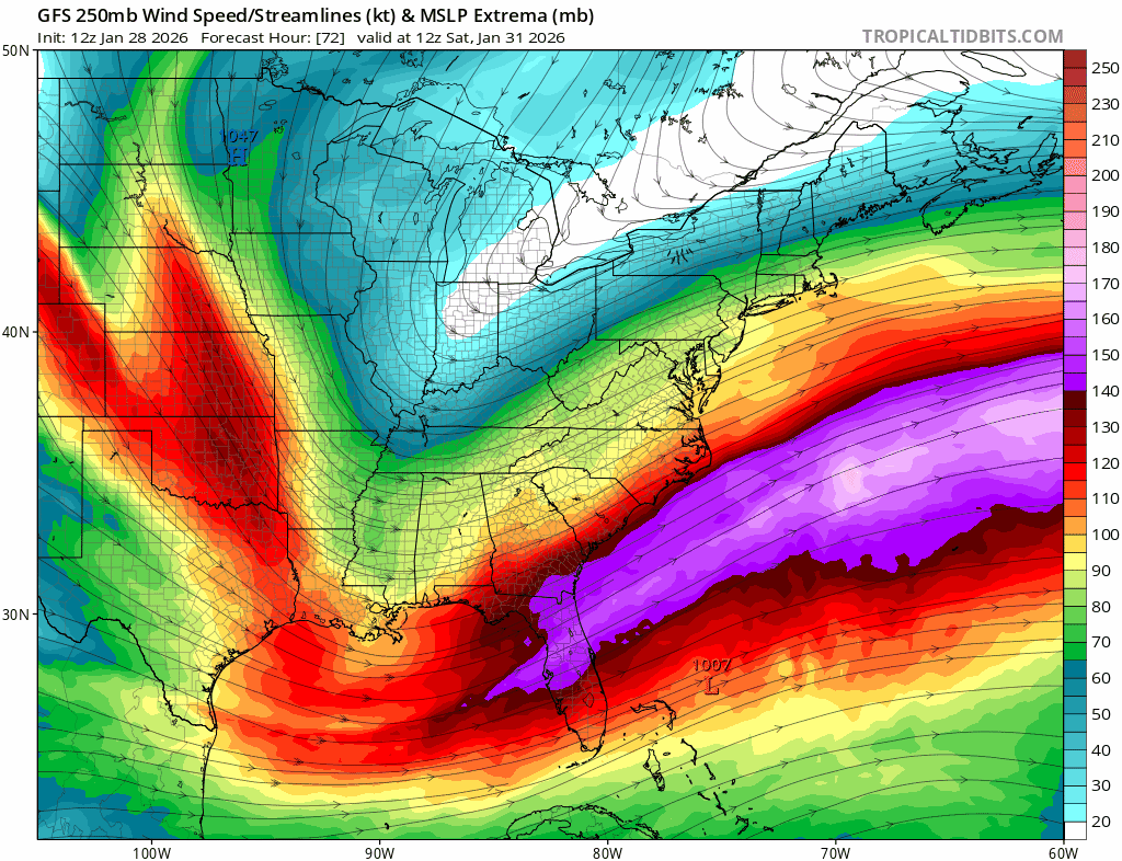
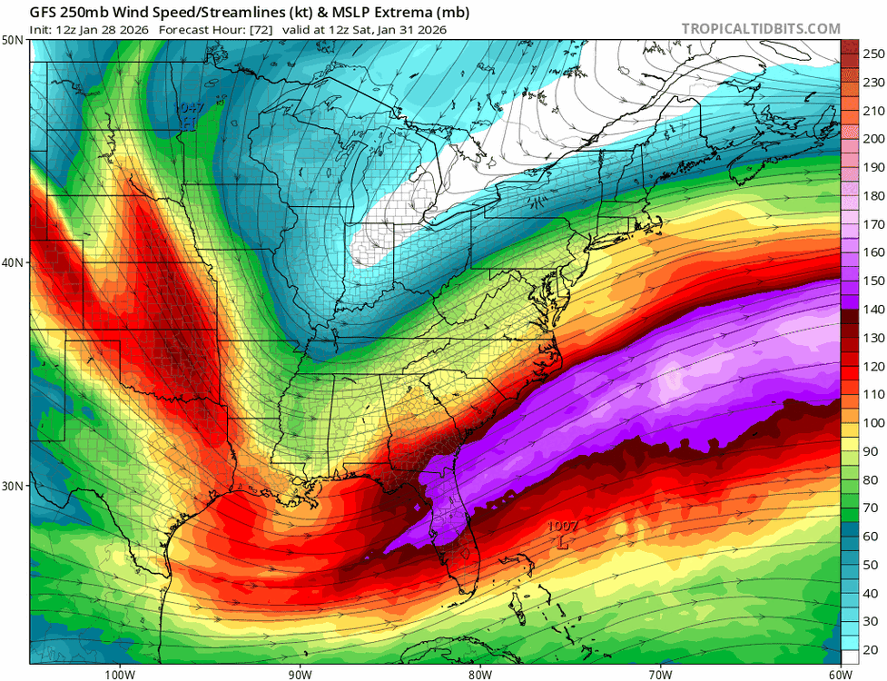
No, I just showed you the 250mb winds. The trough orientation is wrong.
-
Early on the Canadian looks better.
-
You can’t get a storm to turn the corner with a big positively tilted trough, especially when it starts that far South.
-
There was a bit more precip on the NW side but it was a setup back in the upper levels.
-
Bye, bye

-
No chance with upper level winds like this
-
It’s going to end up a tad worse than 06z. The trough axis is a tick further East.
-
The GFS is a hot mess, focusing on the SLP near Bermuda as the dominant feature.
-
What a mess with all of these surface lows.
-
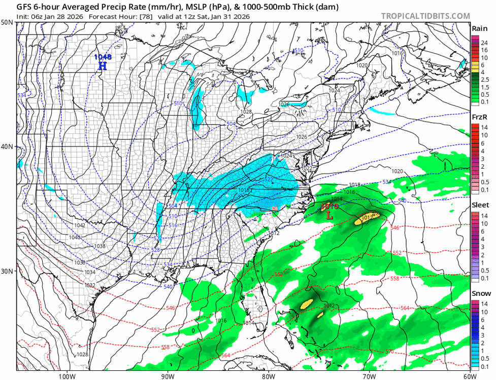
Not much change on the GFS through 06z Saturday.
-
Yeah I was out in it as a volunteer firefighter at the time. We were out chasing downed trees and power lines. Then the next night the river flooding started. There was massive runoff in the hills from the big February snowstorms. The only thing that topped it was being out during Sandy. March 2010 is one of my all time favorite storms. The wind and rain were unbelievable. And in hindsight, it was stupid and dangerous for us to be out in both storms. During Sandy a tree narrowly missed our truck and after that we stopped operations until the next day.
-
BTW, I was wrong. 3/3/10 was a snowstorm. 3/15/10 was the big rain storm that caused 9 deaths.
-
Are you referring to March 2010? It was also March, not late January. There’s a lot more cold air to work with. The analogs are based on 500mb similarities. It’s just a tool to compare past events to current setups at 500mb. It doesn’t mean a repeat is likely.
-
You have no idea what you’re talking about and I’ll just leave it at that.
-
I went from Nothing in Morris County to a blizzard. I ended up with like 24” or so. 50 miles to my West had less than 6”.
-
The top 5 analogs over the East at 96hrs from CIPS. Some all time greats. 1) 1/23/16 2) 12/26/10 3) 1/8/96 4) 3/3/2010 - Massive rain and wind storm 5) 2/24/89
-
Yes that would be correct. It went from a miss to a massive hit at like 48hrs out. Don’t quote me on the exact timing but it was Christmas Eve.
-
I have, 12/26/10, and it happened on 12/24.
-
The NAM looks like the GFS, that kicker is there.
-
18z ICON says congrats Bermuda.
-
The kicker was weaker this run.
-
Yeah but you would think there would be a more expansive precip shield on the NW side. I know its occluding but it does deepen from 982 to 966 in 12 hours while just South of the area.
-
The low SLP moves almost due East from OBX.
-
It’s kind of weird how Boston gets snow Sunday morning while we get flurries.