NJwx85
-
Posts
19,685 -
Joined
-
Last visited
Content Type
Profiles
Blogs
Forums
American Weather
Media Demo
Store
Gallery
Everything posted by NJwx85
-
HRRR running way too warm.
-
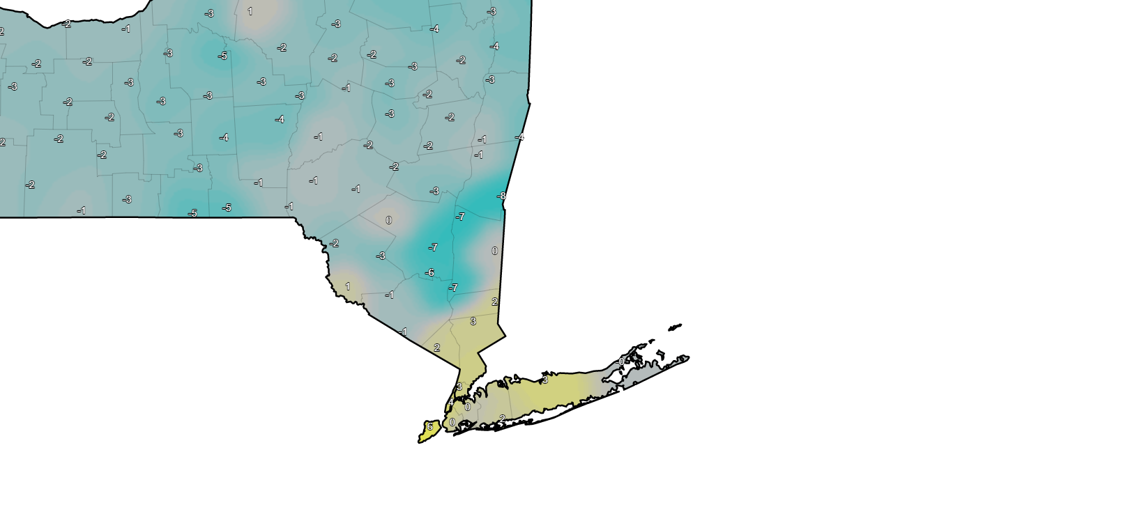
Temperatures starting to crash in the Mid Hudson Valley. SW Duchess County is down 8 degrees in the past 3 hours.
-
Holding steady at 41 degrees. Was supposed to get up to 43 by midnight so running 2 degrees colder than forecasted. That doesn't bode well.
-
28 degrees with moderate rain is about as ugly as it gets here.
-
00z GFS. About the same as 18z but a little more sleet mixing in.
-
0.75” + for Rockland.
-
Down to 39 degrees here now.
-
Yes most of Clarkstown just closed. West NYACK and Felix Festa went remote.
-
Driving home it was 39 in Suffern, 42 in Spring Valley and 41 here in Bardonia. You can see exactly where the gradient is.
-
41 degrees in Mahwah. Those 50’s were out to lunch.
-
This happened once before, I believe 2007. WWA was eventually upgraded to an ice storm warning in places. I believe that is the last time we had one in the NYC warning area outside of maybe Western Passaic.
-
They really needed to drag the 0.25"+ line down to at least Southern Rockland County.
-
Rockland County at 15z tomorrow. 3k 18z NAM.
-
Southern Bergen County at 18z tomorrow. 3k 18z NAM
-
It drops quite a bit more liquid than the Euro between 18z and 00z. Temps really plummet after 12-15z.
-
The last few runs of the HRRR have been trending colder in the near term.
-
If it gets colder even an hour or two sooner it's going to make a difference.
-
I think the reason for the warm tongue into Sullivan County is because of the difference in elevation. The cold air is very shallow.
-
12z Euro gets extreme NNJ and the Hudson Valley below freezing by 12z. That's the key. It actually trended 1-2 degrees colder at this hour than the 00z run.
-
The long range HRRR is similar. Watching for trends.
-
LOL at the GGEM. 20 degree drop in six hours. I don't think so.
-
19 degrees in Poughkeepsie, 22 degrees in Warwick and 30 degrees in White Plains at the same hour. The real cold air isn't far away.
-
It's not a one size fits all scenario. 0.5" will accrete much faster at 28 degrees than it would 32 degrees.
-
Of course it is or I wouldn't bother posting it. It has most areas North of I-80 below freezing by 12z.