NJwx85
-
Posts
19,741 -
Joined
-
Last visited
Content Type
Profiles
Blogs
Forums
American Weather
Media Demo
Store
Gallery
Everything posted by NJwx85
-
Extreme Cold, Snow & Sleet: SECS 1/24 - 1/26
NJwx85 replied to TriPol's topic in New York City Metro
The 00z ICON is 12-18” for most with lollies 20”+. And it lingers snow most of Monday. -
Extreme Cold, Snow & Sleet: SECS 1/24 - 1/26
NJwx85 replied to TriPol's topic in New York City Metro
If you thought Metfan was the biggest weenie on here, think again. -
Extreme Cold, Snow & Sleet: SECS 1/24 - 1/26
NJwx85 replied to TriPol's topic in New York City Metro
My top 3 biggest heartbreaks are: 2/8/13 2/5/10 March 2001 Biggest Miracle: 12/26/10 Biggest storm missed while alive: PD2 - was in FL at Daytona 500. -
Extreme Cold, Snow & Sleet: SECS 1/24 - 1/26
NJwx85 replied to TriPol's topic in New York City Metro
I remember it well. 2 days off school for an inch of slop. -
Extreme Cold, Snow & Sleet: SECS 1/24 - 1/26
NJwx85 replied to TriPol's topic in New York City Metro
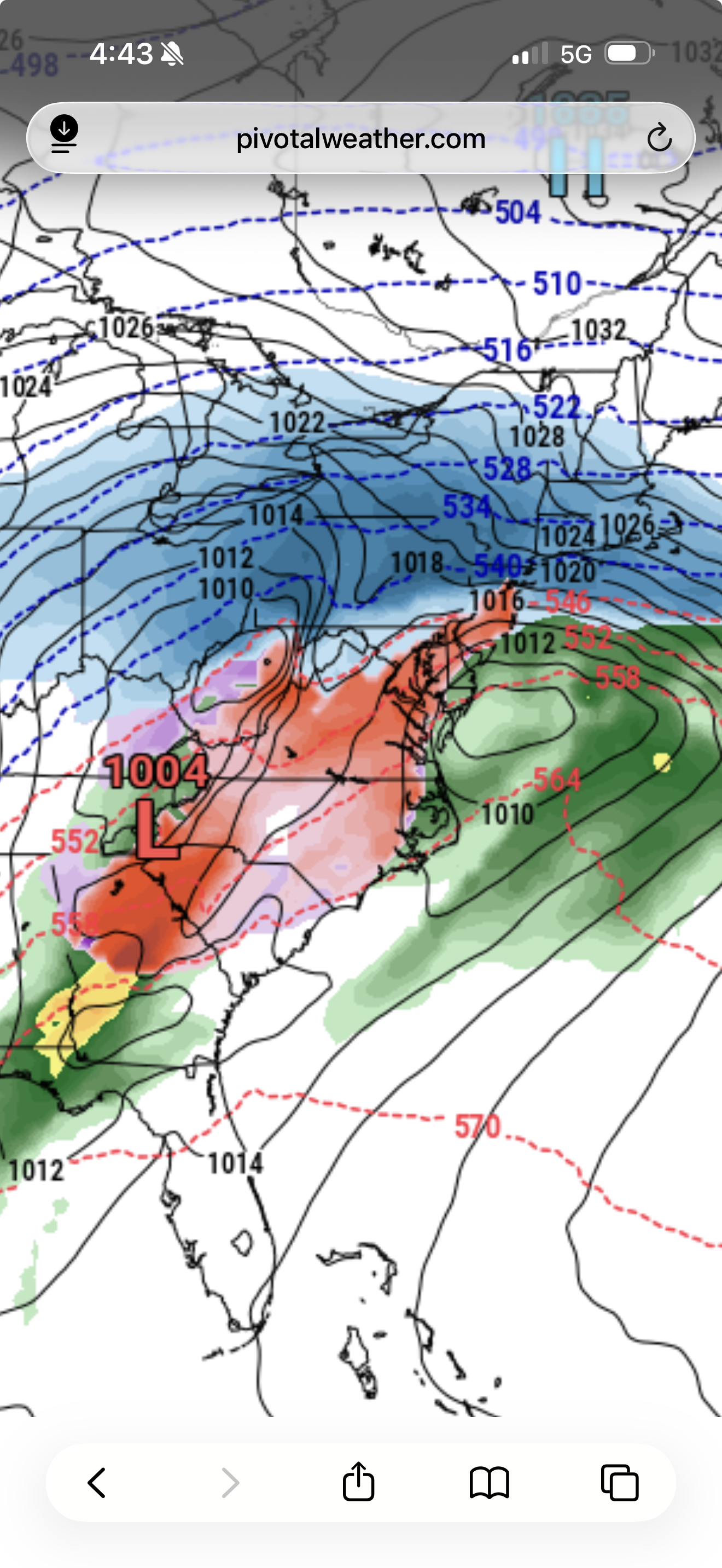
Pivotal weather shows freezing rain but I have a hard time believing it with a 1035mb low over Quebec and a weak surface low off the VA Capes. Primary low dies over West Virginia.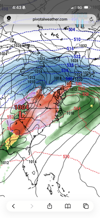
-
Extreme Cold, Snow & Sleet: SECS 1/24 - 1/26
NJwx85 replied to TriPol's topic in New York City Metro
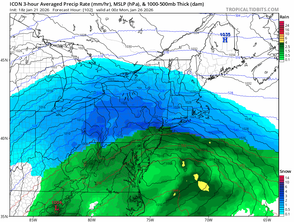
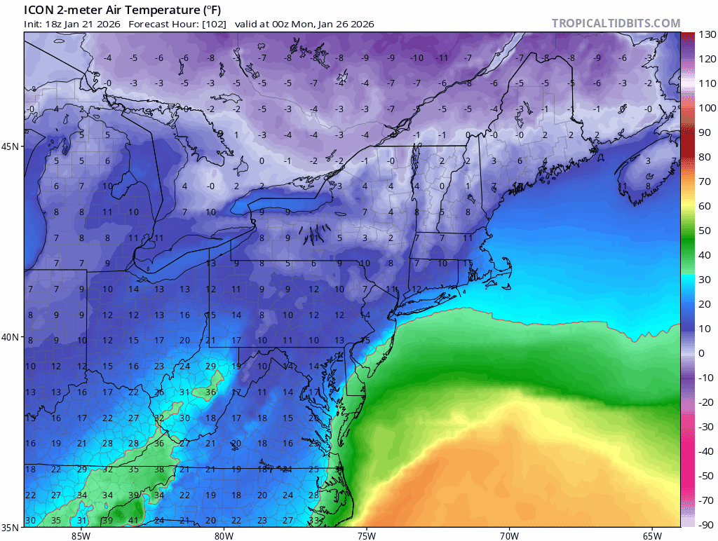
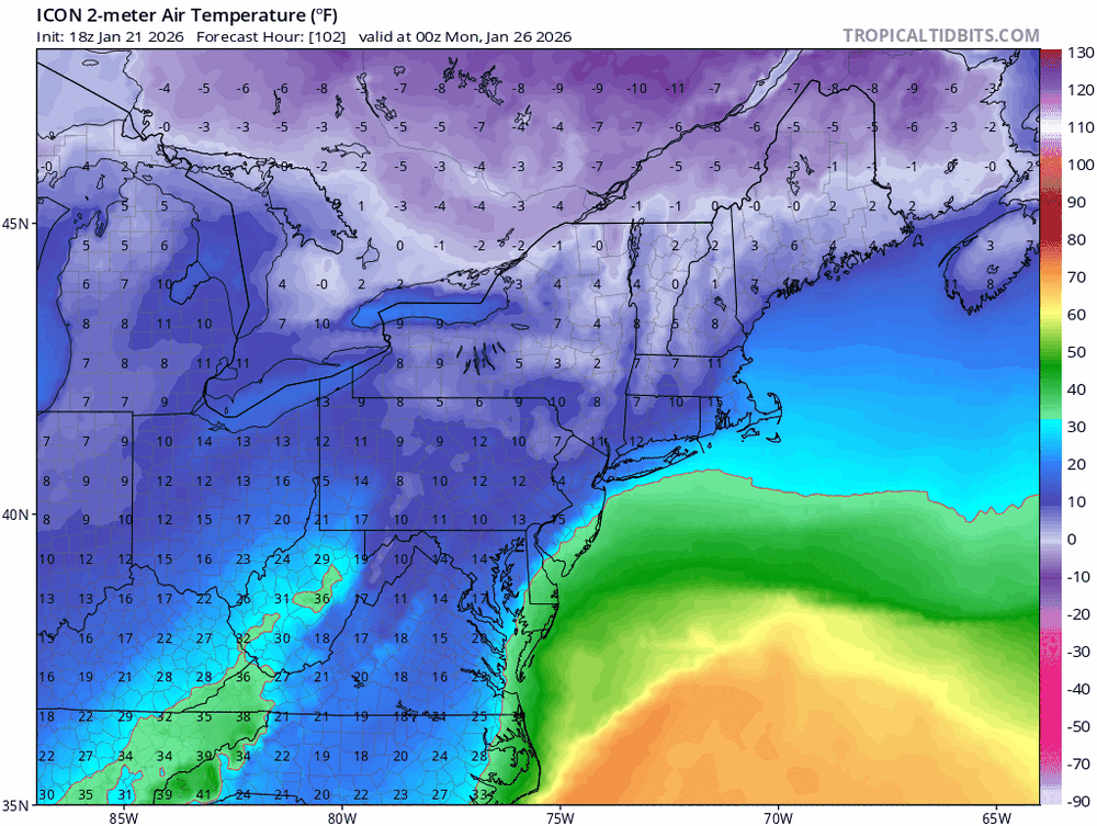
This doesn’t look accurate to me. I think it’s a crappy output from a crappy model. You have 2m temps in the teens in VA and Eastern PA where it’s showing rain.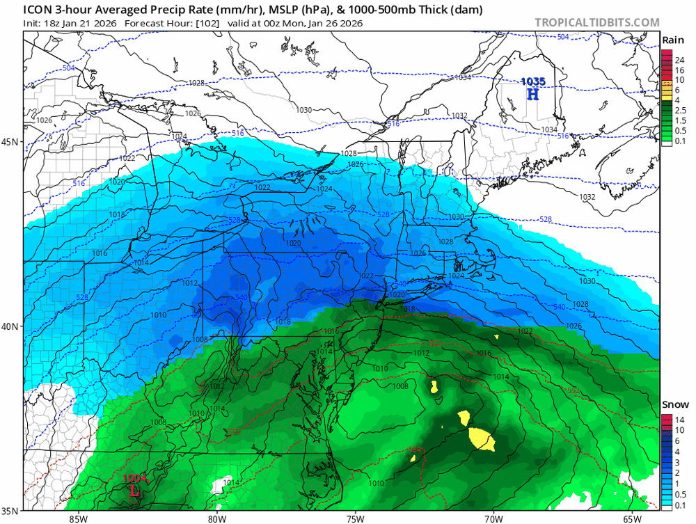
-
Extreme Cold, Snow & Sleet: SECS 1/24 - 1/26
NJwx85 replied to TriPol's topic in New York City Metro
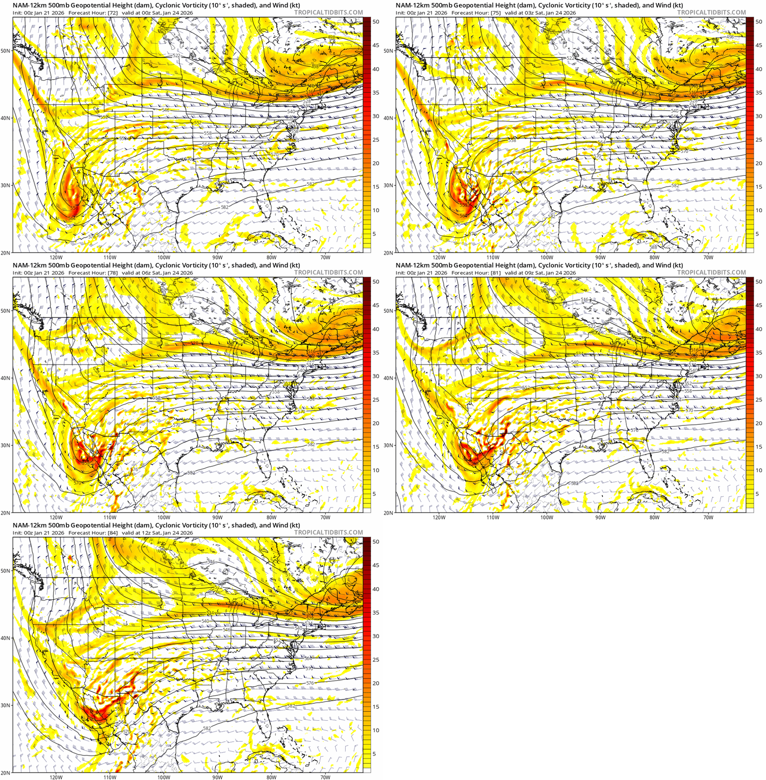
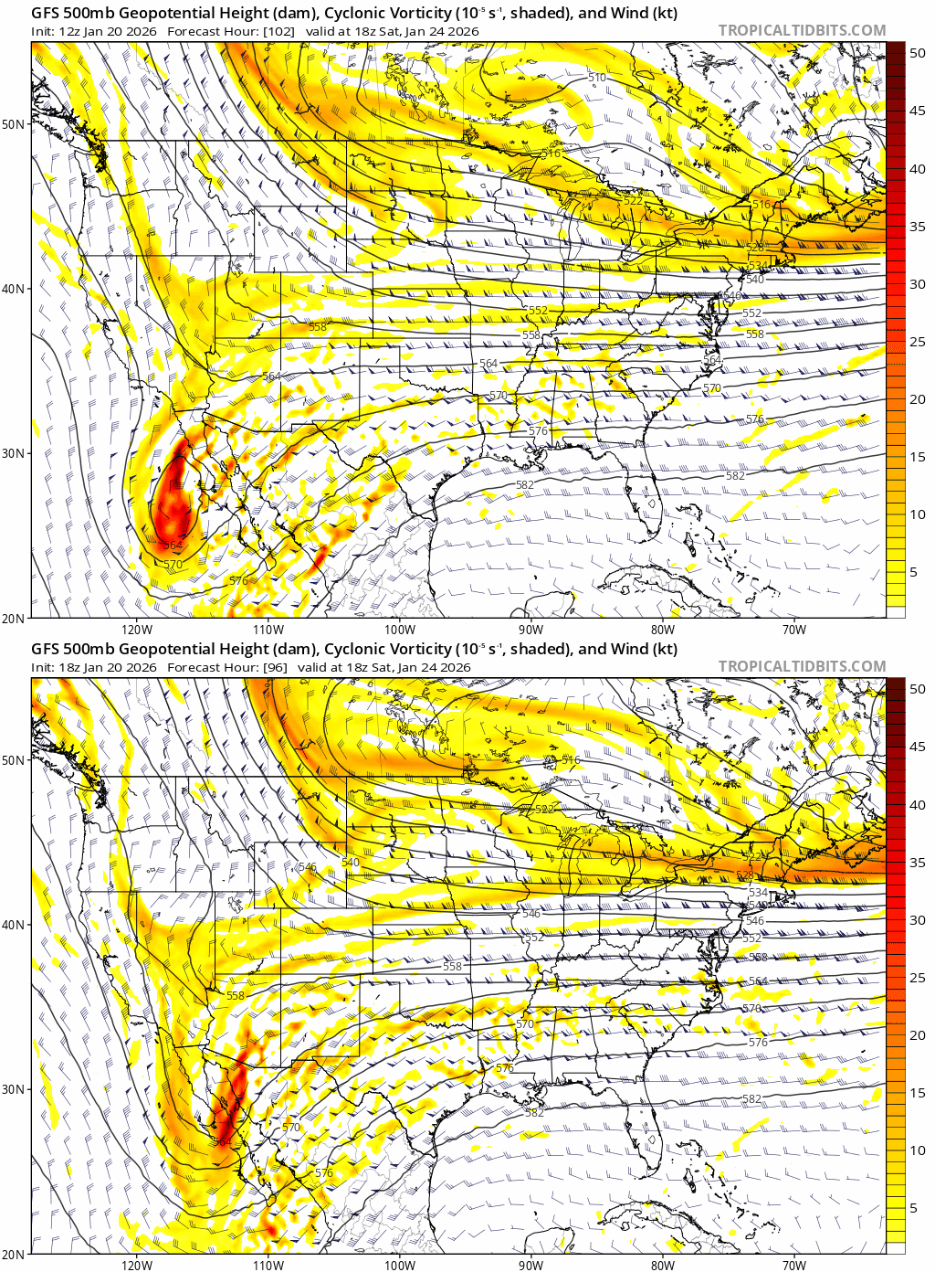
All the models have it down there. The key is it ejecting Saturday morning. It’s interesting that one piece of this storm will bring rain to Southern CA on Friday. -
Extreme Cold, Snow & Sleet: SECS 1/24 - 1/26
NJwx85 replied to TriPol's topic in New York City Metro
Can we get a separate banter thread please? Too much nonsense here the last few hours. -
Extreme Cold, Snow & Sleet: SECS 1/24 - 1/26
NJwx85 replied to TriPol's topic in New York City Metro
Basic physics tells you that you can’t run the upper level low into a 1038-1040mb high. If we didn’t have blocking it would be a completely different story. Heavy snow to a dry slot followed by the potential coastal on Monday is much more likely at this point than significant mixing issues. However, even 96 had some sleet up this way. Can’t rule it out but any guidance holding on to that primary North of say Pittsburg is likely wrong. -
Extreme Cold, Snow & Sleet: SECS 1/24 - 1/26
NJwx85 replied to TriPol's topic in New York City Metro
The Canadian is NOT a good model and I wouldn’t be concerned with it at all unless it started moving back towards a more suppressed look. It’s over amplifying the trough and not handeling the airmass to the North well. -
Extreme Cold, Snow & Sleet: SECS 1/24 - 1/26
NJwx85 replied to TriPol's topic in New York City Metro
The general rule of thumb is that clown maps are for clowns. They aren’t useful for making serious weather forecasts. They don’t account for a lot of things. The short term models like the HRRR are useful for picking up banding or mixing issues. You have in this case a raging jet stream slamming into a brick wall of dense, dry arctic air. It gonna snow, a lot. -
Extreme Cold, Snow & Sleet: SECS 1/24 - 1/26
NJwx85 replied to TriPol's topic in New York City Metro
My parents are coming into HPN from SJU Sunday night and that’s not happening either. Best part is they are on a cruise and have no idea it’s coming. -
Extreme Cold, Snow & Sleet: SECS 1/24 - 1/26
NJwx85 replied to TriPol's topic in New York City Metro
The primary hanging on too long can sometimes be problematic. If I recall that was the issue with March 2001. -
Extreme Cold, Snow & Sleet: SECS 1/24 - 1/26
NJwx85 replied to TriPol's topic in New York City Metro
We’re not getting sleet lol That cold air is way too entrenched. -
Extreme Cold, Snow & Sleet: SECS 1/24 - 1/26
NJwx85 replied to TriPol's topic in New York City Metro
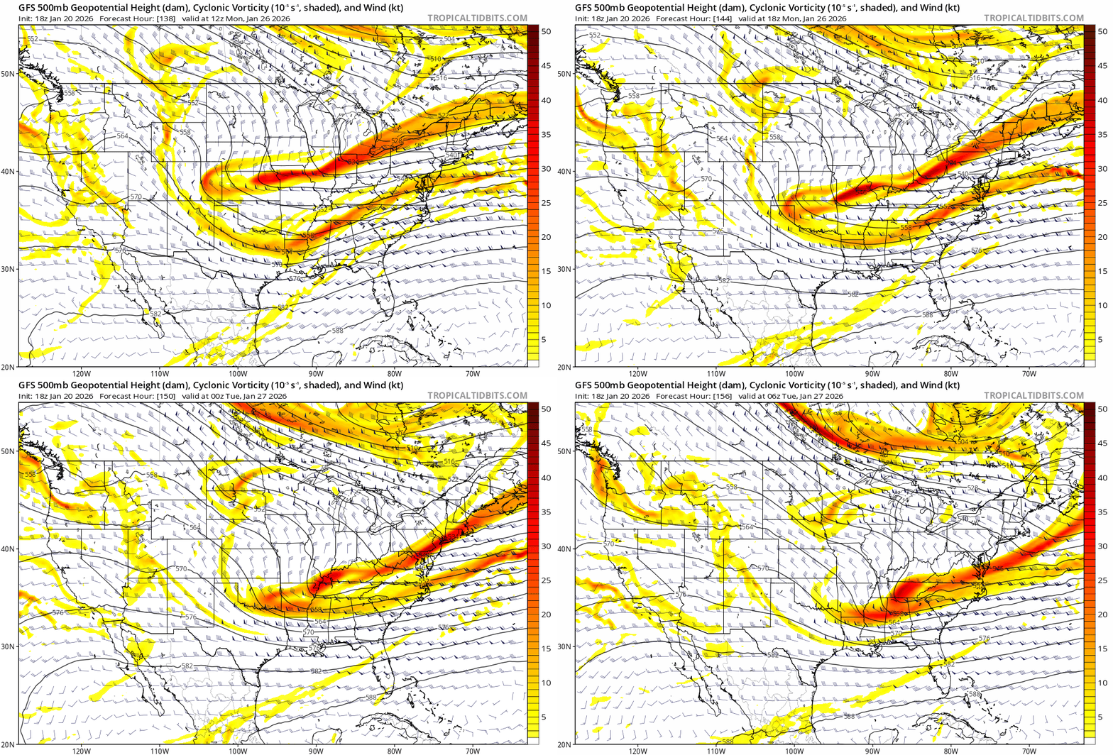
What a band.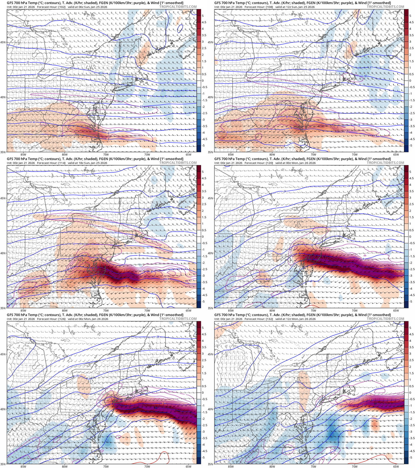
-
Extreme Cold, Snow & Sleet: SECS 1/24 - 1/26
NJwx85 replied to TriPol's topic in New York City Metro
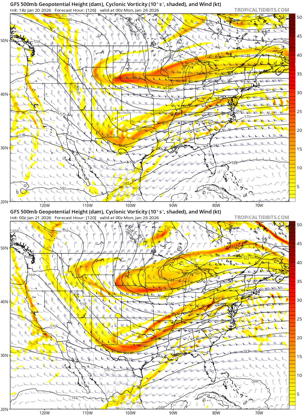
Much cleaner phase and better trough orientation.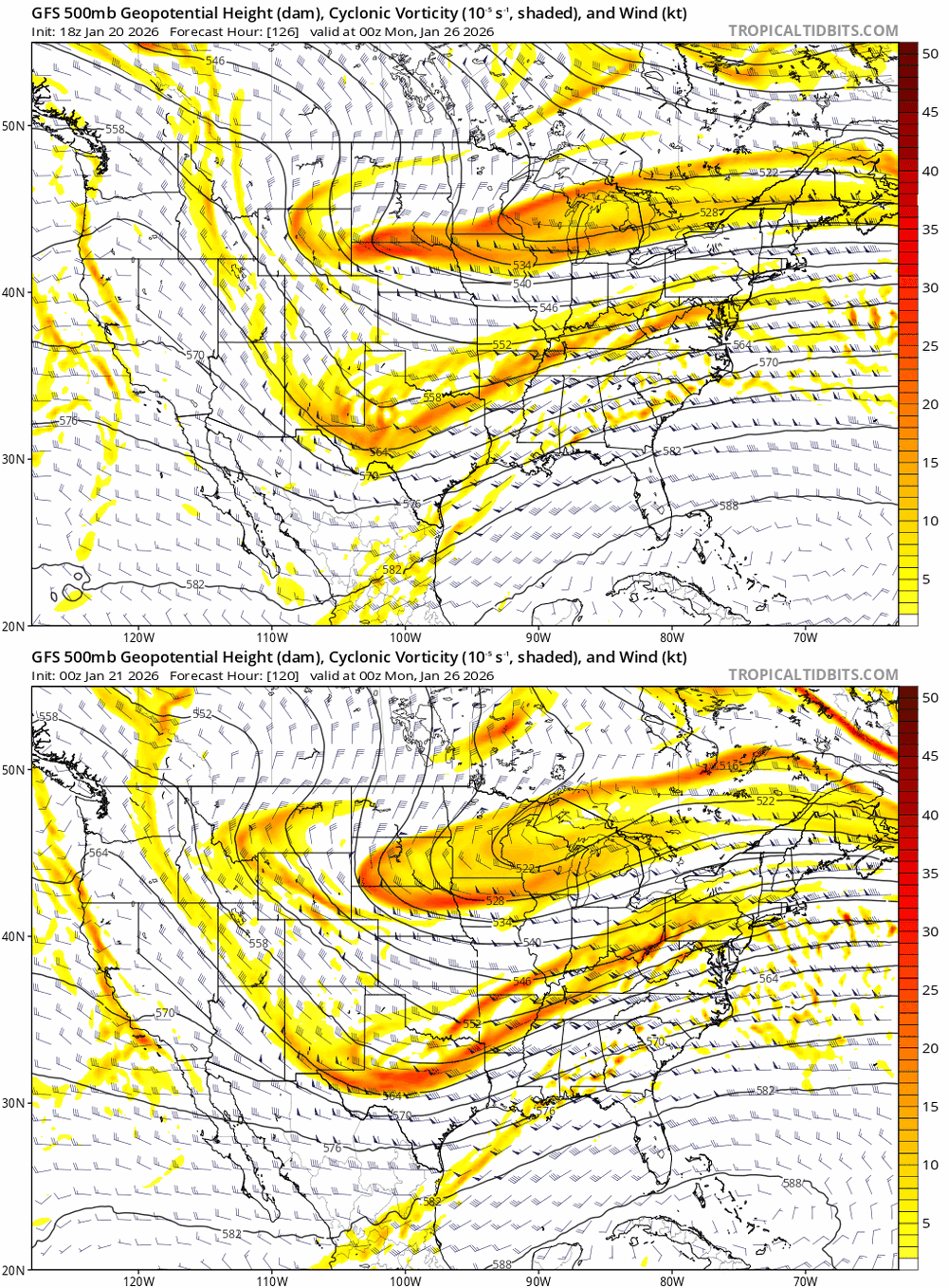
-
Extreme Cold, Snow & Sleet: SECS 1/24 - 1/26
NJwx85 replied to TriPol's topic in New York City Metro
Oh yes I remember you lol -
Extreme Cold, Snow & Sleet: SECS 1/24 - 1/26
NJwx85 replied to TriPol's topic in New York City Metro
I’m not a 20 year old kid anymore. I’m a 40 year old man with 3 kids and a full time job. Don’t have the time I once had. I’ll do my best to chip in on this one though since it’s got blockbuster written all over it. -
Extreme Cold, Snow & Sleet: SECS 1/24 - 1/26
NJwx85 replied to TriPol's topic in New York City Metro
Long range NAM looks good.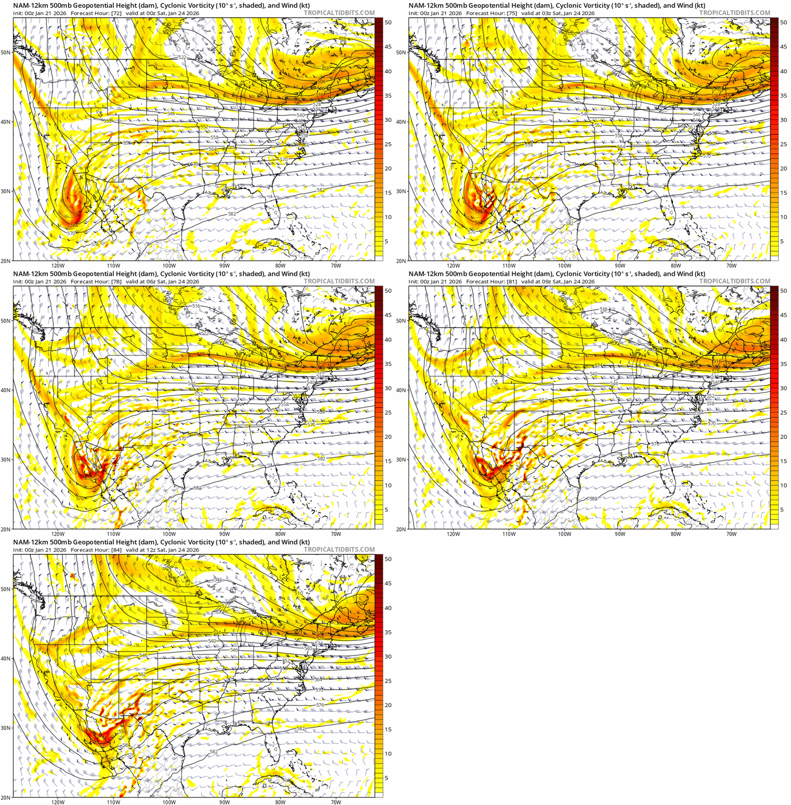
-
Extreme Cold, Snow & Sleet: SECS 1/24 - 1/26
NJwx85 replied to TriPol's topic in New York City Metro
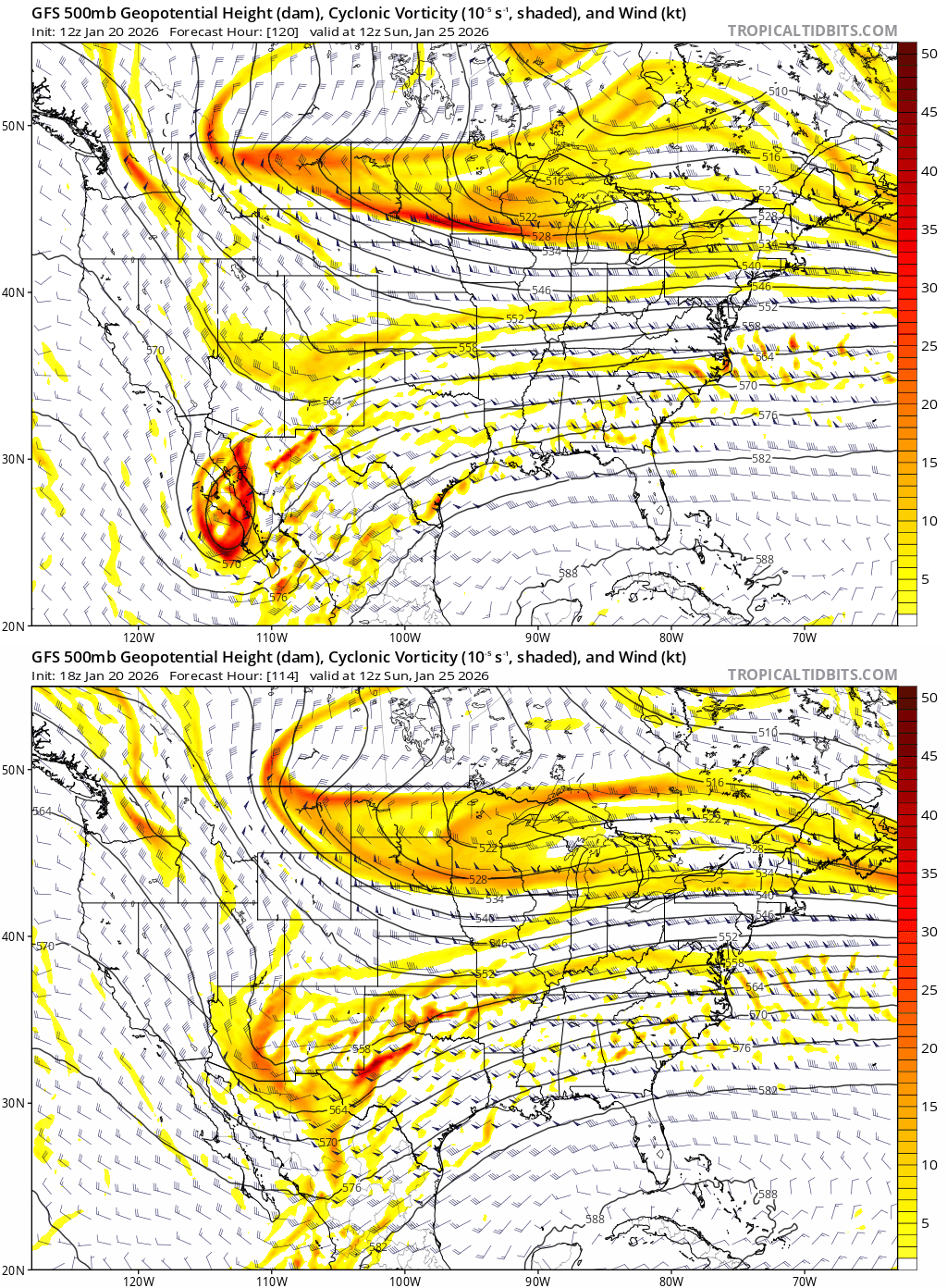
You can see here how the timing is slightly off and instead of a consolidated trough, it gets elongated, weakens, and gets kicked East at the last momiute. Still positive trends.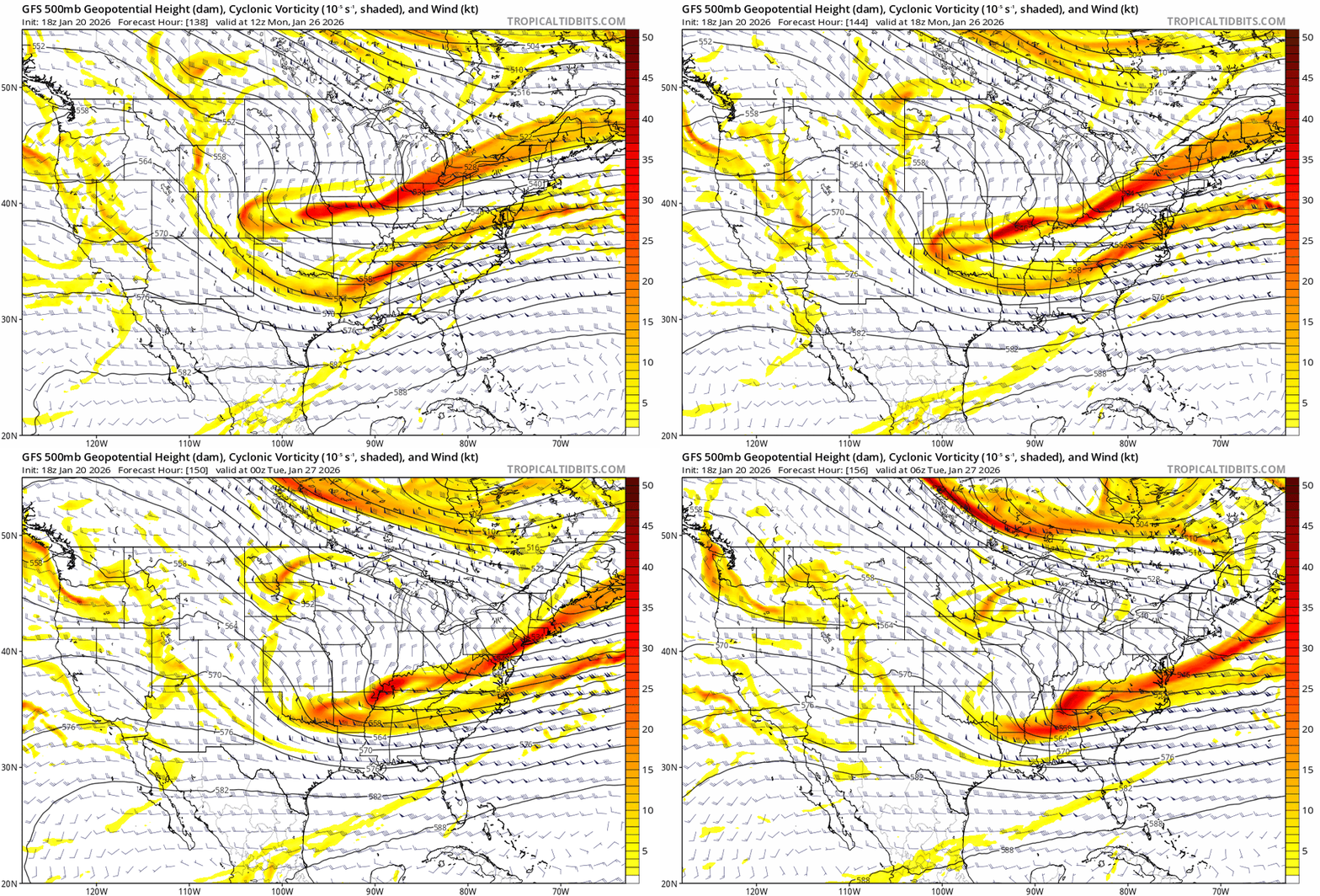
-
Extreme Cold, Snow & Sleet: SECS 1/24 - 1/26
NJwx85 replied to TriPol's topic in New York City Metro
The phase was just a little late. Need to amplify the flow. -
Extreme Cold, Snow & Sleet: SECS 1/24 - 1/26
NJwx85 replied to TriPol's topic in New York City Metro
Going to be a big hit. Surface is way North. -
Extreme Cold, Snow & Sleet: SECS 1/24 - 1/26
NJwx85 replied to TriPol's topic in New York City Metro
Much better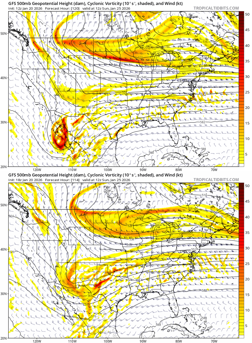
-
Extreme Cold, Snow & Sleet: SECS 1/24 - 1/26
NJwx85 replied to TriPol's topic in New York City Metro
She’s about to go boom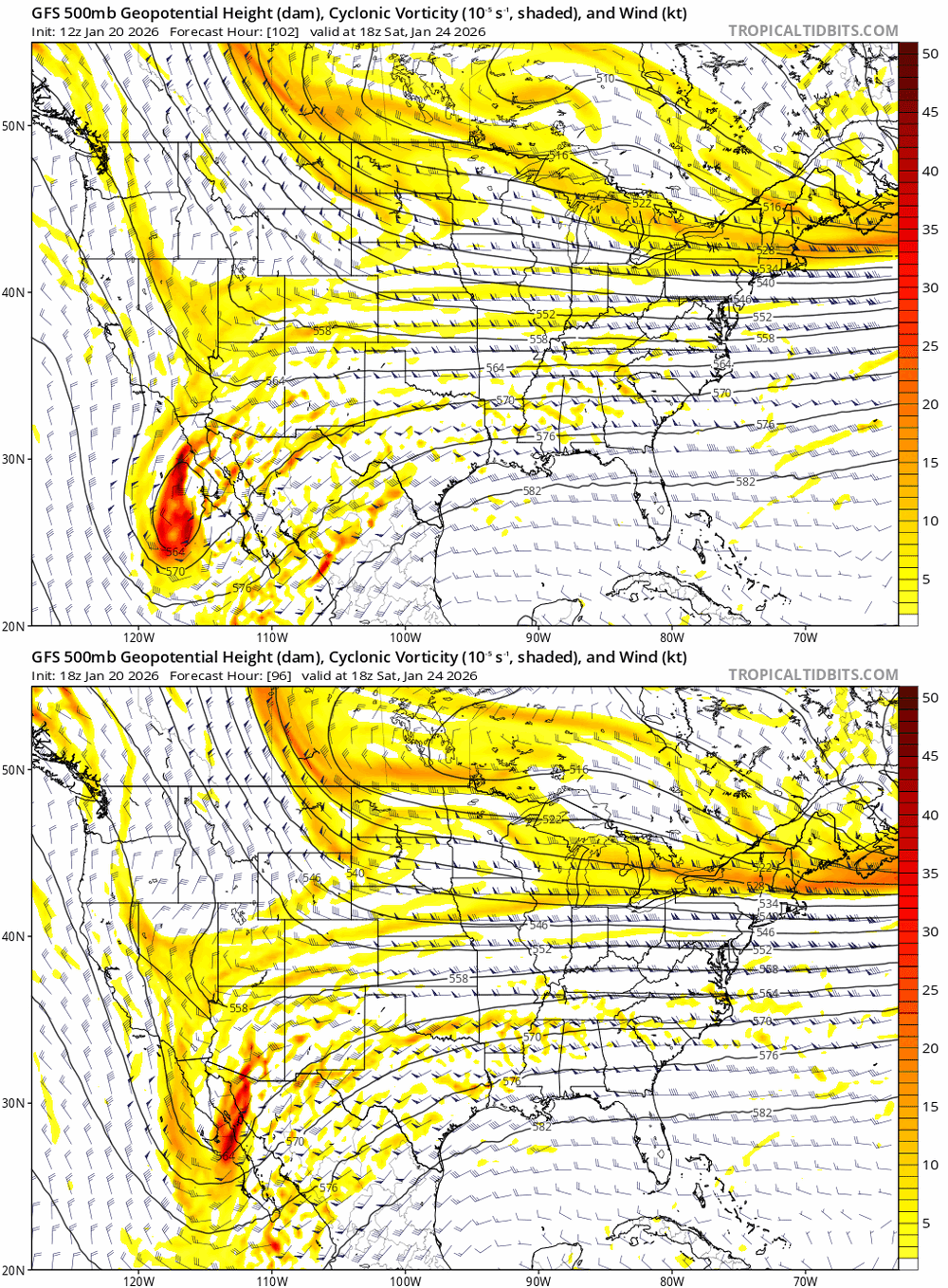
-
Extreme Cold, Snow & Sleet: SECS 1/24 - 1/26
NJwx85 replied to TriPol's topic in New York City Metro
It’s already beginning to interact at 06z Saturday.