NJwx85
-
Posts
19,806 -
Joined
-
Last visited
Content Type
Profiles
Blogs
Forums
American Weather
Media Demo
Store
Gallery
Everything posted by NJwx85
-
That kicker is stronger and in a terrible spot. To have any chance it needs be North of the border on Sunday morning.
-
If you go back and look at the 00z run from 1/22 of the Euro which was a huge hit, the kicker was way up in Central Canada and it was much slower to occlude. All I will say is, that piece that becomes the kicker is currently over the NW Pacific Ocean, somewhere between Japan and the Aleutian Islands. I doubt the models have a good handle on it. It won’t even be on land (North America) until Friday.
-
We need more wave spacing. Also, the storm peaks well South of us and is already occluding as it passes East.
-
The kicker is stronger though, and it still gets kicked East. Reminds me of Juno (yes, I despise naming winter storms)
-
-
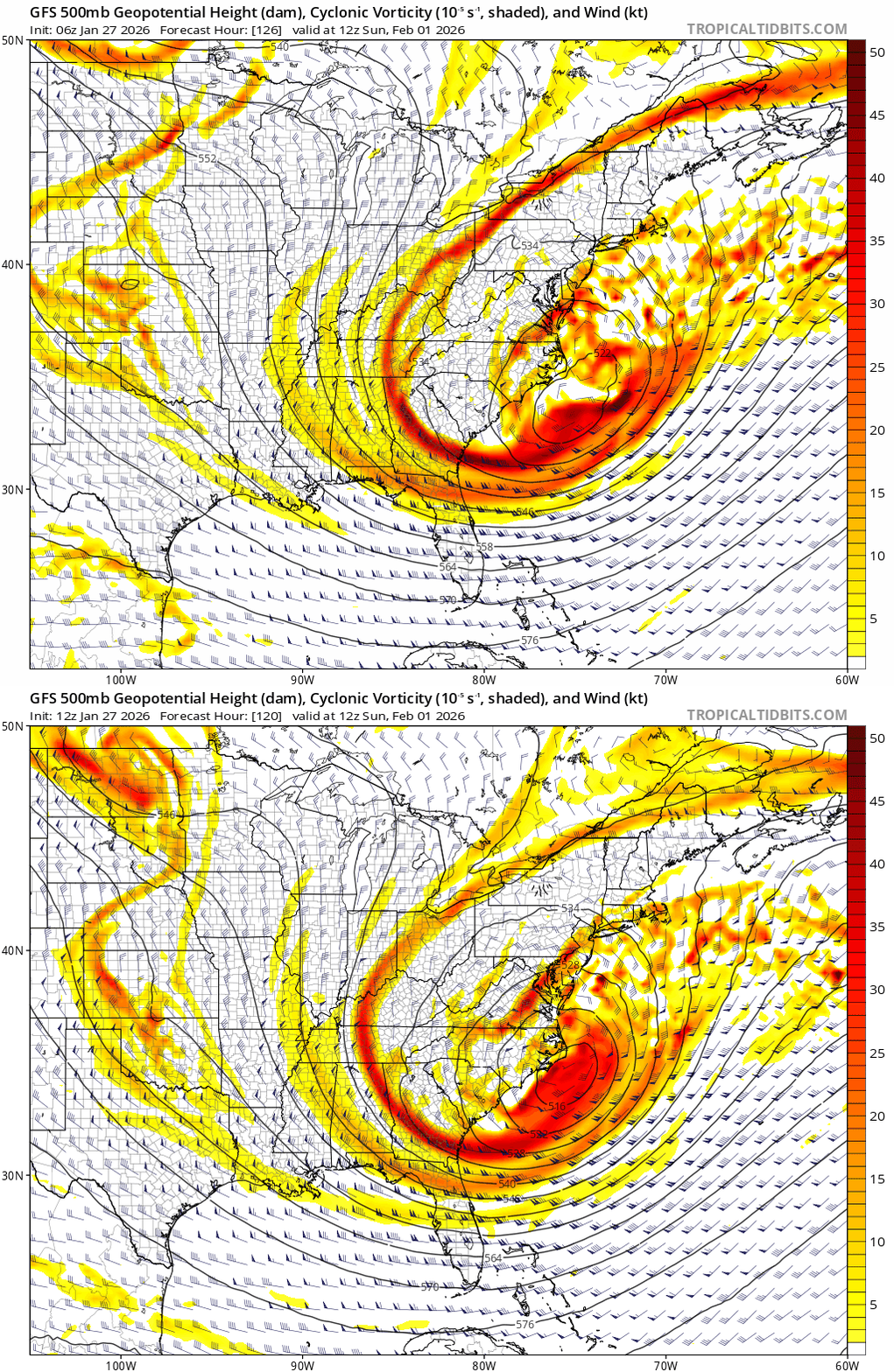
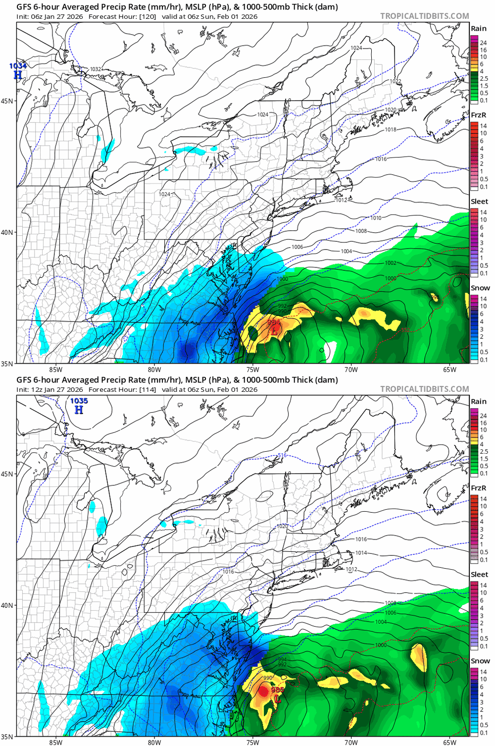
GFS looks great to me at H5. Trough axis is further West and more amped.
-
Some slight improvements on the GFS but don’t know if it’ll be enough.
-
The Northern stream shortwave over the Canadian prairies acts as a kicker. It’s a lot slower on the GFS than the Euro or the ICON. That’s going to be a major issue if the faster/stronger idea is correct.
-
Going out to sea is more a product of this closing off too early than issues with the trough orientation.
-
Yes I know it doesn’t get heavier, my point was more that it’s not going anywhere and anything that melts will just refreeze instead of running off or evaporating. Under normal conditions we would lose a lot over the course of a week. Not so much this time.
-
I know this is a bit cliche but this is definitely one of those scenarios where you don’t want to be in the bullseye 5-6 days out if you’re rooting for a big storm.
-
Yes this is a major concern. The whole roof collapsing thing is a bit tounge in cheek but it’s not out of the realm of possibilities.
-
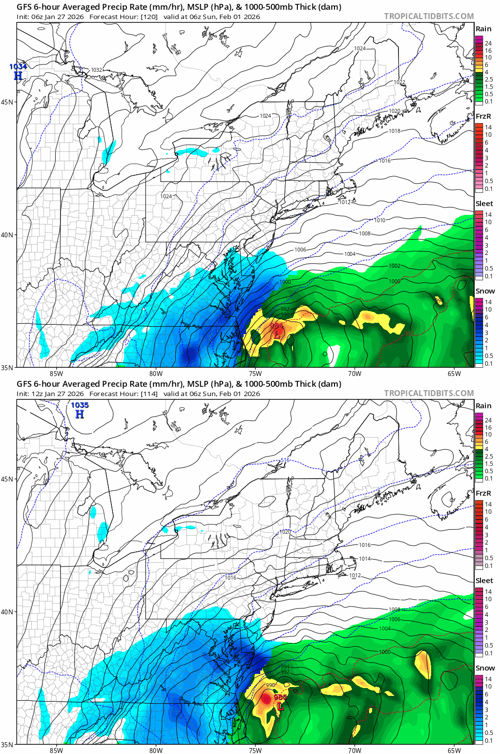
You want this to close off near the Delmarva then. It’s almost weakening by the time it reaches us because it closes off so far South and begins to occlude and fill.
-
I might be over 4 feet if there’s a direct hit here depending on how much melts this week.
-
Spring starts at the end of March and we could use an early Spring after a winter like this. Bitter cold has been relentless.
-
Do you think it’s going to be pure fluff after 6 days of melting in the sun and then refreezing? I have like 18” on my roof. Another 2 feet on top of that wouldn’t be great. And it’s too high for one of those scrapers.
-
I’m kind of hoping this one misses. The piles at the end of my driveway are already shoulder high and I’m running out of room. With temps this week bitterly cold not much will melt. Starting to worry about my roof collapsing.
-
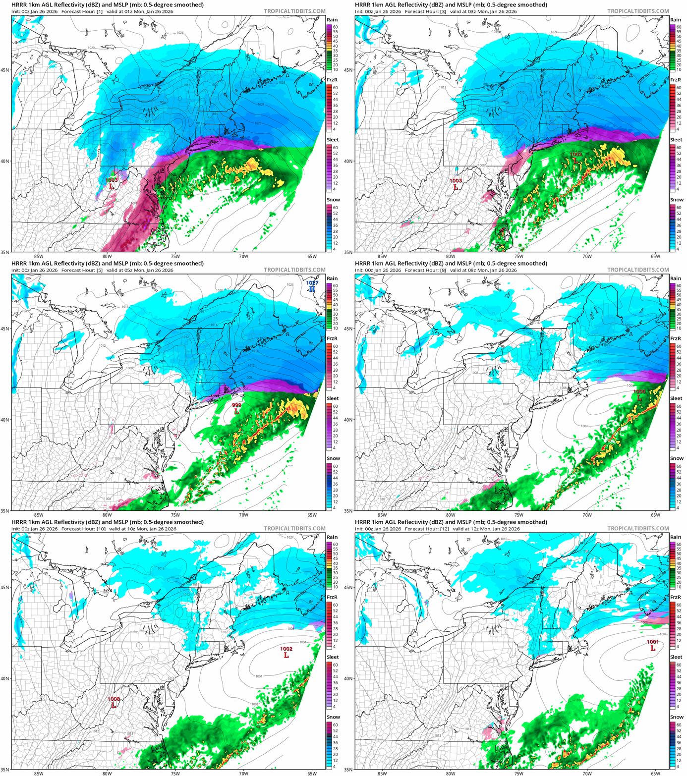
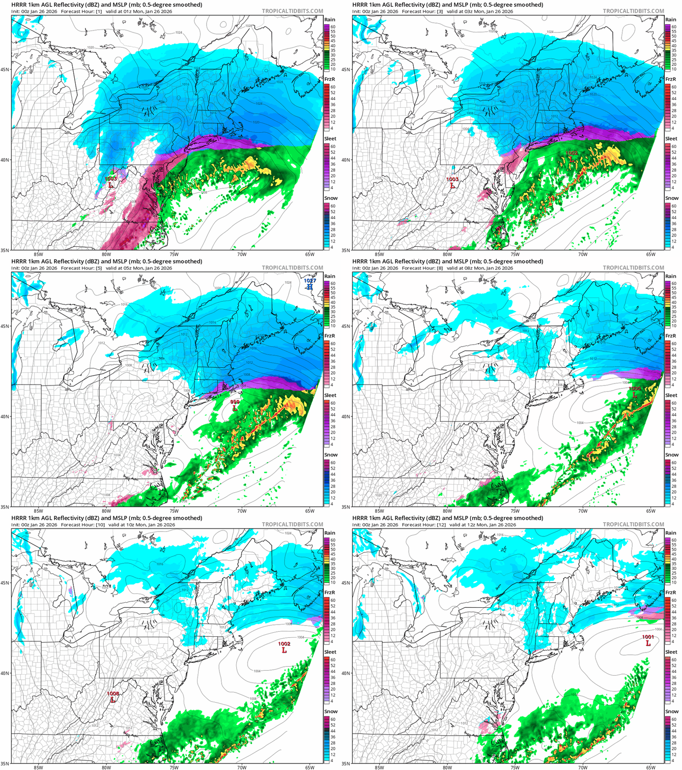
HRRR says that dry slot is gonna fill in
-
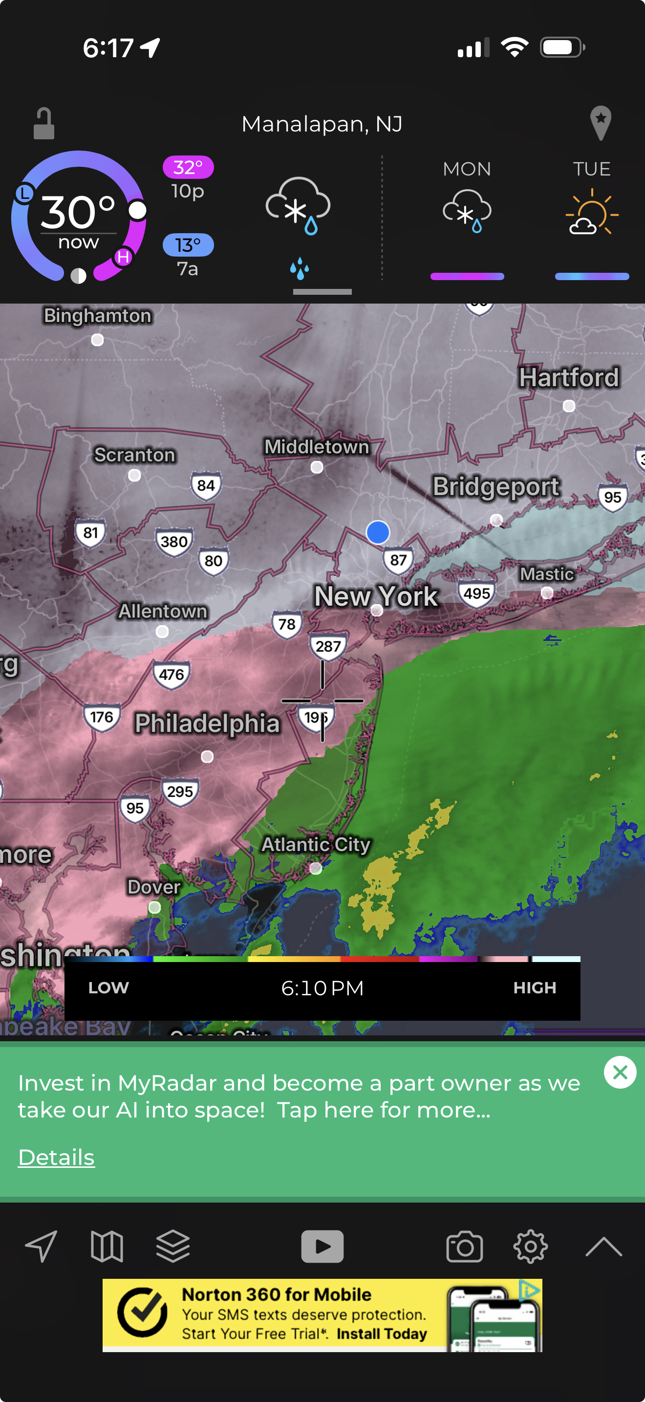
Snowing hard here again but that dry slot is coming fast.
-
You still got a lot of snow. There have been plenty of Miller A’s over the years where I’ve had little or nothing while you guys got smoked.
-
Yikes.
-
Yeah I see that. If that happens I’ll be over 20”.
-
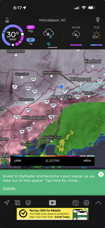
Radar looks plenty juiced to me. That dry slot is over Southern PA and might not even make it that far North. The HRRR has a very brief dry slot before another band comes through overnight.
-
I can confirm that there is some sleet mixing in here now but it’s still 90% snow and still accumulating rapidly.