janetjanet998
-
Posts
6,027 -
Joined
-
Last visited
Content Type
Profiles
Blogs
Forums
American Weather
Media Demo
Store
Gallery
Everything posted by janetjanet998
-
March 17-18 Severe Weather Event
janetjanet998 replied to DanLarsen34's topic in Southeastern States
..SUMMARY A SIGNIFICANT TORNADO OUTBREAK IS EXPECTED WITH NUMEROUS STRONG AND A FEW LONG-TRACK, POTENTIALLY VIOLENT TORNADOES. AN INITIAL ROUND IS EXPECTED TO BEGIN ACROSS EASTERN MISSISSIPPI AND ALABAMA THIS AFTERNOON. A SEPARATE SWATH SHOULD EMANATE FROM SOUTHEAST ARKANSAS TO LOUISIANA THIS AFTERNOON AND SPREAD EAST ACROSS MISSISSIPPI AND ALABAMA THIS EVENING INTO TONIGHT. .DEEP SOUTH MINOR CHANGE MADE TO THE CATEGORICAL HIGH RISK AREA TO EXPAND A BIT. MAIN CHANGE IS TO THE UNDERLYING PROBABILITIES WITH THE ADDITION OF A 45 TOR AND 45 WIND. A DANGEROUS, LONG-DURATION TORNADO OUTBREAK EXPECTED TO COMMENCE THIS AFTERNOON AND PERSIST WELL INTO TONIGHT WITH MULTIPLE ROUNDS OF HEIGHTENED TORNADO POTENTIAL. ONGOING CONVECTION IS WITHIN AN ARC WITH A PRE-FRONTAL SQUALL FROM FAR EAST TX TO NORTHEAST AR AND THEN IN A MORE WEST/EAST-ORIENTATION FROM NORTHEAST AR TO THE AL/TN BORDER AREA. THE NORTHERN ACTIVITY WILL TEND TO REINFORCE THE SURFACE WARM FRONT APPROACHING THE TN BORDER WITH MS/AL THIS AFTERNOON. THE SOUTHWEST BAND WILL LIKELY PERSIST EAST AND SHOULD BREAKUP INTO A BROKEN BAND OF SUPERCELLS AT SOME POINT THIS AFTERNOON AS LOW-LEVEL SHEAR FURTHER STRENGTHENS ACROSS THE ARK-LA-MISS REGION. FARTHER EAST, WARM-ADVECTION SHOWERS IN SOUTHEAST MS TO WEST-CENTRAL AL WILL LIKELY DEEPEN BY EARLY AFTERNOON INTO A SEPARATE SWATH OF SEVERAL DISCRETE SUPERCELLS IN AN ENVIRONMENT OF STRENGTHENING LOW TO DEEP-LAYER SHEAR. BETWEEN THESE TWO AREAS, THE DESTABILIZING WARM SECTOR WITH WARMING BOUNDARY-LAYER TEMPERATURES AND MID 60S TO LOW 70S DEW POINTS, WILL SUPPORT AN EXPANSIVE PLUME OF 1500-2500 J/KG MLCAPE. BY LATE AFTERNOON AND INTO EARLY TONIGHT, A LOW-LEVEL JET SEGMENT WILL STRENGTHEN TO AT LEAST 50-60 KT ACROSS MS/AL AS THE MIDLEVEL TROUGH APPROACHES FROM THE WEST, CONTRIBUTING TO VERY STRONG LOW-LEVEL SHEAR (0-1 KM SRH IN EXCESS OF 300 M2/S2). BUOYANCY WILL BE SLOW TO DECREASE AFTER SUNSET AND WITH EASTWARD EXTENT BASED ON THE PREVALENCE OF RATHER RICH BOUNDARY-LAYER DEW POINTS, VERY FAVORABLE WIND PROFILES (WITH 700-MB WINDS REACHING 70-80 KT) WILL MAINTAIN THE THREAT FOR LONG-TRACK, INTENSE TORNADOES WITH BOTH WARM-SECTOR SUPERCELLS, AS WELL AS SUPERCELLS WITHIN THE BROKEN BAND NEAR AND AHEAD OF THE SURFACE WIND SHIFT PROGRESSING EAST ACROSS MS BY EARLY TONIGHT. THE STRONG TORNADO AND SIGNIFICANT DAMAGING WIND THREAT WHILE BECOMING MORE SPATIALLY CONFINED WITH TIME, WILL LIKELY PERSIST ACROSS PARTS OF AL OVERNIGHT AND SHOULD SPREAD INTO WESTERN GA BEFORE 12Z. ..GRAMS/BENTLEY.. 03/17/2021 -
March 17-18 Severe Weather Event
janetjanet998 replied to DanLarsen34's topic in Southeastern States
some background on that event https://en.wikipedia.org/wiki/Tornado_outbreak_of_April_14–16,_2011 -
March 17-18 Severe Weather Event
janetjanet998 replied to DanLarsen34's topic in Southeastern States
"this is not going to be April 3-4 1974" everyone was saying that morning point being every outbreak is unique and even if another 4/27/11 was perfectly modeled the day before no one would claim "This will be 4/27/11 all over again" of course all the stars have align perfectly and the odds are it won't I suspect the slower trend will continue .. even though now this may start in the central western forum (OK/TX) it may be a good idea to make this the main thread for the event? -
March 17-18 Severe Weather Event
janetjanet998 replied to DanLarsen34's topic in Southeastern States
UM...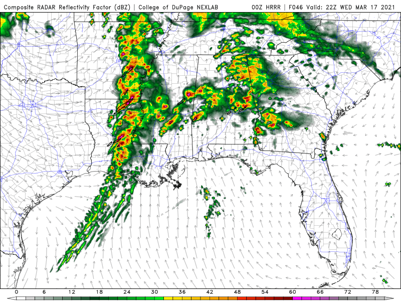
-
Beware the Ides of March (and into the 16th)
janetjanet998 replied to Hoosier's topic in Lakes/Ohio Valley
Trees are a gorgeous white here....but on some of them only the tops are...while others the whole tree is -
Severe Weather Threat 3-16-21 through 3-18-21
janetjanet998 replied to cheese007's topic in Central/Western States
or this as the main thread -
March 17-18 Severe Weather Event
janetjanet998 replied to DanLarsen34's topic in Southeastern States
-
Severe Weather Threat 3-16-21 through 3-18-21
janetjanet998 replied to cheese007's topic in Central/Western States
chance of a High risk somewhere IF NAM is correct.. of course that will depend un unpredictable meso features not known until that day also will be over multiple sub forums....(central western, SE. Ohio Valley, TN valley..so It might be best if we use this as the main thread -
00z NAM coming in hot for WEDS to say the least could start late Tuesday night even OK/MO/AR a cold bowling ball at 500mb moving into the warm sector results in MLCAPE >2000 overnight with little CIN
-
That cell is warned now
-
One supercell looks like it will move into the SE Metro of Amarillo The city has been rather lucky with no direct tornado hits Over the years In fact one hit in 1949 but besides that not much
-
444 ACUS11 KWNS 131745 SWOMCD SPC MCD 131744 TXZ000-NMZ000-131945- MESOSCALE DISCUSSION 0163 NWS STORM PREDICTION CENTER NORMAN OK 1144 AM CST SAT MAR 13 2021 AREAS AFFECTED...EAST-CENTRAL NM INTO PORTIONS OF NORTHWEST TX CONCERNING...SEVERE POTENTIAL...WATCH LIKELY VALID 131744Z - 131945Z PROBABILITY OF WATCH ISSUANCE...80 PERCENT SUMMARY... THE SEVERE THREAT WILL RAPIDLY INCREASE BY EARLY AFTERNOON ACROSS FAR EAST-CENTRAL NM INTO NORTHWEST TX. SUPERCELLS CAPABLE OF ALL SEVERE HAZARDS ARE POSSIBLE. THE AREA IS BEING MONITORED FOR WATCH ISSUANCE IN THE NEXT 1-2 HOURS. DISCUSSION...AS OF 1730Z, A SURFACE LOW WAS LOCATED TO THE SOUTHWEST OF CLOVIS, NM. A DRYLINE EXTENDED SOUTHWARD FROM THE LOW ACROSS THE SOUTHEASTERN PLAINS OF NM INTO SOUTHWEST TX. STRONG HEATING ALONG/AHEAD OF THE DRYLINE AMID THINNING CIRRUS SHIELD OVER WESTERN PORTIONS OF THE TX SOUTH PLAINS HAS ALLOWED TEMPERATURES TO INCREASE INTO THE MID 60S TO LOW 70S. DEWPOINTS ARE QUICKLY INCREASING INTO THE LOW 60S ACROSS THE REGION AS WELL. AS A RESULT, INHIBITION IS QUICKLY ERODING NEAR AND EAST OF THE SURFACE LOW, AND DEEPENING CU HAS RAPIDLY DEVELOPED LATE THIS MORNING ALONG THE DRYLINE. THUNDERSTORMS CONTINUE TO DEVELOP NEAR THE SURFACE LOW AND NORTH OF A QUASI-STATIONARY SURFACE BOUNDARY STRETCHING WEST-EAST ACROSS EAST-CENTRAL NM AND THE TX PANHANDLE. THIS ACTIVITY IS LIKELY ELEVATED, BUT MAY CONTINUE TO POSE A THREAT FOR NEAR-SEVERE HAIL. AS THE DRYLINE CONTINUES TO MIX EASTWARD INTO EARLY AFTERNOON, ISOLATED THUNDERSTORM DEVELOPMENT IS EXPECTED IN THE NEXT COUPLE OF HOURS NEAR THE NM/TX BORDER WHERE LITTLE CAPPING REMAINS AND MLCAPE HAS INCREASED TO 1000-1500 J/KG. THIS ACTIVITY WILL INITIALLY BE CAPABLE OF LARGE HAIL AND STRONG GUSTS. VWP DATA FROM KFDX SHOWS A LONG, STRAIGHT HODOGRAPH WITH WEAK LOW-LEVEL DIRECTIONAL SHEAR. INITIAL SPLITTING SUPERCELLS ARE EXPECTED. AS THIS ACTIVITY SHIFTS EAST/NORTHEAST INTO NORTHWEST TX, LOW LEVEL HODOGRAPHS SHOULD BEGIN TO ENLARGE AS STORMS ENCOUNTER STRONGER BACKED LOW-LEVEL WINDS. THIS SHOULD INCREASE TORNADO POTENTIAL AS CELLS PROGRESS EASTWARD INTO A BETTER LOW LEVEL SHEAR AND MOISTURE ENVIRONMENT.
-
OH river at Cario at 45.8 expected to hold steady the next week or so before falling Mod flood stage is 46 feet Pattern change with heavy Rains for parts of the area possible later next week though
-
TN valley heavy rain/flooding week of whenever
janetjanet998 replied to janetjanet998's topic in Tennessee Valley
Hi guys Just some updates on my little obsession with lake Cumberland.... the lake was 709 feet last Saturday it now is almost 725 ft..in fact it has risen 12 feet in the past 48 hours or so as inflows increased from the previous days rains and storms trained over it Sunday..in fact at one point for a few hours it was rising at 1/2 foot or more per hour 5-7 inches fell over the lake and parts of the northern basin with 3-4 inches over the southern basin outflows were 10,400cfs , was up to 14,000cfs this morning The link to the actually inflows posted here in 2019 is dead but I calculated back then a .01 change in lake level each hour is about 7000 cfs The Lake rose .16 ft last hour so ( 16 * 7000) + (14K outflows) = so inflows are still an impressive 126,000 cfs or so The most they can outflow without flooding properties downstream and sandbagging first is 29,000 Cfs long story short the lake should hit 730 by this weekend which is about where it was in 2019 before the big rains The mistake they made back then was not to use the full 29,000 cfs outflow but instead used 15-22K the weeks leading up to the big event as a result they had to flow out 35,000 , then 45,000 the finally 60,000 at the last minute to prevent the Dam from overflowing luckily that spring was pretty dry when lake levels were elevated above 740 after the crest The stars have to align just right but one of the stars is..a high lake level going into an La nina spring The good news no rain for at least the next 7 days but I hope a dry forecast won't mean that they don't utilize the full 29,000 cfs outflow now the difference between 22,000 and 29,000 outflow is .about .a 1/4 of a foot (.01 per hour) over many days that can really add up and make a difference later as far as flood storage edit: it does look like they do plan to increase ourflows to 22,000 tomorrow and 27,000 thursday https://www.tva.com/environment/lake-levels/Wolf-Creek -
New crest forecast at Cario 40.5 on March 7th..
-
3 inches along OH river the next five days...running high from snowmelt .plus very heavy rains over the TN valley, .this water can be stored in KY lake but will eventually need to be released into the OH river OH river forecast as of yesterday, crest at Cario IL 35.7 on march 4th (without most of the rain shown below) flood stage 40 record 61.7
-
BUF 1041 AM EST SAT FEB 20 2021 NEAR TERM /THROUGH SUNDAY/ LAKE EFFECT OFF LAKE ERIE OVERACHIEVED OVERNIGHT THROUGH DAYBREAK THIS MORNING AS SHORTWAVE TROUGH AND DEEPER MOISTURE CROSSED THE REGION WITH H85 TEMPS OF -14C. MANY REPORTS OVER 20 INCHES IN NARROW AREA OF SOUTHERN ERIE COUNTY WITH A COUPLE REPORTS AROUND 30 INCHES. HIGH SLRS AND FOCUS OFF THE THE LIMITED BUT STILL VERY EFFECTIVE OPEN WATERS OF EASTERN LAKE ERIE HELPED TREMENDOUSLY. LAKE EFFECT OVER WAYNE INTO N. CAYUGA WAS STEADY BUT NOT NEAR AS STRONG AS THE BAND OFF LAKE ERIE. AS THE FAVORABLE BACKGROUND FORCING AND MOISTURE IS JUST APPROACHING NOW, SEEING THIS LAKE EFFECT INCREASE AND THAT SHOULD STAY THE CASE WITH 1-2 INCH PER HOUR RATES INTO THIS EVENING. EXTENDED THE GOING WARNING THERE UNTIL MIDNIGHT TONIGHT AS THE LAKE EFFECT WILL CONTINUE HEAVY AT TIMES INTO THE EVENING THOUGH WILL BECOME MORE FOCUSED LIMITED IN COVERAGE BY THIS EVENING.
-
850 temps -14C or so delta T's decent but not extreme..it looks like there is a small ice free area with a decent fetch on the NE side of the lake but this isn't a case with deltas 20-25 with a full open fetch looks like a small shortwave bringing moisture and there seems to be some type of convergence just SW of BUF with another band this one will be studied for sure Edit: now it looks like Huron connection getting going with the leftovers crossing that small open fetch and recharging and converging with another small band hugging the south shore
-
and you are correct...at least some if not most seems to be smokestacks you can clearly see the Byron nuclear plant SW of RFD edit: also check out the "clear streak" jetting east across the lake east of MKE on your shot
-
wow it looks like the CU is developing over non total snow covered (non farm fields) areas where it isn't a total white out like urban area and wooded areas in river valleys look at the IL river valley now , CU developing over darker areas (woods) and moving SE, even its river tributaries like Vermillion and Kankakee same for parts of Rock river or I'm just imagining things? edit: or maybe it's just urban areas. I can make out Peoria with CU streaming SE from it I can also make out smaller cities I think like Lasalle and Ottawa
-
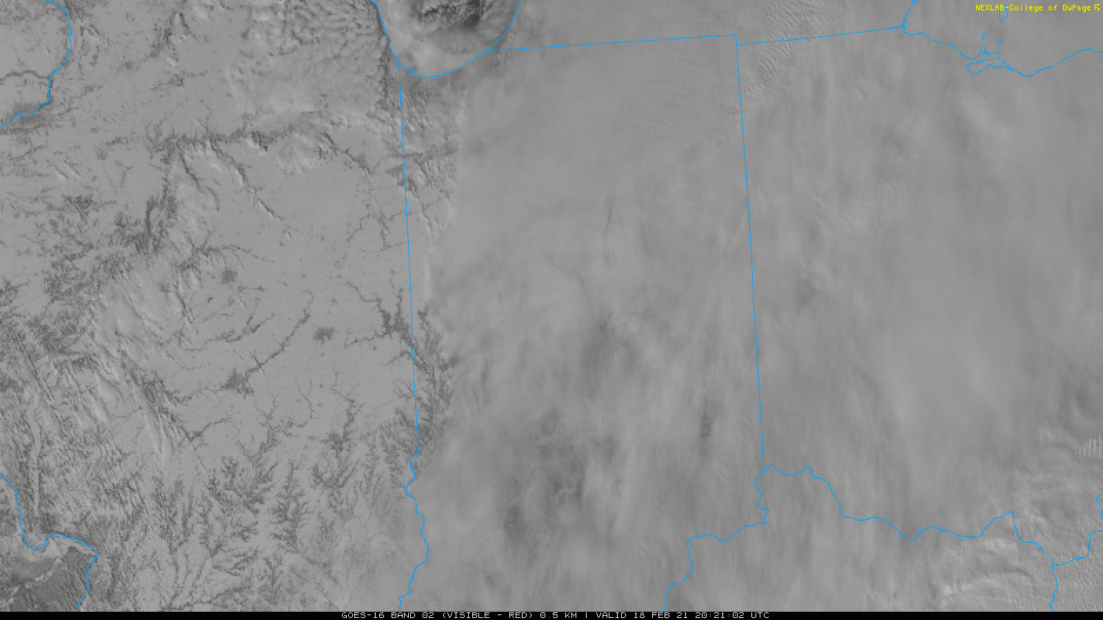
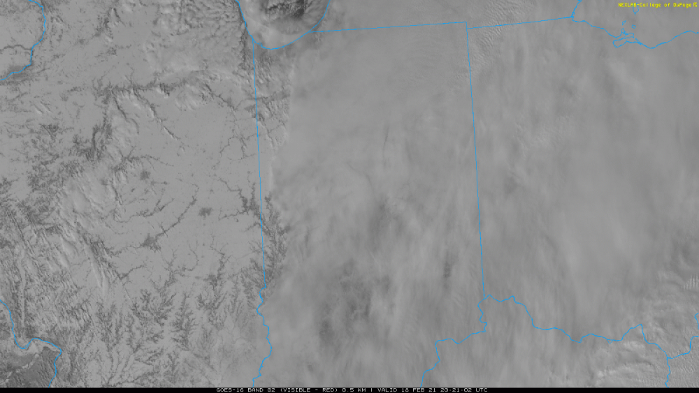
update : 2-18 this is getting insane active pattern to continue with more snow northern sections and rain south major OH, mid-lower MS river flooding likely
-
Feb 17-19th Potential Of Potential
janetjanet998 replied to Chicago Storm's topic in Lakes/Ohio Valley
AREA FORECAST DISCUSSION NATIONAL WEATHER SERVICE CHICAGO/ROMEOVILLE, IL 956 AM CST THU FEB 18 2021 UPDATE 955 AM CST... WE DID PUSH OUT A QUICK UPDATE A LITTLE WHILE AGO TO INCREASE POPS NOTABLY THROUGH THE REST OF THE MORNING AND INTO THE EARLY AFTERNOON HOURS, NAMELY ACROSS PORTIONS OF NORTHEAST ILLINOIS WHERE PERSISTENT NEAR-SURFACE CONVERGENCE IS HELPING TO SQUEEZE OUT LAKE-ENHANCED SNOWFALL. CONVERGENCE IS FORECAST TO REMAIN MAXIMIZED INTO DUPAGE, COOK, AND LAKE (IL) COUNTIES EVEN INTO EARLY THIS AFTERNOON, AND HAVE ADDED A SLIVER OF ADDITIONAL 1-2" OF EXTREMELY FLUFFY SNOWFALL (SLRS NEAR 30+:1) IN THIS AREA. IT'S A BIT UNCLEAR HOW THINGS TREND INTO THIS AFTERNOON, WITH GUIDANCE OFFERING UP A VARIETY OF SOLUTIONS HERE. THINKING WE SHOULD EVENTUALLY DISLODGE THIS LAKE ENHANCEMENT THIS AFTERNOON WITH THINGS PUSHING A BIT MORE INLAND THIS AFTERNOON AND EVEN INTO THE EVENING. ELSEWHERE, WE'VE GOT JUST ENOUGH LOW-LEVEL ASCENT TO SQUEEZE OUT FLURRIES/LIGHT SNOW UNDER PARTLY CLOUDY/PARTLY SUNNY SKIES, AND ANTICIPATE THAT THIS WILL REMAIN THE CASE TODAY. UPDATED PRODUCTS WILL BE OUT SHORTLY. -
Feb 17-19th Potential Of Potential
janetjanet998 replied to Chicago Storm's topic in Lakes/Ohio Valley
got tp be close to SN+ on the I-294 at Willow Road IDOT cam in the band north of ORD. big fatties (at 9:34) https://www.travelmidwest.com/lmiga/showCamera.jsp?id=IL-ISTHA-kd0fNjSsumZa1oeypUWqju1vzBo=&direction=N (edit lessened now at 9:43) -
from yesterday and likely some compaction since but wow if these are correct SNOW DEPTH (NE IL) IL-LK-69 : HIGHWOOD 0.9 S * : 0.01 / 0.1 / 35.0 / IL-CK-211 : OAK LAWN 1.6 WNW * : T / T / 31.1 IL-CK-149 : OAK LAWN 0.5 SSW * : 0.00 / 0.0 / 28.5 /
-
Feb 17-19th Potential Of Potential
janetjanet998 replied to Chicago Storm's topic in Lakes/Ohio Valley
mesolow hitting the IL/WI border clipping NE Lake county IL and then into SE WI don't think that was expected at this point (LOT said LES snow should move east and up the MI shoreline)