-
Posts
9,271 -
Joined
-
Last visited
Content Type
Profiles
Blogs
Forums
American Weather
Media Demo
Store
Gallery
Everything posted by downeastnc
-
the island there just north of the storm for 12-18 hrs is Emerald Isle probably one of if not the most developed island on the NC coast....
-
The ability to see and record the storms every second of their life has also gotten way better....if a storm in the mid ATL hits a RI and jacks up to a Cat 4 for 12 hrs we know it, if that happened in 1960 chances are we wouldn't. I suspect we see a west trend in all the models as the plane has found Jose to barely be a 55mph TS and he should weaken quickly and this will allow him to not have the effect on the ridge the earlier model runs had.....
-
Yeah NHC calling for a solid Cat 3 hit on Puerto Rico....guess mother nature isnt wanting anyone to feel left out this year....she has got one heck of a circulation building as well could be a very large cane...she is probably 300 miles top to bottom at the moment
-
HWRF gives Puerto Rico a solid hit....
-
Its actually a Cape Lookout hit with a NW track directly inland over eastern NC....
-
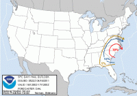
Tornados count relationship to hurricanes in NC
downeastnc replied to downeastnc's topic in Southeastern States
Believe what? We just noticed a strange pattern where it seems that the years that have extremely active severe weather in NC also tends to be the years we have landfalling TC in NC, while years with quiet severe weather seasons tend to not have landfalling TC's. Its just a interesting and fun observation and every year around this time we try to see where the numbers are. -
Debbie raising hell in Australia this location is just SE o where Josh is sustained 110 gusting 132... https://www.wunderground.com/cgi-bin/findweather/getForecast?query=Proserpine+Hamilton+Isla%2C+Australia This is where Josh actually or as close of a obs point as I can find to his location.... https://www.wunderground.com/cgi-bin/findweather/getForecast?query=pws:IQUEENSL1168
-

Southeast Sanitarium - A Place to Vent
downeastnc replied to Jonathan's topic in Southeastern States
The RGEM looked terrible and 12Z and its starting to correct etc, the 18Z much better some places in Pitt Co went fro no snow to 7" in one run lol......something wonky happened at 06Z to screw it all up but the models are coming back home now....the para NAM matched the GFS pretty well, don't know much about it but maybe they corrected some of the amplification bias, either way by 12Z tomorrow central and eastern NC at least will be staring down a HECS I hope.... -
Latest track has Nock-10 as a 90 knt storm basically right over or just south of Manila still, the southern end of the island of Cantanduanes and its "capital" Virac a city of 75k people looks to have took a direct hit though and the storm was easily a 130-140 knt storm when it hit there.......the path it is on is good for the rest of the folks there though over land and this thing should weaken fairly quickly.....
-

Southeast Winter Storm Threats - Model Performance
downeastnc replied to griteater's topic in Southeastern States
Pressure in Maine right now is around 1040-1042 so that's pretty close...... http://forecast.weather.gov/MapClick.php?site=car&zmx=&zmy=&map_x=216&map_y=172&x=216&y=173#.WFhy7KwzV9N -
The town Josh was last in has reported winds gusting 80-100 mph for at least 4 hrs now.....that's a long time to deal with winds like that.....haven't seen any reports over 105ish though so far at any of the obs sites on the east coast....... this location gusting to 120 mph looks to be in the north eyewall never got the center... http://www.cwb.gov.tw/V7e/observe/real/46706.htm
-
Pretty big eye and looks to be strengthening on the front side as it hits, Josh was in Hualien City not sure if he moved north or not, the last obs had gust to 89 mph there , pressure was 968mb and the worse of it is still a hr or two away....just gusted to 100
-
Dude I live in NC I totally understand how CAD setups work, it is nothing for there to be 20 or even 30 degree temp differences here in just 20 miles.....it happens dozens of times every year. I cant count the times we sat in the mid 30's while New Bern 45 miles away was in the low 60's. I have also been the guy in the 60-70 while Raleigh stayed stuck in the 30-40's. I have seen the temp stay rock steady at the same temp for a day or two once we get wedged in, the temp will actually stay the exact same thing for 24-48 hrs and then it can warm up 10-20 degrees in just a hr or two. None of that has anything at all to do with AGW.
-
Guess I don't see how normal weather is "definitely worth posting", it isn't even a interesting article.
-
This is so silly I cant even tell if your just being a troll here.......or you are somehow implying this has something to do with AGW. There was 34 degree of temp rise in 12 hrs that isn't exactly unheard of this time of year... , the entire article is totally stupid and written by someone with no understanding of the normal climate in this part of the world apparently because it wasn't amazing....unless he just means how changeable the weather is the April on the east coast.
-

Tornados count relationship to hurricanes in NC
downeastnc replied to downeastnc's topic in Southeastern States
The number of tornados we had this year from Jan 1 to June 1st indicated that we would be very likely to have a landfalling TC this season in NC. The total number of tornados in 2014 is still not confirmed but several tornados I know occurred are not listed as official but the total was around 30 which would put 2014 in the top tier so after last night we have had a landfalling TC in 6 of the 7 years we have had 30 or more tornados by June 1st.... -

Tornados count relationship to hurricanes in NC
downeastnc replied to downeastnc's topic in Southeastern States
Since we are officially at the cut off point we used to make these list I thought I would give a update, based on the numbers out there the number of tornados so far is in the mid to upper 20's and possibly right at 30 but a lot of these are unconfirmed reports of tornados etc. so a firm working number is hard to find ATM. That said with the above numbers of 25-30 tornados so far this year means we fall into the above average chance of seeing a landfalling TC in NC. If we have had 30 (unofficially we have had 28 ) then 5 out of 6 years with that many ended with a landfalling TC in NC......however and interestingly the one year we had 30+ tornados and no landfall we were in a EL Nino which we are apparently in or heading into now...... If you take all years that had a landfalling TC in NC and average all of them the average number of tornados in a year with a landfall is 28 which is again right about where we are for the year. So again all indicators strongly suggest a higher than normal chance of a landfalling TC in NC this year.....with the El Nino being the only caveat. the last few years have proven pretty reliable since this thread first started 2011 had a insanely high number of tornados well over 30 and we had Irene 2012 had 17 and Beryl was technically a depression then a post tropical system with winds of 40mph over the NC coast so that's iffy and we haven't been counting depressions and haven't really considered post/sub/extra tropical systems and how they factor in especially since the criteria used to determine these things has evolved and gotten more precise over the last 20 years or so. 2013 we had 8 tornados and that matches the average of tornados we have for years without landfalls so that is exactly what we would have expected last year. -

Tornados count relationship to hurricanes in NC
downeastnc replied to downeastnc's topic in Southeastern States
Going to bump this thread to make it easier to keep track of how many tornados we have this year, since we do pretty good about listing confirmed ones in threads I was hoping folks would also include any confirmed tornados this year in this thread. The numbers in 2011 pointed to us getting hit and we had Irene , last year we barely had any tornados and obviously no hits from last years putrid TC season. This year we have had 3 confirmed that I know of all yesterday 2 in Roberson and 1 in Wayne, there was also the Beaufort hit but I checked and it was Dec 26th so it wont count on this years cycle....if there was another one I missed this year let me know here thanks. -

Tornados count relationship to hurricanes in NC
downeastnc replied to downeastnc's topic in Southeastern States
Cant say we didnt warn ya........ -
In the main Atlantic hurricane thread on the main forum I had seen several years thrown out there as analogs for this years cane season......two of the more common ones were 1996 and 1999 which if you lived in NC are years we got smacked about quite a bit. So the other day Shaggy looked up those years and searched for severe weather to see if they had active severe weather springs or not and to see what those years had. Interestingly enough 4-15-96 had a tornado outbreak in NC then strangely enough 4-15-99 also had a small outbreak then of course we all know what happened 4-16-2011 So while I dont really hold to much faith in analogs I was surprised to see this and overall both 96 and 99 were very good severe years with lots of springtime storm activity all across the SE and North Carolina. I will however be a believer if NC gets hit by several hurricanes this year lol......


