sbnwx85
-
Posts
1,778 -
Joined
-
Last visited
Content Type
Profiles
Blogs
Forums
American Weather
Media Demo
Store
Gallery
Everything posted by sbnwx85
-
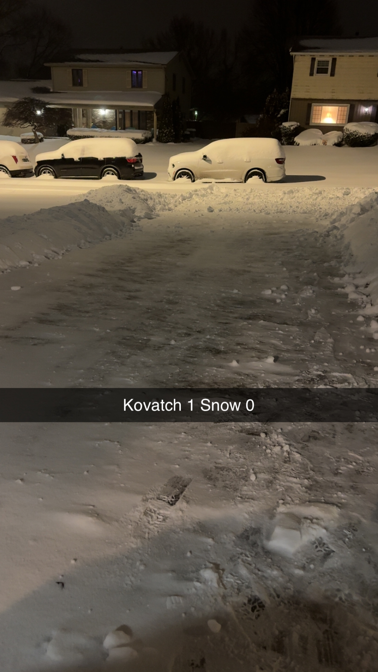
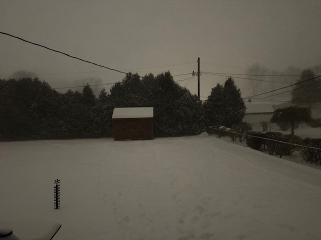
Blizzard-like under this narrow snow squall.
-

Winter 2025-26 Short Range Discussion
sbnwx85 replied to SchaumburgStormer's topic in Lakes/Ohio Valley
Nothing to see here. Go about your business. The WWA for me is really for the northern third of the county. I’ll end up with two inches of wind swept snow over the course of 24 hours. -
Winter 2025-26 Medium/Long Range Discussion
sbnwx85 replied to michsnowfreak's topic in Lakes/Ohio Valley
GFS operational was much wimpier with next weekend’s storm but there are several good hits on the ensembles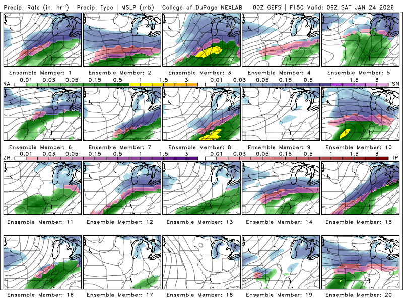
-
Cold day with temps in the teens. Lake effect compaction is real though. Down to about a 6” snow pack. I know you’re all feeling bad for me.
-
Seems like a fun way to get CO poisoning.
-
Winter 2025-26 Short Range Discussion
sbnwx85 replied to SchaumburgStormer's topic in Lakes/Ohio Valley
HRRR looks particularly snow squally for many of us this evening into tonight. -
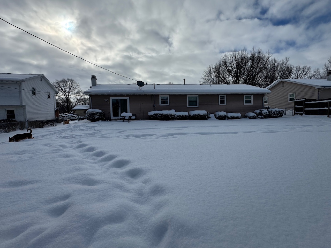
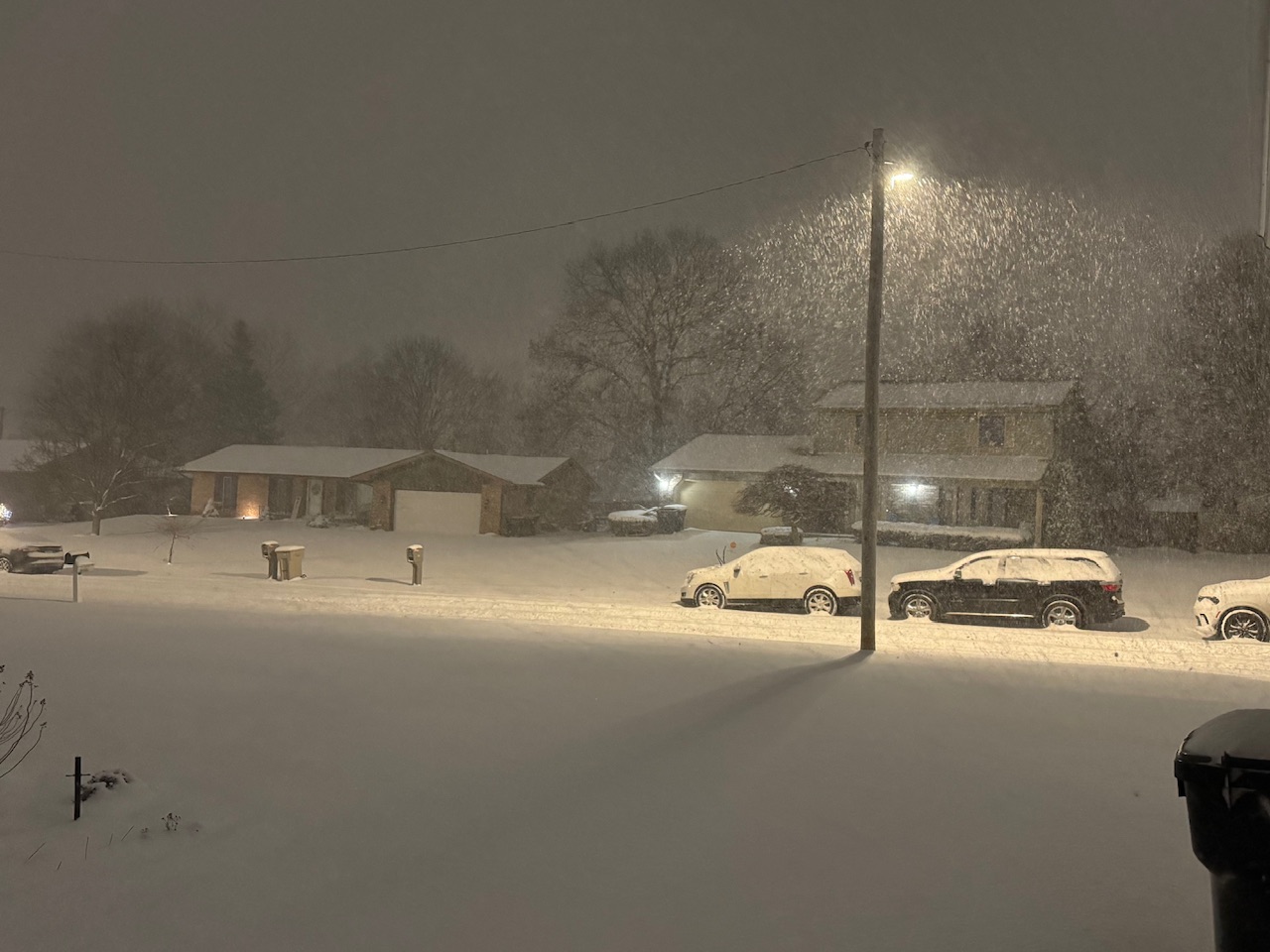
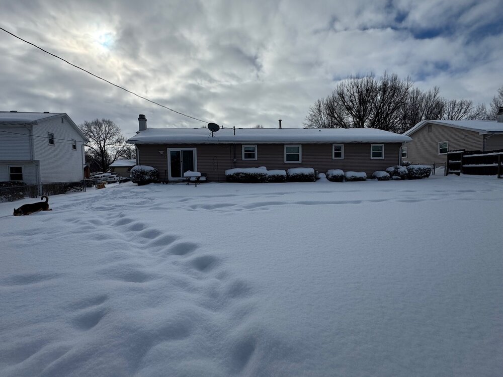
Two-day lake effect snow total in South Bend was officially 17.1". Total for the winter: 54.5" Another 3.9" will make this the snowiest winter in 9 years. My backyard event total: 14.5" Backyard winter total: 52.7"
-
Winter 2025-26 Short Range Discussion
sbnwx85 replied to SchaumburgStormer's topic in Lakes/Ohio Valley
Looks like 1-3" for just about all of us overnight into tomorrow. -
Winter 2025-26 Short Range Discussion
sbnwx85 replied to SchaumburgStormer's topic in Lakes/Ohio Valley
Funny enough, this prayer was answered... I might have to start going to church again.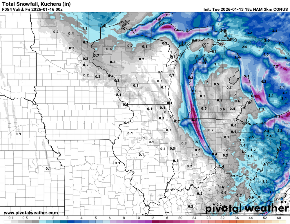
-
Winter 2025-26 Short Range Discussion
sbnwx85 replied to SchaumburgStormer's topic in Lakes/Ohio Valley
Dog days of winter

-
Winter 2025-26 Short Range Discussion
sbnwx85 replied to SchaumburgStormer's topic in Lakes/Ohio Valley
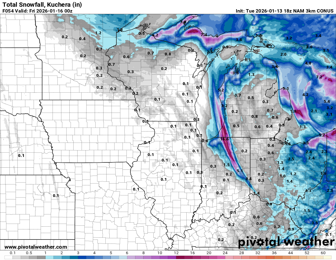
Official stats from South Bend: 12.6” fell on Wednesday setting a record for max snowfall for January 14. It is the 17th day in South Bend history with a foot or more of snowfall. Another 4” fell overnight bringing the storm total to 16.6”. These stats are taken from the north side of town, so my 11”+3” =14” here on the south side would fall in line. RECORD EVENT REPORT NATIONAL WEATHER SERVICE NORTHERN INDIANA 1237 AM EST THU JAN 15 2026 ...RECORD DAILY MAXIMUM SNOWFALL SET AT SOUTH BEND... A RECORD SNOWFALL OF 12.6 INCHES WAS SET AT SOUTH BEND YESTERDAY. THIS BREAKS THE OLD RECORD OF 6.0 INCHES SET IN 1985. -
Winter 2025-26 Short Range Discussion
sbnwx85 replied to SchaumburgStormer's topic in Lakes/Ohio Valley
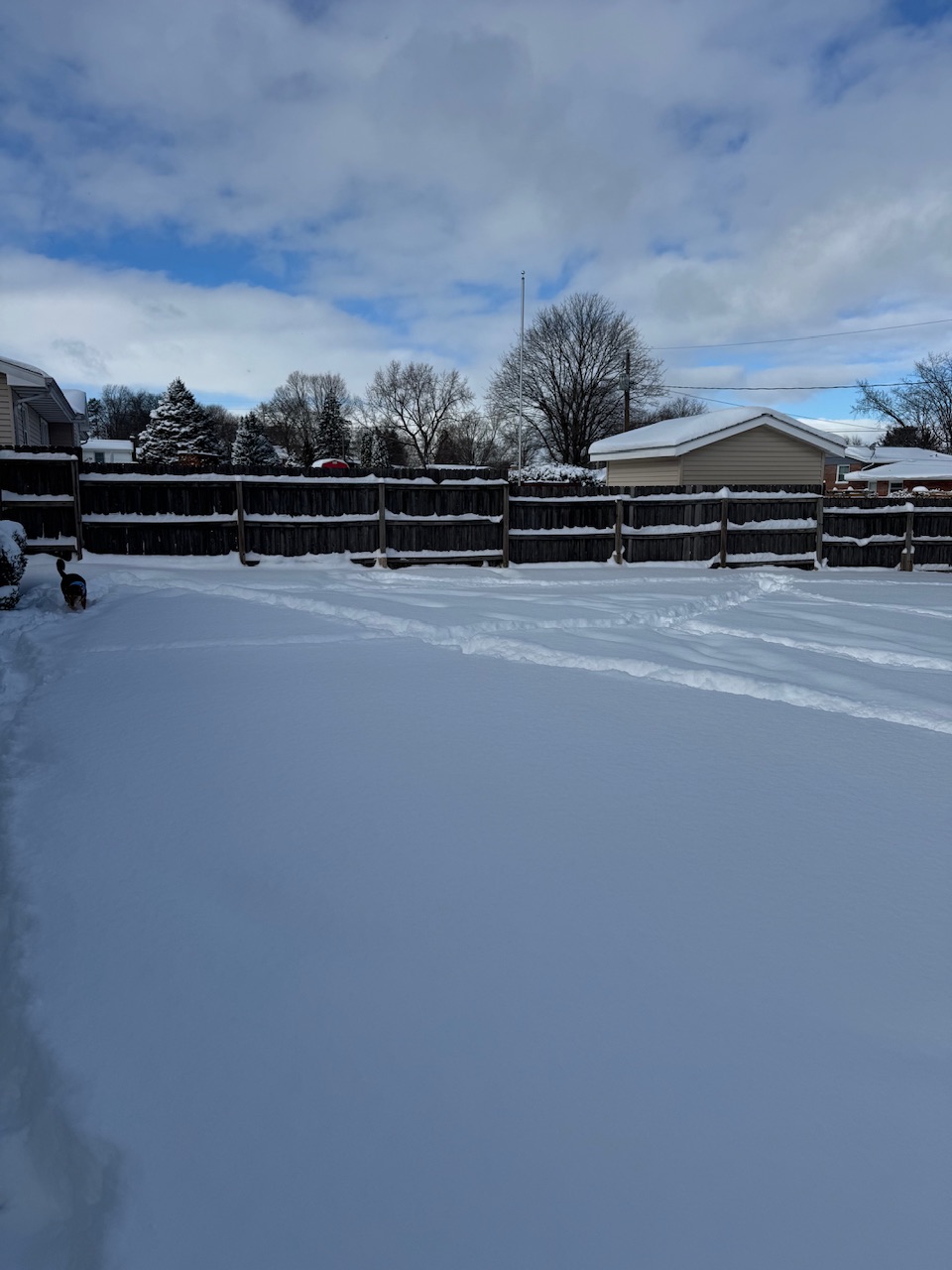
We got 3” of fresh snow from round 2, but it’s already compacting. I guess snow total would be 14” from the event with a 12” snow depth. Obviously very happy. I’ll take some pics when I decide to go shovel the sidewalk I’ve ignored so far. -
Winter 2025-26 Short Range Discussion
sbnwx85 replied to SchaumburgStormer's topic in Lakes/Ohio Valley
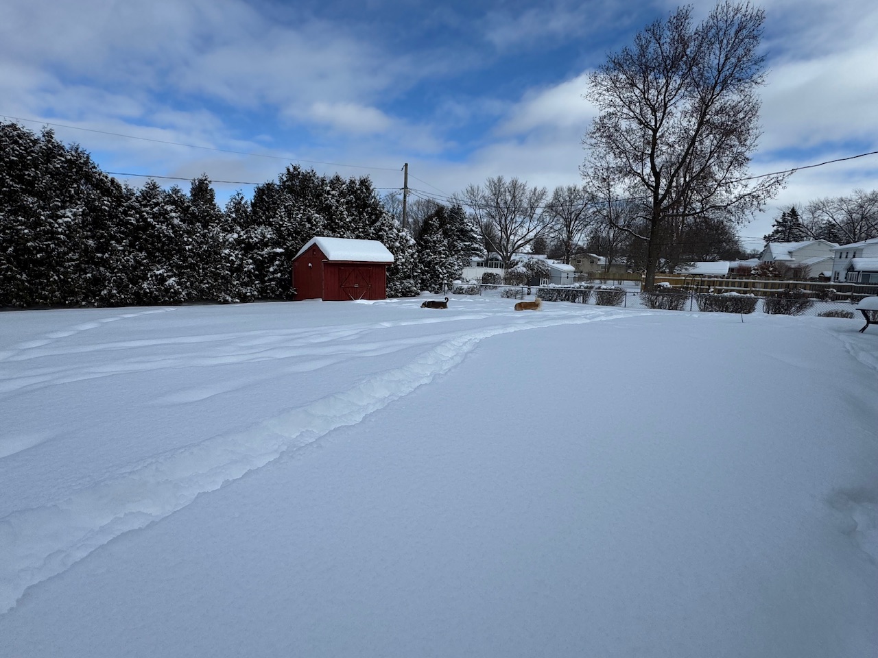
Woke up to a foot of snow on the ground. I went to bed with 11”. It seems like it snowed more than an inch overnight, but I’ll have to check the driveway later to see how much new snow the band put down after I went to bed. I think compaction might taking over already? That and drifting. -
Winter 2025-26 Short Range Discussion
sbnwx85 replied to SchaumburgStormer's topic in Lakes/Ohio Valley
Shoveled the driveway during the lull before round 2 moves in. The band seems narrower. We’ll see what damage it does before it sweeps off tothe west.
-
Winter 2025-26 Short Range Discussion
sbnwx85 replied to SchaumburgStormer's topic in Lakes/Ohio Valley
Band has swung to my east. Sitting at 11” with light snow. The dogs love it.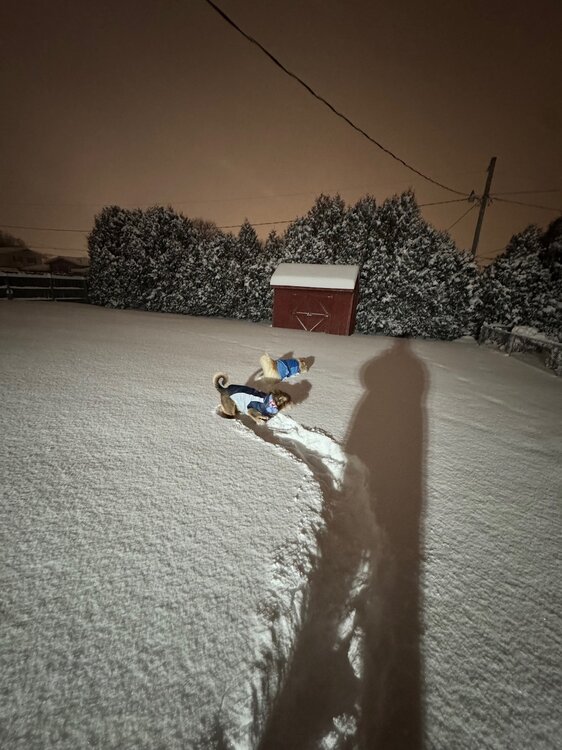
- 508 replies
-
- 12
-

-
Winter 2025-26 Short Range Discussion
sbnwx85 replied to SchaumburgStormer's topic in Lakes/Ohio Valley
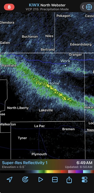
In for the long haul? UPDATE... Issued at 842 PM EST Wed Jan 14 2026 Lake effect band continues to organize further, remaining generally in place from Benton Harbor to South Bend to Bourbon then curving to Wabash. Minor fluctuations in its position are occurring with a slight eastward shift over the past 20 to 30 minutes. Shouldn`t deviate too much from this area for at least the next couple of hours or more as sfc obs show convergence between Plymouth and Goshen. Reports slowly trickling in with roughly 2 to 3 inches in SW Kosciusko county, 6 inches and counting in South Bend. Headlines still looking good for now, although an expansion of the advisory may be needed into Miami and Wabash counties. Regarding amounts, will be taking a close look at them with a likihood of shifting the heavier axis slightly east through 6Z. Upstream obs show the flow isn`t in a hurry to shift until influence of the low lessens. -
Winter 2025-26 Short Range Discussion
sbnwx85 replied to SchaumburgStormer's topic in Lakes/Ohio Valley
Up to 10”. Four inches in the last hour. Top tier stuff. Still ripping. -
Winter 2025-26 Short Range Discussion
sbnwx85 replied to SchaumburgStormer's topic in Lakes/Ohio Valley
South side. Good spot rn -
Winter 2025-26 Short Range Discussion
sbnwx85 replied to SchaumburgStormer's topic in Lakes/Ohio Valley
Up to 6” and still ripping. Probably 2-3” per hour rates.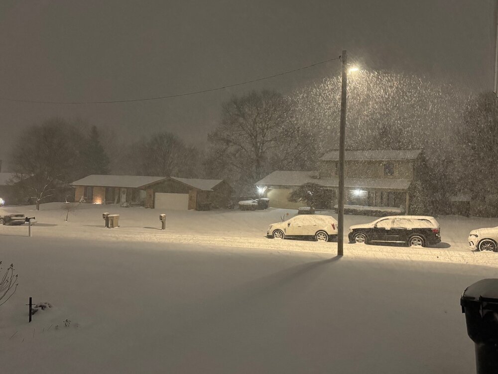
-
Winter 2025-26 Short Range Discussion
sbnwx85 replied to SchaumburgStormer's topic in Lakes/Ohio Valley
Brother it is rippin. 5” so far and 2” more for every hour this bad boy hangs outz -
Winter 2025-26 Short Range Discussion
sbnwx85 replied to SchaumburgStormer's topic in Lakes/Ohio Valley
I’ll try not to be (too) annoying tonight. Looks like the band is stopping its westward momentum and trying to come back east. Would be huge if true. -
Winter 2025-26 Short Range Discussion
sbnwx85 replied to SchaumburgStormer's topic in Lakes/Ohio Valley
I escaped.
-
Winter 2025-26 Short Range Discussion
sbnwx85 replied to SchaumburgStormer's topic in Lakes/Ohio Valley
Getting the goods but stuck in a windowless producer booth. Lame. -
Winter 2025-26 Short Range Discussion
sbnwx85 replied to SchaumburgStormer's topic in Lakes/Ohio Valley
18z NAM moves the band around a little more. Kind of a "widespread" foot for much of St. Joseph and LaPorte in IN and Berrien in MI. -
Winter 2025-26 Short Range Discussion
sbnwx85 replied to SchaumburgStormer's topic in Lakes/Ohio Valley
I'm working dayside (which is rare) and producing a show, so I haven't had time to really pay too much attention to how things have evolved locally. There's probably a couple of inches on the ground already, and the main band has already taken shape to the east. There's a 2nd band over my house inSouth Bend that is producing nicely. I'm currently between the bands at work. Would be wild if the NAM is right and the main show sets up to the east over Elkhart. HRRR still wants to move it west and drop 40" over LaPorte. Putting it in between over South Bend would be the dream.