

sbnwx85
-
Posts
1,954 -
Joined
-
Last visited
Content Type
Profiles
Blogs
Forums
American Weather
Media Demo
Store
Gallery
Everything posted by sbnwx85
-
Wow, even if it does happen, my area gets split like a pair of cheap khakis on Chris Farley.
-
After striking out with the storms yesterday we got a good storm today. Nothing severe but it was nice to get some heavy rain and thunder.
-
After avoiding the worst yesterday, we are in the thick of the smoke here. AQI over 400. Smells nasty.
-
Smoke got worse. AQI now in the 200's here. I can't imagine how much worse it is to the north and west. Woof.
-
This sunset is gonna be bonkers
-
We're right on the southern edge of the smoke. AQI has been in the 100's all day. Slowly getting worse. I wasn't able to smell anything in the smoke this morning, but getting a faint hint of something this afternoon.
-
88 yesterday and 91 today. Dews around 70 today. Not as bad as last week, but also, getting more acclimated to the heat/humidity.
-
Correct me if i'm wrong, but wouldn't this be like "block out the sun for a few hours" kind of stuff in Michigan?
-
This thunder is loud af. I love it
-
Garden variety cell grew into a decent storm. 50 mph gust in there at one point. Outflow breeze feels great rn. More storms backbuilding. Gonna be a good day.
-
Under a warning here but the main line should stay north. Although there’s a nice pop up cell providing some garden variety
-
A whole bunch of rain if those storms start training.
-
80 percent chance was crazy
-
Best climo
-
From NWS IWX social media: Yes, you are reading this correctly, South Bend, IN had 10.06" of rain in June! This is incredibly rare to have over 10" of rainfall in just one month (especially taking into consideration that rainfall this June came from efficient heavy rainfall producing thunderstorms rather than from tropical remnants). There has only been one other time 10"+ of rainfall has occurred in June (1993 with 10.86", which is the monthly record rainfall). June 2026 was the 2nd wettest June on record in South Bend. Since records began in 1893, 10"+ of rainfall has only happened 3 other times. 10.06" in June 2026 ranks as the 4th wettest month ever in South Bend's history, behind 13.92" (Sept 2008), 12.81" (August 2016), and 10.86" (June 1993).
-
We did finally hit 90 in South Bend yesterday. We're already at 90 today. Currently 90/75.9/102
-
Been stuck at 89 the last three hours at SBN. 89/75/99 currently.
-
ready2derecho
-
81/75 at 10 am is soupy af.
-
Tell me can you feel it?
-
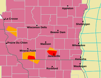
Couple a 'nader warnings up in Southern Wisco
-
I love Florida (in February).
-
Y'all can keep that nonsense
-
We're taking the father-in-law up to Road America on Sunday. Long-range NAM has a rainout... but it's on an island, and it's long-range NAM, so taking with a giant grain of salt. Most of the rain should stay south
-
Turned mine off today. Best climo


