sbnwx85
-
Posts
1,783 -
Joined
-
Last visited
Content Type
Profiles
Blogs
Forums
American Weather
Media Demo
Store
Gallery
Everything posted by sbnwx85
-
It’s got that “feel” to it. Sun out, strong southerly winds (30 mph gusts), warm but not too hot. Initiation will be real close here.
-

2023 Short/Medium Range Severe Weather Discussion
sbnwx85 replied to Chicago Storm's topic in Lakes/Ohio Valley
Hoping storms initiate in time tomorrow to see some severe wx. Worried about a miss east. -
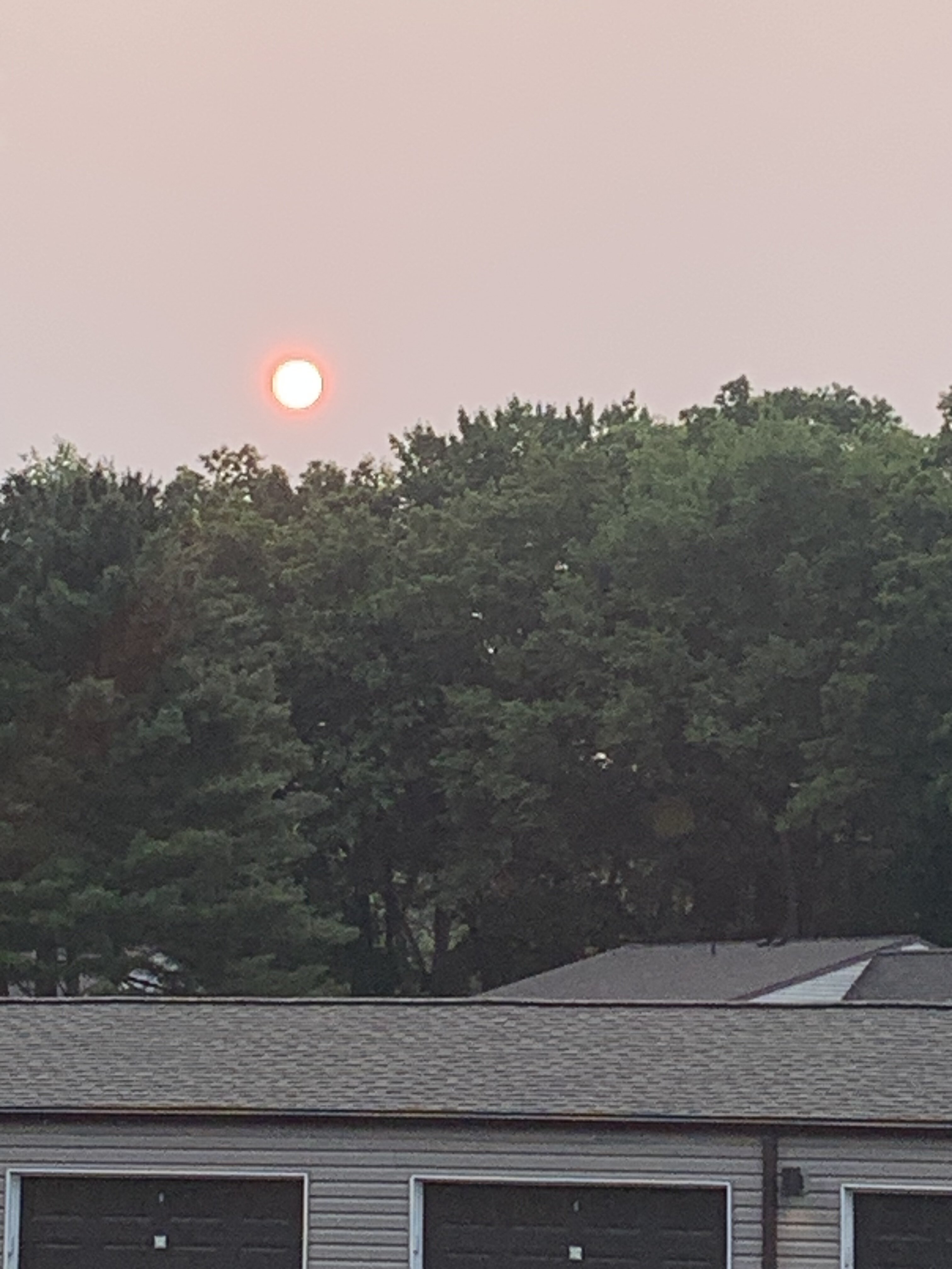
A fair amount of smoke in the upper levels this morning. It appears to be overcast at first glance but there are no clouds in the sky. The sun is nice and red.

-
This is my fave weather. 50's and 60's and overcast. Wish it could be like this every day in the summer...save the occasional derecho.
-
I have no idea how long-range HRRR handles smoke but Friday morning looks like it could be bad particularly in Ohio, but also Southern Michigan and Northern Indiana.
-
2023 Short/Medium Range Severe Weather Discussion
sbnwx85 replied to Chicago Storm's topic in Lakes/Ohio Valley
Good video of the Carroll County landspout. -
I don't think I've ever seen one of these in our neck of the woods: BLOWING DUST WARNING NWS LINCOLN IL 125 PM CDT MON MAY 1 2023 ILZ051-052-061-020000- /O.NEW.KILX.DU.W.0001.230501T1825Z-230502T0000Z/ 125 PM CDT MON MAY 1 2023 Sangamon-Christian-Shelby- ...BLOWING DUST WARNING IN EFFECT UNTIL 7 PM CDT THIS EVENING... * WHAT...Visibility less than one quarter mile in blowing dust. * WHERE...Sangamon, Christian and Shelby Counties. * WHEN...Until 7 PM CDT this evening. * IMPACTS...Severely limited visibilities are expected. Travel will be dangerous and possibly life-threatening. PRECAUTIONARY/PREPAREDNESS ACTIONS... People with respiratory problems should make preparations to stay indoors until the storm passes. Be ready for a sudden drop in visibility to near zero. If you encounter blowing dust on the roadway or see it approaching, pull off the road as far as possible and put your vehicle in park. Turn the lights all the way off and keep your foot off the brake pedal. Remember, Pull Aside, Stay Alive. $$
-
Meanwhile we're working on setting records here at home:
-
Nasty dust storm in Central Illinois south of Springfield has caused a massive pileup on I-55. https://www.facebook.com/WICSABC20/videos/1226438338073741
-
Stood in the garage while the squall line came through. Winds gusted to about 40 mph. Heavy rain. Some good CG's. Nice spring storm.
-
Pretty lame so far.
-
It’s certainly odd getting most of the severe weather of the day in the morning. A cell to my southwest went warned for ping pong ball size hail. At this point I think we may get some spin ups along the squall line but I don’t know that we’ll get an outbreak. It felt nice to let the dogs out in shorts and a tshirt.
-
Good meteorological discussion on that LM cell, guys. Best board in the biz.
-
I was about to say that storm has that look to it...
-
All eyes are on today but I'm getting more and more concerned about tomorrow's potential. I haven't seen this kind of wording used by this NWS office in a long time.
-
00z HRRR doin' me a concern.
-
A rare Day 3 update from SPC: Day 3 Convective Outlook AMEND 1 NWS Storm Prediction Center Norman OK 0302 PM CDT Mon Apr 03 2023 Valid 051200Z - 061200Z ...THERE IS A SLIGHT RISK OF SEVERE THUNDERSTORMS WEDNESDAY FROM THE GREAT LAKES REGION AND OHIO VALLEY SOUTHWESTWARD INTO THE LOWER MISSISSIPPI VALLEY... AMENDED FOR SLOWING UPPER TROUGH, WESTWARD EXPANSION OF SEVERE THREAT ...SUMMARY... Severe thunderstorms are possible over a large area from the Great Lakes region southwestward to the Lower Mississippi Valley Wednesday. This may include cells capable of producing tornadoes and extensive wind damage, primarily north of the Ohio River, with other severe storms expected into the lower Mississippi Valley. This amendment is primary due to the slowing upper trough, and the westward expansion of severe probabilities. Severe storms may be ongoing as far west as the St. Louis area at 12Z Wednesday, with favorable conditions remaining for tornadoes and damaging winds expending mainly northeastward. Farther south, lower 70s F dewpoints and heating ahead of a cold front is expected to support scattered storms during the day into the lower MS Valley, where mainly hail and damaging gusts will be possible. This westward demarcation of the severe threat will likely be adjusted further incoming updates.
-
IWX discussion is solid. I found the bolded section especially interesting. .SHORT TERM...(This Evening through Tuesday) Issued at 313 PM EDT Mon Apr 3 2023 The forcing mechanism for rain chances these next 12 hours or so is a little murky. As of this writing, a stationary front is bisecting the area SW to NE, evident mainly in difference between temperature and dew points over the area. Very little to speak of for surface wind. Isentropic ascent on the 295K surface seems to line up ok with current radar returns hugging the MI-IN line and IL-WI line. Rain shower coverage is expected to increase through the evening and overnight as lift along this isentropic surface amplifies. Additionally, a secondary baroclinic zone at 850-mb lifts in overnight. Lapse rates near 7.5C/km offer a slight chance of thunder as the previous forecaster stated, so, no change to that piece of the forecast. Rain chances on Tuesday are expected to decline after sunrise as the previously described forcing mechanisms continue to lift north. Forcing is generally absent through the daytime hours on Tuesday, thus making shower and storm chances uncertain. Therefore, the SPC outlook for Tuesday seems to be nocturnal. After sunset, the 850-mb jet intensifies according to the NAM and HREF and we're in the right exit region which is not ideal for thunderstorm development. Dew points will swell to near 60 degrees late Tuesday, indicative of ample moisture. MUCAPE and shear will be ample as well. composite reflectivity on a suite of CAMs show some discrete supercells possible overnight, while others are quiet. I have asked for a downgrade to a marginal risk for this uncertainty but was declined with no further details. So, we'll continue to message a lesser/uncertain threat Tuesday night while focusing more on Wednesday. && .LONG TERM...(Tuesday Night through Monday) Issued at 313 PM EDT Mon Apr 3 2023 The risk of severe weather seems more likely on Wednesday as a 110kt 500-mb jet moves over Illinois and into Michigan. We'll be in the right entrance region late in the day, offering favorable upper- level support for storms. Forecast soundings show plenty of CAPE and shear, and once again a risk for tornadoes via strong SRH (looping hodographs). Storm mode is a little murky in the CAMs, with some showing discrete storms ahead of the cold front. Others confine the severe risk to just the cold front. I'd estimate the severe weather risk to begin midday if the discrete storms are able to materialize. The cold front looks to sweep from west to east and exit the forecast area soon after sunset Wednesday. A much welcome break from active weather arrives thereafter with high pressure taking shape through at least Saturday. The next upper- level low moves through the region early next week with significant disagreement in guidance at this distance. this low could bring cooler and rainy conditions.
-
Locally, it looks like we're going to be sitting on a powder keg tomorrow according to the HRRR...even this far to the east. But it doesn't look like there will be a match to set off the explosion. The RAP and NAM keep the squall line from coming through here until early Wednesday afternoon. That would be enough time to create enough instability to get some severe weather.
-
That is pretty interesting.
-
Look at the reports so far for this event.
-
The rain shield on the northern end of the Central Illinois line of storms is going to kill off the storms coming in from Northern Illinois.
-
Absolute scenes in Iowa.
-
Video of the tornado moving through Little Rock.
-
Horrible scenes coming out of Little Rock.