Good AFD from IWX:
Key Messages for Winter Storm:
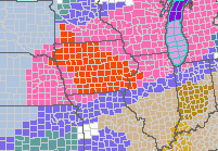
* Headlines have been upgraded to a Winter Storm Warning in far sw
MI and nw IN, a Winter Weather Advisory along and north of US 24,
and a Wind Advisory southeast of US 24.
* The bulk of the hazardous weather and difficult travel
(wind/snow/blowing snow) will occur late Friday afternoon into
Saturday. Lesser impacts are expected during the day on Friday,
though areas that get into heavier wet snow could see roads become
slick and slushy.
* Total snow accumulations in excess of 6 inches in the Winter Storm
Warning, 1-5" in the Winter Weather Advisory. Wind gusts up to 50
mph Friday night into Saturday in the Wind Advisory.
A classic panhandle hook type winter storm the obvious concern for
Friday and Saturday. Latest water vapor loop shows the vigorous
shortwave now entering the Four Corners with lee side cyclogenesis
commencing near the OK/TX panhandles. This pv anomaly will
eventually eject northeast and take on a negative tilt once reaching
the Mid MS Valley and lower Great Lakes. This will take place under
a coupled jet, while in the low levels intense theta-e
convergence/advection and latent heat release favors a rapidly
deepening cyclone tracking north-northeast through central IL-
northern IN-lower MI Friday afternoon into Friday night. A model
consensus favor a sfc pressure center drop to near 975 mb by Friday
night, near January records and similar to the Tuesday system. The
difference this time around will be the incoming cold air with added
baroclinicity and CAA for winds/blowing snow.
12z guidance remained relatively stable regarding track/timing and
expected significant impacts from snow and wind. Initial warm
conveyor precip lifts in Friday morning into early Friday afternoon,
especially west of Interstate 69. Rain/snow line likely sets up near
the US 30 corridor in IN and US 24 in OH with excellent moisture
transport supporting a localized burst of snow during this time. A
marginal temp profile in the lowest 7-8 kft suggest another
wet/heavy snow with poor rations and compaction, which should limit
accums through early Friday afternoon.
Deep UVM/moisture plume and developing trowal on the northern fringe
of the deepening sfc low lifts through mid Friday afternoon into
early Friday evening with primarily rain southeast of US 24, a
mixture of rain and snow over the central CWA, and mainly moderate-
heavy snow (rates 1-2"/hr) over far nrn IN and srn MI for a time.
Wrap around, wind whipped, snow on the southern fringe of the deep
low then becomes the concern overnight Friday night into Saturday
morning within the pivoting deformation axis, mainly along and
northwest of US 24 where several inches of wind blown snow is
expected during this time. Significant blowing snow and reduced vis
with gusts well into advisory (45 mph +) expected into at least
Saturday morning area-wide as cold air wraps in behind the deep
cyclone. The greatest wind potential is still favored southeast of
US 24 later Friday night into Saturday morning where a Wind Advisory
was hoisted. Additional accums into Saturday will be light, with the
exception being in far nw/nc IN and srn MI where lake enhancement
will support several more inches of snow and difficult to nearly
impossible travel.
&&
.LONG TERM...(Sunday through Thursday)
Issued at 230 PM EST Thu Jan 11 2024
Key Message:
* An arctic airmass will settle in with times of headline worthy
wind chills (-15F or colder) and periodic chances for lake effect
snow showers/flurries.
The coldest air of the season will become the story Sunday into next
week as a deep longwave trough sets up under high latitude blocking.
The next shortwave and potential winter storm in this pattern change
continue to favor areas south and east of the local area early next
week, though some light snow could graze the area. Period of mainly
lake-effect snow can be expected through much of the long period
otherwise, mainly our west-northwest flow LES belts near the MI
border where impacts/accums are expected at times. Headline level
wind chills will be possible starting Sunday night otherwise.