

Daniel Boone
-
Posts
3,555 -
Joined
-
Last visited
Content Type
Profiles
Blogs
Forums
American Weather
Media Demo
Store
Gallery
Everything posted by Daniel Boone
-
Spring/Summer 2026 Pattern Discussion Thread
Daniel Boone replied to Carvers Gap's topic in Tennessee Valley
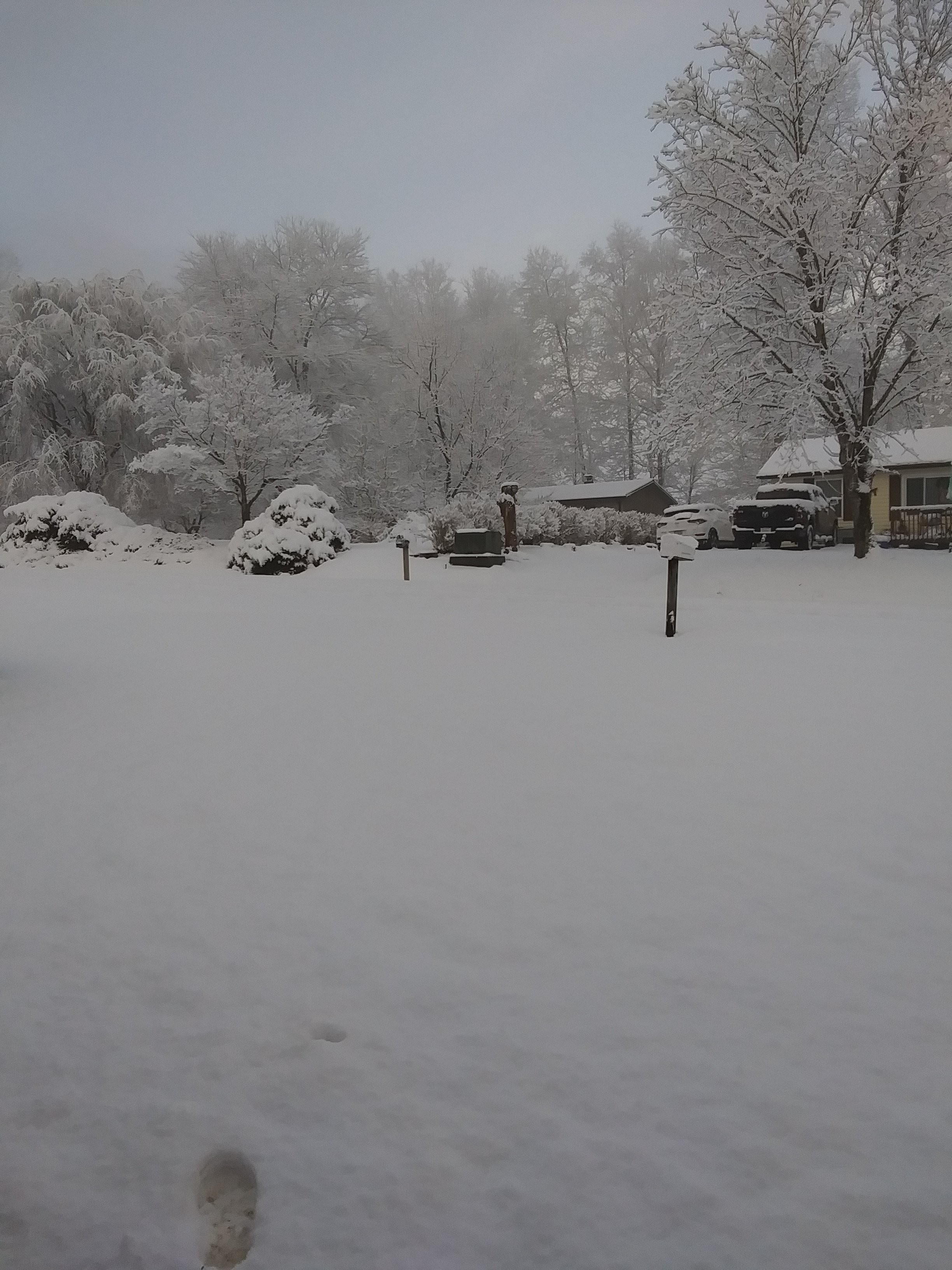
Measured 2.5" on Board at 4:30 . Snow has stopped now other than light small flakes. -
Spring/Summer 2026 Pattern Discussion Thread
Daniel Boone replied to Carvers Gap's topic in Tennessee Valley
Had between a quarter and half inch on grass and snow board befor snow lightened up for a while. So, melted some..picking backmip now. Had what we already got fell at night we'd probably had over an inch on Snow board. Alot of heat still coming up from ground and Solar heating through clouds this time of year is hampering Accs. -
Spring/Summer 2026 Pattern Discussion Thread
Daniel Boone replied to Carvers Gap's topic in Tennessee Valley
Moderate to hevy Snow here with a dusting. -
Spring/Summer 2026 Pattern Discussion Thread
Daniel Boone replied to Carvers Gap's topic in Tennessee Valley
Thanks Buddy !! -
Spring/Summer 2026 Pattern Discussion Thread
Daniel Boone replied to Carvers Gap's topic in Tennessee Valley
Thanks!! -
Spring/Summer 2026 Pattern Discussion Thread
Daniel Boone replied to Carvers Gap's topic in Tennessee Valley
Thanks Man!! -
Spring/Summer 2026 Pattern Discussion Thread
Daniel Boone replied to Carvers Gap's topic in Tennessee Valley
Thanks Man !! -
Spring/Summer 2026 Pattern Discussion Thread
Daniel Boone replied to Carvers Gap's topic in Tennessee Valley
Thanks Man !! -
Spring/Summer 2026 Pattern Discussion Thread
Daniel Boone replied to Carvers Gap's topic in Tennessee Valley
Thanks Man!! -
Spring/Summer 2026 Pattern Discussion Thread
Daniel Boone replied to Carvers Gap's topic in Tennessee Valley
Thanks Buddy!! -
Spring/Summer 2026 Pattern Discussion Thread
Daniel Boone replied to Carvers Gap's topic in Tennessee Valley
It was same up here. 2000 Feet had a dusting with maybe an inch above 2500 ft on Wallen Ridge near Pennington gap. Norton had Vehicles and grass covered from what I was told. Not alot of observing lately as Son n Law passed little over a week ago and Life here has changed. -
Spring/Summer 2026 Pattern Discussion Thread
Daniel Boone replied to Carvers Gap's topic in Tennessee Valley
There's a pretty good chance you see colder reading's than that as some very cold air lurks to our North in Canada. I think around here anyway , the first is called something like Sarvis.?. After a type of Tree I think. Second, redbud, third Dogwood then Blackberry. Nothing to tat really of course. I've witnessed years with more than that many cold snaps and some less. The Dogwood one "may" have some merit; if you tie in a Spiritual Component. -
Showing half the amount of what I recorded here in Lee County VA.
-
With the late SSWE , depending on how late with the Lag , it may cause an extended Severe Season. Could cause a shift south of us for a period (probably early April) then a strong revamping rest of April well into or even through May.
-
Spring/Summer 2026 Pattern Discussion Thread
Daniel Boone replied to Carvers Gap's topic in Tennessee Valley
Yeah, it sure does man. I like tracking severe but am not a Fan, if that makes sense. Lol. That's Jax and Jeff's cup of Tea. -
Thanks man ! Good to know.
-
Yeah. Larry, I had been concerned we could be headed into another "dust bowl" situation as the Southern Plains has been very dry as well. That 31-32 sticks out. Could you run some numbers in the current Plains situation ? Then what we can find on the Global Indices leading up to the Dust Bowl. Hopefully the incoming Nino will derail any such evolution this time.
-
Wow ! An inch more. Did you get thunder ?
-
Came out well with this one here. 1.32" . A bit more than forecast for here.
-
Exactly. Ridge/Trough axis Mean was too far East. Winter Storms and Snowfall Averages have gradually decreased over the Decades. I think it's long term scale Cyclical instead of Man made as far as the Global Landscape. Greenland was once Farmland. Greenland was Frozen Tundra before that. Large Urban Areas have obvious man made effects. Oceans also are definitely affecting Climate as well. We can still cash in if things align right and have a banner Snowfall Winter.
-
Hopefully it does come further South. Be nice to go out with a Bang for many. The Ohio Valley and Northeast has had plenty enough.
-
What a banner Winter for the Ohio Valley and Northeast,as well as much of the MA. At least one more big dog for the Ohio Valley is looking more likely the first of the Week. If only the mean Trough had been a bit further Southwest. Cincinnati down to Charleston WV have had abundant Snow. As has Danville VA to the Tidewater up the Delmarva and points North. The Great Valley has had near average Snowfall (Todays Averages) with a few locations somewhat below. The Plateau has averaged overall slightly below north to well below South. The biggest below disparity has been much of middle Tn in our Forum. So close to having the coldest, snowiest Winter here since 2014-15. I wish something unforeseen would force the Trough further South so we could get the Goods Monday. However, doesn't look likely as features out west war against that happening.
-
The mediums got worse the closer you got, (especially the Euro)other than the Canadian. As you noted, they did better at range , of which they ey should be incompared to SRM's. Short range wasn't good at all for the Cumberlands but well for the heart of the Great Valley. HRRR and 3k totally missed amounts from here back to the Plateau west of Knoxville. We had 1-6" here in Lee County. Looks as though they over projected downsloping.
-
It was horrible with this . The Nam Suite and HRRR was here as well. The Canadian Suite did best for back here in the Cumberlands.
-
Reached 25 for the high. Forecast was for 30. Currently 22 with lt Snow. A fresh Dusting since Solar Effects left. Have an Inch still on Ground in the open Lawn Area. About 2 inches in some shaded Area's. Had all the Snow that has fallen accumulated the Total would have been around 4 inches. Model's overall did poorly with this here as John alluded to earlier. I think the Canadian Suite were the winners here. John probably has kept up with it more than me. HRRR I think was terrible. Nam was bad as well. As far as Medium Range Models and the System as a whole, I'd say the GFS won hands down particularly picking up on the Storm at range.



