Blizzard of 93
-
Posts
13,087 -
Joined
-
Last visited
Content Type
Profiles
Blogs
Forums
American Weather
Media Demo
Store
Gallery
Everything posted by Blizzard of 93
-
Central PA Winter 25/26 Discussion and Obs
Blizzard of 93 replied to MAG5035's topic in Upstate New York/Pennsylvania
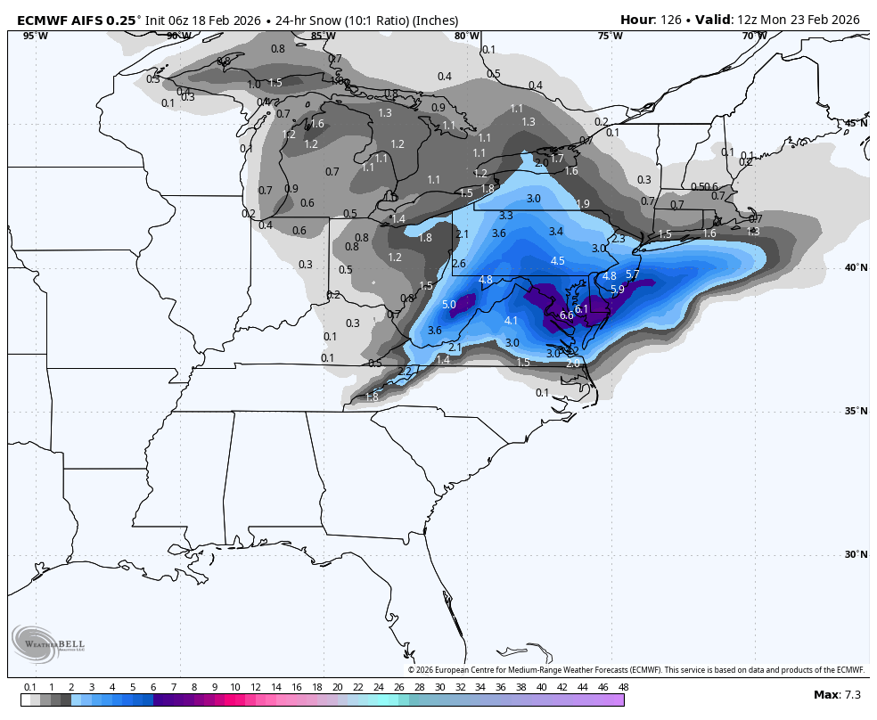
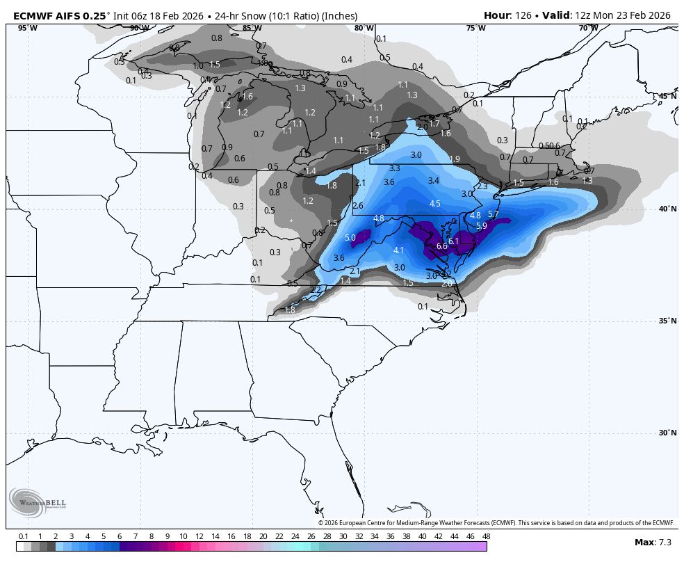
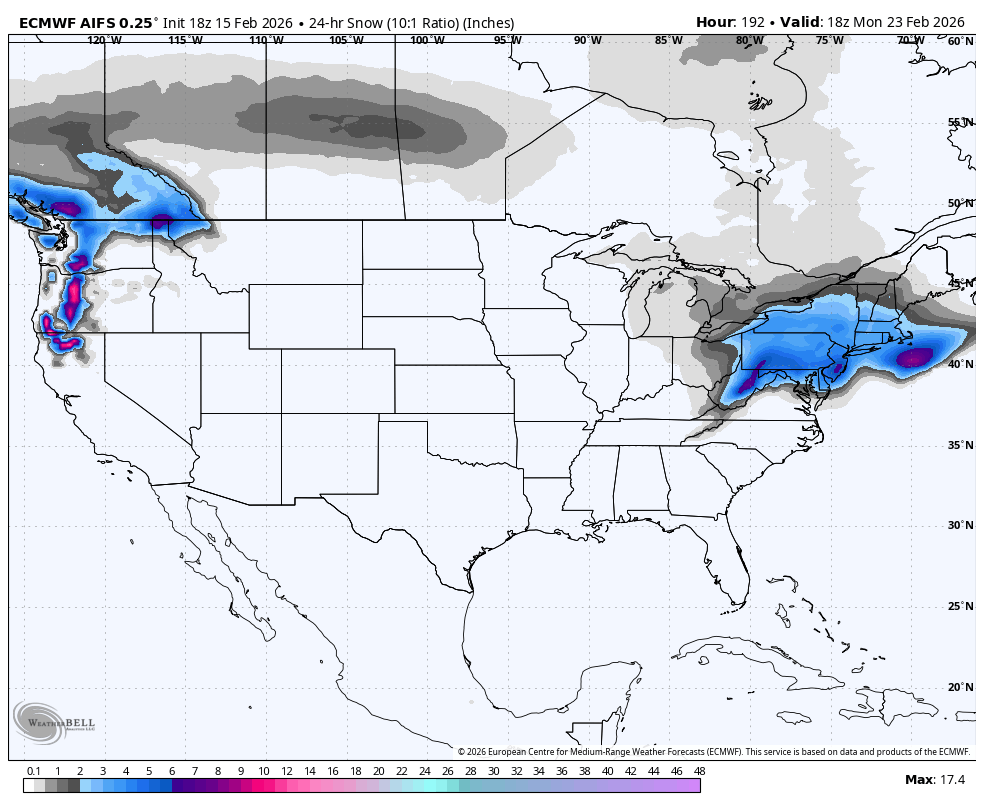
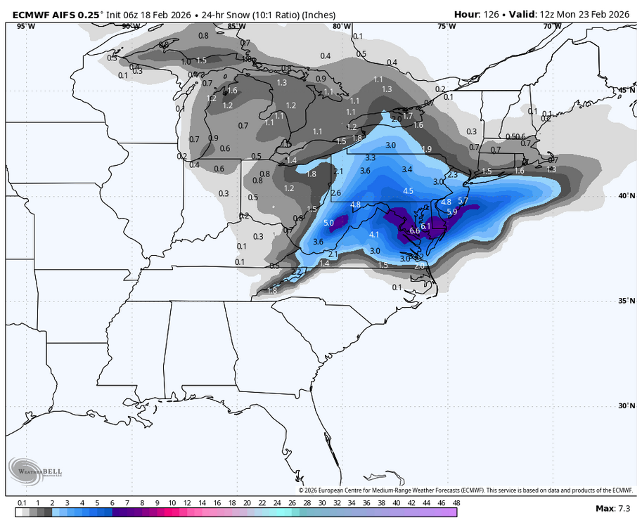
Unfortunately most models went the wrong way at 0z for the Sunday chance. The 6z AI Euro still offers some hope for a moderate event chance.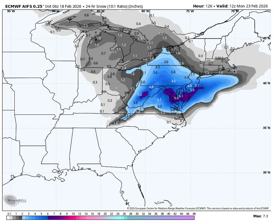
-
Late February/Early March 2026 Mid-Long Range
Blizzard of 93 replied to WxUSAF's topic in Mid Atlantic
-
Central PA Winter 25/26 Discussion and Obs
Blizzard of 93 replied to MAG5035's topic in Upstate New York/Pennsylvania
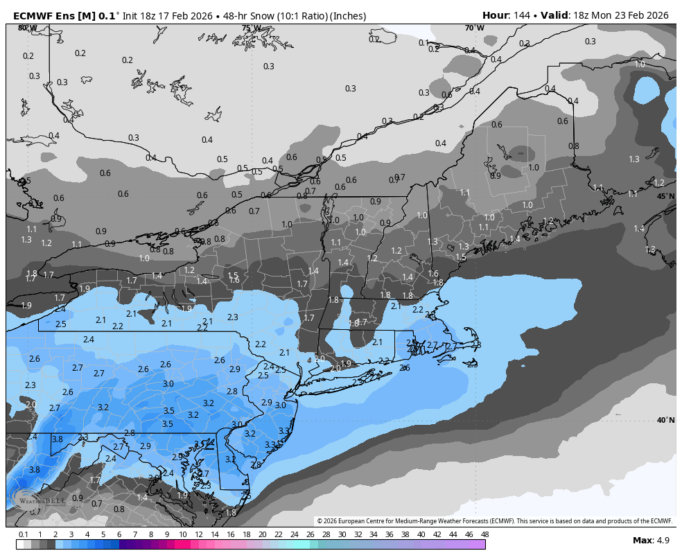
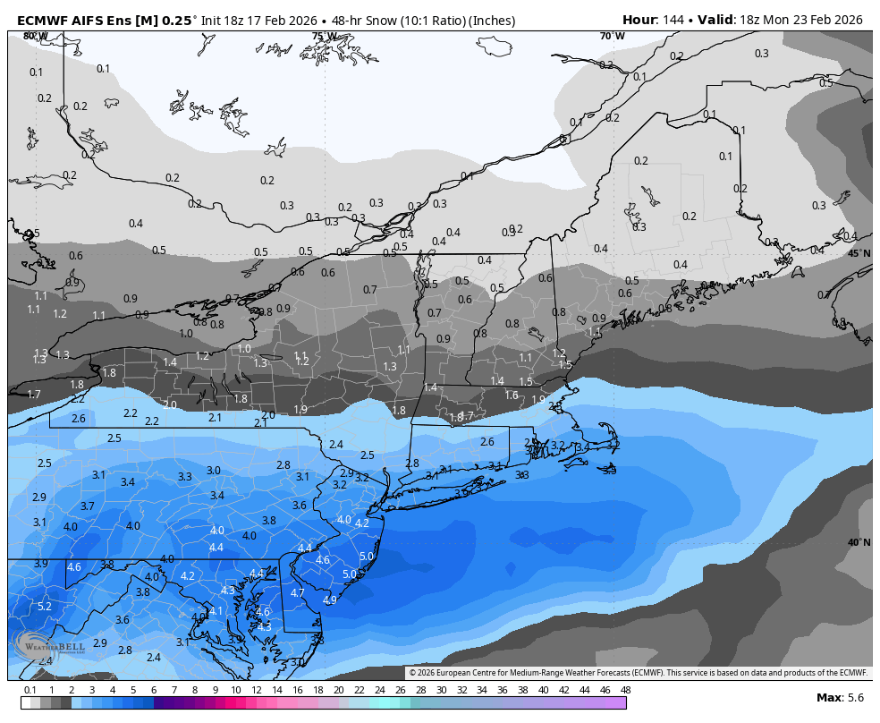
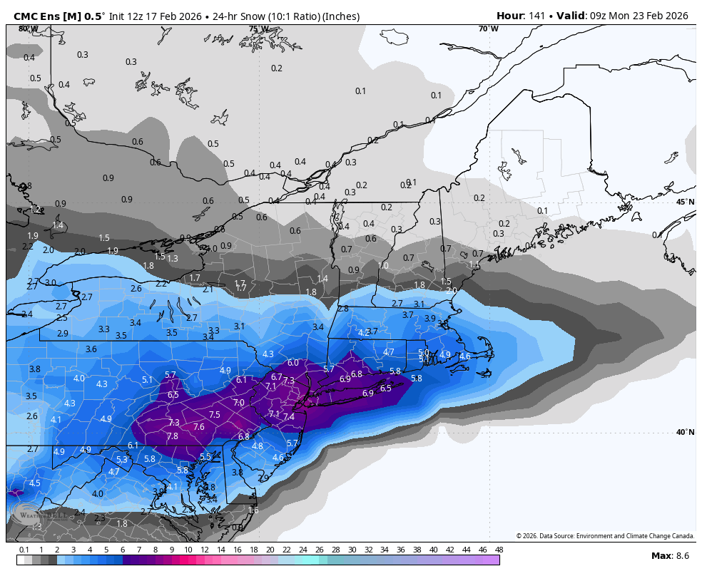
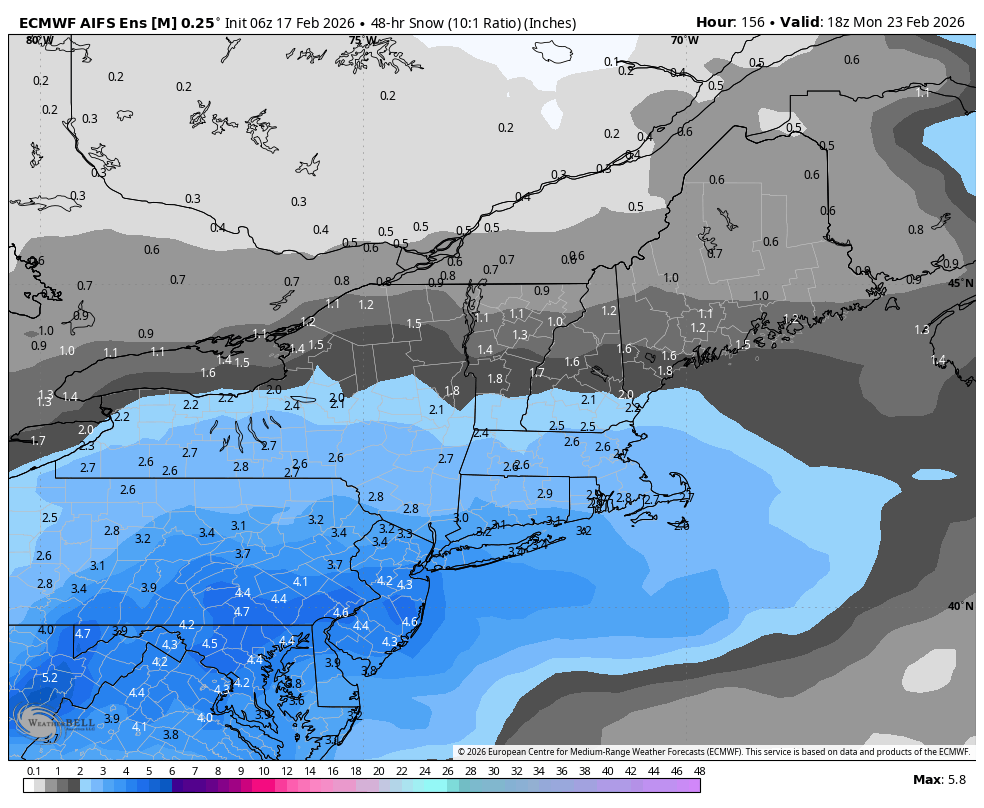
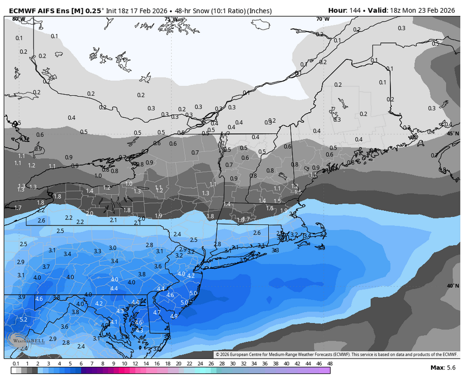
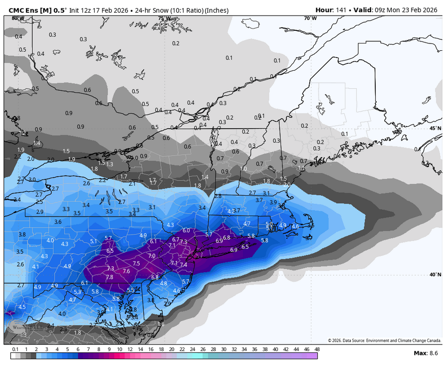
Ensembles are still the best tool that we have at this range. The 18z EPS, 18z AI EPS & 12z Canadian ensemble all point to the chance of a moderate snow potential on Sunday. Details TBD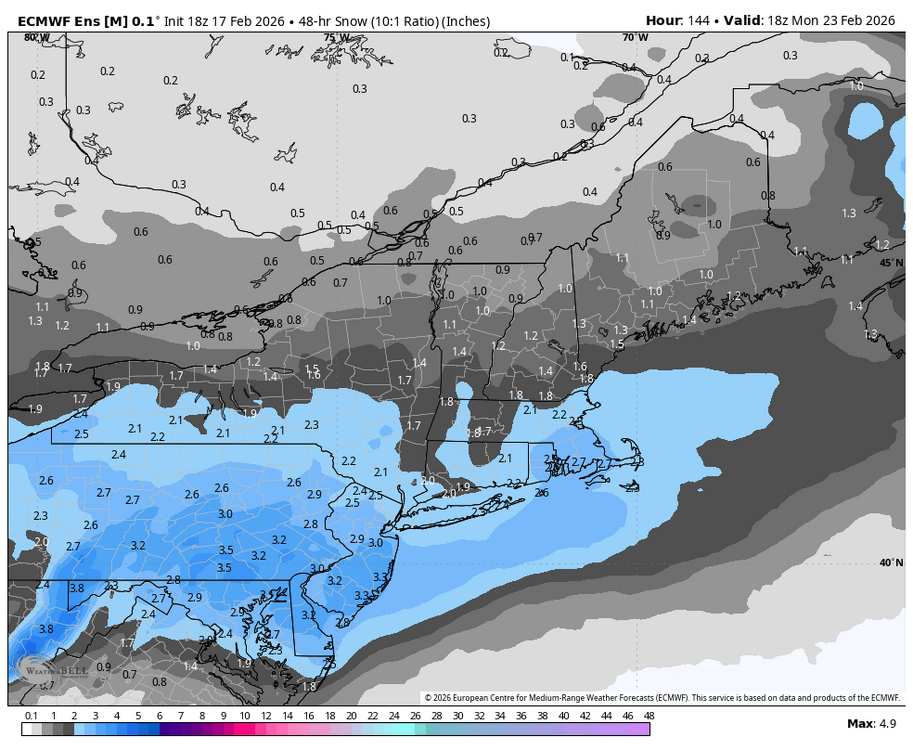
-
Central PA Winter 25/26 Discussion and Obs
Blizzard of 93 replied to MAG5035's topic in Upstate New York/Pennsylvania
6z AI EPS looks good for Sunday into Monday & the 6z Regular EPS at the end of its 6 day run improved as well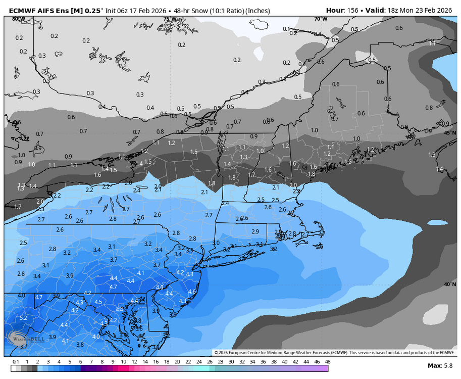
-
Central PA Winter 25/26 Discussion and Obs
Blizzard of 93 replied to MAG5035's topic in Upstate New York/Pennsylvania
This Sunday chance is gaining momentum for snow potential across most models. 6z GFS, 0z Canadian & 6z AI Euro -
E PA/NJ/DE Winter 2025-26 Obs/Discussion
Blizzard of 93 replied to LVblizzard's topic in Philadelphia Region
@brooklynwx99 posted this in another thread earlier this evening. “this speaks for itself... AIFS-ENS is very similar to Feb 21. not advertising impacts like that, obviously, but it's becoming clear that this setup holds high end potential. we'll see how things trend in the coming days, but man that is uncanny” -
Central PA Winter 25/26 Discussion and Obs
Blizzard of 93 replied to MAG5035's topic in Upstate New York/Pennsylvania
18z EPS & 18z AI EPS look great as well for the Sunday chance. Lots of maps are posted in the Mid Atlantic thread for your viewing pleasure. -
Central PA Winter 25/26 Discussion and Obs
Blizzard of 93 replied to MAG5035's topic in Upstate New York/Pennsylvania
Yes, indeed, hopefully we reel this one in for Sunday. -
Central PA Winter 25/26 Discussion and Obs
Blizzard of 93 replied to MAG5035's topic in Upstate New York/Pennsylvania
I know, but I didn’t believe it, but here we are, lol! -
Central PA Winter 25/26 Discussion and Obs
Blizzard of 93 replied to MAG5035's topic in Upstate New York/Pennsylvania
Lol, this worthless storm is infuriating me to the bitter end… I I don’t think that I have EVER seen a freaking change over happen well to my South east prior to my change over to snow in Marysville. Normally the change over happens first in Altoona, State College, Newport, Marysville, MDT, then Lancaster l, etc… Not tonight! -
Late February/Early March 2026 Mid-Long Range
Blizzard of 93 replied to WxUSAF's topic in Mid Atlantic
18z GFS AI & 18z GEFS AI also have the 23rd chance. -
Late February/Early March 2026 Mid-Long Range
Blizzard of 93 replied to WxUSAF's topic in Mid Atlantic
18z Euro AI has the 23rd chance.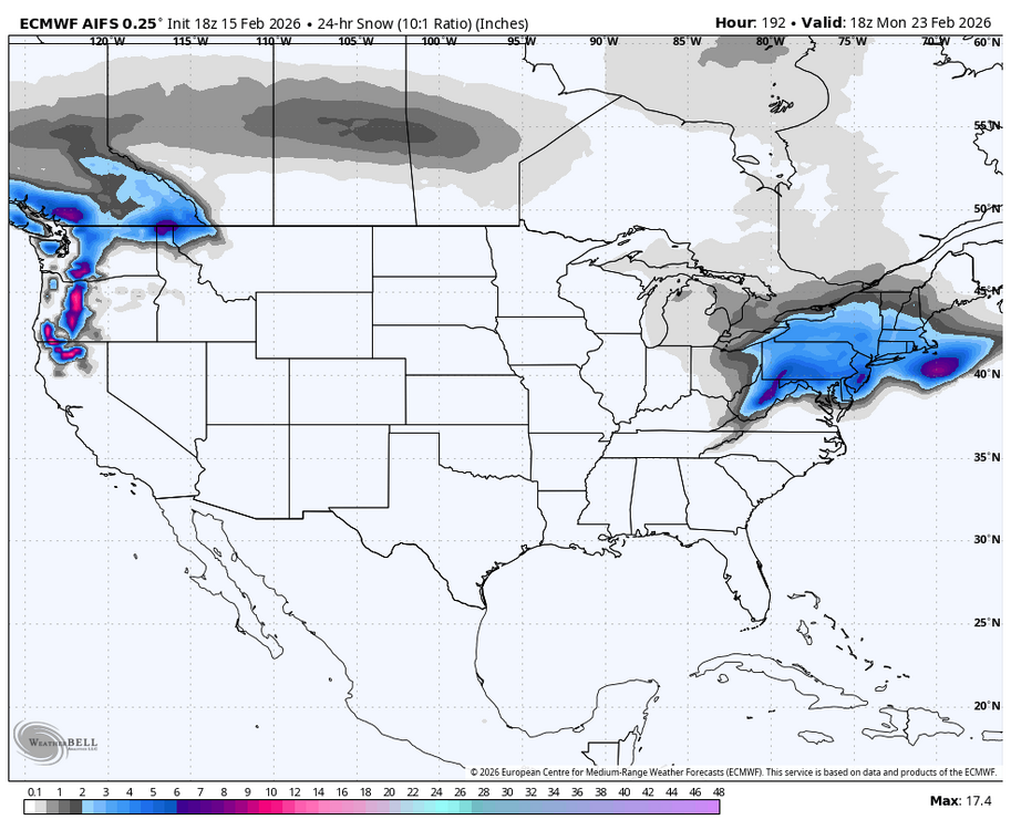
-
Central PA Winter 25/26 Discussion and Obs
Blizzard of 93 replied to MAG5035's topic in Upstate New York/Pennsylvania
-
Central PA Winter 25/26 Discussion and Obs
Blizzard of 93 replied to MAG5035's topic in Upstate New York/Pennsylvania
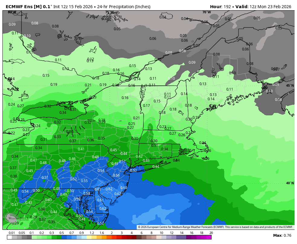
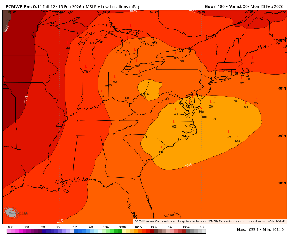
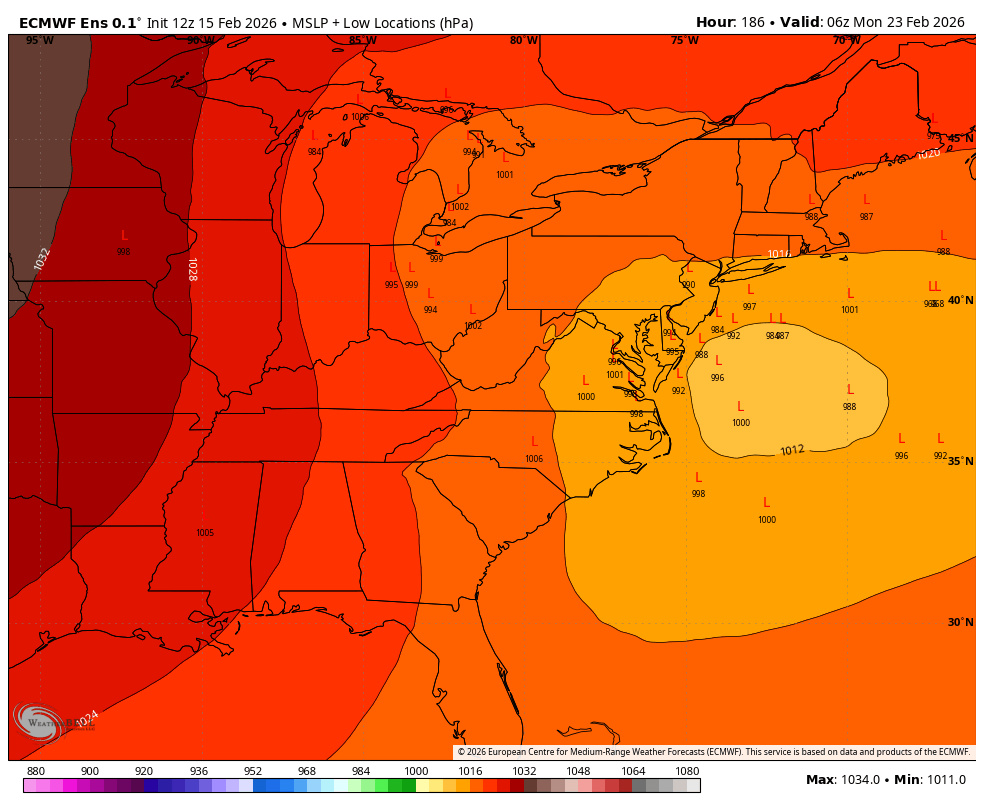
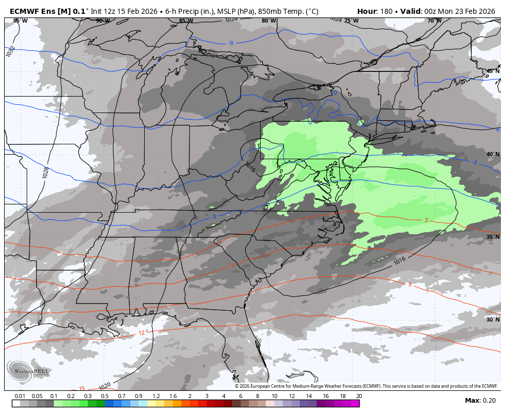
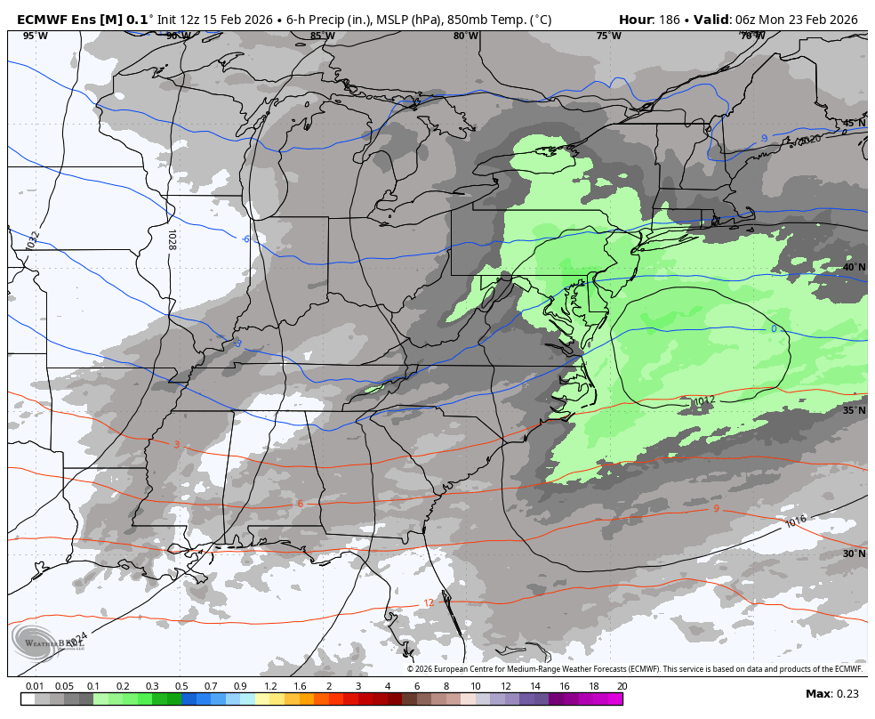
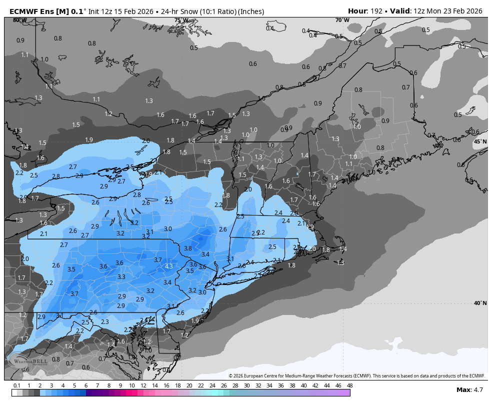
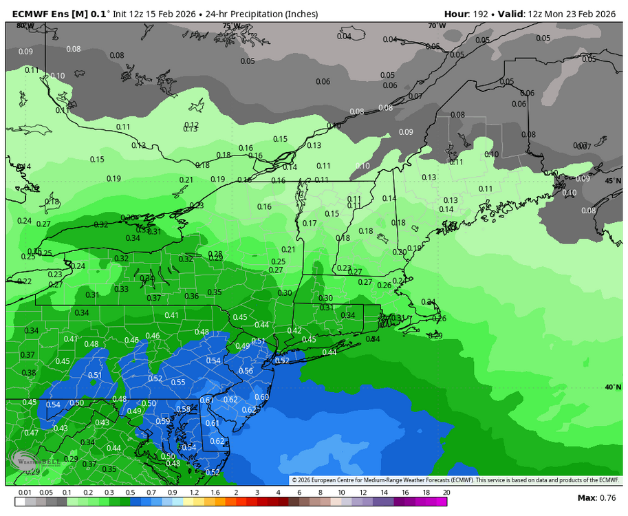
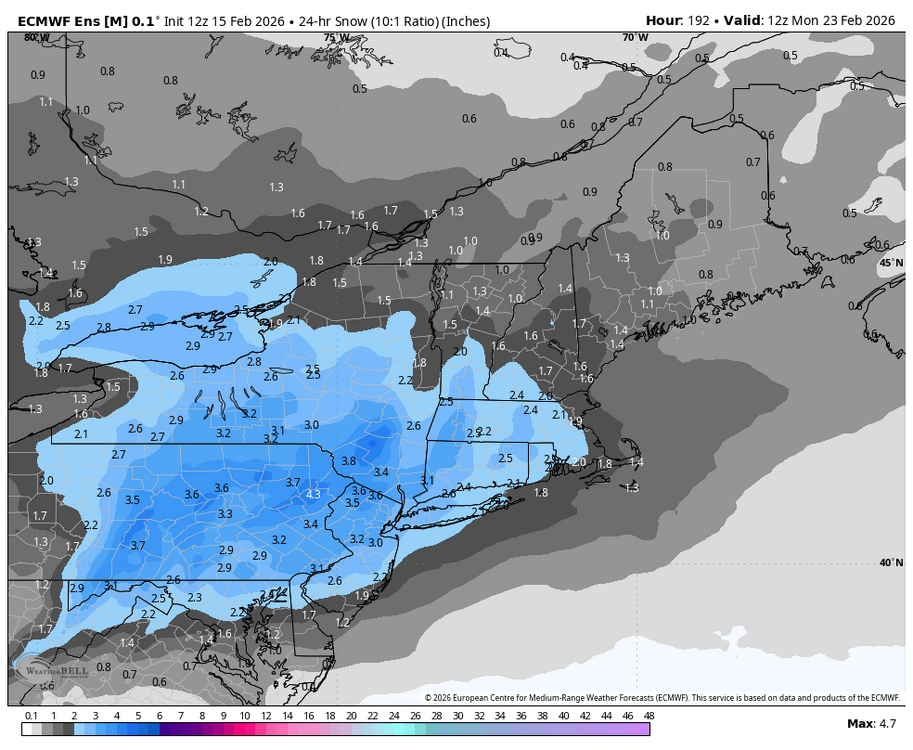
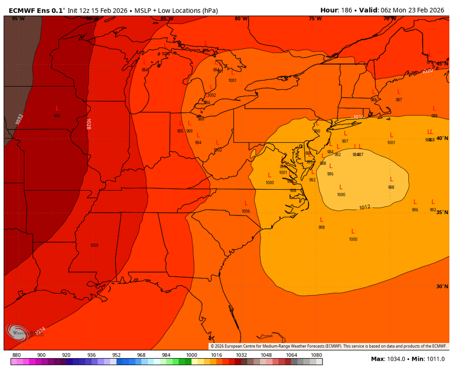
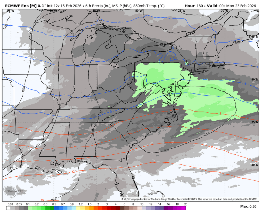
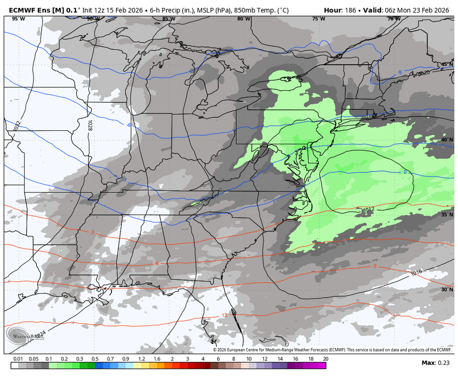
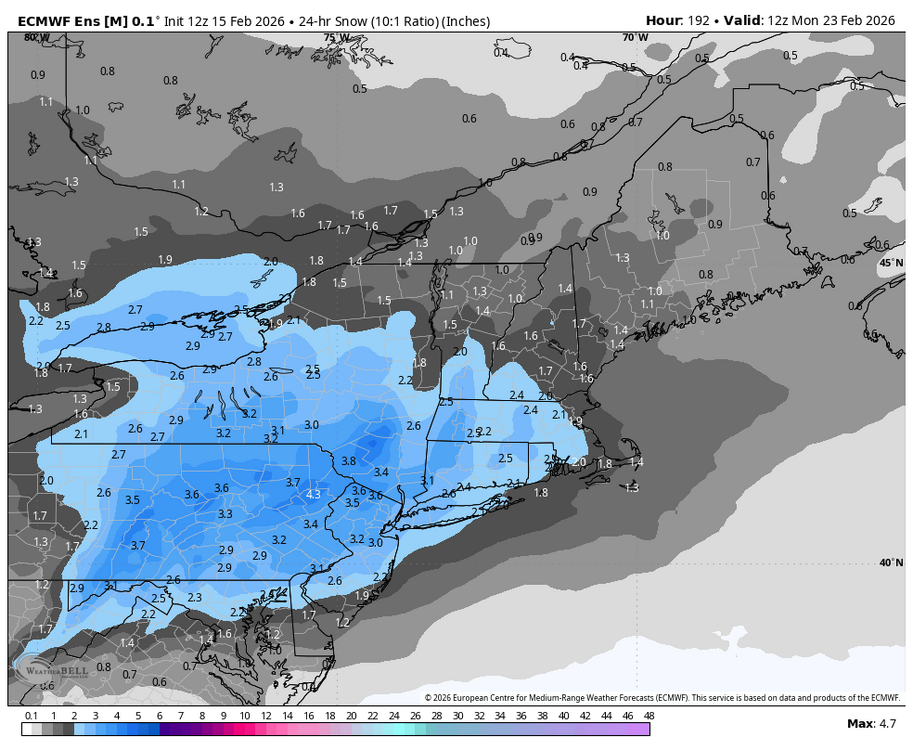
The window on the 23rd on the 12z EPS has a favorable Miller B look this run that could lead to a potential winter storm chance.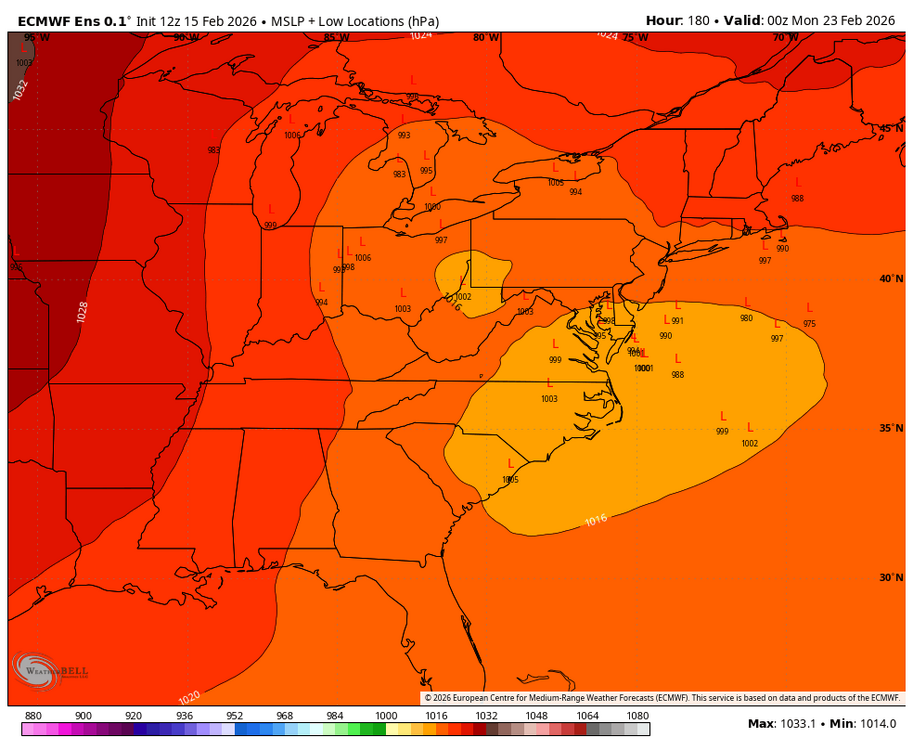
-
Late February/Early March 2026 Mid-Long Range
Blizzard of 93 replied to WxUSAF's topic in Mid Atlantic
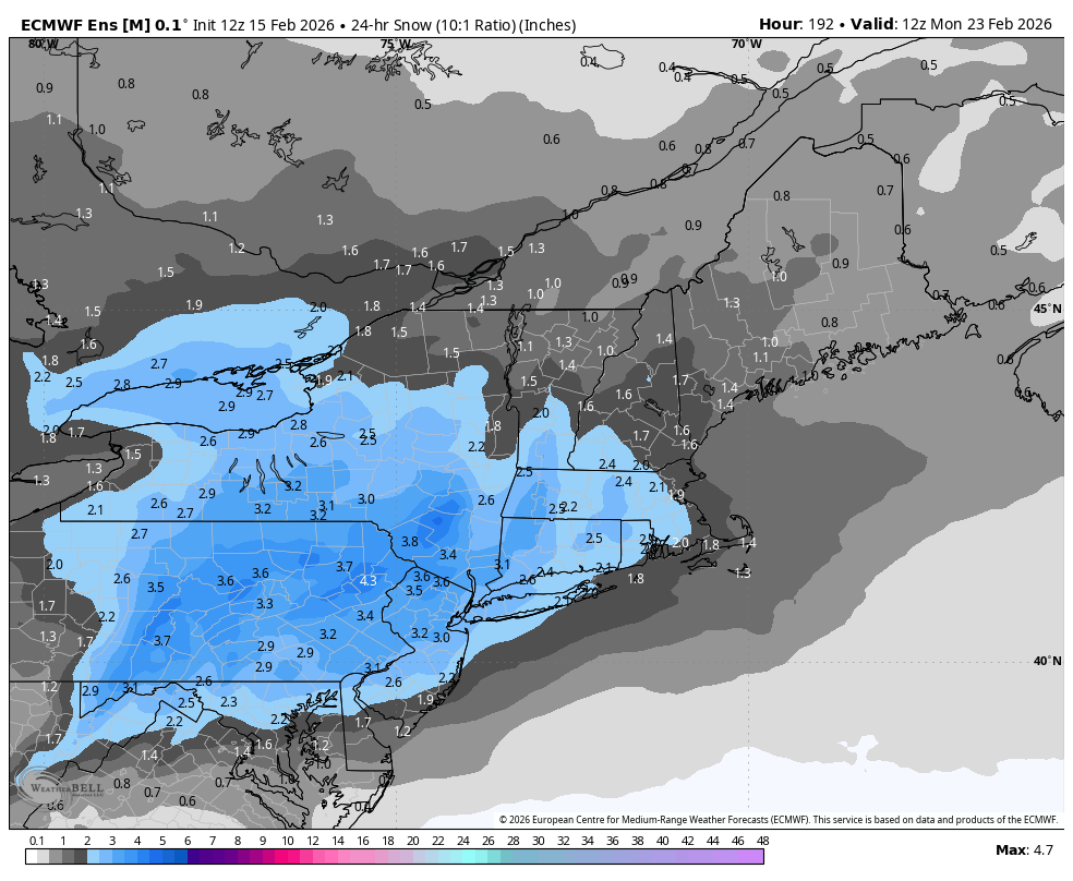
Here is the 12z EPS 24 hour precip & snow for the 23rd chance.
-
Late February/Early March 2026 Mid-Long Range
Blizzard of 93 replied to WxUSAF's topic in Mid Atlantic
The window on the 23rd on the 12z EPS has a favorable Miller B look this run that could lead to a potential winter storm chance.
-
Central PA Winter 25/26 Discussion and Obs
Blizzard of 93 replied to MAG5035's topic in Upstate New York/Pennsylvania
Even after whatever table scraps we may get this evening, the 12z Euro & Euro AI say that the pattern through the end of this month looks to be active with a few Winter storm chances. -
Central PA Winter 25/26 Discussion and Obs
Blizzard of 93 replied to MAG5035's topic in Upstate New York/Pennsylvania
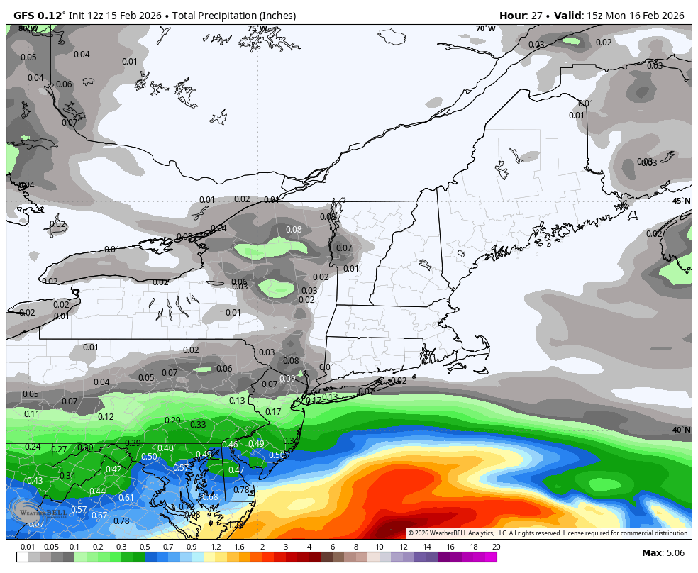
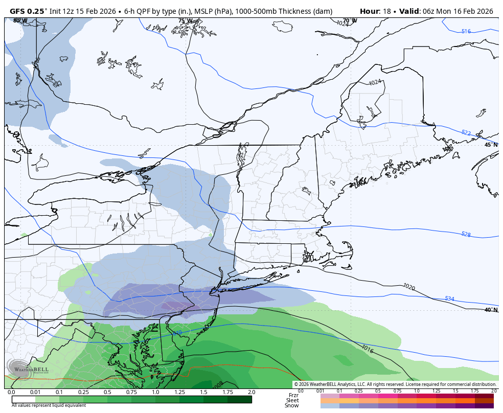
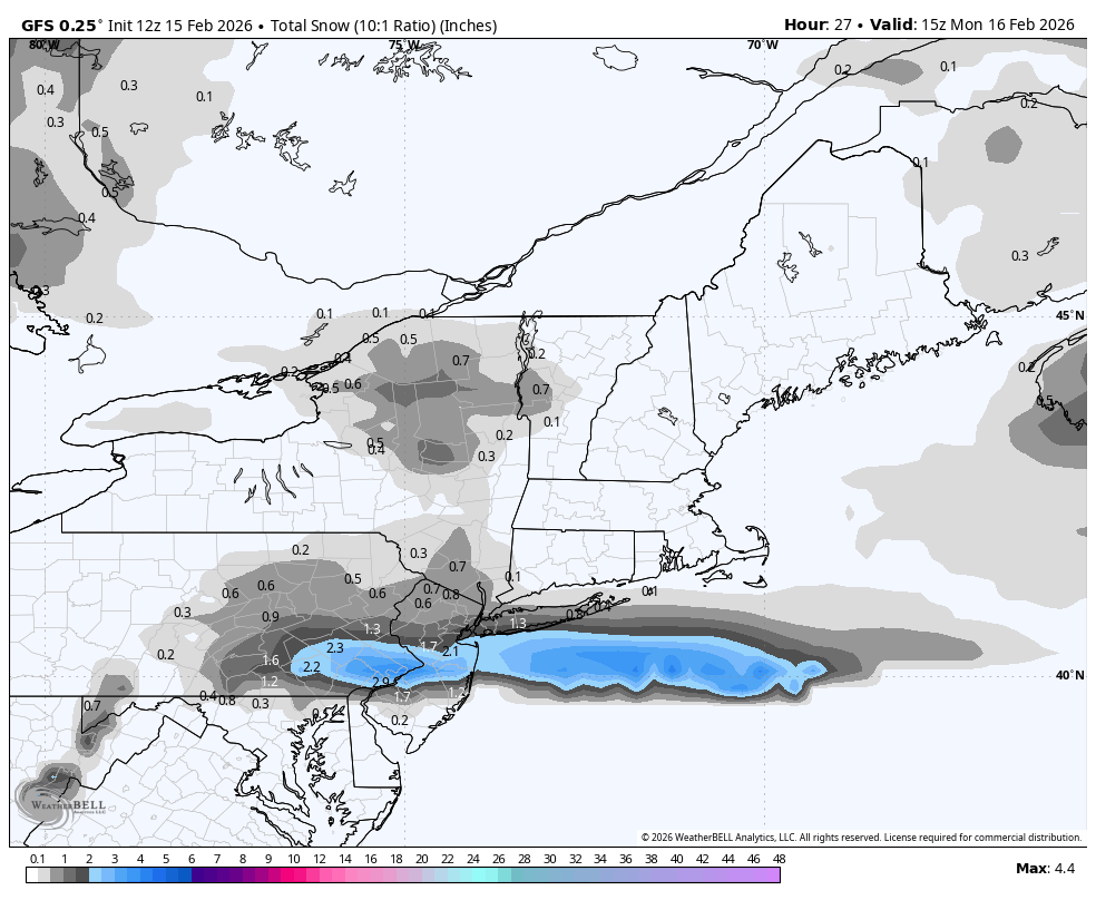
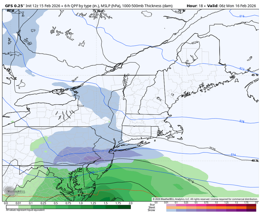
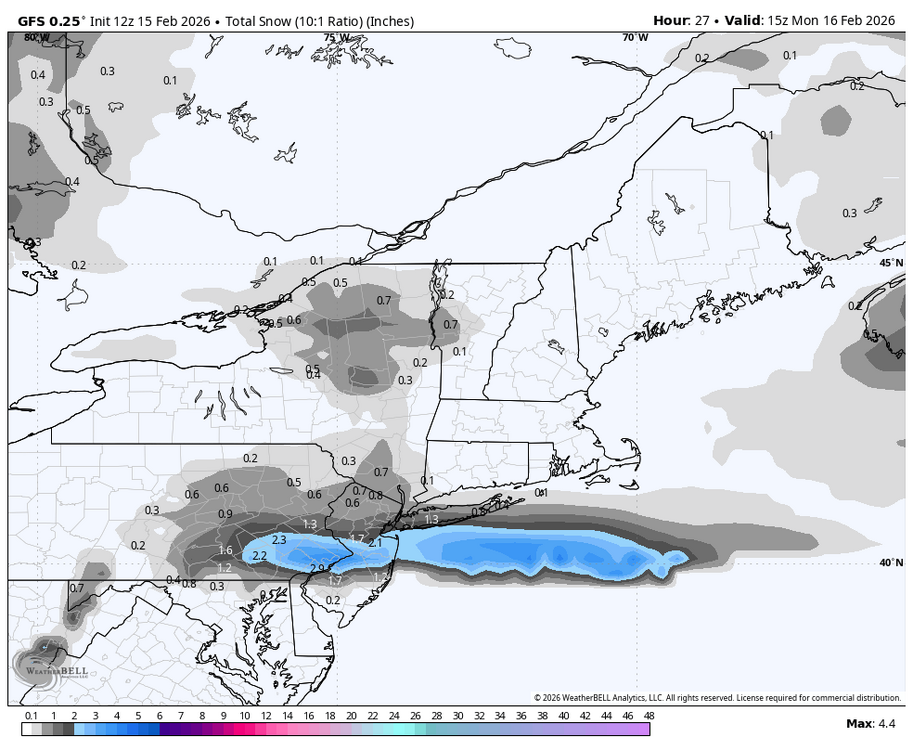
12z GFS still is showing 1 to 2 inches of snow tonight for the LSV.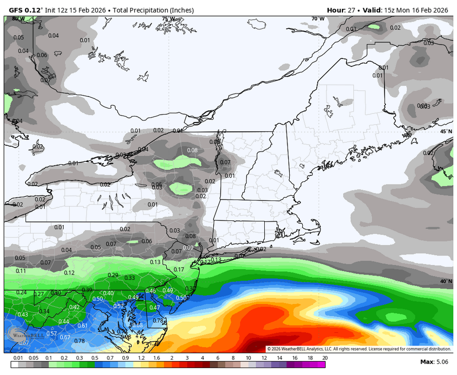
-
Central PA Winter 25/26 Discussion and Obs
Blizzard of 93 replied to MAG5035's topic in Upstate New York/Pennsylvania
The “better” runs early yesterday had the LSV getting .4 to .5 of precip that produced 3 to 4 inches of snow on the snow maps. Now, in that same time period, the models are closer to .2 of precip, so that’s only producing around 1 inch or snow or less in recent runs. -
Central PA Winter 25/26 Discussion and Obs
Blizzard of 93 replied to MAG5035's topic in Upstate New York/Pennsylvania
It’s all about precip rates. If we would get good precip, it would snow. Marginal situations require good rates to overcome & snow. -
Central PA Winter 25/26 Discussion and Obs
Blizzard of 93 replied to MAG5035's topic in Upstate New York/Pennsylvania
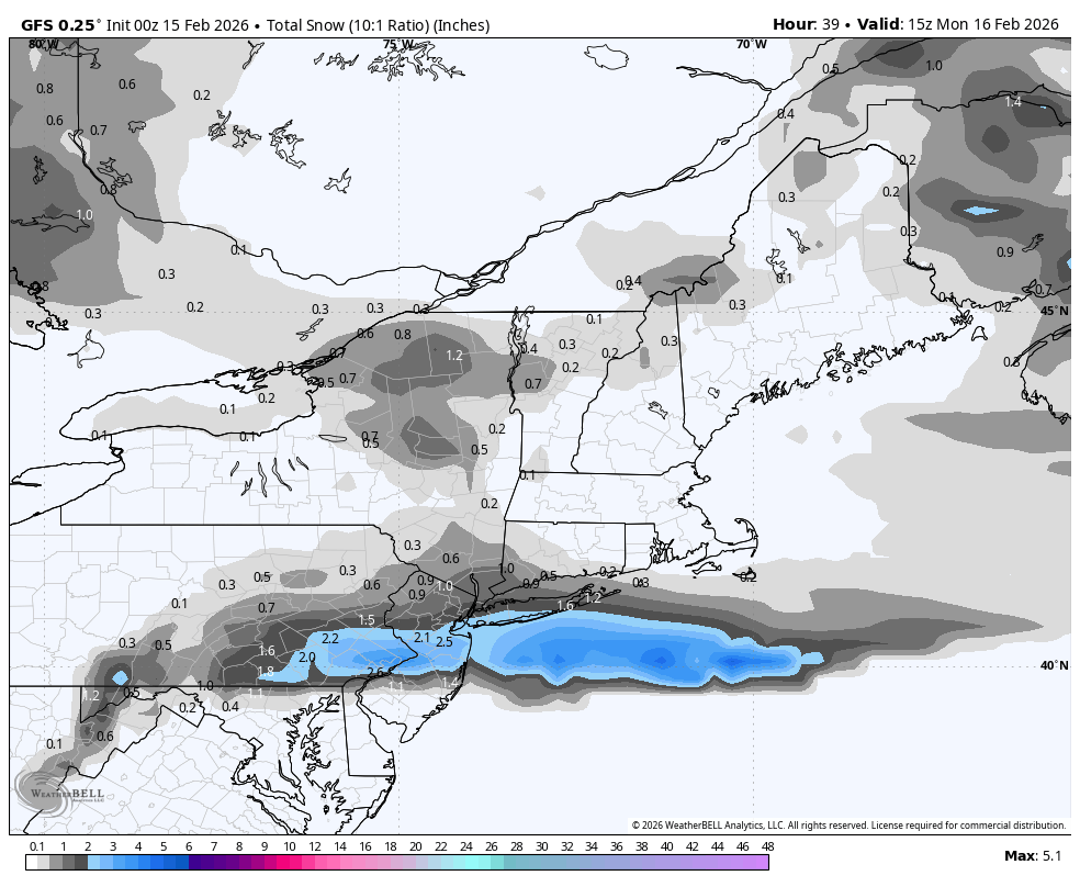
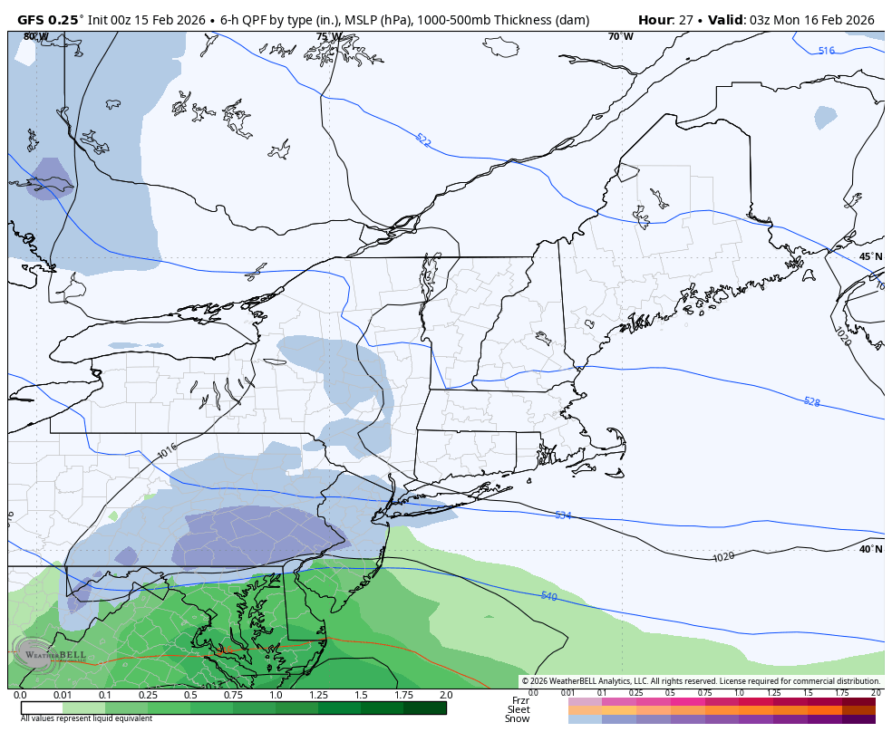
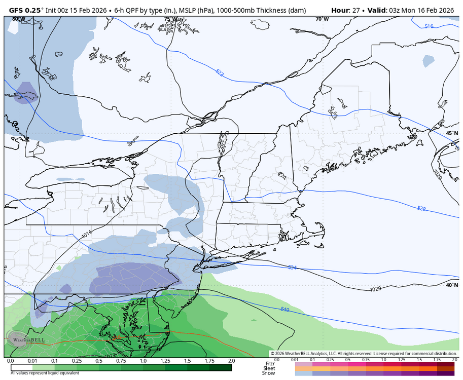
0z GFS keeps hope alive for tomorrow evening with up to 2 inches for the LSV this run.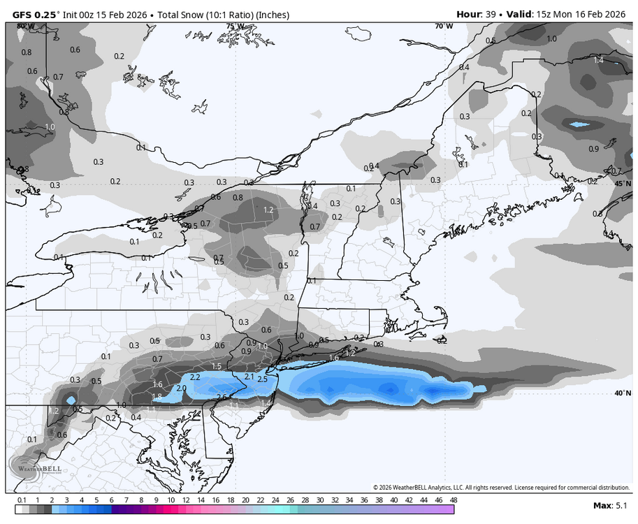
-
Central PA Winter 25/26 Discussion and Obs
Blizzard of 93 replied to MAG5035's topic in Upstate New York/Pennsylvania
I mean, just look at thIs from @Newman in the Philly thread. Just a tiny difference between 12z and 18z RRFS. Something must've gotten into the NOAA mesoscale products at 12z LOL -
Central PA Winter 25/26 Discussion and Obs
Blizzard of 93 replied to MAG5035's topic in Upstate New York/Pennsylvania
Under 48 hours, nine times out of 10, once a trend starts, it usually either builds momentum or levels out. These continual all over the place rug pulls are brutal with this potential event. -
Central PA Winter 25/26 Discussion and Obs
Blizzard of 93 replied to MAG5035's topic in Upstate New York/Pennsylvania
I am so ready to be done tracking this system! 2 weeks ago, many of us started watching this weekend period. It went from potential major storm to no storm to late yesterday looking like a potential recovery to an Advisory event to now who the bleep knows! -
Central PA Winter 25/26 Discussion and Obs
Blizzard of 93 replied to MAG5035's topic in Upstate New York/Pennsylvania
18z just cut back as well. About .20 less precip for the LSV, so snow amounts are now less than 2 inches for most of us this run.