Blizzard of 93
-
Posts
13,024 -
Joined
-
Last visited
Content Type
Profiles
Blogs
Forums
American Weather
Media Demo
Store
Gallery
Everything posted by Blizzard of 93
-
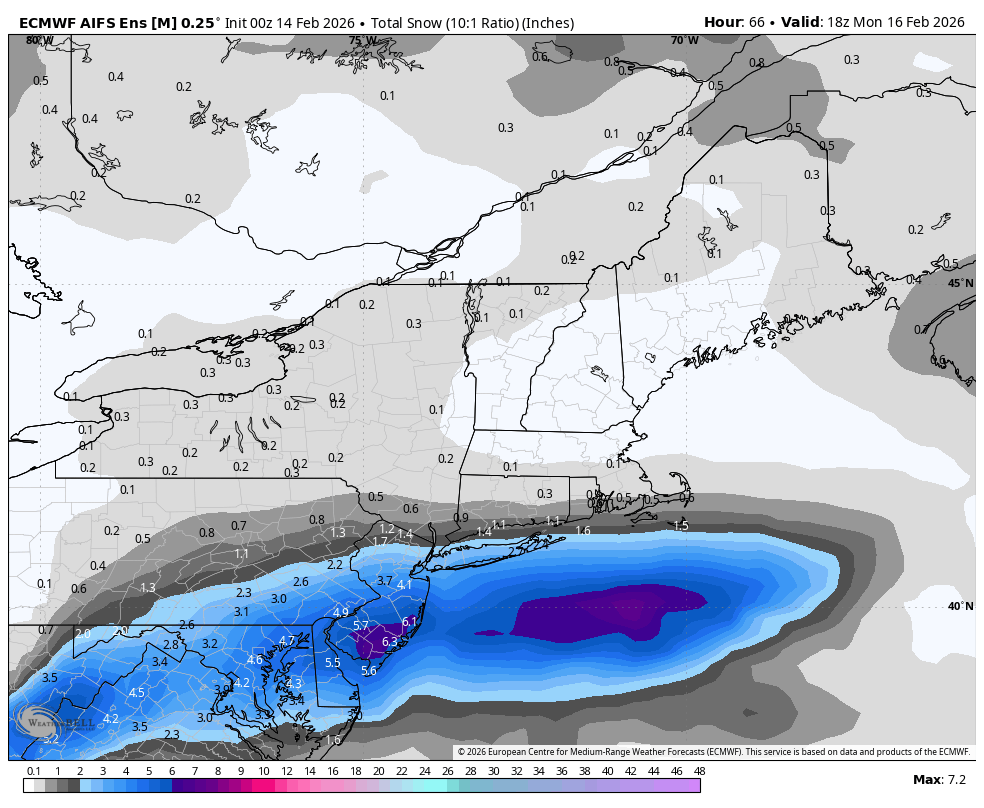
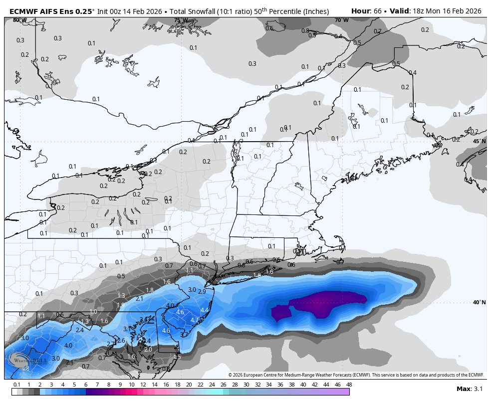
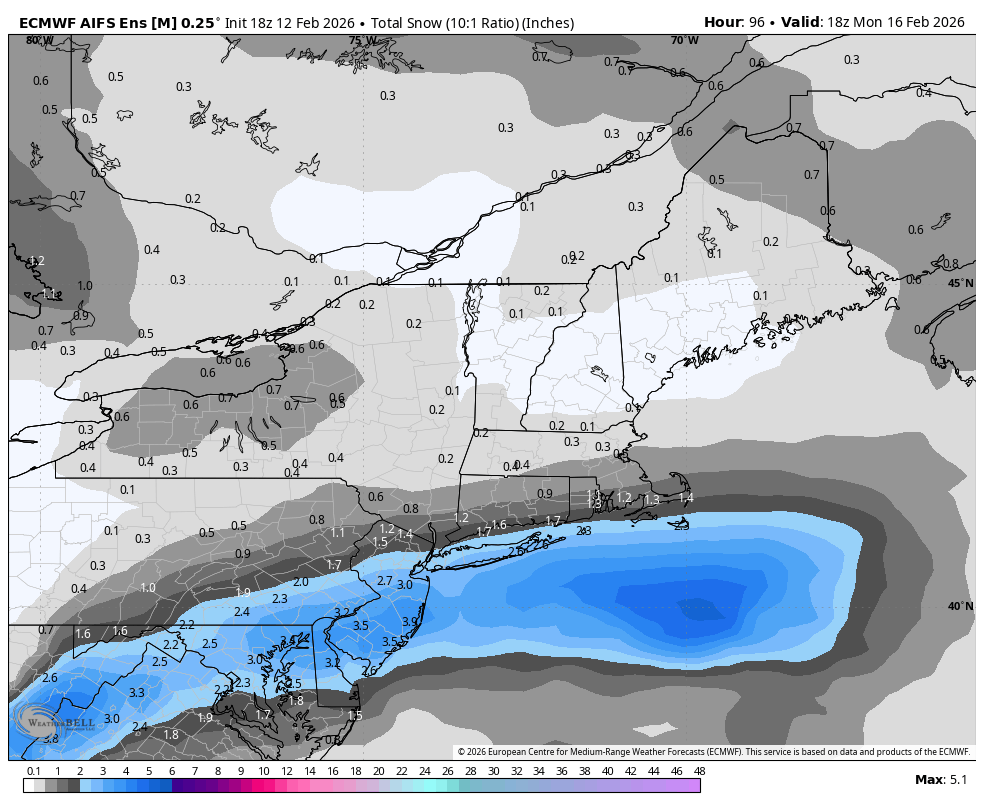
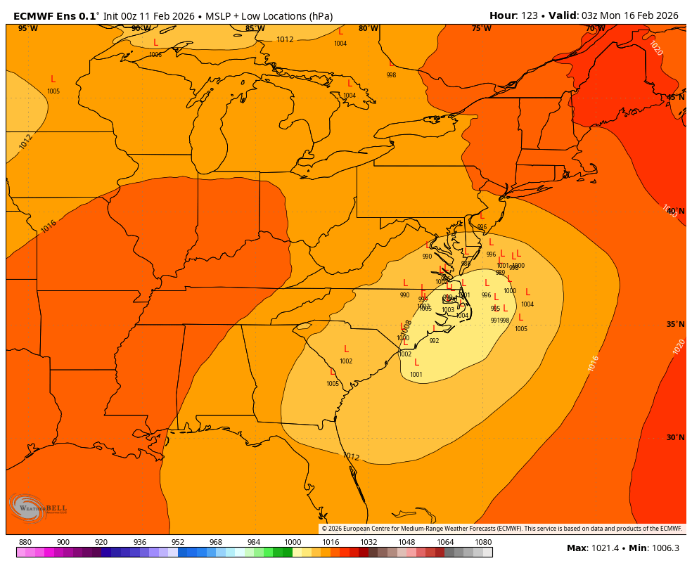
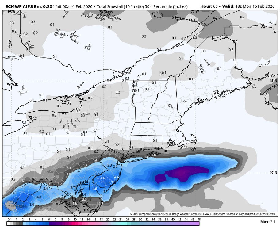
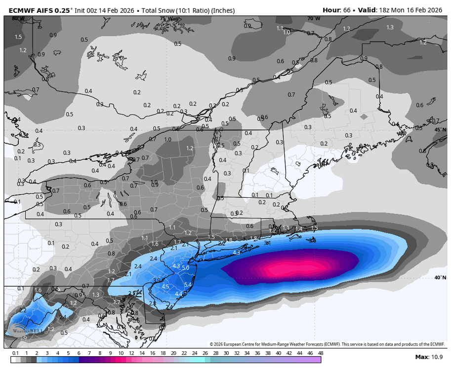
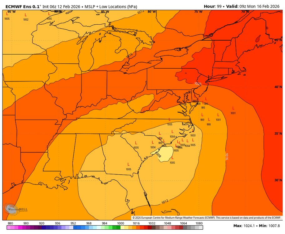
The 0z AI EPS also shows snow on both the mean & median.

-
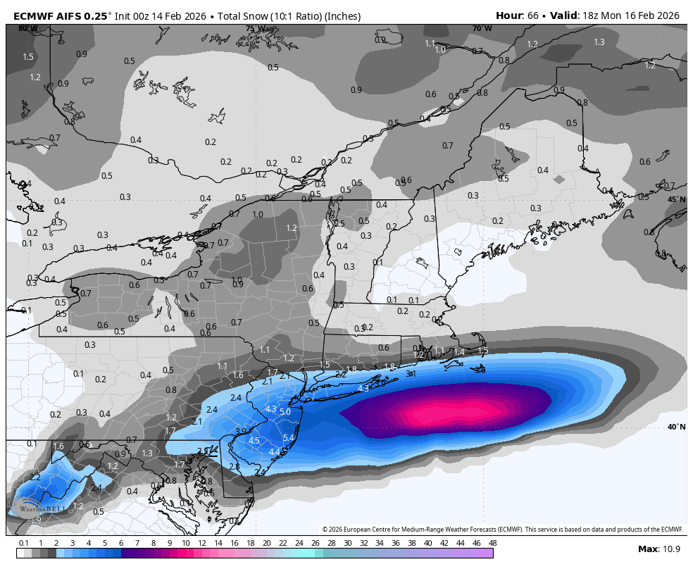
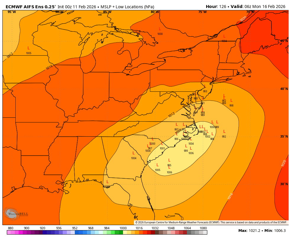
The 0z Euro AI shows some snow by Monday am.
-
Central PA Winter 25/26 Discussion and Obs
Blizzard of 93 replied to MAG5035's topic in Upstate New York/Pennsylvania
Where do I sign for the 0z GFS ? This looks like some of the runs that we had several days ago for this Sunday pm chance… Let’s see if we can reel this in…?
-
Central PA Winter 25/26 Discussion and Obs
Blizzard of 93 replied to MAG5035's topic in Upstate New York/Pennsylvania
Very active 18z GFS run with multiple Winter storm chances after our brief warm up next week. -
Central PA Winter 25/26 Discussion and Obs
Blizzard of 93 replied to MAG5035's topic in Upstate New York/Pennsylvania
Yes, hopefully models finally converge by tomorrow, but I would sign for the solid Advisory level event that the 18z GFS is showing for southern PA Sunday night. -
Central PA Winter 25/26 Discussion and Obs
Blizzard of 93 replied to MAG5035's topic in Upstate New York/Pennsylvania
Well, we only have the 6z ICON on our side this morning for the Sunday snow chance…. Let’s hope for a comeback at 12z …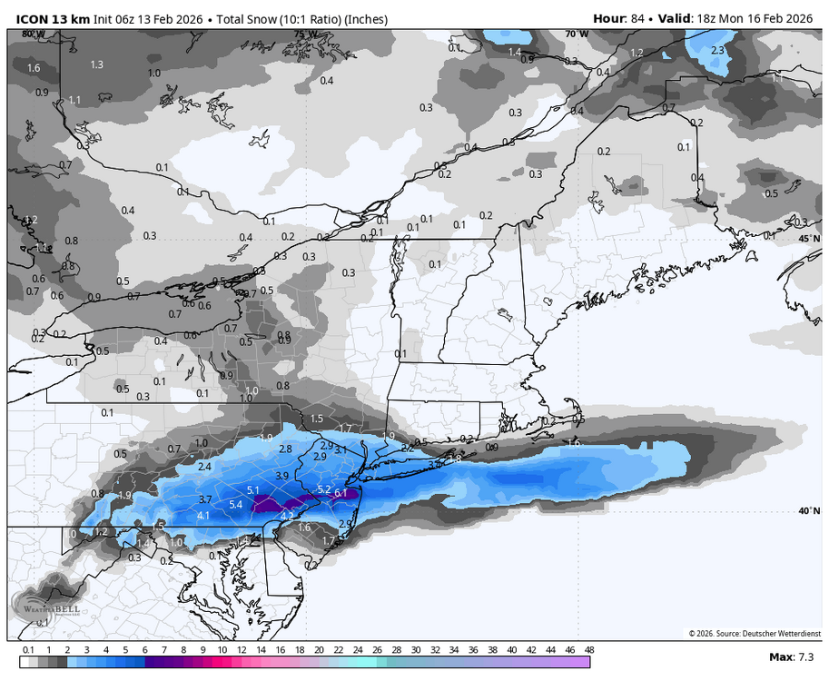
-
Central PA Winter 25/26 Discussion and Obs
Blizzard of 93 replied to MAG5035's topic in Upstate New York/Pennsylvania
Even if this one mostly misses us, there should be more chances as the month goes on. -
Central PA Winter 25/26 Discussion and Obs
Blizzard of 93 replied to MAG5035's topic in Upstate New York/Pennsylvania
18z Euro AI & AI EPS both keep hope alive for southern PA as well.
-
Central PA Winter 25/26 Discussion and Obs
Blizzard of 93 replied to MAG5035's topic in Upstate New York/Pennsylvania
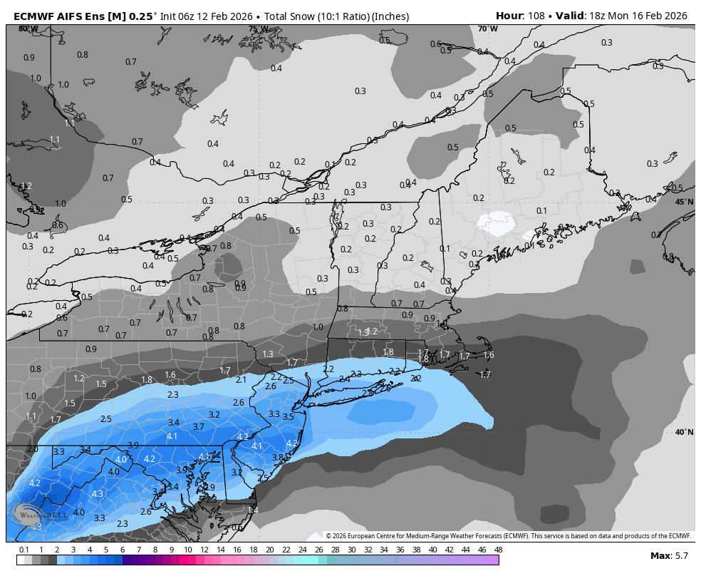
18z Euro keeps the hope alive for the Sunday chance for southern PA.
-
Central PA Winter 25/26 Discussion and Obs
Blizzard of 93 replied to MAG5035's topic in Upstate New York/Pennsylvania
6z AI EPS still says that we are in the game for later this weekend.
-
Central PA Winter 25/26 Discussion and Obs
Blizzard of 93 replied to MAG5035's topic in Upstate New York/Pennsylvania
6z GEFS also has a light event chance on Sunday into Monday as well.
-
Central PA Winter 25/26 Discussion and Obs
Blizzard of 93 replied to MAG5035's topic in Upstate New York/Pennsylvania
6z EPS still brings a chance of light snow on Sunday to southern PA.
-
Central PA Winter 25/26 Discussion and Obs
Blizzard of 93 replied to MAG5035's topic in Upstate New York/Pennsylvania
18Z AI EPS - thanks to @Weather Will in the Mid Atlantic thread. For CTP, about half of the ensemble members bring at least light snow & several heavy hitters remain as possible outcomes. -
Central PA Winter 25/26 Discussion and Obs
Blizzard of 93 replied to MAG5035's topic in Upstate New York/Pennsylvania
6z AI EPS beefed back up to what it had been showing consistently for days up until 2 days ago, but it’s good to see it back on board at 0z & especially 6z. The 6z Regular EPS is on board too. -
Central PA Winter 25/26 Discussion and Obs
Blizzard of 93 replied to MAG5035's topic in Upstate New York/Pennsylvania
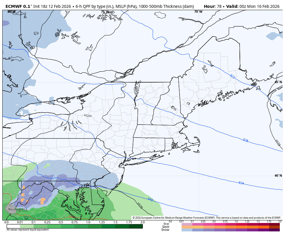
6z Euro continues to be on board with a slightly warmer & more tucked low position near the DelMarVa before it exits off of the coast. It still brings warning level snow to the Harrisburg area this run. If we end up with this track, I like our chances.
-
Central PA Winter 25/26 Discussion and Obs
Blizzard of 93 replied to MAG5035's topic in Upstate New York/Pennsylvania
If the 12z models are board, they will be updating again later today. -
Central PA Winter 25/26 Discussion and Obs
Blizzard of 93 replied to MAG5035's topic in Upstate New York/Pennsylvania
It’s not me… I am showing what the models said… Also, I posted their discussion from yesterday evening & CTP was certainly monitoring the potential. -
Central PA Winter 25/26 Discussion and Obs
Blizzard of 93 replied to MAG5035's topic in Upstate New York/Pennsylvania
0z EPS & 0z AI EPS got back on board as well.

-
Central PA Winter 25/26 Discussion and Obs
Blizzard of 93 replied to MAG5035's topic in Upstate New York/Pennsylvania
0z Canadian is still on board as well & has not wavered much the last couple of days.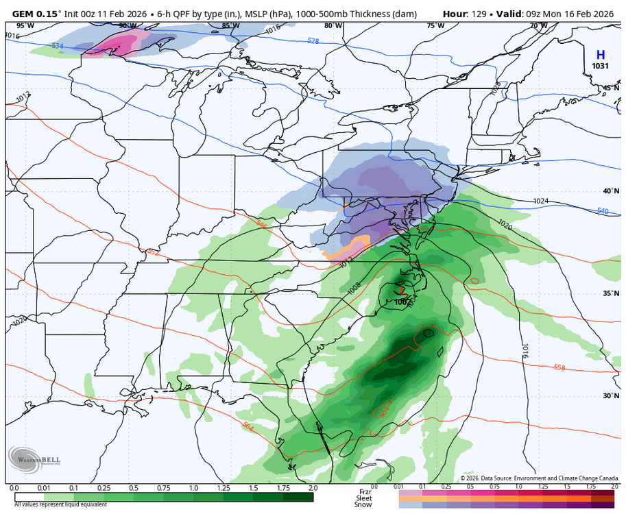
-
Central PA Winter 25/26 Discussion and Obs
Blizzard of 93 replied to MAG5035's topic in Upstate New York/Pennsylvania
@MAG5035 & everyone else! Check out the 0z Euro for the Sunday pm chance. Great run for CTP. -
Central PA Winter 25/26 Discussion and Obs
Blizzard of 93 replied to MAG5035's topic in Upstate New York/Pennsylvania
Detailed & entertaining Forecast Discussion from CTP on the Sunday snow chance. KEY MESSAGE 2: Continuing to monitor the potential for winter weather on Sunday. Over the next few days, a closed low currently off the NorCal Coast will drop southward as it opens a bit, and take a turn to the east after reaching the Baja Peninsula. The trough swings east over the srn US, and eventually develops a sfc low as Gulf moisture is incorporated. Timing and occurrence are fairly well- agreed- upon at that point. Mud gets thrown onto the crystal ball as divergence in track of the low and depth/residence of the cold air over the ern US are seen in the latest deterministic forecasts. If precip gets into PA, the hints are still there that the air will be cold enough in PA to have some snow at first, but not a slam dunk certainty. As alluded to, the GFS and ECMWF, and ECMWF-AI latest runs are keeping the low track flatter. That would make much, if not all, of the precip miss PA to the south. But, ensemble means from both sides of the pond and nord de la frontiere make precip well into PA with the CMCE mean pushing the most QPF into PA - and much farther north. The latest NBM guidance has trended lower with PoPs, which matches recent trends in guidance. The best chance for precipitation is currently across southern PA. Additional shifts/modifications are likely and we will continue to keep an eye for a more consistent/longer trend to make tweaks to this weekend`s forecast. -
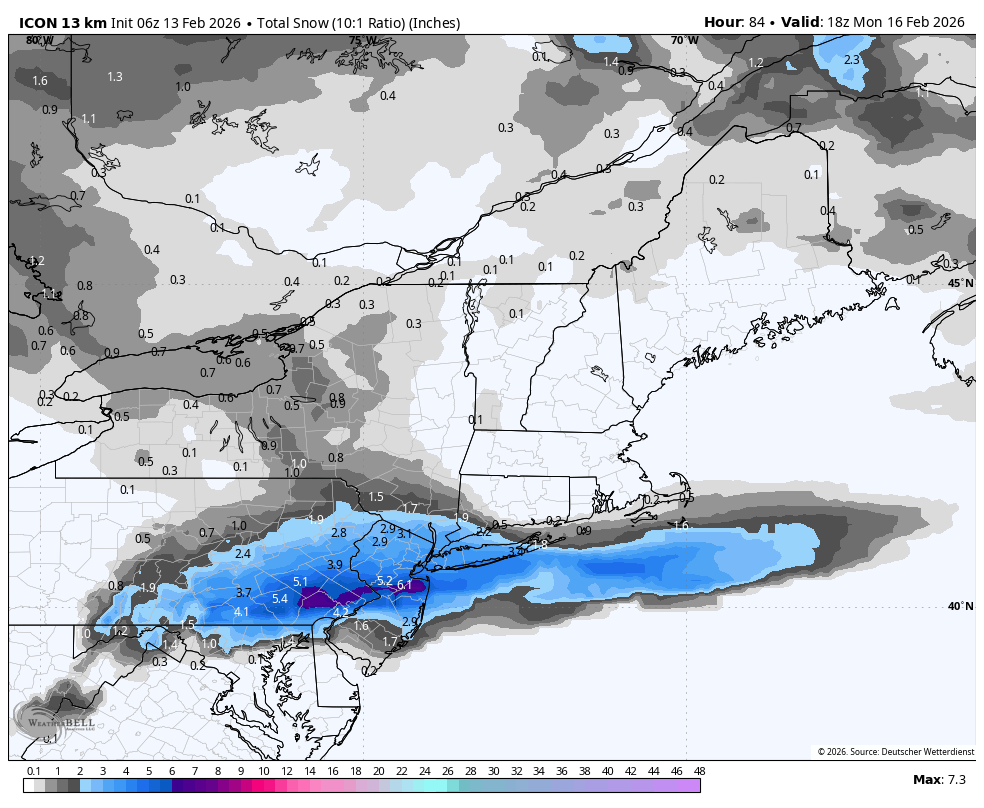
Thanks, I didn’t realize that it only went out to 84 hours.
-
Central PA Winter 25/26 Discussion and Obs
Blizzard of 93 replied to MAG5035's topic in Upstate New York/Pennsylvania
18z EPS is way too close to write anything off at this range.


-
@mitchnick or anyone else have the 18z Canadian?
-
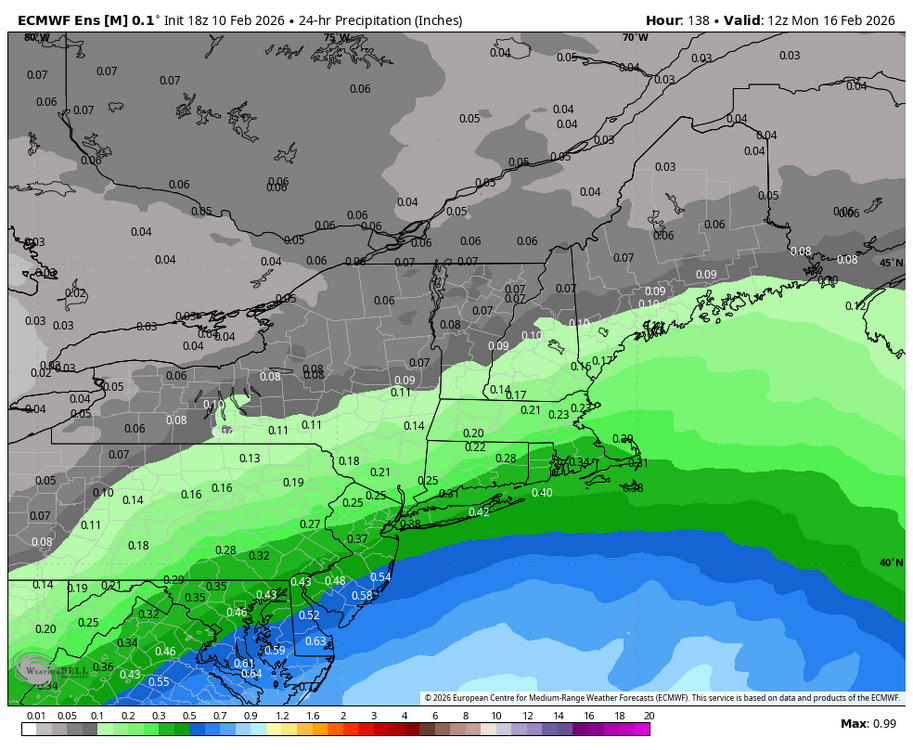
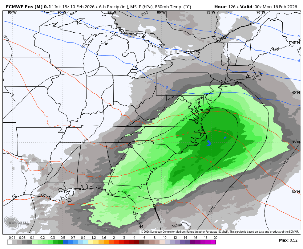
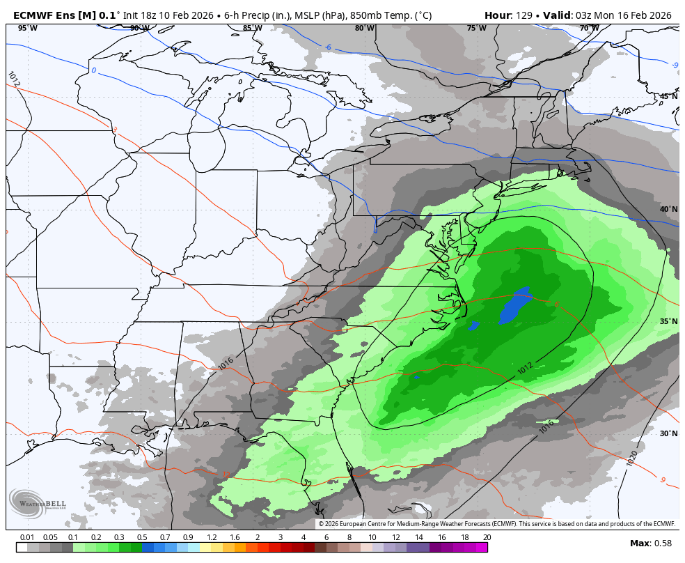
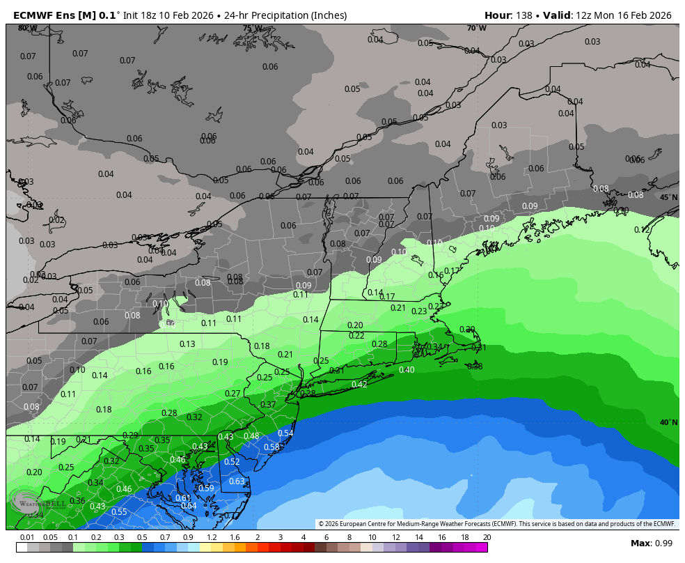
Here is the 24 precip on the 18z EPS.