Blizzard of 93
-
Posts
13,024 -
Joined
-
Last visited
Content Type
Profiles
Blogs
Forums
American Weather
Media Demo
Store
Gallery
Everything posted by Blizzard of 93
-
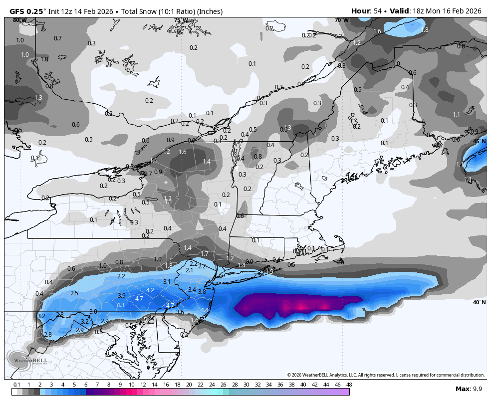
Central PA Winter 25/26 Discussion and Obs
Blizzard of 93 replied to MAG5035's topic in Upstate New York/Pennsylvania
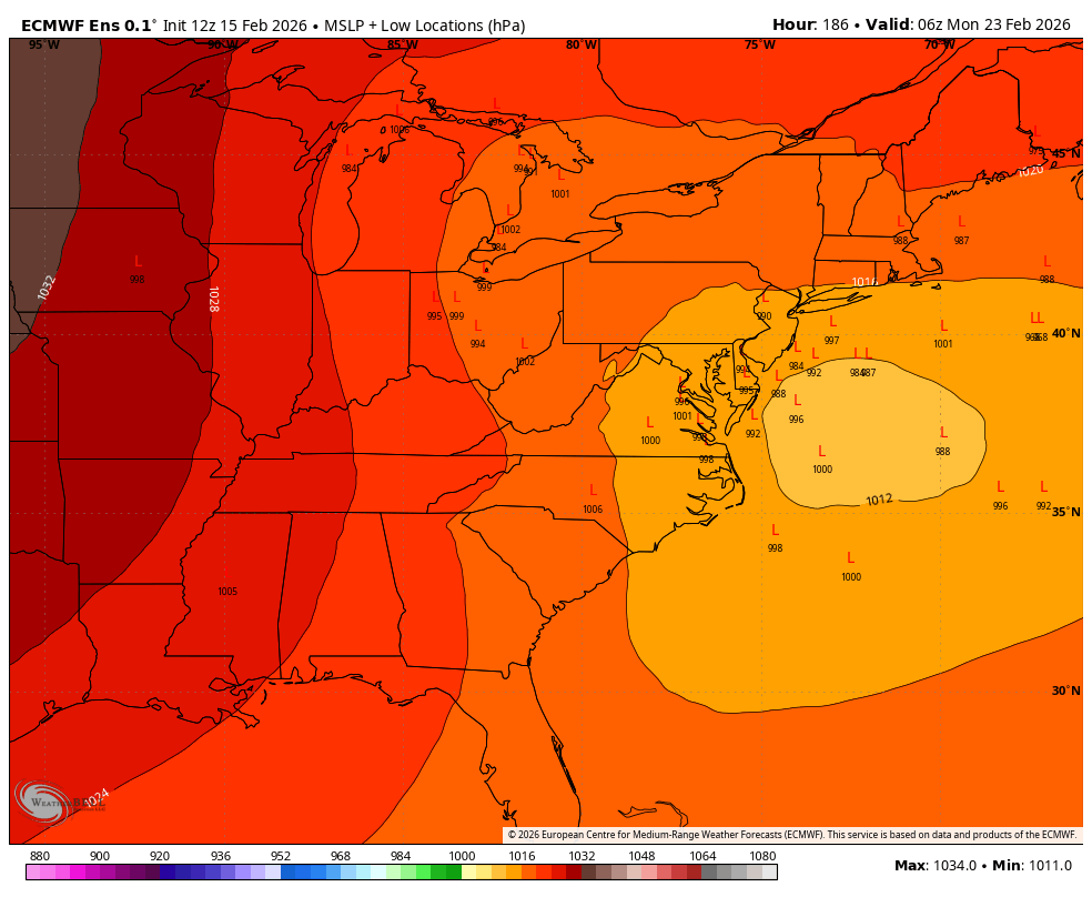
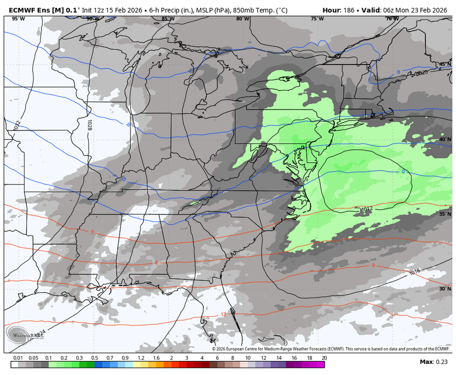
The window on the 23rd on the 12z EPS has a favorable Miller B look this run that could lead to a potential winter storm chance.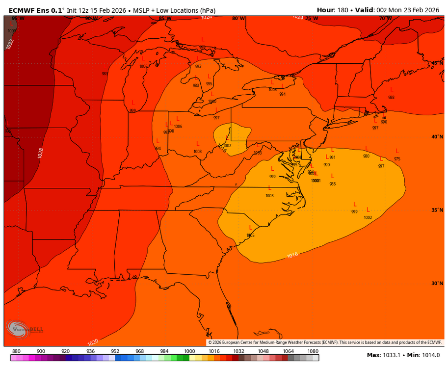

-
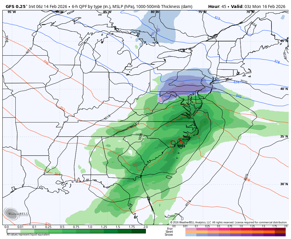
Late February/Early March 2026 Mid-Long Range
Blizzard of 93 replied to WxUSAF's topic in Mid Atlantic
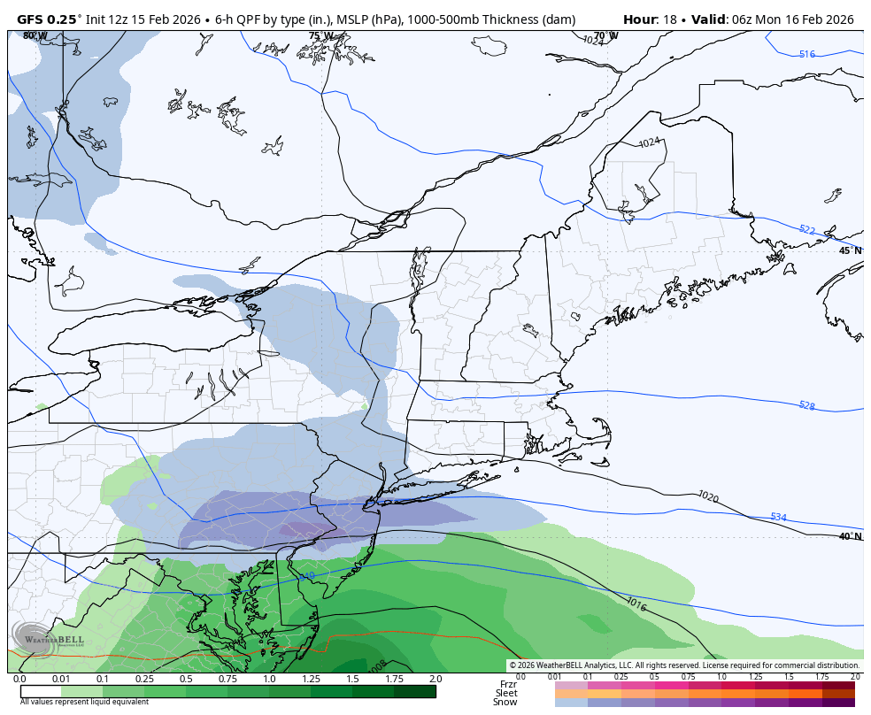
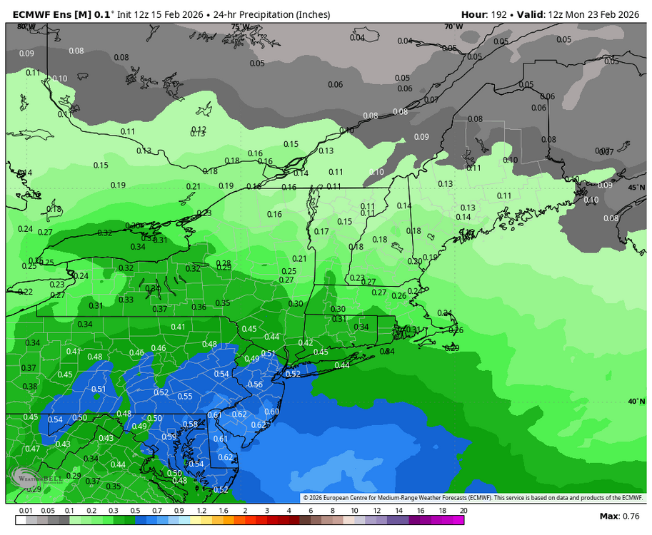
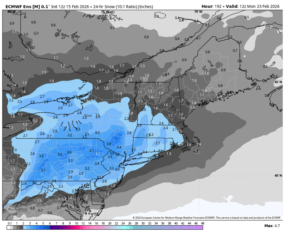
Here is the 12z EPS 24 hour precip & snow for the 23rd chance.
-
Late February/Early March 2026 Mid-Long Range
Blizzard of 93 replied to WxUSAF's topic in Mid Atlantic
The window on the 23rd on the 12z EPS has a favorable Miller B look this run that could lead to a potential winter storm chance.
-
Central PA Winter 25/26 Discussion and Obs
Blizzard of 93 replied to MAG5035's topic in Upstate New York/Pennsylvania
Even after whatever table scraps we may get this evening, the 12z Euro & Euro AI say that the pattern through the end of this month looks to be active with a few Winter storm chances. -
Central PA Winter 25/26 Discussion and Obs
Blizzard of 93 replied to MAG5035's topic in Upstate New York/Pennsylvania
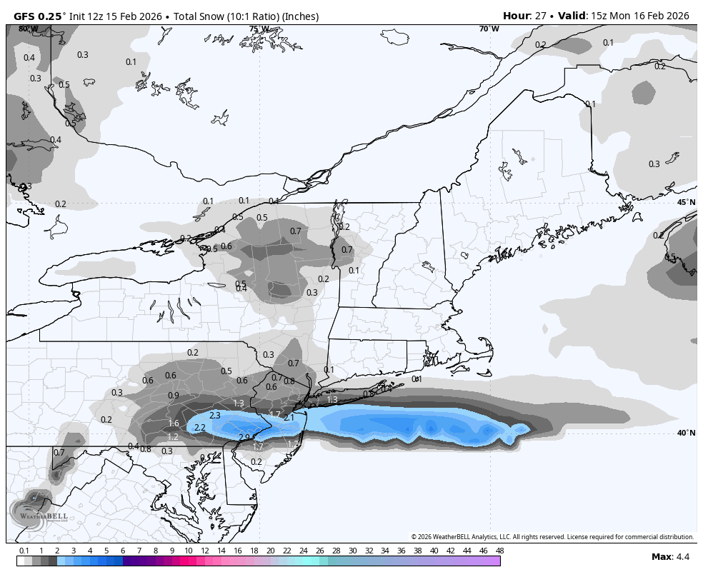
12z GFS still is showing 1 to 2 inches of snow tonight for the LSV.

-
Central PA Winter 25/26 Discussion and Obs
Blizzard of 93 replied to MAG5035's topic in Upstate New York/Pennsylvania
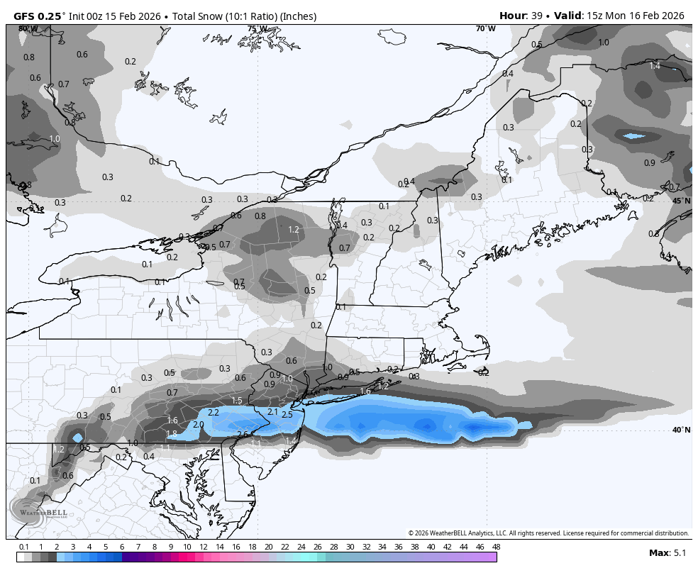
The “better” runs early yesterday had the LSV getting .4 to .5 of precip that produced 3 to 4 inches of snow on the snow maps. Now, in that same time period, the models are closer to .2 of precip, so that’s only producing around 1 inch or snow or less in recent runs. -
Central PA Winter 25/26 Discussion and Obs
Blizzard of 93 replied to MAG5035's topic in Upstate New York/Pennsylvania
It’s all about precip rates. If we would get good precip, it would snow. Marginal situations require good rates to overcome & snow. -
Central PA Winter 25/26 Discussion and Obs
Blizzard of 93 replied to MAG5035's topic in Upstate New York/Pennsylvania
0z GFS keeps hope alive for tomorrow evening with up to 2 inches for the LSV this run.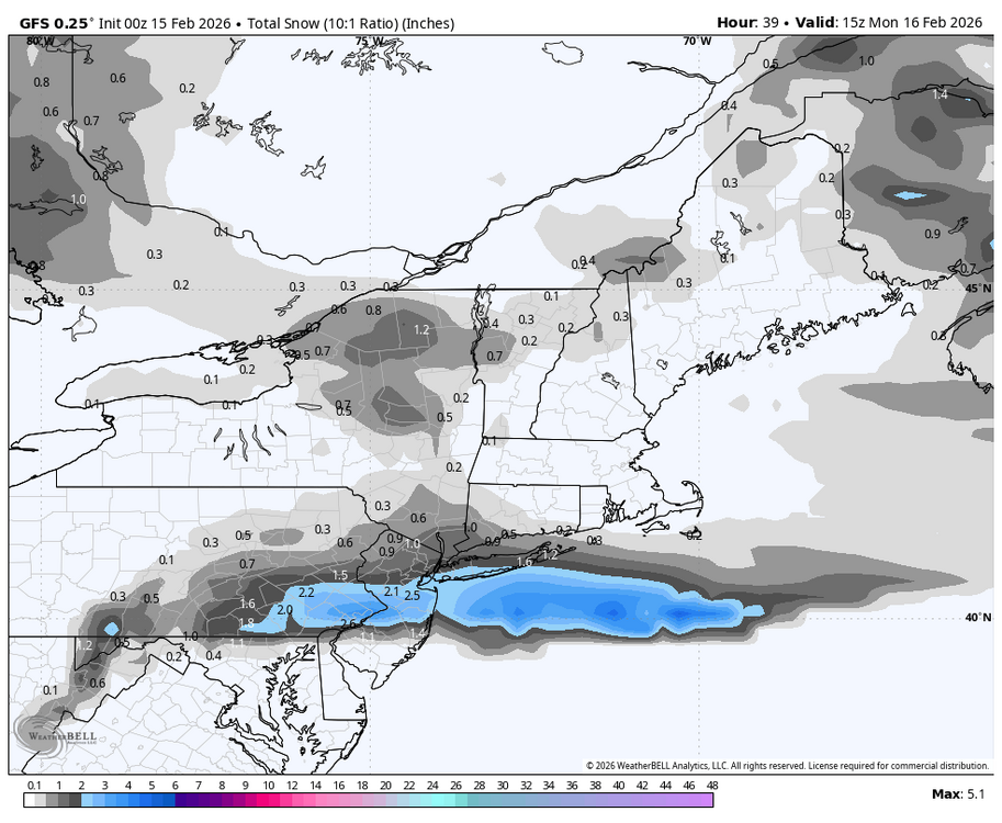
-
Central PA Winter 25/26 Discussion and Obs
Blizzard of 93 replied to MAG5035's topic in Upstate New York/Pennsylvania
I mean, just look at thIs from @Newman in the Philly thread. Just a tiny difference between 12z and 18z RRFS. Something must've gotten into the NOAA mesoscale products at 12z LOL -
Central PA Winter 25/26 Discussion and Obs
Blizzard of 93 replied to MAG5035's topic in Upstate New York/Pennsylvania
Under 48 hours, nine times out of 10, once a trend starts, it usually either builds momentum or levels out. These continual all over the place rug pulls are brutal with this potential event. -
Central PA Winter 25/26 Discussion and Obs
Blizzard of 93 replied to MAG5035's topic in Upstate New York/Pennsylvania
I am so ready to be done tracking this system! 2 weeks ago, many of us started watching this weekend period. It went from potential major storm to no storm to late yesterday looking like a potential recovery to an Advisory event to now who the bleep knows! -
Central PA Winter 25/26 Discussion and Obs
Blizzard of 93 replied to MAG5035's topic in Upstate New York/Pennsylvania
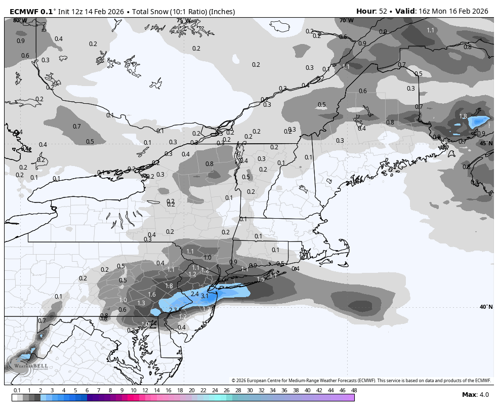
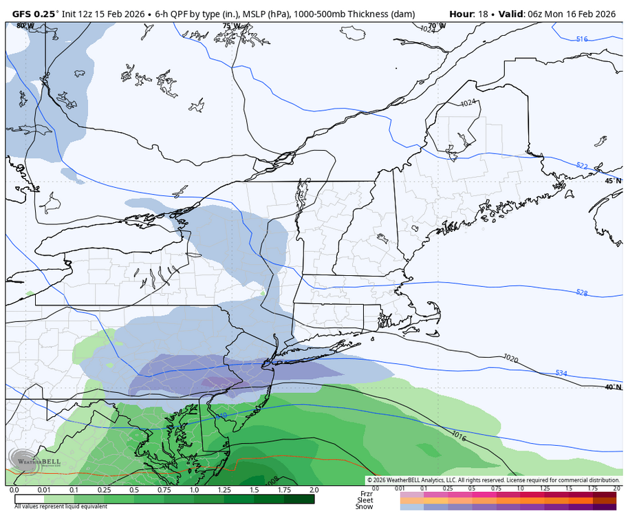
18z just cut back as well. About .20 less precip for the LSV, so snow amounts are now less than 2 inches for most of us this run. -
Central PA Winter 25/26 Discussion and Obs
Blizzard of 93 replied to MAG5035's topic in Upstate New York/Pennsylvania
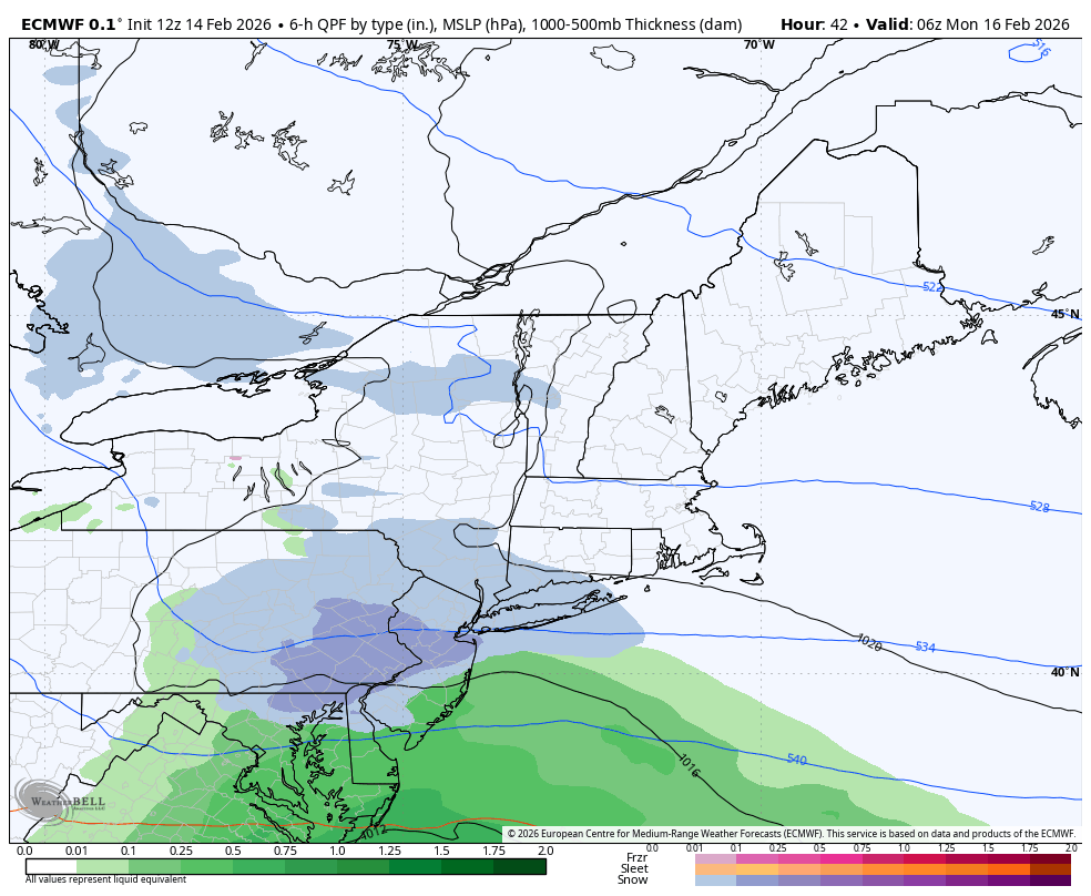
I do like seeing the healthy looking established precip shield already covering most of Missouri & extending the whole way down to the Texas Gulf coast. The ingredients are there for us to over perform if we get the rates in southern PA tomorrow evening. -
Central PA Winter 25/26 Discussion and Obs
Blizzard of 93 replied to MAG5035's topic in Upstate New York/Pennsylvania
Lol, .49 for ITT! -
Central PA Winter 25/26 Discussion and Obs
Blizzard of 93 replied to MAG5035's topic in Upstate New York/Pennsylvania
51 on my home Marysville station. Felt great to go out without a coat! -
Central PA Winter 25/26 Discussion and Obs
Blizzard of 93 replied to MAG5035's topic in Upstate New York/Pennsylvania
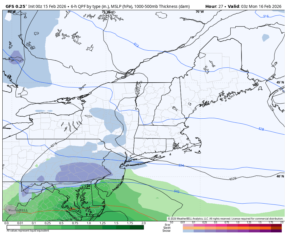
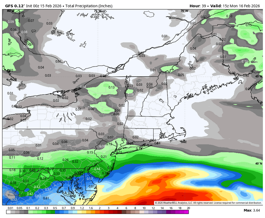
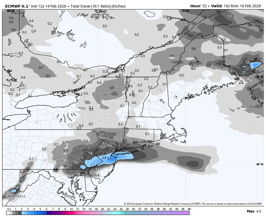
12z Euro precip improved for the LSV at 12z vs. 6z. -
Central PA Winter 25/26 Discussion and Obs
Blizzard of 93 replied to MAG5035's topic in Upstate New York/Pennsylvania
-
Central PA Winter 25/26 Discussion and Obs
Blizzard of 93 replied to MAG5035's topic in Upstate New York/Pennsylvania
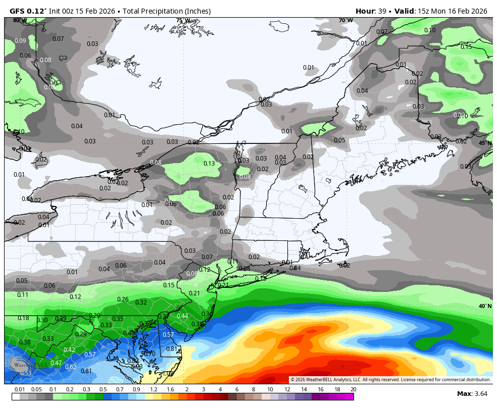
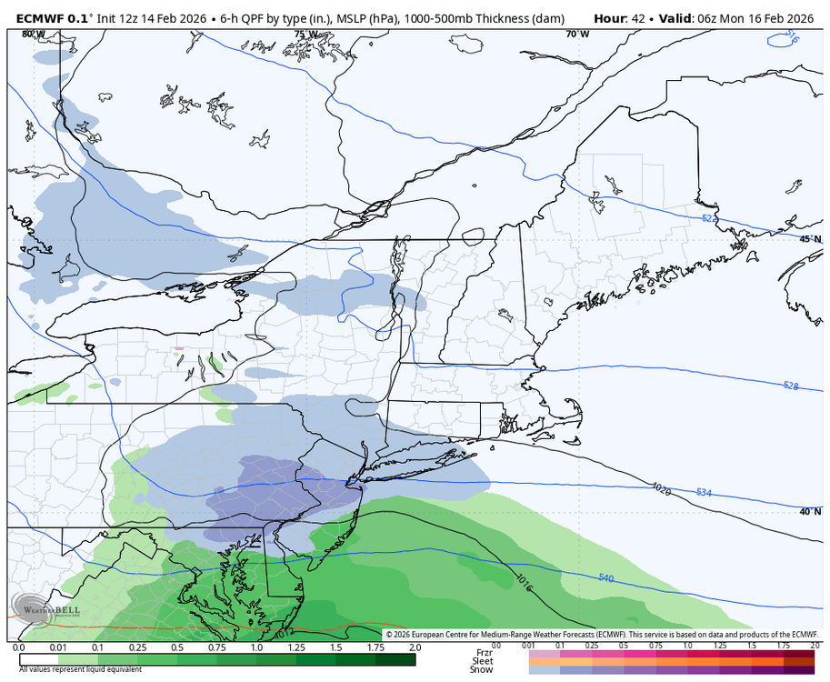
12z Euro coming in slightly better for snow & precip in the LSV over its previous run. Maps coming soon. -
Central PA Winter 25/26 Discussion and Obs
Blizzard of 93 replied to MAG5035's topic in Upstate New York/Pennsylvania
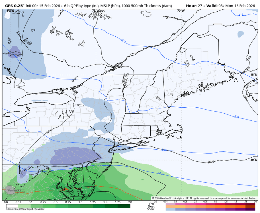
Lol, I just realized that he 12z GFS precip map put a “blue” area of .50 precip right over ITT & MJS ! -
Central PA Winter 25/26 Discussion and Obs
Blizzard of 93 replied to MAG5035's topic in Upstate New York/Pennsylvania
For the LSV area, the precip difference between 12z & 6z on the GFS was mostly noise level. -
Central PA Winter 25/26 Discussion and Obs
Blizzard of 93 replied to MAG5035's topic in Upstate New York/Pennsylvania
Agreed, if we get moderate rates, we will snow tomorrow evening. The track is ideal to work with a marginal air mass at this time of year. There is not a primary low tracking toward northern WV this time. -
Central PA Winter 25/26 Discussion and Obs
Blizzard of 93 replied to MAG5035's topic in Upstate New York/Pennsylvania
Yes, solid hold for the 12z GFS and in line with the 12z NAMs.
-
Central PA Winter 25/26 Discussion and Obs
Blizzard of 93 replied to MAG5035's topic in Upstate New York/Pennsylvania
Great to see the NAMs joining the GFS this morning! The last big storm a few weeks ago, the NAMs did well at least with thermals, hopefully they continue & lock in later today. -
Let’s hope for some model consensus today.
-
Central PA Winter 25/26 Discussion and Obs
Blizzard of 93 replied to MAG5035's topic in Upstate New York/Pennsylvania
I would love for the 6z GFS to be right for tomorrow pm… Hopefully we get some model consensus later today.