Blizzard of 93
-
Posts
13,024 -
Joined
-
Last visited
Content Type
Profiles
Blogs
Forums
American Weather
Media Demo
Store
Gallery
Everything posted by Blizzard of 93
-
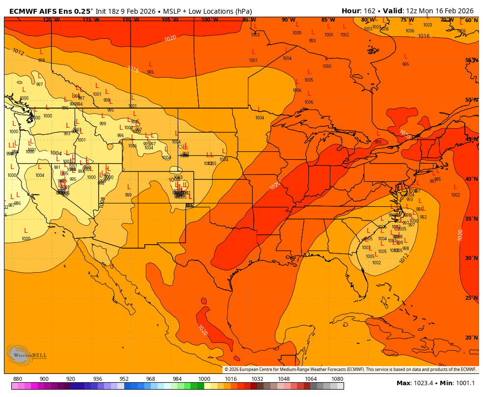
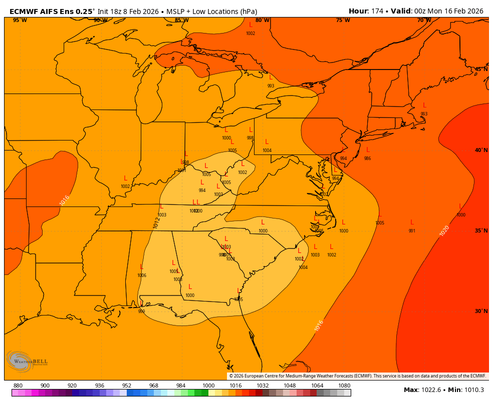
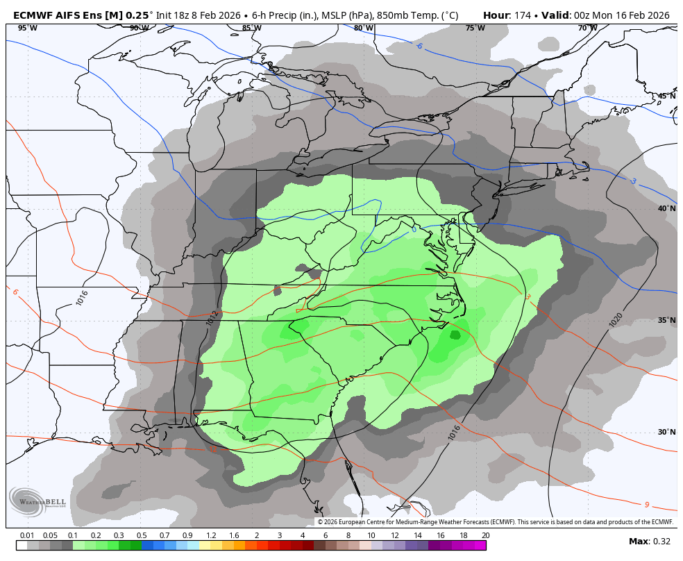
18z EPS is way too close to write anything off at this range.


-
Central PA Winter 25/26 Discussion and Obs
Blizzard of 93 replied to MAG5035's topic in Upstate New York/Pennsylvania
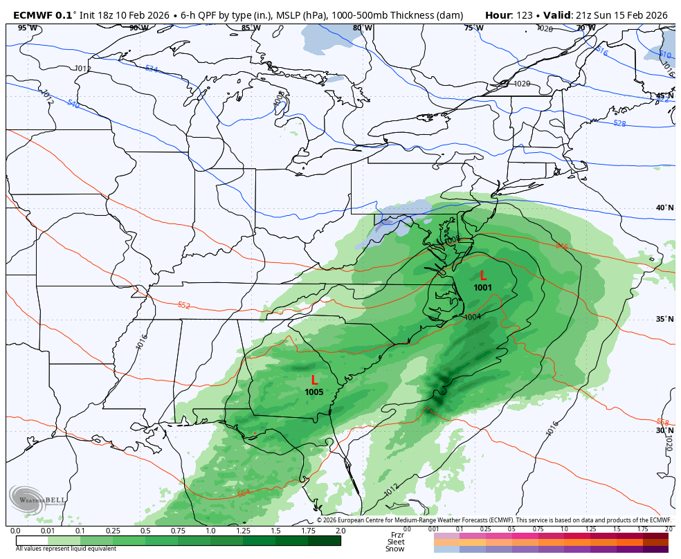
Agreed, the Sunday chance is still way too close to write off at this range. The 18z Euro was a close call & grazes southern PA with some light snow this run. It was not far away from something more.

-
Central PA Winter 25/26 Discussion and Obs
Blizzard of 93 replied to MAG5035's topic in Upstate New York/Pennsylvania
MDT only needs 9 inches or so more of snow to reach seasonal average of 30 inches by early April. We still have 6 realistic weeks to score, so it’s certainly within reach. -
Central PA Winter 25/26 Discussion and Obs
Blizzard of 93 replied to MAG5035's topic in Upstate New York/Pennsylvania
6z EPS & 6z AI EPS are on board for the Sunday into Monday snow chance. Reminder that the regular EPS only goes out to 144 hours, but the AI EPS goes out up to 15 days.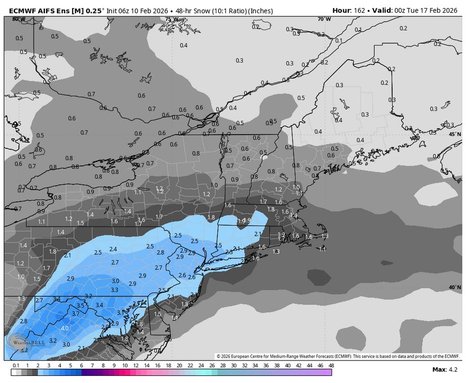
-
Central PA Winter 25/26 Discussion and Obs
Blizzard of 93 replied to MAG5035's topic in Upstate New York/Pennsylvania
The 6z Euro just made a good change & is now on team snow chance for Sunday st the end of its 144 run. -
Central PA Winter 25/26 Discussion and Obs
Blizzard of 93 replied to MAG5035's topic in Upstate New York/Pennsylvania
0z Canadian is still on team CTP snow chance for Sunday.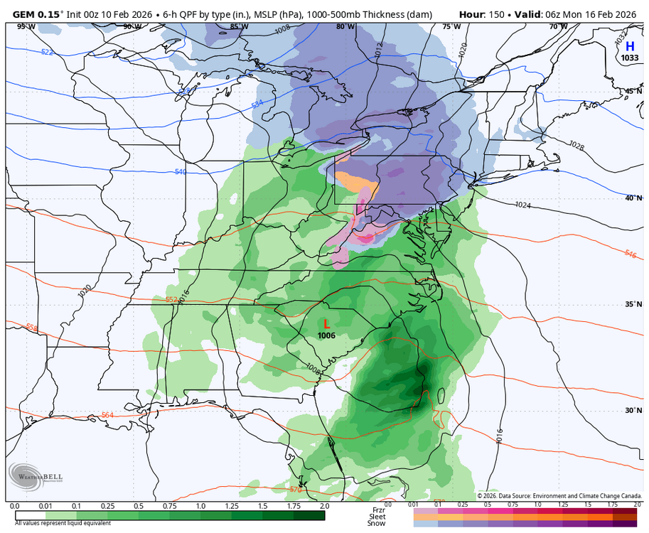
-
Central PA Winter 25/26 Discussion and Obs
Blizzard of 93 replied to MAG5035's topic in Upstate New York/Pennsylvania
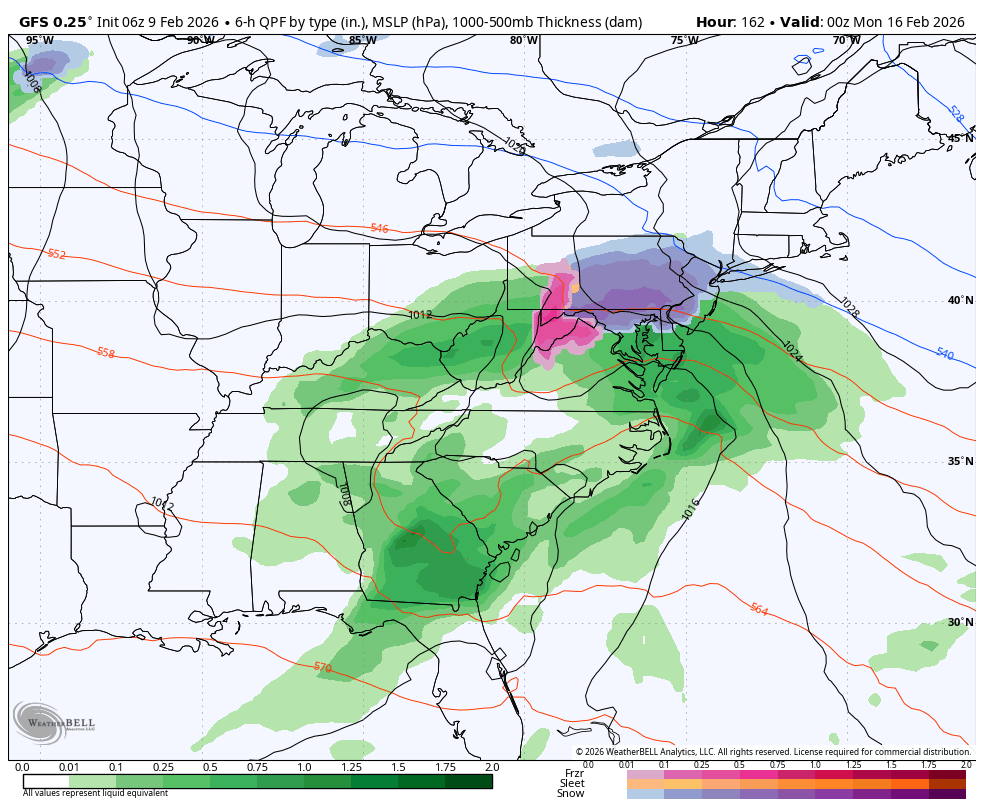
@mitchnick I liked the look at the end of the 18z EPS as well & think it would have delivered a decent front end thump for southern PA on to the north if the run continued. 6hr snowfall on 18z Eps at 144hrs. Nothing in our area before that hour.
-
Central PA Winter 25/26 Discussion and Obs
Blizzard of 93 replied to MAG5035's topic in Upstate New York/Pennsylvania
My lean right now for this Sunday is a 3 to 6 type of front end snow thump that mixes or changes over depending on the final track. I think that the chances of a high end event are diminishing, but I think a low end Warning to Advisory level snow are still on the table for many of us. -
Central PA Winter 25/26 Discussion and Obs
Blizzard of 93 replied to MAG5035's topic in Upstate New York/Pennsylvania
Way too soon for that. Lots of options are still on the table. -
Central PA Winter 25/26 Discussion and Obs
Blizzard of 93 replied to MAG5035's topic in Upstate New York/Pennsylvania
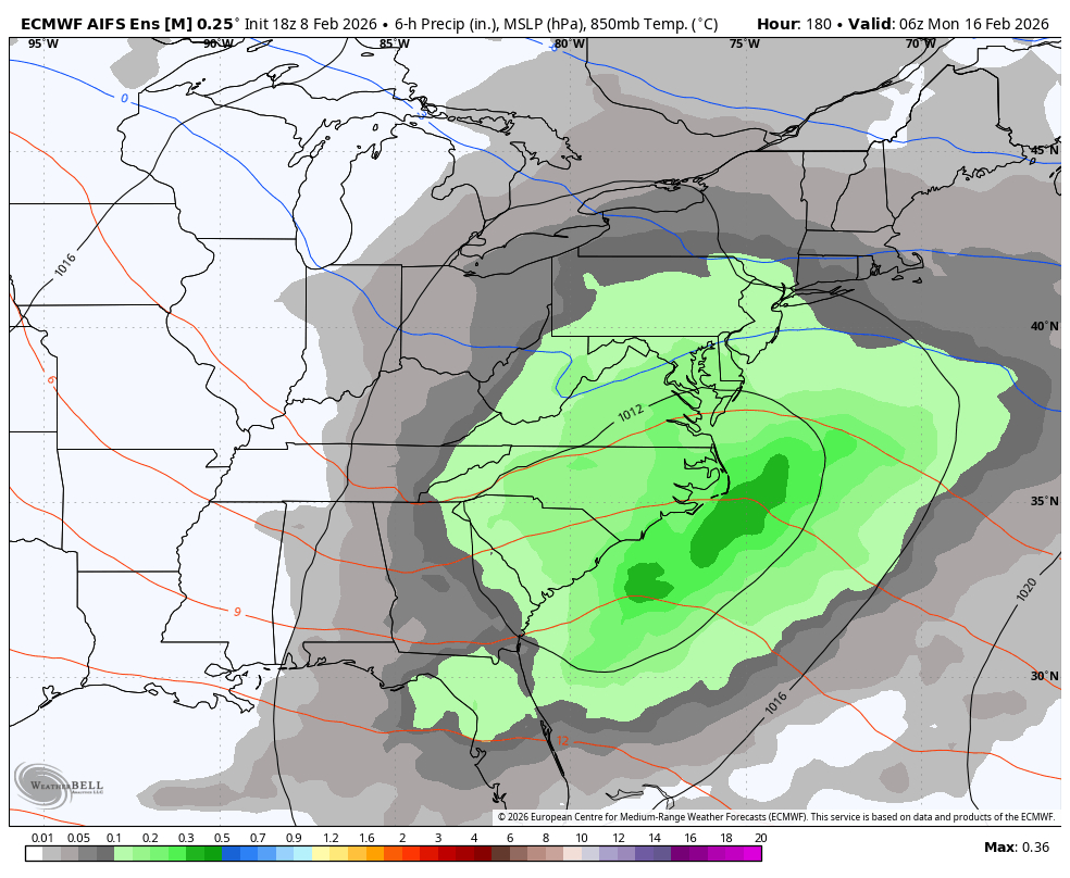
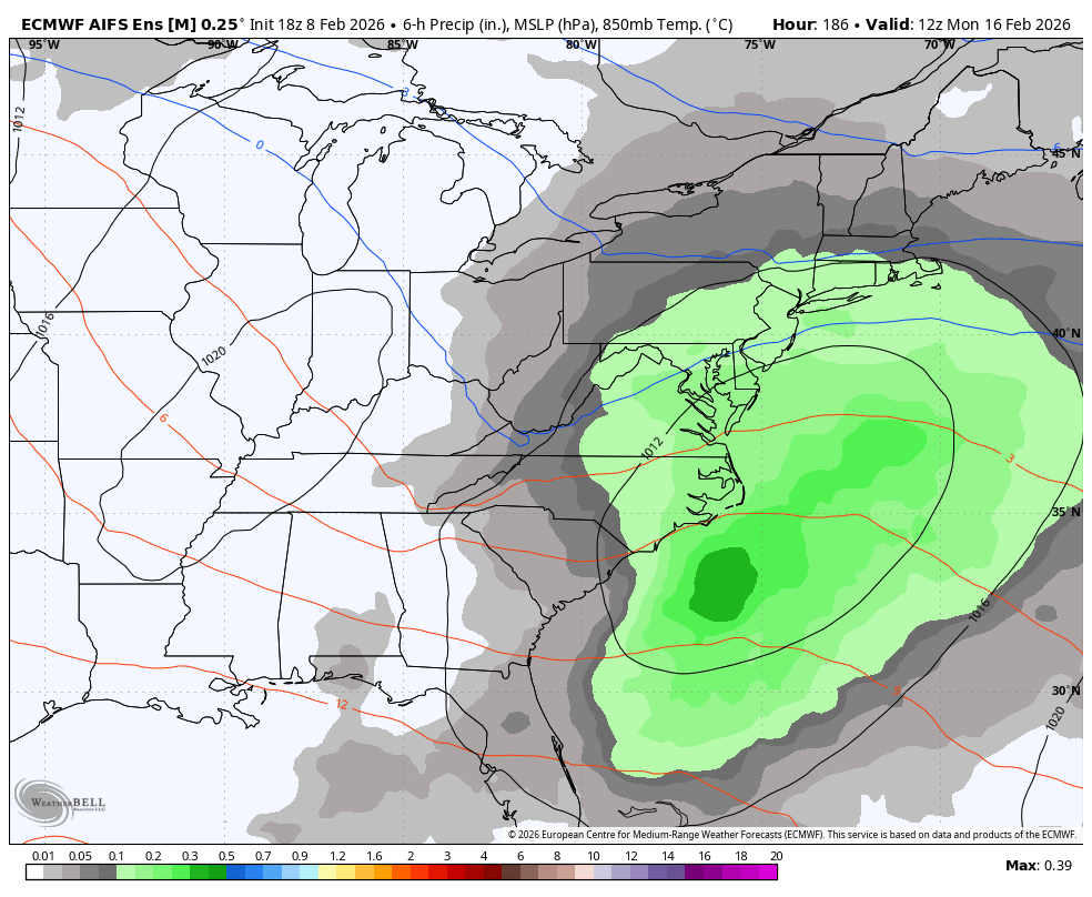
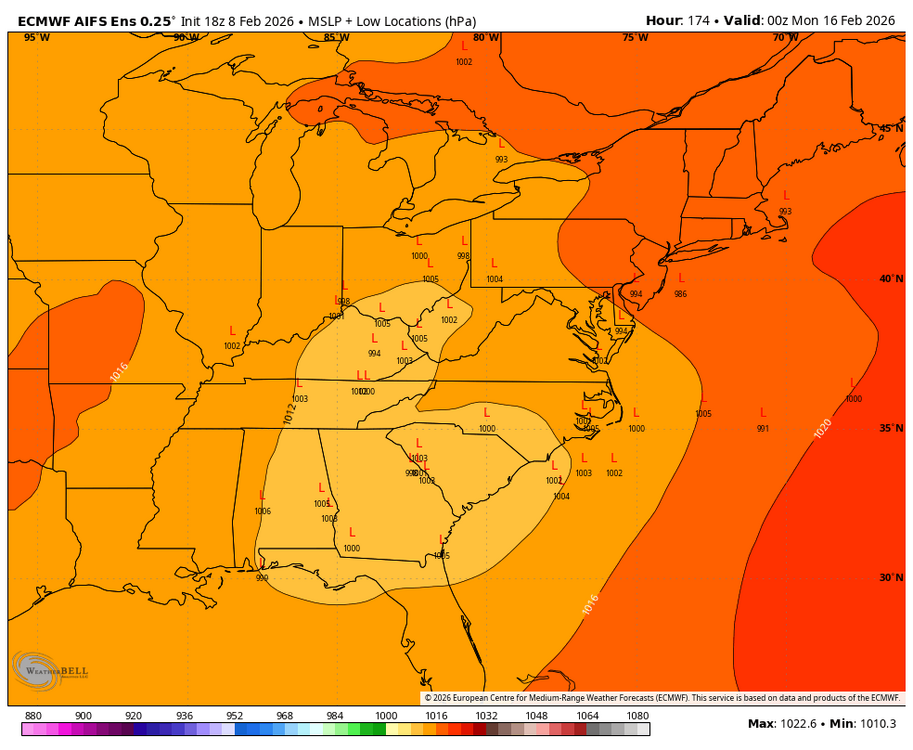
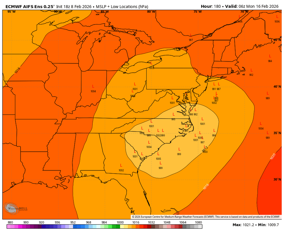
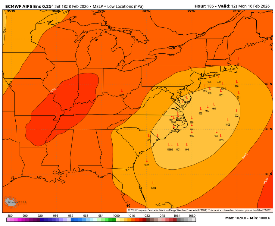
Here are CTP’s thoughts on the Sunday Winter storm chance. KEY MESSAGE 2: Risk managing potential for Valentine`s Day weekend storm Aside from the 09/12Z GFS to some extent, an ensemble consensus including ECMWF, CMC, NBM, and AI runs would lean toward an increasing potential for wintry weather arriving by the second half of Valentine`s Day weekend. That said, there is still plenty of time and space between now and then. Wintry weather/impacts, particularly details surrounding how much and what ptypes, are uncertain/unclear. Confidence right now is on low side, but the potential certainly exists and will need to be monitored in the coming days. -
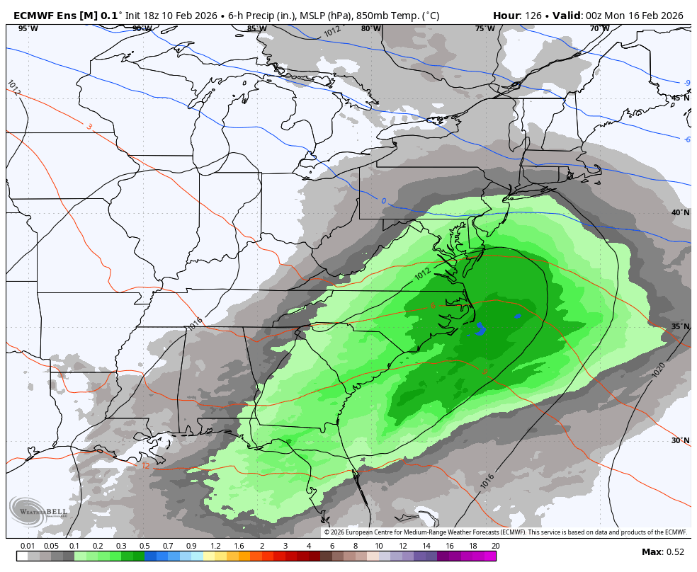
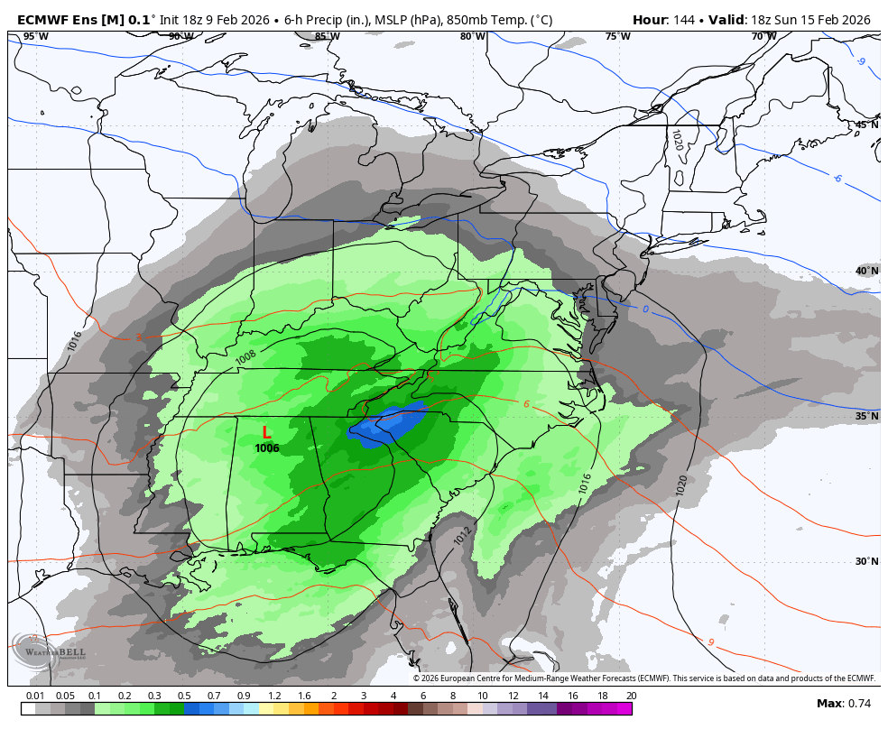
18z AI EPS main issue is lack of good precip getting near most of the region.


-
The lower snow totals on the 18z AI EPS are mostly due to a south & east track cluster and lower precipitation totals that held down snow amounts on most members. It basically followed the Op AI Euro this run.
-
Central PA Winter 25/26 Discussion and Obs
Blizzard of 93 replied to MAG5035's topic in Upstate New York/Pennsylvania
6z GFS & 0z Canadian both have significant front end thumps of snow this run for CTP on Sunday, while the Euro has an icy start. This will be a long week of tracking…
-
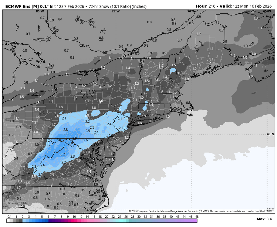
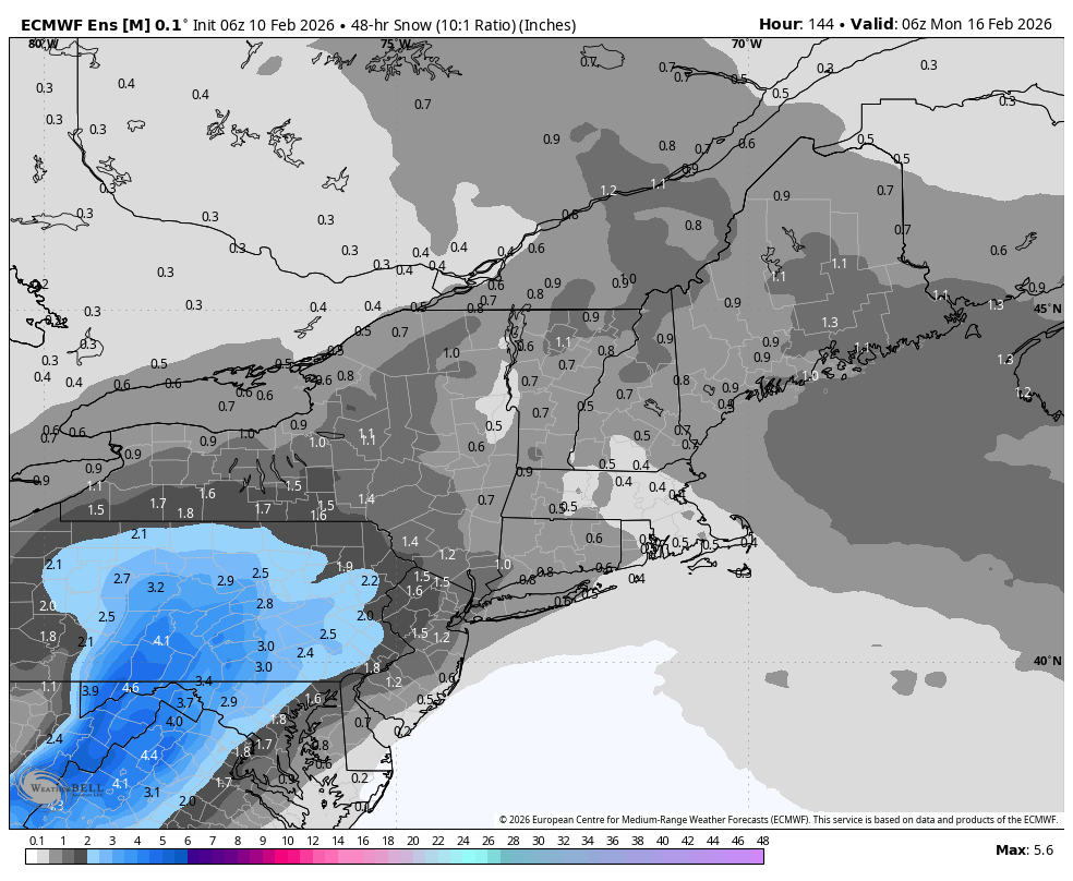
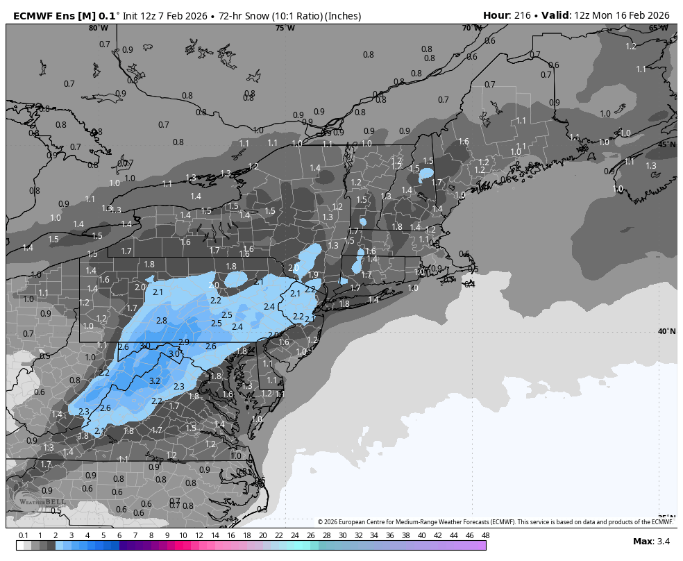
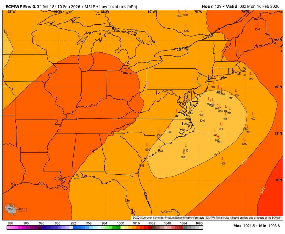
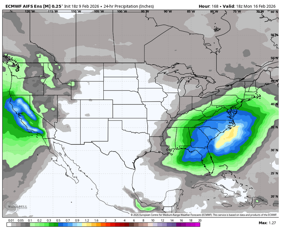
18z AI EPS snow map
-
More from the 18z AI EPS


-
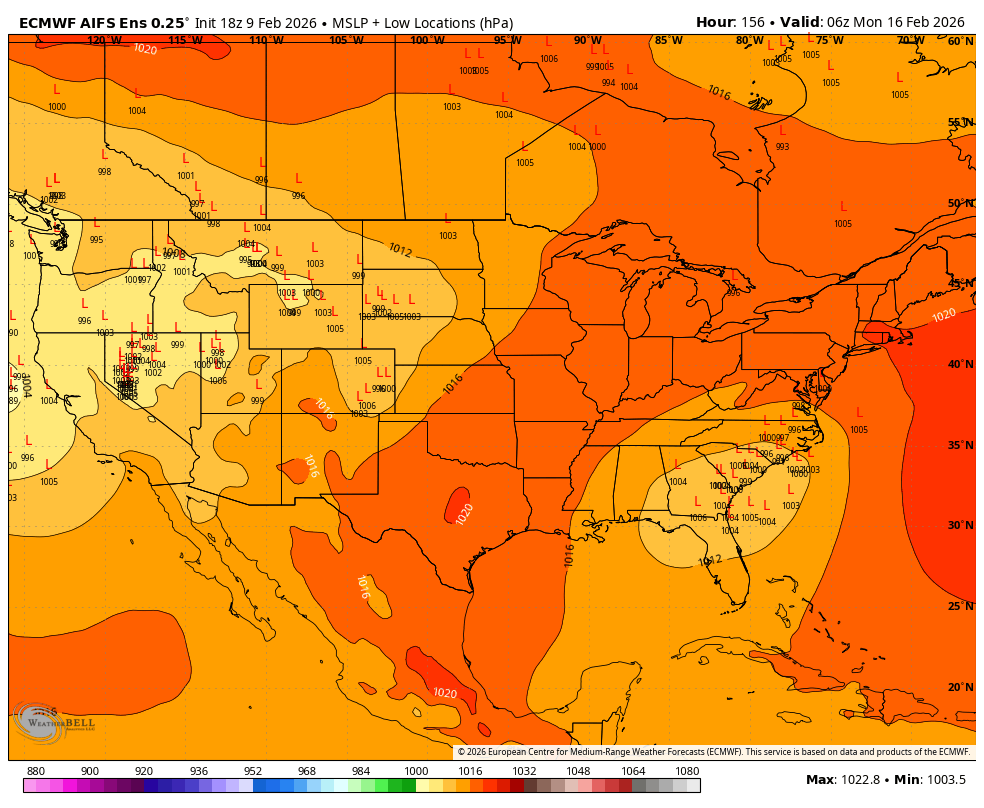
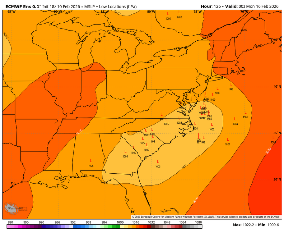
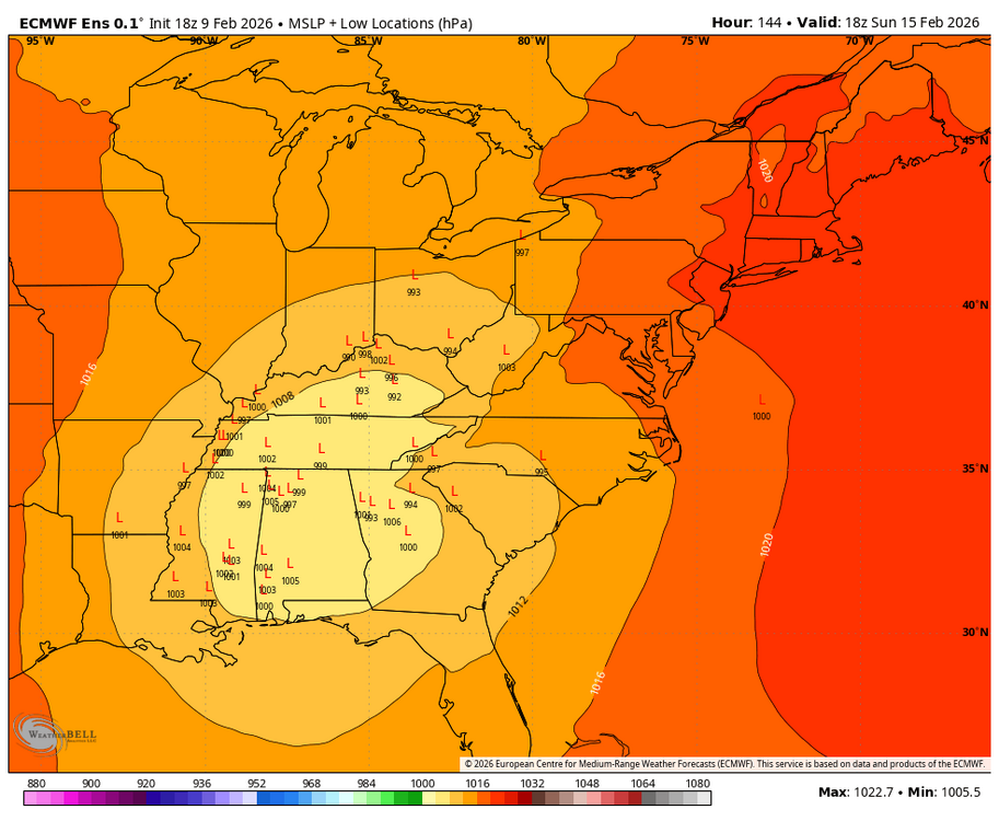
18z AI EPS looks solid with a good clustering of low tracks jumping to the coast.
-
Central PA Winter 25/26 Discussion and Obs
Blizzard of 93 replied to MAG5035's topic in Upstate New York/Pennsylvania
The trend is our friend in CTP … Long way to go, but good to see the Ops at 12z all showing a storm in our region this run. Details TBD… -
Central PA Winter 25/26 Discussion and Obs
Blizzard of 93 replied to MAG5035's topic in Upstate New York/Pennsylvania
-
Central PA Winter 25/26 Discussion and Obs
Blizzard of 93 replied to MAG5035's topic in Upstate New York/Pennsylvania
Fake fake news. Every model snows on us next weekend at least to start. -
Central PA Winter 25/26 Discussion and Obs
Blizzard of 93 replied to MAG5035's topic in Upstate New York/Pennsylvania
Agreed, this season has featured many nights in the single digits, but I haven’t been able to get to below zero. Last January’s -2 is still my coldest temperature of this decade. -
Winter Storm Threat *Technical* Discussion. No Op Run PBP or Snow maps
Blizzard of 93 replied to CAPE's topic in Mid Atlantic
People can read more & post less. They can read & learn without sifting through emotional whiny banter that changes every 6 hours… It is ok to just read & not interject mindless posts that offer no value. These posts in here are gold & are the reason that I joined this forum 12 years ago. My learning continues because of the good posters on here & across the various regional forums. -
Central PA Winter 25/26 Discussion and Obs
Blizzard of 93 replied to MAG5035's topic in Upstate New York/Pennsylvania
MDT added .3 of snow to the total for the Friday pm event. They really seem to be making an effort to get the snow total right this season. -
Central PA Winter 25/26 Discussion and Obs
Blizzard of 93 replied to MAG5035's topic in Upstate New York/Pennsylvania
I had a few wind gusts even until early evening that shook the house & it sounded like a freight train was moving through the neighborhood. -
Not really that amazing when considering that they are both bottom of the barrel models…
-
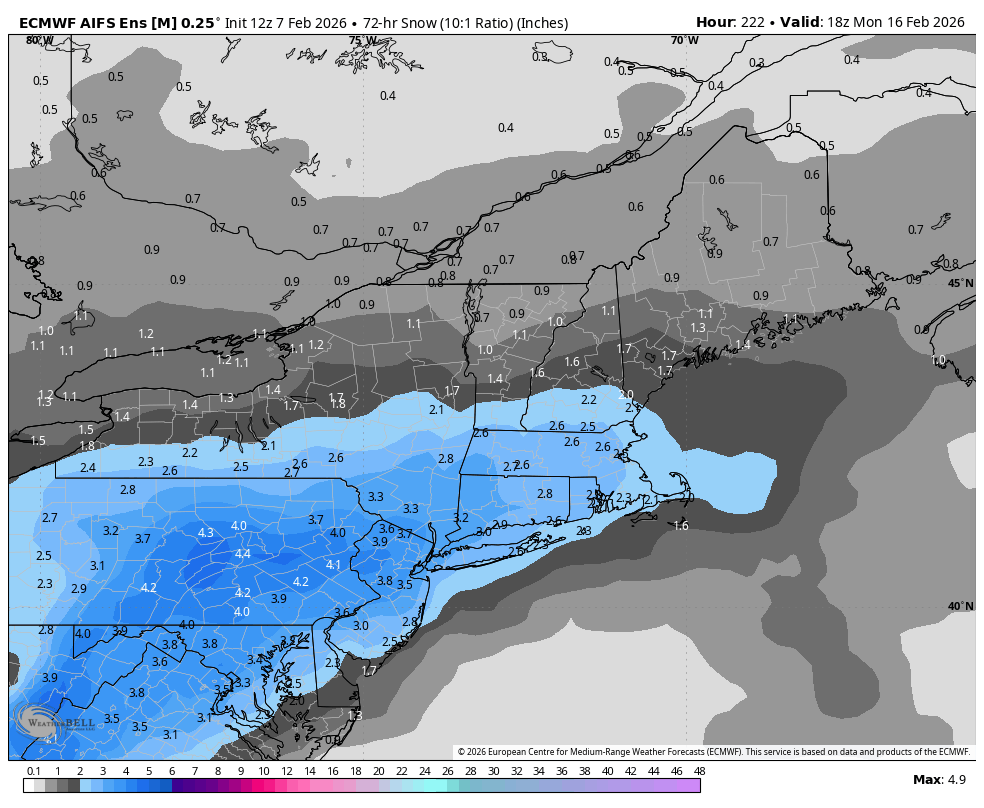
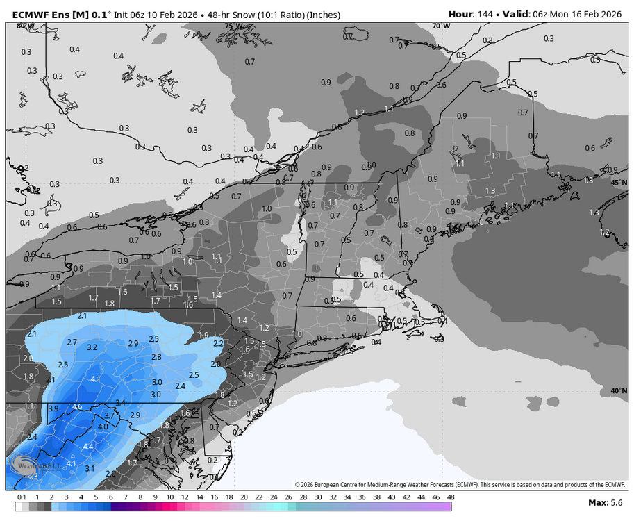
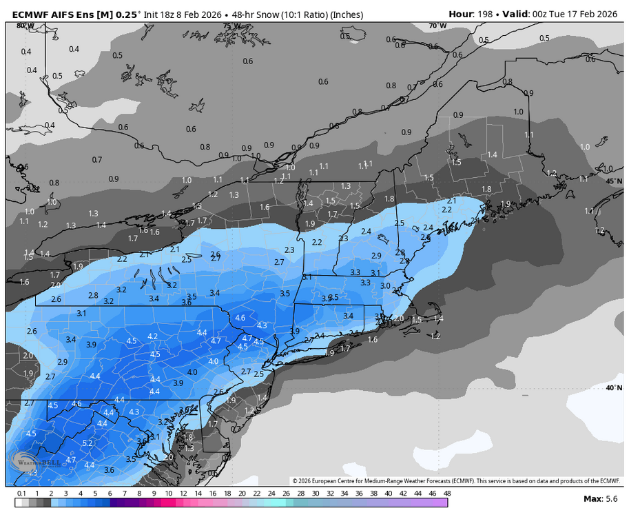
Here’s AI EPS 3 day snow map as of next Monday afternoon.