The 4 Seasons
-
Posts
7,985 -
Joined
-
Last visited
Content Type
Profiles
Blogs
Forums
American Weather
Media Demo
Store
Gallery
Everything posted by The 4 Seasons
-
-

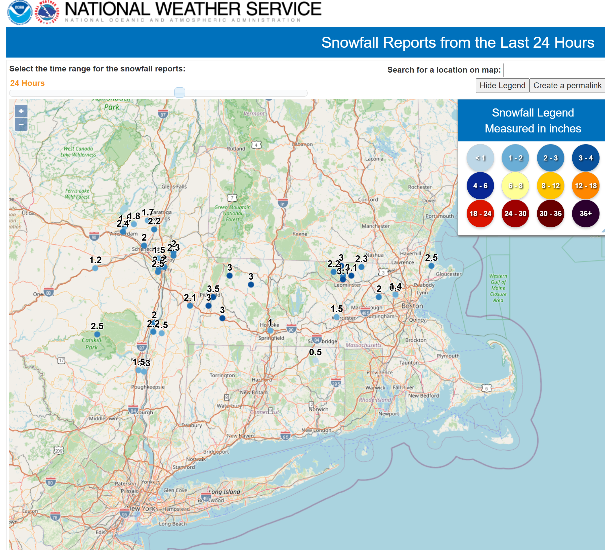
2/24 - 2/25 Clipper Obs (1 - 2" for many on forum)
The 4 Seasons replied to Northof78's topic in New York City Metro
good i put you in <1" -
2/24 - 2/25 Clipper Obs (1 - 2" for many on forum)
The 4 Seasons replied to Northof78's topic in New York City Metro
@snywx @CPcantmeasuresnow@CPcantmeasuresnow you guys got a total for this, it would be helpful, theres almost nothing for Orange county if you see this within the hour -
ok thanks. Yeah i mean this whole thing was just a rough guesstimate and i used the NESIS map for data points and coop/climo data. I have no idea what the hell was happening back in the horse and buggy days. But ive heard a lot of the official stuff is way under reported. Kocin said its probably their biggest storm of all time and the 21" is way under done. And for sure BDR is under
-
what town is this?
-
Unbelievable. Anutha one...
-
what did you get on Feb 25th? Everything in Norfolk cty is <1" on cocorahs
-
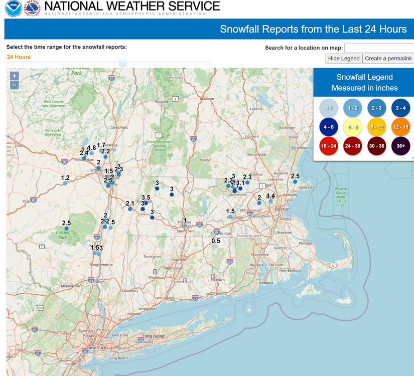
Clipper Fires In Wednesday Feb 25 Disco/ Obs
The 4 Seasons replied to Damage In Tolland's topic in New England
still not great, but yeah better, most around there are 2+ -
Clipper Fires In Wednesday Feb 25 Disco/ Obs
The 4 Seasons replied to Damage In Tolland's topic in New England
they updated to 1.3 -
Blizzard of 2026 is now up in the WS Archive with a full radar loop, sfc/upper air maps and bunch of other images related to the storm https://www.jdjweatherconsulting.com/feb-22-23-2026
-
The Blizzard of 2026 is now up in the WS Archive as the 11th 3"+ event of the season with radar, sfc/upper air maps and snowfall maps. It also made it to the Historic Snowstorms Archive as a 12"+ event, so there is a bunch of extra radar, satellite and other maps related to the storm https://www.jdjweatherconsulting.com/feb-22-23-2026
-
Less snow than Newark and BDR
-
Some Rhode Islanders are saying F
-
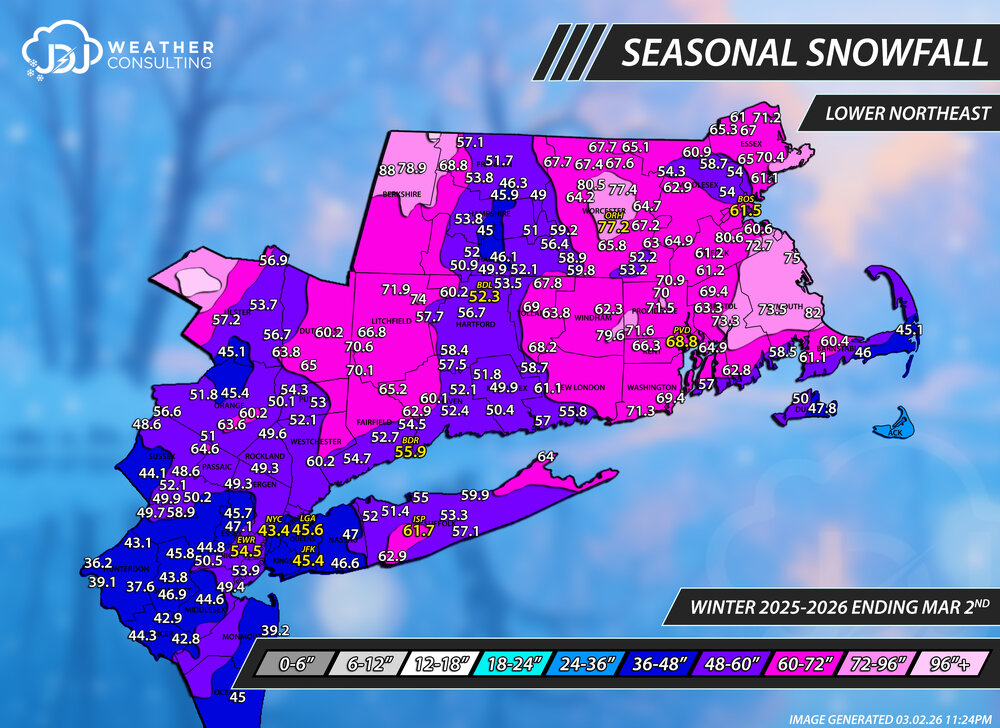
As of March 2nd. Snowfall/Normal to date/% of normal to date (BDR) - 55.9"/26.4"/212% (BDL) - 52.3"/42.1"/124% (NYC) - 43.4"/24.9"/174% (EWR) - 54.5"/26.0"/210% (PVD) - 68.8"/30.2"/228% (BOS) - 61.5"/39.5"/156% (ORH) - 77.2"/58.5"/132%
-
I can't believe i have to do another snowfall map for this thing
-
All sleet
-
i'll fix it for the final season map
-
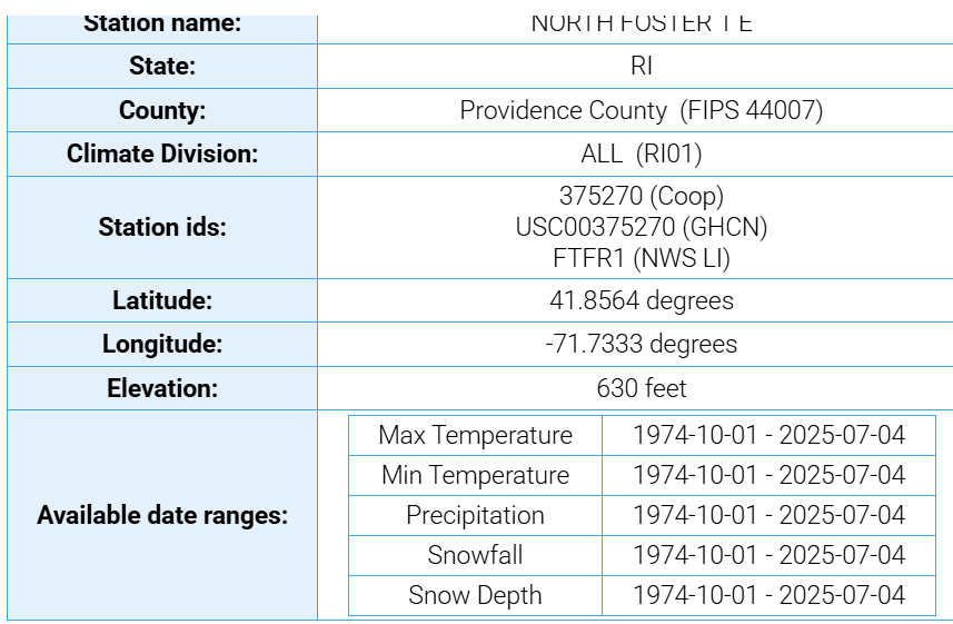
I don't know why North Foster doesn't show up anymore it looks like it stopped reporting snowfall in 2025 Where did you get the N Foster number from? I included that area 72-96 and the 71.6 is Foster 4.0SSE cocorahs station
-
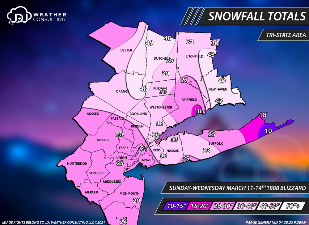
yea BDRs Mar 1888 total is totally ridiculous
-
Quincy cocorahs, the same one you said who slanted 28" near me. It's just S/SE of BOS and was close to the BOS seasonal total so thats why i put it in. The 80.6 is Blue Hill which makes sense why its high but most of the other reports around there north and west of you are ~60 ish
-
That CT river valley in MA mirrors their typical seasonal snowfall lol
-
Season to date snowfall ending March 2nd. Reports are from here, cocorahs, COOP, climate sites. This was a tough one with a lot of missing days in cocorahs and reports that didn't line up or make sense. Did the best i could with the information i had. SNE/Tri-State/CT only maps are also up and a season progression animation. Winter 25-26 Seasonal Snowfall This is the 4th update of the season and probably the second to last update with a final map coming in April sometime when the threat of additional snow drops to near zero. March 2nd Update Snowfall Progression

-
light snow
-
I remember March 2016 we hit 81 on Mar 9th and then got a 4-6" snowstorm on Mar 21st and 2 more snow/ice storms in early April. It's a wild month.