Chinook
-
Posts
11,160 -
Joined
-
Last visited
Content Type
Profiles
Blogs
Forums
American Weather
Media Demo
Store
Gallery
Everything posted by Chinook
-

Major November Outbreak Possible
Chinook replied to Tallis Rockwell's topic in Central/Western States
tornado track of the earliest EF-3 on Friday -
So, I guess 3 ft of snow fell since September 30th in WA, OR, ID, MT, WY, and CO, with more coming.
-
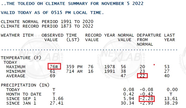
Toledo tied a record high of 76 degrees from, surprisingly, 1978. There has been quite a low percentage of normal rainfall since September 1st.
-
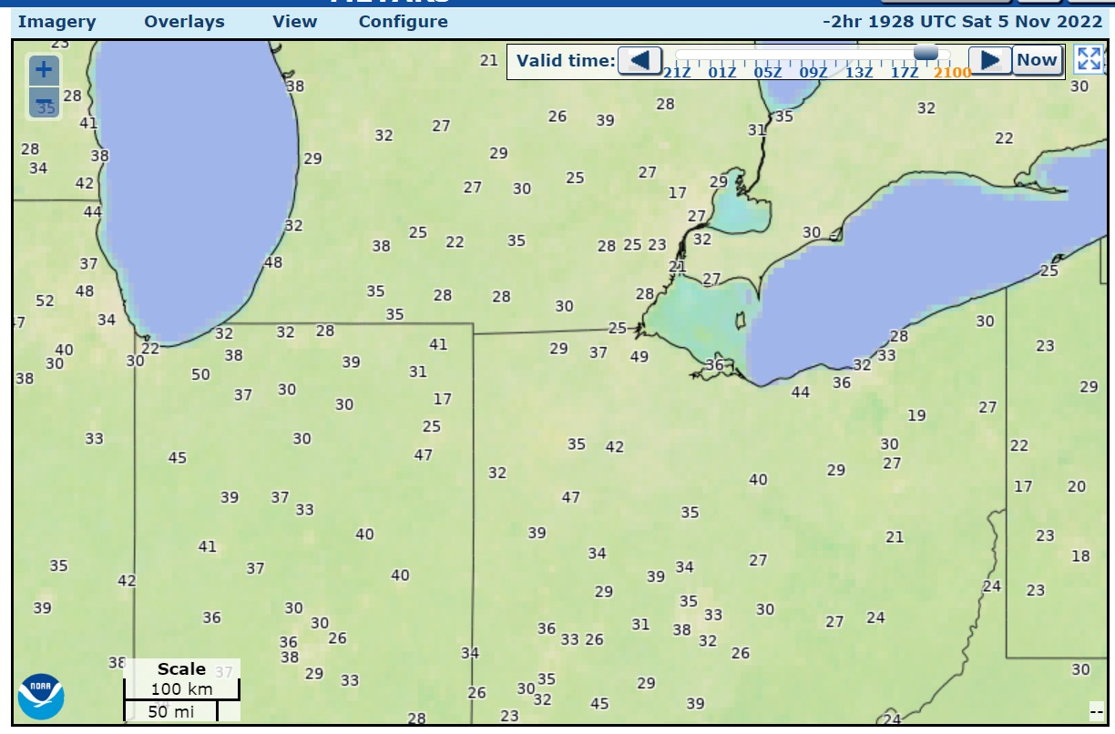
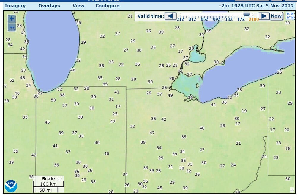
Max wind gusts measured by METARs (standard gust, not "pk wnd") a couple of hours ago (knots)
-
My area has been slow to get into the wind gusts. I just went jogging with a temperature of 70 degrees, fading sunshine, and wind gusts only up to about 15 to 20mph occasionally. There were groups of leaves blowing down the street. I wouldn't go jogging with 35-40 gusts, it's to much.
-
There was a 76mph wind report in NW Illinois
-
Major November Outbreak Possible
Chinook replied to Tallis Rockwell's topic in Central/Western States
heavy damage reported at Idabel, Oklahoma from a couple of hours ago. -
Major November Outbreak Possible
Chinook replied to Tallis Rockwell's topic in Central/Western States
continuation of Boston TX tornado -
Major November Outbreak Possible
Chinook replied to Tallis Rockwell's topic in Central/Western States
large tornado debris signature at Bagwell, TX -
Major November Outbreak Possible
Chinook replied to Tallis Rockwell's topic in Central/Western States
damage to homes at Powderly, Texas -
Major November Outbreak Possible
Chinook replied to Tallis Rockwell's topic in Central/Western States
Tornado debris possible at Honobia/Pickens Oklahoma (this storm) -
Major November Outbreak Possible
Chinook replied to Tallis Rockwell's topic in Central/Western States
Very rural eastern Oklahoma (Fort Smith AR radar) -
Major November Outbreak Possible
Chinook replied to Tallis Rockwell's topic in Central/Western States
I think this was the tornado ( a while ago) northwest of Paris TX next to the Red River -
Major November Outbreak Possible
Chinook replied to Tallis Rockwell's topic in Central/Western States
first thunder/heavy rain of the day at Denton -
Major November Outbreak Possible
Chinook replied to Tallis Rockwell's topic in Central/Western States
Here is the HRRR model (00z) with the SCP with radar overlay for late afternoon tomorrow. -
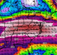
The fateful day of November 10th, 1975 compared to the upcoming weather situation on Saturday. The Edmund Fitzgerald Storm went from 1000mb near Wichita, Kansas to 984mb in Lake Superior in 24 hours. Our current weather situation will have a low of 1004-1006mb near Wichita, Kansas moving toward 987mb to near La Crosse Wisconsin within 24 hours, and then moving to Lake Superior as shown.
-
Major November Outbreak Possible
Chinook replied to Tallis Rockwell's topic in Central/Western States
HRRR updraft helicity tracks up to 08z Saturday -
Major November Outbreak Possible
Chinook replied to Tallis Rockwell's topic in Central/Western States
The new Day-2 outlook has 10% hatched tornado probabilities and 30% wind probabilities including the region of Dallas to the Red River, Texarkana.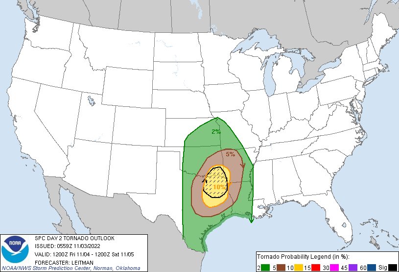
-
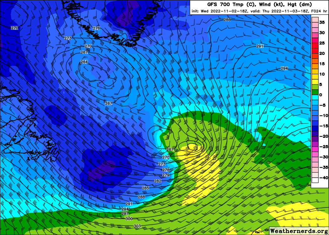
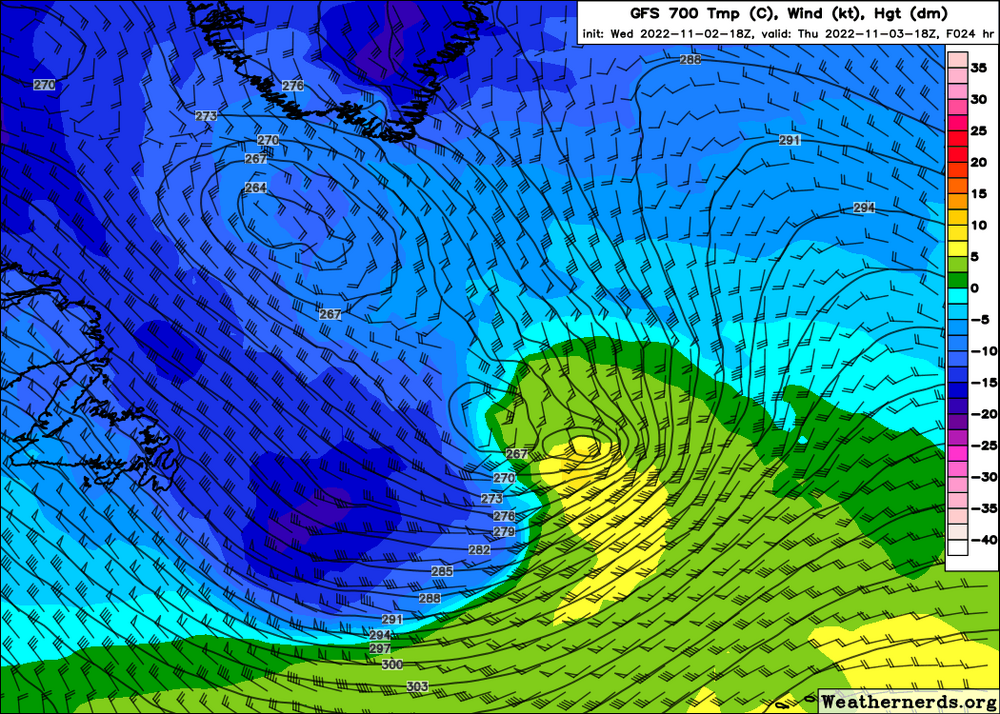
Hurricane Martin getting caught by the cold air aloft. The GFS has 100 kt winds close to the ocean surface as this transitions.
-
HRRR has band of moderate snow/rain at Denver at 22z (4:00PM) tomorrow (temperature is 37)
-
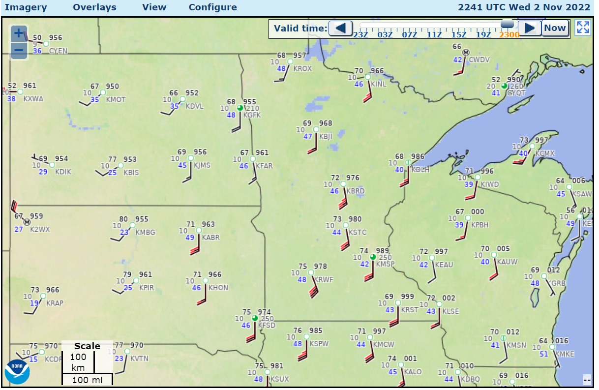
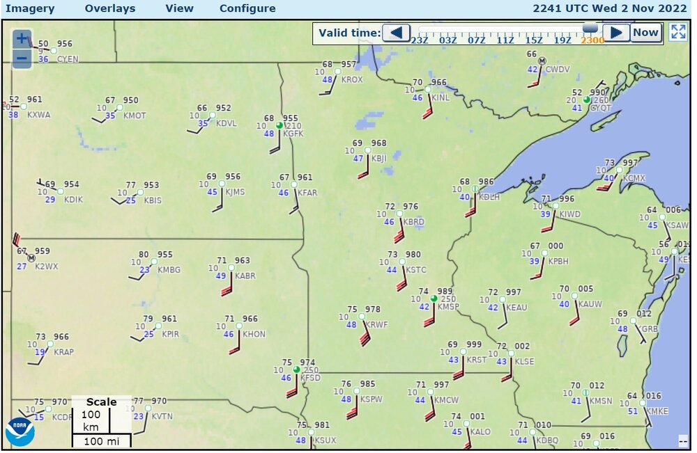
75-80 degrees up north
-
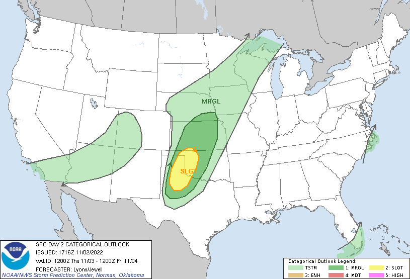
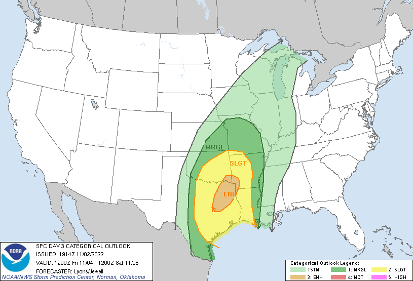
day 2/day 3
-
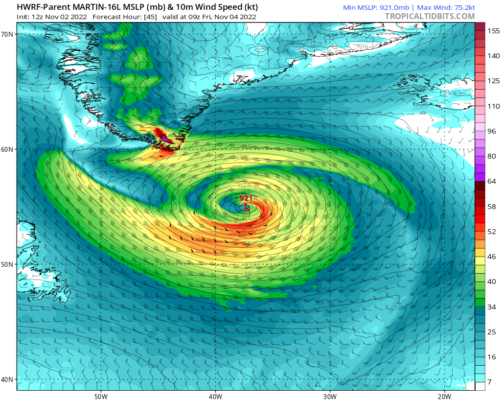
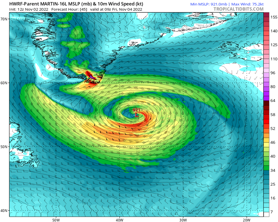
Models have this merging with the mid latitude trough to produce maybe 927mb near Greenland. I wonder if that's the sort of freak storm, that, sunk dozens of ships of Europeans going back and forth to North America in the 1700s and such. HWRF- large grid
-
I found one prickly pear cactus on the Oak Openings soil years ago, not sure if it was early 2000s or something. Then I moved to a place that had prickly pear cactus, (and only that type.) The Rocky Mountain foothills at ~5100 ft had prickly pear cactus.
-
Yes. It's kind of funny to see the perhaps specifically-planted white pine in there. The forest shouldn't have pine. It was my favorite outdoor place before the Rocky Mountains.