Chinook
-
Posts
11,159 -
Joined
-
Last visited
Content Type
Profiles
Blogs
Forums
American Weather
Media Demo
Store
Gallery
Everything posted by Chinook
-
both posted April 19th near Cody, in northern Wyoming. I guess they briefly had a category 4 hurricane or something like that
-
Now the FV3, WRF-NSSL, and WRF-ARW have some convection on Friday (48 hours)
-
Useful plot for finding the correlation between scoring differential and true winning percentage (wins/games.) The Avalanche have the highest number of wins in the history of the Avalanche/Nordiques franchise. Several of the top teams in the NHL are trying to overcome some playoff futility in recent history, including Avalanche, Panthers, Maple Leafs, Oilers, Wild.
-
This was posted on Twitter on April 1st
-
The models show almost no precipitation in the Plains for tonight and tomorrow. For Friday, the NAM shows a high amount of capping pretty far west, possibly up to the dryline. The GFS shows high LCLs, but lower capping. Yes, there will be a strong low pressure system, but the only thing really good is 0-3km shear. So it kind of stinks unless we see some reason to think there will be higher chances of thunderstorms.
-
 I kind of missed this one, since I don't normally look for tropical storm information in April. There was a Category-4 equivalent Typhoon Malakas, with max wind of 115 kt as determined by JTWC, on April 13th. This was away from land areas south and east of Japan, and west of Guam, if I could ever find Guam on a map, seriously.
 -
three preliminary tornado reports, with large supercell, with 1" to 4" hail reported
-
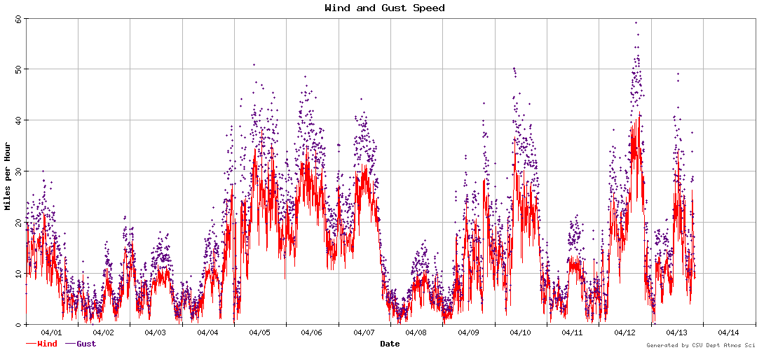
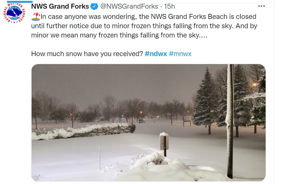
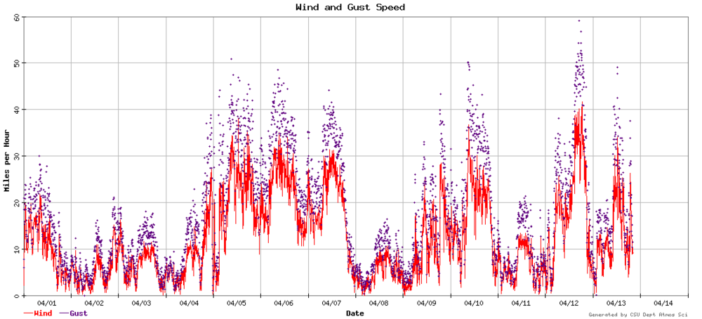
a nice weather-related joke from NWS Grand Forks. They had blizzard conditions for many hours in central North Dakota. a windy weather reporting station in Fort Collins-- 8 calendar days had wind gusts of 30mph+ since 4/4 (including 4/4 evening)
-
radar image from Salado TX today. I haven't done this GRLevel2 stuff for a while-- downloaded a new 21-day free trial, and maybe I'll maximize my 3D slice and high res possibilities central arkansas last night
-
huge field of opportunities for updraft helicity tracks tomorrow. Some models have helicity tracks near Terre Haute and Evansville
-
tornado debris signature at Spring Valley, MN
-
I missed a lot of this stuff today, but here is a radar image of a possible tornado at the MN/IA border right now. radar is from ARX, generally south of Minneapolis
-
I think this is a debris signature east of Mayflower Arkansas. If not, then there's a tornado emergency, so there's got to be a tornado on ground, right?
-
could I please please please get one day without a 30mph wind
-
The models agree on a low pressure developing Sunday with rain/snow near the Colorado Wyoming border, with possible rain/snow for me at 06z Sunday (midnight). That low will be gone quickly. Then the big question mark is Tuesday, where models have a deep low pressure development with snow over the western half of Colorado. The 12z ECMWF does not have the high values of QPF/snow over eastern Colorado, like previous runs. Overall, ensembles/WPC forecasts show some QPF of 0.4-0.8" for the northeast quarter of Colorado over the next 7 days (or more.) This could be something that changes quickly, even though ensembles shouldn't be as changeable as operational runs.
-
sheesh, the ECMWF. These models just do not agree.
-
My area had wind gusts at least 25kt at KFNL each hour from 15z Tuesday to 01z (this hour), so that's 32 hours in a row, I think. The 06z GFS and 00z ECMWF, and sort of the 12z ECMWF today had a big snow storm in the next Monday-Wednesday time frame. I think that's low probability for snow over 4" but we'll keep an eye on it. Really, it is about time for snow to make a return.
-
my area had wind gusts to 48mph-51mph, and it really was windy for over 12 hours, I think edit: wind gusts over 25kt for 24 straight hours
-
Severe weather possibilities for tomorrow will exist just after 12z until much later, possibly. This is the 04z HRRR updraft helicity tracks. SPC has 10% tornado (enhanced) close to the Gulf of Mexico in AL, GA
-
radar-detected rotation tracks in a 2-hr time frame. (Alvarado TX in center of image)
-
The latest HRRR shows some multicell storms coming into Fort Worth by 04z (11pm central). Surface-based CAPE is a decent 1500 J/kg at this time, and possibly similar most-unstable CAPE by this evening.
-
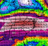
Welcome to spring! My place has not had significant snow over 0.1" for a while. I'm pretty sure the snow will come back some time. As for this week: the GFS has 25 kt surface winds and 55kt winds at about 2000ft+ above ground on Tuesday. I think a high wind warning will happen for some counties of Colorado on Tuesday.
-
two recent confirmed tornadoes at McLain MS and Gordo AL, near Tuscaloosa AL easy to identify large rotation tracks in the last hour
-
there has been a TDS right next to GWX radar. Hopefully it stopped being a tornado when it went by the radar