jbenedet
-
Posts
7,815 -
Joined
-
Last visited
Content Type
Profiles
Blogs
Forums
American Weather
Media Demo
Store
Gallery
Everything posted by jbenedet
-

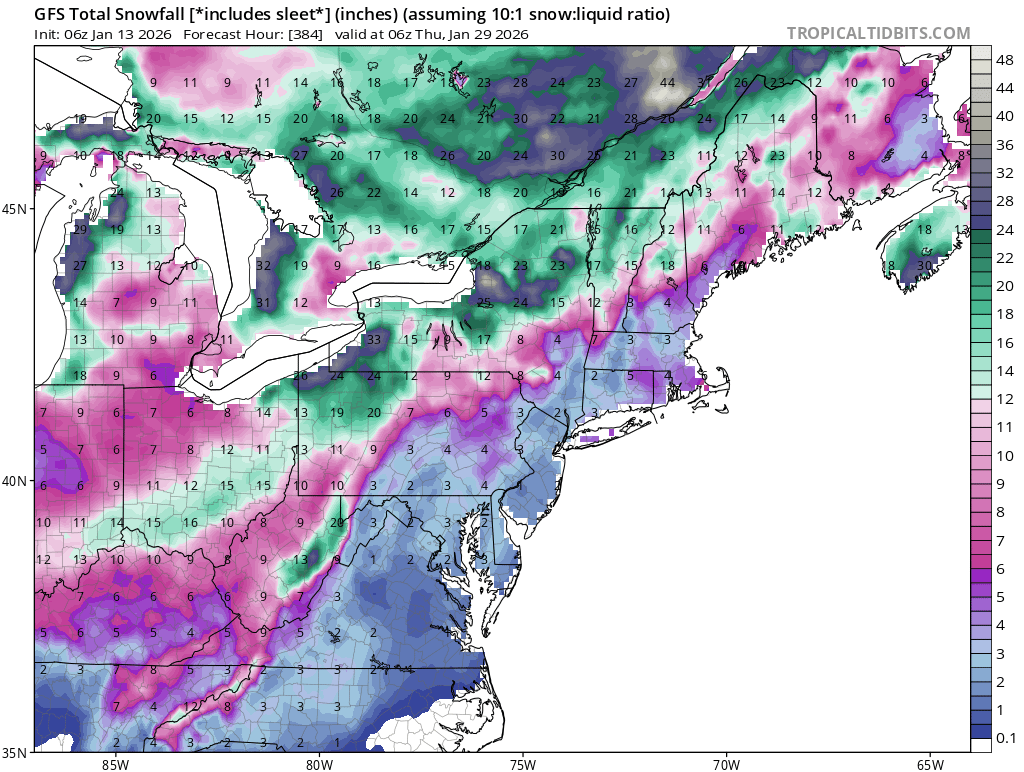
First Legit Storm Potential of the Season Upon Us
jbenedet replied to 40/70 Benchmark's topic in New England
Not best company but 12z CMC also has similar evolution. This threat is legit. -
First Legit Storm Potential of the Season Upon Us
jbenedet replied to 40/70 Benchmark's topic in New England
The EC-AIFS is actually on board with this one. I think Boston to SE MA still very much should watch for heaviest snowfall of the season. A very low bar(I know)… 12z GFS is super amped but at least evolution is similar. This is key difference from the 16th where GFS had no other support at similar lead time. -
We tried to tell em about the 18th. Here we are. Very interesting indeed. we watch closely
-
January 2026 regional war/obs/disco thread
jbenedet replied to Baroclinic Zone's topic in New England
Yea this was a complete flip. We had cold that overperformed to that date—temps consistently below forecast. It’s been the opposite since… -
January 2026 regional war/obs/disco thread
jbenedet replied to Baroclinic Zone's topic in New England
40/34 We torch since the 6th scattered snow cover gone today. -
January 2026 regional war/obs/disco thread
jbenedet replied to Baroclinic Zone's topic in New England
The 18z GFS ain’t happenin’. wagons north. -
January 2026 regional war/obs/disco thread
jbenedet replied to Baroclinic Zone's topic in New England
Can’t wait for MJO phase 7 to cook these weenies. Day 10 won’t be a mid Atlantic story. It’s up here. The GEFS and EPS calling absolute BS on that gradient being so far south. GTFO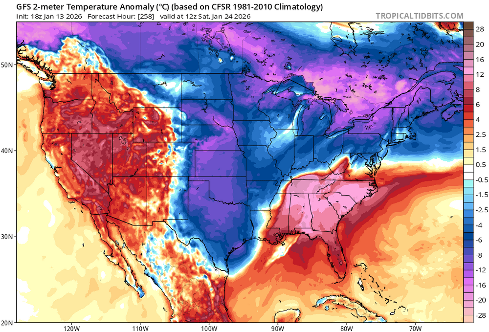
-
January 2026 regional war/obs/disco thread
jbenedet replied to Baroclinic Zone's topic in New England
You do realize you could run it through day 10 and see the same pattern? Or you could just run it every cycle and see the same gradient… This is an important signal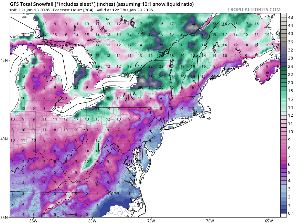

-
January 2026 regional war/obs/disco thread
jbenedet replied to Baroclinic Zone's topic in New England
Since the 7th— feels and looks like a shift back to 2025 persistence Temps back to over-performing. It’s a subtle but very important change. -
January 2026 regional war/obs/disco thread
jbenedet replied to Baroclinic Zone's topic in New England
We gradient
-
January 2026 regional war/obs/disco thread
jbenedet replied to Baroclinic Zone's topic in New England
Mood snows end for me with the holidays. Go big or let’s stay AN. -
Zzzzzzzz
-
Like this?


-
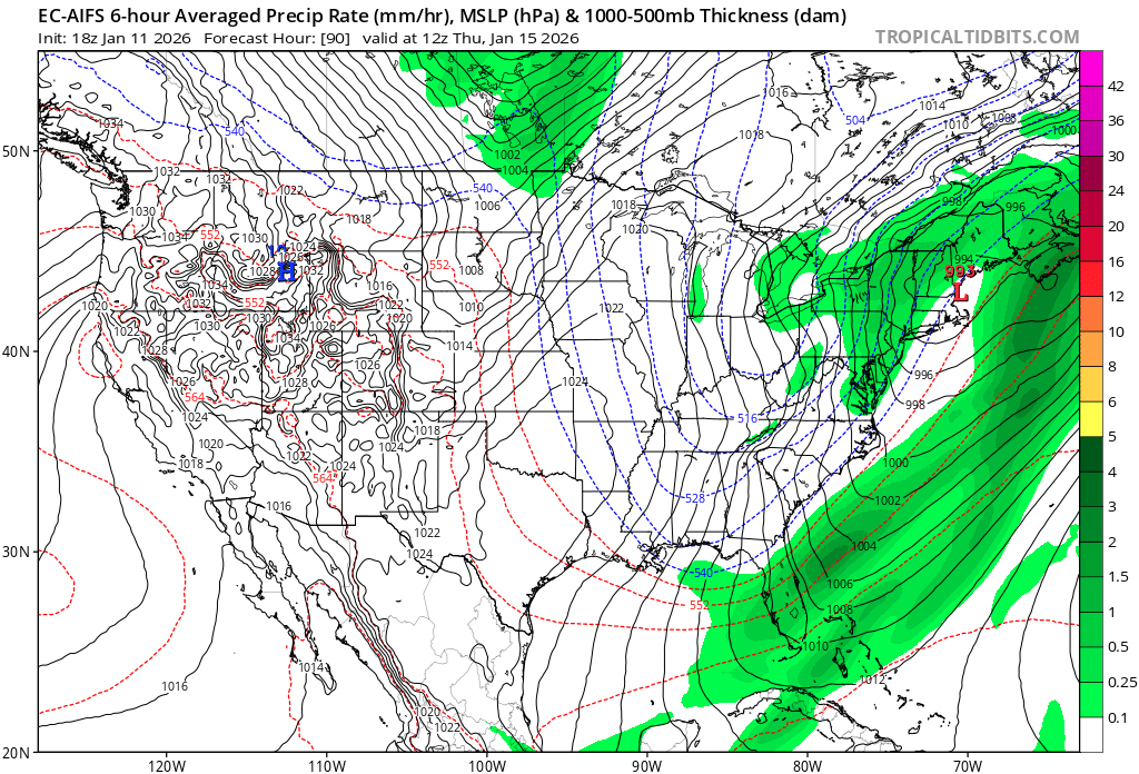
EC AIFS and GFS again are worlds apart…
-
January 2026 regional war/obs/disco thread
jbenedet replied to Baroclinic Zone's topic in New England
This is the 4th day of 40+… Been a long time… -
January 2026 regional war/obs/disco thread
jbenedet replied to Baroclinic Zone's topic in New England
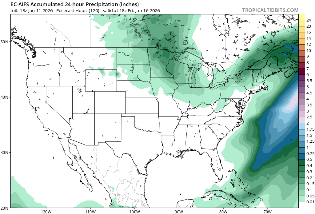
I could easily see the 18th split the forum like the 12z GFS advertised… But at least we’re looking at legit big storm potential. The synoptic setup is amped.. 977 over Bangor ME giving a hint at the potent setup. Finally something to track -
January 2026 regional war/obs/disco thread
jbenedet replied to Baroclinic Zone's topic in New England
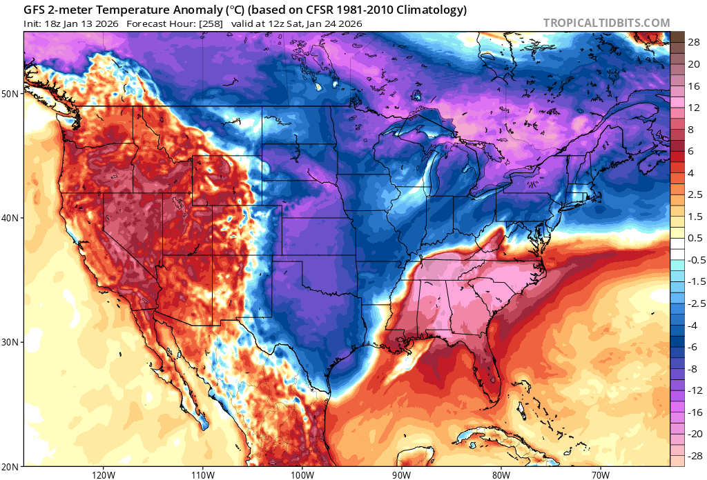
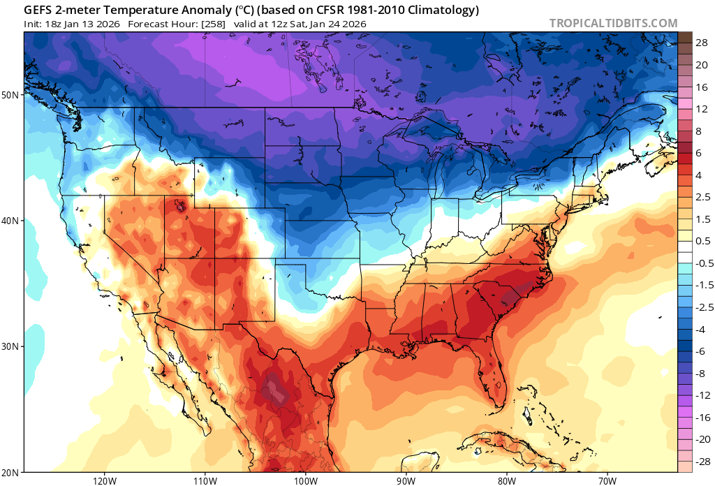
Legit arctic airmass around 18th. But looks like one of them “west is colder than north” type packages. Slight moderation as it swings East after diving south… Boston warmer than Greenville SC type deals… Could be a big deal in places like Atlanta… -
The shit solution on the ICON also opens the door to the 18th. Similar to the 6z GFS. That’s the one to watch.
-
Batten down the hatches folks. 1-3” incoming.
-
Bc you believe this will be a significant snowstorm? Let’s hear — what’s your call?
-
Move to the southeast if you want to call an advisory level threat a major snowstorm. By New England standards - this isn’t even a storm at this stage. It’s weather in January.
-
Can one of the mods put a weenie tag next to the title of this thread?
-
The GEFS and EPS are still an open wave frontal boundary evolution. The very early mid level cut off over the southeast is just a potent meso vort traversing the boundary. It doesn’t allow for a bend back or strengthening of the already diffuse BZ… So on top of all the limitations—you’re not gonna get the mid level magic out of this either.
-
January 2026 regional war/obs/disco thread
jbenedet replied to Baroclinic Zone's topic in New England
That’s where I’m at right now. -
January 2026 regional war/obs/disco thread
jbenedet replied to Baroclinic Zone's topic in New England
I need to see another model blow up H5 like that over the southeast before I bite.