jbenedet
-
Posts
7,800 -
Joined
-
Last visited
Content Type
Profiles
Blogs
Forums
American Weather
Media Demo
Store
Gallery
Everything posted by jbenedet
-
Parting the sky like Moses did the Red Sea.
-
Suns out guns out for the milfs?
-
Today looking a lot like yesterday here. Even the surprise afternoon jump once the sun gets to flex and the light winds shut off. 60 attainable. We take.
-
I only see upside when GFS is outputting upper 40’s with 850 temps >0C. Biggest error bars on modeling is that of clouds. My bet is that output is wrong. South of I84 will be tough though. Best in Maine, worst south of 84.
-
TMI. Time for some manscaping
-
Sunday looks the worst down to Joisey and LI. Big sell on 40's here with surface HP overhead.
-
The people who want well manicured lawns don’t let their kids on the lawn. The worst.
-
Pretty cool. But this boomer obsession with grassy lawns is ridiculous. Want to save water? Stop growing grass. Idiots. If you live in a desert, make your immediate surroundings match the climate--why struggle for the opposite?. Cactuses and succulents would do just perfectly, landscaped around rocks sand and gravel.
-
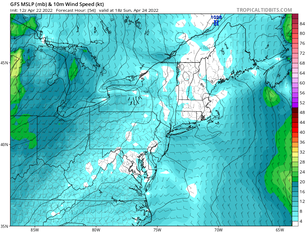
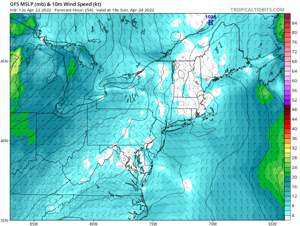
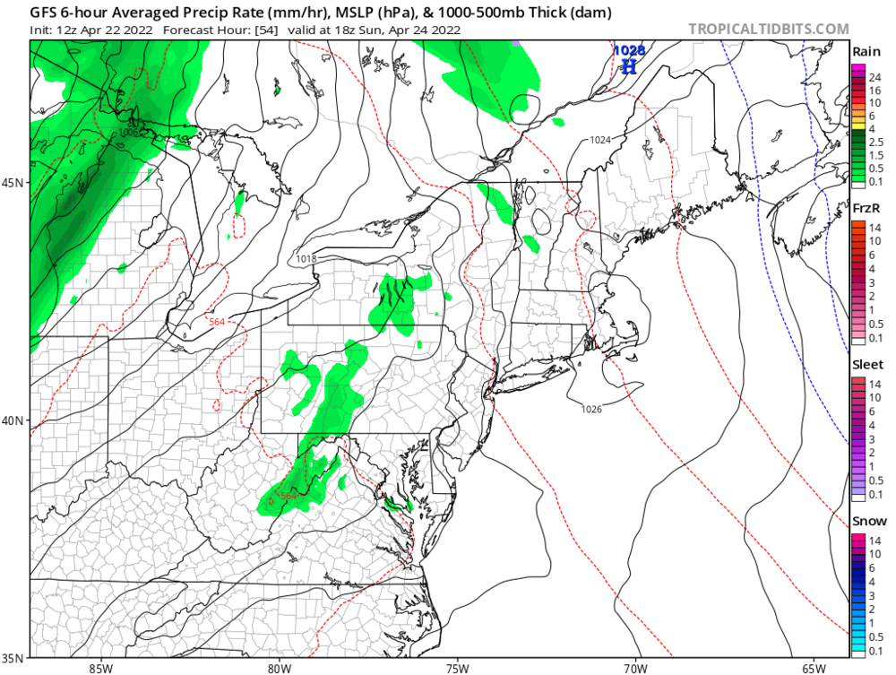
Sunday is sending the door down to NYC midday. Best in maine?
-
Into late april if we gonna door we hope it goes all the way to ACY. The worst is for the Mid Atlantic with the onshore flow. We can 60 with a Canadian airmass. That's my hope/expectation come Sunday and into early May, generally. Otherwise close the blinds.
-
Through first week in may GFS op struggles to get one(?) location in New England to 70 through entire time series.The euro is pretty much the same. Run after run showing gahbich. Impressively bad. “Where warm fronts go to die” shifts from Winne to NYC, just in time for spring. FTL.
-
you pay a hefty premium for nicer weather than that. I’d move if I loved this weather. If not wanting to leave the country, get something dirt cheap in down east Maine.
-
Long Guidance is brutal. Haven’t seen a legit tropical airmass (warm sector) since late October and none in sight. Dewless 50’s are a reprieve in late winter but into late April, it just flat out doesn’t cut it anymore. welcome to Scotland
-
First day in forever with a dewy feel. Noice.
-
I don’t radiate well—on a hill here. Also I believe this time of the year is great to start—many days of cool rain and less pests. So long as you can avoid the frost it’s a good risk/reward bet.
-
Feeling pretty damn good about giving the grass the first mulch cut and planting >50% of the garden vegetables yesterday. Will likely do another 25% today.
-
Thurs into the shittah. Cruel early guidance. Those 80’s stuck in South joisey. That’s turning into a “best in ME”, surface HP overhead with the back door down to the northern mid Atlantic. Oof.
-
You’re way off on these numbers, especially since Covid. Covid (more remote work) + housing bubble + no interest on savings has a ton of people owning more than one home.
-
Lol. COL is way too high for this shit weather. Why? New England has too many transients—people who live here only 3-6 months a year and stay in their Florida Condos the other 6. Resi real estate inflated. And those small businesses we all love also take the hit, paying high rent for 12 months on revenues of half the population for 6. “Look at all those nice homes! Great demographics! High Disposable income!” Ehh, but the occupants are 1500 miles away bro. Check back in May. Oof.
-

March 2022 Obs/Disc: In Like a Lamb, Out Like a Butterfly
jbenedet replied to 40/70 Benchmark's topic in New England
We 60 Best day in the next 10. Left work early. Time for a beer. -
March 2022 Obs/Disc: In Like a Lamb, Out Like a Butterfly
jbenedet replied to 40/70 Benchmark's topic in New England
EPS/GFS is BS for second half of next week. Yea sure that Wednesday shortwave could cut into Manitoba but it’s not eroding the confluence over the northeast US. What most likely happens is it does cut, but then cuts off quickly and fills and we still have a trough overhead with the BZ over the northern mid Atlantic, primed for a secondary. Snow threat is legit through the 1st. -
March 2022 Obs/Disc: In Like a Lamb, Out Like a Butterfly
jbenedet replied to 40/70 Benchmark's topic in New England
Friday and Saturday look pretty damn decent. Friday especially- that has low 60's written all over it for the NH seacoast. Huge win before we see the worst weather next week. Next week we winter in spring. Out with a bang. -
March 2022 Obs/Disc: In Like a Lamb, Out Like a Butterfly
jbenedet replied to 40/70 Benchmark's topic in New England
Thurs looks interesting for a frozen mess from the monads to dendrite and dryslot. -
March 2022 Obs/Disc: In Like a Lamb, Out Like a Butterfly
jbenedet replied to 40/70 Benchmark's topic in New England
Who does yard work in running shoes. This guy. -
March 2022 Obs/Disc: In Like a Lamb, Out Like a Butterfly
jbenedet replied to 40/70 Benchmark's topic in New England
In like a butterfly out like a lion.