jbenedet
-
Posts
7,815 -
Joined
-
Last visited
Content Type
Profiles
Blogs
Forums
American Weather
Media Demo
Store
Gallery
Everything posted by jbenedet
-
This now has the look of a classic DC to Boston MECS. I do think the megalopolis is all in game for 12”+
-
I think it’s done. I think it’s more likely to tick south than north from here.
-
That read with clear - NAO says “MJO 8” Or at least a lot more 8 than 7…to put it crudely… Interesting…
-
Do you have a good reference for NAO data? I’m thinking that’s the only way to have a good idea on which way this will register 7/8…
-
Not financial advice but… Check out Chevron $CVX Thank me later.
-

Extreme Cold, Snow & Sleet: SECS 1/24 - 1/26
jbenedet replied to TriPol's topic in New York City Metro
Anyone have a good NAO dataset they could share? Something more than the ncep teleconnection forecast. -
Not done gon’ north.
-
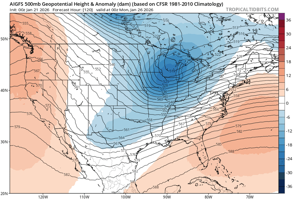
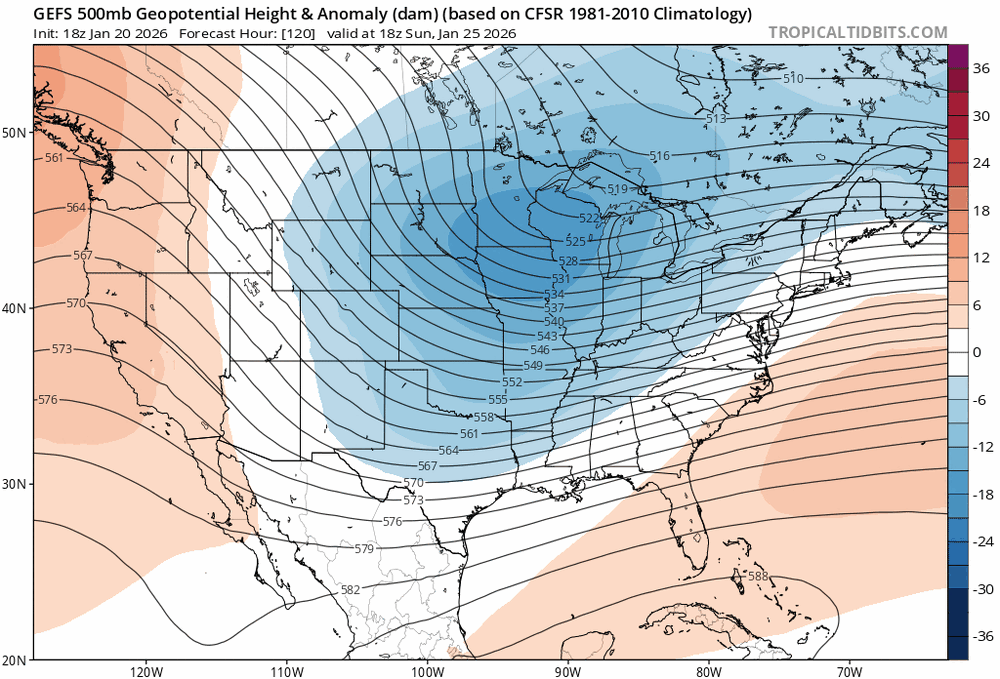
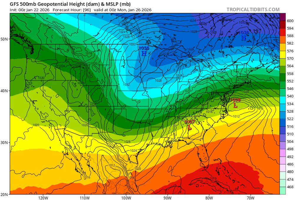
The 6z AI GFS has completely lost the mid level -height anoms in the east now. Also the long wave ridge axis is like 300 miles west of Washington state now..
-
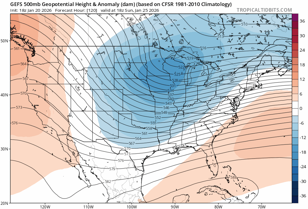
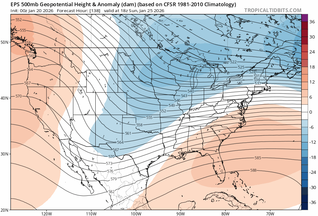
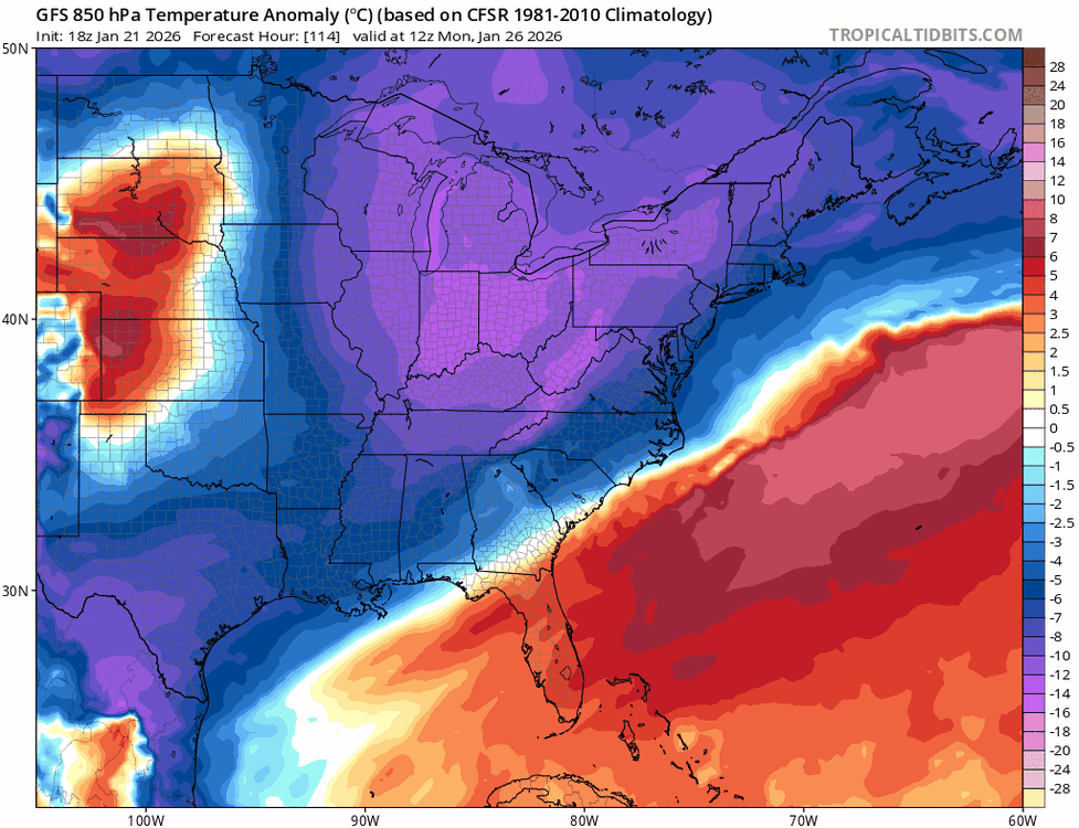
To me the cold is dumping increasingly in the central conus and much less so in the east. The -AO is legit. That will also give fuel to the primary to hold on longer “bend back” than latest guidance.
-
It’s not done.
-
Yea agree that this willl be juicier in that regard The antecedent airmass is also warming…albeit from a very cold to cold in the east. Need to watch it closely… But the typical areas that can’t rely on just the antecedent airmass to stay all snow need to worry about a lot of mixing already. Cape/islands, coastal RI and CT.
-
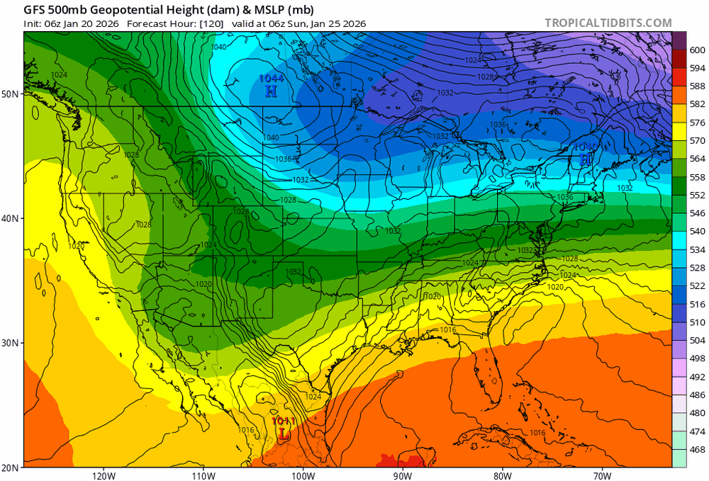
That Canadian high position though…

-
GEFS is like 4 runs away from saying “what PV?”
-
100 hours to go…
-
This is wonky. The dual surface lows.. What I’m thinking is more that the lead wave fizzles and the trailing surface reflection is our main storm up here… An how that would change the mid level evolution if that lead wave is dampened completely.
-
There is sooo much long wave spacing out west to get this further north. That ridge axis out west keeps inching west. It’s basically in general position where we open up inland runner risk…
-
Tbh the mid level support isn’t there to anchor the high. Given the intensity of the trailing shortwave it’s not much to see it slide east and become that giant surface high that merges with the WAR that we’ve seen happen so many times before…. The Canadian surface high kicking east like 24 hours sooner is basically the only thing that needs to change to take on a high amplitude MJO phase 7 look which we will be in at go time… Not much given still 100 hours out.
-
She ain’t done going north. Question is, how far she go…
-
January 2026 regional war/obs/disco thread
jbenedet replied to Baroclinic Zone's topic in New England
I know, I know it’s just the CMC But. it looks a lot like the trending in the respected EPS… Same behavior… very similar look Look less at the SLP and more at the long wave features….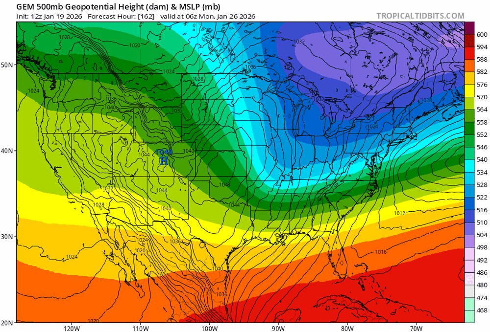
-
January 2026 regional war/obs/disco thread
jbenedet replied to Baroclinic Zone's topic in New England
The resolving of long wave features that the EPS and GEFS typically can reliably provide inside 10 days was absent. That was the rug pull. In just 6 runs inside 6 days the EPS is looking completely different in synoptic evolution. The lead wave is a side show. Everything moving to the trailing shortwave for us in the east.
-
January 2026 regional war/obs/disco thread
jbenedet replied to Baroclinic Zone's topic in New England
Wrong take. Anyway….I said my piece. We watch 12z -
January 2026 regional war/obs/disco thread
jbenedet replied to Baroclinic Zone's topic in New England
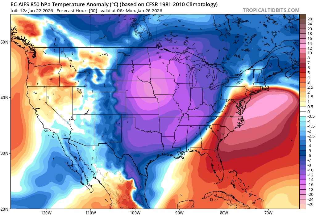
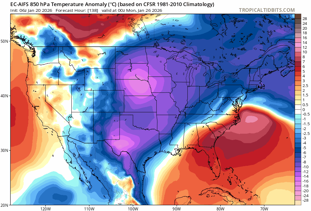
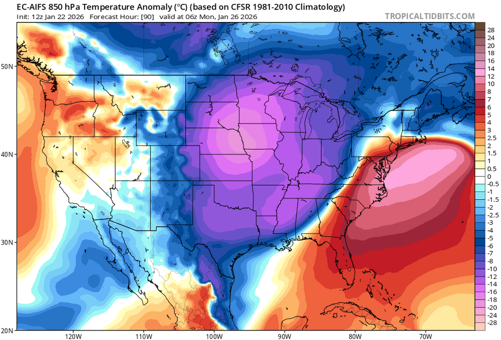
EC AIFS definitely saying balance is toward warmer solution in the east from here. Just seeing the low level cold anoms increase in the central CONUS and greatly relative to the east coast is pretty telling. -
January 2026 regional war/obs/disco thread
jbenedet replied to Baroclinic Zone's topic in New England
EC AIFS saying “what cold” in the east with all that cold to back into in the central conus. wow.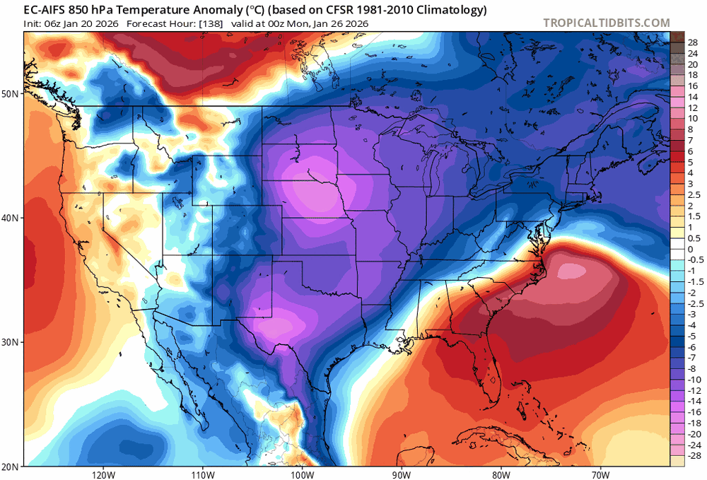
-
January 2026 regional war/obs/disco thread
jbenedet replied to Baroclinic Zone's topic in New England
I’m not sure it’s going warmer but I think that risk is higher than colder from here. I folded and now I’m wait and see.. -
January 2026 regional war/obs/disco thread
jbenedet replied to Baroclinic Zone's topic in New England
Probably should be noted that a high amplitude 7 to 8 MJO progression in late January around the time of a strong shortwave is the thing forecasting nightmares are made of.