
dailylurker
-
Posts
6,046 -
Joined
-
Last visited
Content Type
Profiles
Blogs
Forums
American Weather
Media Demo
Store
Gallery
Everything posted by dailylurker
-

Big Heat (and storms?) Week into July 4th Weekend
dailylurker replied to yoda's topic in Mid Atlantic
Just an absolute furnace out here. It feels like Vegas in mby. I remember being in Vegas when I was 15. It was 123 during the day and 98 at night. -
Big Heat (and storms?) Week into July 4th Weekend
dailylurker replied to yoda's topic in Mid Atlantic
Raging heat in the lowland along the upper South River 101/82. Impressive. Glad I used my bosses card and shut down business at 11. -
Big Heat (and storms?) Week into July 4th Weekend
dailylurker replied to yoda's topic in Mid Atlantic
The dewpoints down along 450 where the South River turns into lowland wetlands is gotta be 82-83. The temp drops a couple degrees when the land dips down to sea level but the DP is impressive. It's 100 once you climb up to 120-150 feet elevation. It's easy 100 in Crofton. Sky is clear now. I think Crofton goes 103 -
Big Heat (and storms?) Week into July 4th Weekend
dailylurker replied to yoda's topic in Mid Atlantic
Mostly cloudy here now. Boooo lol -
2026 Mid-Atlantic Severe Storm General Discussion
dailylurker replied to Kmlwx's topic in Mid Atlantic
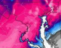
Justin Berk is honking on a flood threat for Sunday and Monday.- 1,038 replies
-
- 2
-

-

-
- severe
- thunderstorms
- (and 7 more)
-
Big Heat (and storms?) Week into July 4th Weekend
dailylurker replied to yoda's topic in Mid Atlantic
Already 97 in Crofton and 96 here east of Crofton in the woods. Wild DP and heat in the South River watershed. -
Big Heat (and storms?) Week into July 4th Weekend
dailylurker replied to yoda's topic in Mid Atlantic
New around here? Lol It’s heat. Of course DC will reach 100 today, and probably will for the next 5 days -
Big Heat (and storms?) Week into July 4th Weekend
dailylurker replied to yoda's topic in Mid Atlantic
Heat Dome Erica looks on track. God, this is so boring. It's hard to get into heat lol -
Home brew next week?
-
Mods. Lock this turd lol
-
Big Heat (and storms?) Week into July 4th Weekend
dailylurker replied to yoda's topic in Mid Atlantic
Here in the lowlands I never doubt heat. This area is the Oswego County of heat. Just like the Tug, when they call for snow, it always happens, and some. Same here with heat -
It's been a dark rainy day here. I got pretty wet this morning while working. It's been a lazy, rainy afternoon.
-
Is it possible I'm having a hot hand right now? Another nice blob headed for mby as i type. This is the greenest drought i can remember. No dead grass here yet. The heat will kill it regardless.
-
That batch of rain west of DC has been sitting there since last evening. It just morphs but doesn't move east. That area is doing well. I'm thankful for the rain i received last evening.
-
Like the "29 inches of snow that fell at BWI in 2016. Bogus. I measured 21" at BWI. The biggest official snowstorm is Bogus. Feb 2010 was the GOAT.
- 259 replies
-
- 1
-
-
- we got burned
- rugpull central
- (and 1 more)
-
I wish I could lol. Seems like theres a boundary across our region. Hopefully it lights up this evening.
-
Mission accomplished. I caught my jumbos today. Beautiful day for crabbing. The rain held off until we were done crabbing and sitting outside on the screen porch eating. I probably have gotten close to an inch so far. Radar looks interesting.

- 226 replies
-
- 12
-
-
More brutally boring weather ^ lol. Looks like a good day to go crabbing. I'm hoping to sit on my screen porch and eat crabs later on while it's storming.
-
It's the same game for the past 3 years. We're not getting anything besides a few sprinkles today. The only story in town is the extreme heatwave and the drought.
-
I started a thread for a few sprinkles lol.
-
Anyone else having trouble loading the site? It's been terrible for the past two days.
-
I probably should I waited to start this thread. Everything pretty much trended north where they don't need rain. Hopefully it keeps going north. Not trying to ruin the weekend with worthless sprinkles.
-
It looks like a front will be stalling over our area late Friday afternoon and low pressure in the Midwest moves along the front and into the area. It looks like a slow mover. It could be a long duration, beneficial rain event. Let's talk about it here.
-
Anyone notice the absence of wildfire smoke from Canada from season? I wonder what the difference is this year. More rain?
-
Using my "I'm the boss" card this afternoon. The area of rain is building and looking good. I'm going to put my bathing suit on and go for a rainy hike. It's been so dry that it should feel great out there.


