
CAPE
-
Posts
36,457 -
Joined
-
Last visited
Content Type
Profiles
Blogs
Forums
American Weather
Media Demo
Store
Gallery
Everything posted by CAPE
-
Unless it is a legit, sustained west-based block- but that is unlikely to occur unless the AO is also negative. I guess there is some possibility the mean Pac ridge is close enough to the west coast in early winter to pop a +PNA for a time. Some of the climate models have suggested this before the Pac goes to total crap by mid winter. Latest CFS runs have backed off on that idea, and also any semblance of HL help. It is starting to get a clue.
-
This is true but one thing to consider here is the official method for measuring the AO and NAO phases(surface based), vs the sensible weather impacts we associate with the h5 heights in those domains. They mostly should be aligned, but not always.
-
The 840 hour GEFS looking good for mid November.
-
60 F here and still breezy/cloudy. Total rainfall 1.51" An underperformer here for once!
-
They generally are all depicting a 'typical Nina' look, and we are clearly in a Nina. People get too locked into these monthly means though, as if the h5 pattern will always look like a LR smoothed mean in real time lol. Ultimately, we just cant know, and there will be some chances even if the winter does overall end up a dumpster fire.
-
This look would surely produce an apocalyptical blizzard if it were mid Jan.
-
No kidding, They have completely abandon that. I don't get the feeling he is hurt though. I think this is an attempt to 'transform him' to keep him healthy, and/or its just Roman being a dope and going pass happy when the team is better suited to pounding it on the ground. The main offseason goal was to be able to keep defenses from loading the box by stretching the field on the outside a bit more, and to do that you need the right type of receivers. Hollywood can do it, but he is not a big, physical target. There have been a few times in the last 2 games where Lamar got the ball to him but he short-armed it, or didn't strongly pull it in. Ofc they went and drafted another smallish, fast guy instead of a tall, physical playmaker.
-
The last 2 winters were weak, wimpy undefined Nino/warm neutral, and the sensible weather that resulted could have easily occurred in a Nina. So I guess its debatable, lol.
-
We pretty sure it wont be a Nino.
-
Steady rain has been falling here again. Looks like the last gasp. 1.42"
-
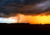
Pretty decent pressure gradient/wind field between the remnant low and the high to the north.
-
Winds have really picked up here over the last hour. That easterly flow is getting going.
-
From Ravens 247- REPORT CARD: Wink Head of the Class, Roman Fails Glad I'm not the only one who thinks he has been awful.
-
1.15" here so far.
-
The offensive problems the Ravens are having this year go deeper than Lamar. Ofc he is the quarterback, and the MVP, so he gets all the attention, good or bad. The OL and the crappy play calling are the bigger issues, and for those who want him to throw outside downfield with more success, where are the big and talented wideouts that can make those contested and back shoulder catches? Hollywood is not that guy. Boykin? LOL. Ravens have always been terrible at drafting legit playmaking wide receivers. They need to solidify the OL and get back to playing smash mouth football, and feature the most talented back they have- Dobbins. He gets a few carries a game and does more with those than Ingram carrying the ball the whole game. He had all of one carry yesterday, and it was dazzling. Another head scratcher with the "game plan".
-
WPC QPF looks wet for the entire region. 1-3" through tomorrow evening.
-
That's weak sauce, and not the main show. I am east, and not even a tenth here, which was exactly the forecast for today. Look to the south-southwest. That's the juice from the remnants of Delta moving in, and it will interact with the stalled front. Unfortunately the heavier stuff may fall over this way(dont need it) but there still should be a good soaking for DC-BWI and the NW burbs.
-
The steadier rain was always supposed to fall overnight until around noon tomorrow.
-
Maybe the knee/illness and lack of practice, but that doesn't even make much sense given the apparent "game plan". There is definitely a change in the play calling this season, seemingly to limit his running. I still don't get why they don't seem to run as much overall though, given the 3 great backs they have. Throwing 37 times today? That is not how this offense works. The OL has looked pretty meh so far, but Harbaugh needs to have a closed door meeting with Roman. He did this same crap years ago with SF. Lamar is not Mahomes. Let Lamar be Lamar.
-
8 wins should be more than enough to win that division.
-
LV RAIDERS. Damn. Making the Chiefs vaunted O look fairly ordinary.
-
Yeah while I am bitching, not enamored with Roman's play calling so far this year. The D was a monster today. Winning like the good old days.
-
Nice of the Bengals to run out the clock on this drive. Ravens offense could have used the work though. Still sputtering along. Lamar made some bad decisions under pressure and got away with a few. O line is shaky and inconsistent, both pass and run blocking Would not be surprised if Antonio Brown is a Raven in the next few weeks. They really have limited threats downfield outside of Hollywood, and he is too small to be the only guy.
-
Greg Gumbell has called Lamar Jackson 'Murray' several times. He is even worse than he used to be.
-
I'll go with the black squirrels. I have never seen one imy until this Fall. Now seeing them all over- It has to mean something. Low solar...black squirrels...yeah baby. HL blocking winter incoming.


