

CAPE
-
Posts
36,283 -
Joined
-
Last visited
Content Type
Profiles
Blogs
Forums
American Weather
Media Demo
Store
Gallery
Everything posted by CAPE
-

Feb Long Range Discussion (Day 3 and beyond) - MERGED
CAPE replied to WinterWxLuvr's topic in Mid Atlantic
You do ok in marginal setups. Already been screwed by suppression/timing twice with potential snow going to places further south. Could have been decent events for the MA coastal plain. -
Feb Long Range Discussion (Day 3 and beyond) - MERGED
CAPE replied to WinterWxLuvr's topic in Mid Atlantic
Other than some esoteric and probably unproven correlations, the NAO is notoriously difficult to predict at long leads. There is a definite correlation to the AO state, and it tends to happen more in Ninos (I think), but beyond that it is tough to call. It has definitely been more persistently in the positive phase during winter over the last 50 years. Maybe that trend is about to shift. -
Feb Long Range Discussion (Day 3 and beyond) - MERGED
CAPE replied to WinterWxLuvr's topic in Mid Atlantic
As we approach mid month, GEFS has a -AO/NAO, -EPO, neutral to +PNA. -
Feb Long Range Discussion (Day 3 and beyond) - MERGED
CAPE replied to WinterWxLuvr's topic in Mid Atlantic
The block has been pretty effective in mitigating any SE ridge tendency, despite guidance attempting to pop it. For whatever reason in the LR, the models tend to go back to boilerplate Nina look, but it never really happens. -
Feb Long Range Discussion (Day 3 and beyond) - MERGED
CAPE replied to WinterWxLuvr's topic in Mid Atlantic
But we needed to see that WB snow probability map to confirm. -
Feb Long Range Discussion (Day 3 and beyond) - MERGED
CAPE replied to WinterWxLuvr's topic in Mid Atlantic
I would say not so much. Wrong way from the 0z run. Could also see something along the front, but haven't looked too deeply into that possibility. -
Feb Long Range Discussion (Day 3 and beyond) - MERGED
CAPE replied to WinterWxLuvr's topic in Mid Atlantic
Still time ofc, but trends are not good. -
Feb Long Range Discussion (Day 3 and beyond) - MERGED
CAPE replied to WinterWxLuvr's topic in Mid Atlantic
6z GEFS does look flatter and further east than 0z run. -
Feb Long Range Discussion (Day 3 and beyond) - MERGED
CAPE replied to WinterWxLuvr's topic in Mid Atlantic
Mount Holly's take for the Sunday-Monday potential- Deterministic guidance over the past 24 hours has taken an eastern shift in a potential surface low track however there`s still quite a bit of spread in the ensemble guidance. I suspect over the next couple of days we`ll see this trend continue as the 250mb jet axis acts as a wall to push the developing low pressure system off shore. However its certainly within the ensemble envelope that we`ll see the low pressure system sneak back inside and towards the coast. So its worth watching for changes but likely the storm will have little impact over the region other than to bring rather cold temperatures to the region. Temps early next week will be running on the order of 10 degrees below normal.. -
Feb Long Range Discussion (Day 3 and beyond) - MERGED
CAPE replied to WinterWxLuvr's topic in Mid Atlantic
Forecast highs here low 40s for Sat and Sun, dropping to 34 for Monday. -
Feb Long Range Discussion (Day 3 and beyond) - MERGED
CAPE replied to WinterWxLuvr's topic in Mid Atlantic
No surprise there is plenty of uncertainty for late in the weekend, but this is how to make a forecast and keep all possible outcomes in play. Saturday Night A chance of snow showers after 1am. Partly cloudy, with a low around 27. Chance of precipitation is 30%. Sunday A chance of snow showers before 9am, then a chance of rain and snow showers between 9am and 10am, then a chance of rain showers after 10am. Partly sunny, with a high near 43. Chance of precipitation is 40%. -
Jan 31st - 33rd Storm Obs and Disco like it's 1979
CAPE replied to Bob Chill's topic in Mid Atlantic
Cabin in the woods. -
Jan 31st - 33rd Storm Obs and Disco like it's 1979
CAPE replied to Bob Chill's topic in Mid Atlantic
Few pics from around my property today. My seasonal wetland is quite wet. Last year at this time it was mostly dry. I will be trudging around in there seeding it with larvicide in another 6 weeks or so.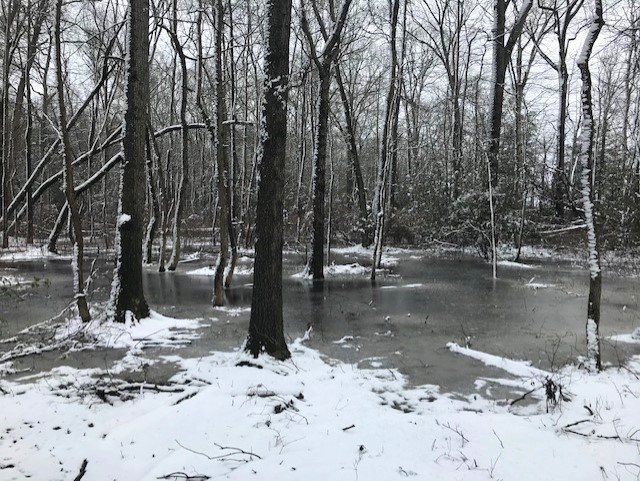
-
Jan 31st - 33rd Storm Obs and Disco like it's 1979
CAPE replied to Bob Chill's topic in Mid Atlantic
Snowing decently here now with some big flakes, temp down to 32. Might get a dusting before this band dies out. -
Jan 31st - 33rd Storm Obs and Disco like it's 1979
CAPE replied to Bob Chill's topic in Mid Atlantic
Everyone has their own interpretation of 'busted' I suppose. I didn't get as much as I wanted, nor what many of the models had depicted, but I did get about what I expected, being objective about the general setup, the complexities, and my location. -
Jan 31st - 33rd Storm Obs and Disco like it's 1979
CAPE replied to Bob Chill's topic in Mid Atlantic
Radar looks more impressive here now than at other times where it was snowing light to moderately and accumulating, yet just random flakes flying around. I think there is some drying in the mid levels. We have finally reached the end of this protracted snow showery event I think. -
Feb Long Range Discussion (Day 3 and beyond) - MERGED
CAPE replied to WinterWxLuvr's topic in Mid Atlantic
Rare bird these days. We sure could do with an event like this. -
Feb Long Range Discussion (Day 3 and beyond) - MERGED
CAPE replied to WinterWxLuvr's topic in Mid Atlantic
Here is h5 for that event. -
Feb Long Range Discussion (Day 3 and beyond) - MERGED
CAPE replied to WinterWxLuvr's topic in Mid Atlantic
It may have been a southern slider that ended up a MA slider. It definitely had some latitude gain though as it tracked eastward I believe. I don't think it was straight W-E in its track. I could be wrong. I am sure @psuhoffman can provide the specifics. -
Feb Long Range Discussion (Day 3 and beyond) - MERGED
CAPE replied to WinterWxLuvr's topic in Mid Atlantic
I just remember it look suppressed, then it looked like it might hit the coastal plain of MD and DE, then it trended NW in the last day or so and ended up a solid event for everyone. That's how it can work with some decent blocking and legit cold in place. No mixing issues except maybe in SE VA or something. I recall it being in the mid teens here from start to finish, no lulls in intensity, and ended up with 7". Loved that day. -
Feb Long Range Discussion (Day 3 and beyond) - MERGED
CAPE replied to WinterWxLuvr's topic in Mid Atlantic
Perfect. In some ways, that was the most enjoyable event of that remarkable winter. -
Jan 31st - 33rd Storm Obs and Disco like it's 1979
CAPE replied to Bob Chill's topic in Mid Atlantic
I dont think we are getting the goods with this one. Looks good for Easton and Denton and further SE. -
Jan 31st - 33rd Storm Obs and Disco like it's 1979
CAPE replied to Bob Chill's topic in Mid Atlantic
Some flakeage here now. Maybe I can catch the NW edge of this one. -
Feb Long Range Discussion (Day 3 and beyond) - MERGED
CAPE replied to WinterWxLuvr's topic in Mid Atlantic


