CAPE
-
Posts
36,850 -
Joined
-
Last visited
Content Type
Profiles
Blogs
Forums
American Weather
Media Demo
Store
Gallery
Everything posted by CAPE
-
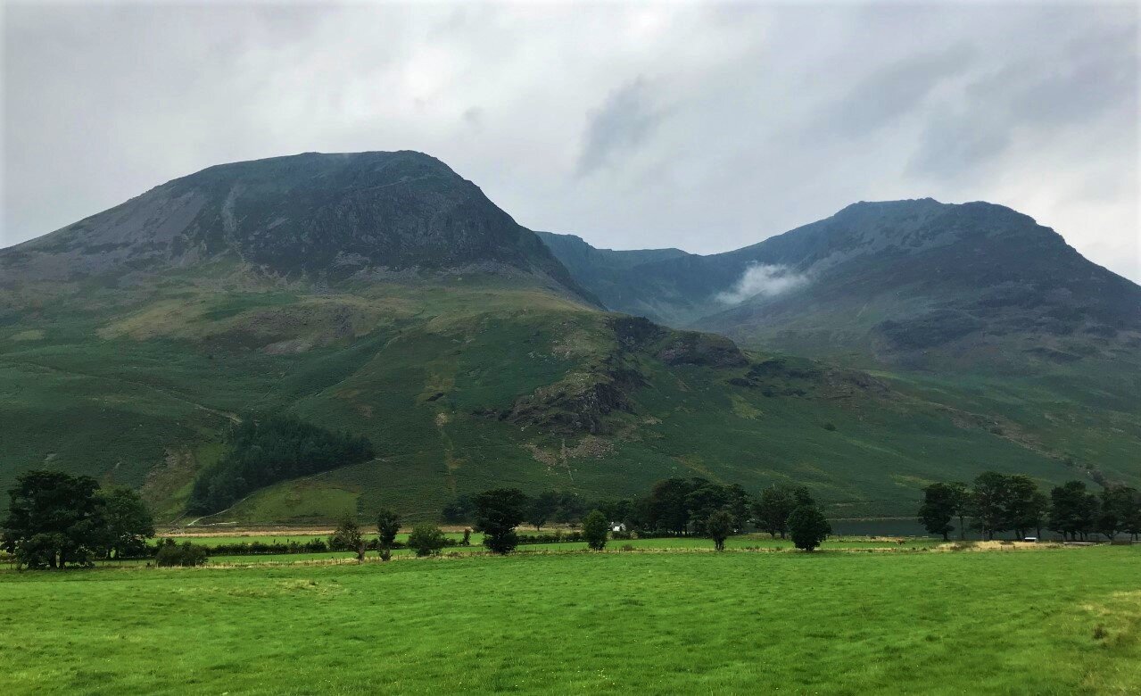
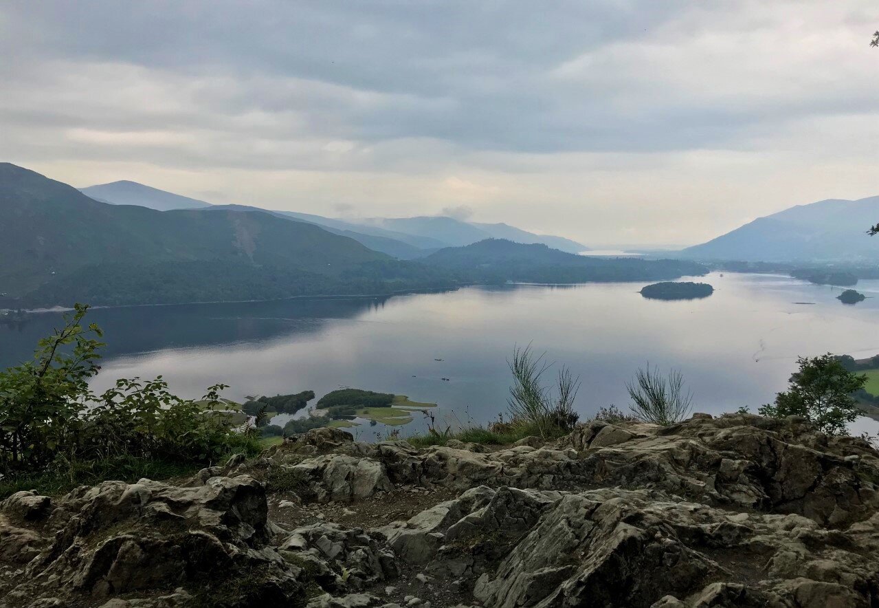
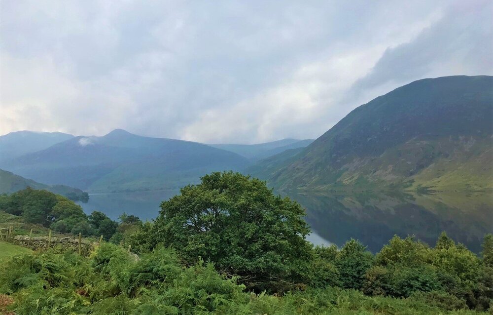
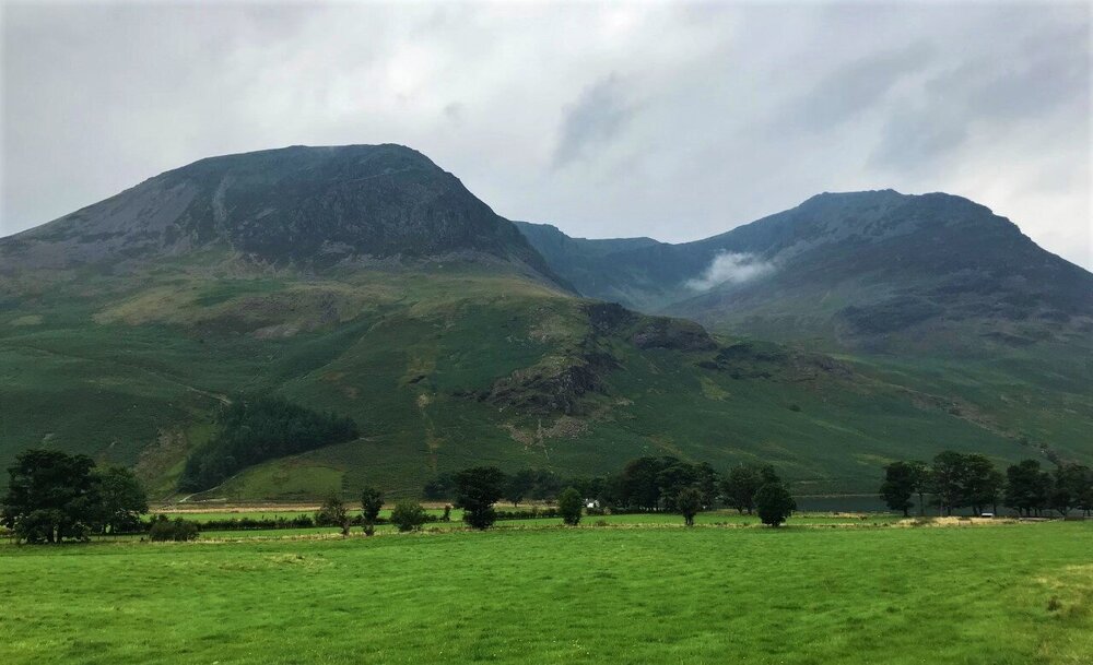
Currently in Cumbria, in the Lake district. Just gorgeous here. Did some hiking today and took a bunch of photos. I could totally live here, and this area gets some decent snow most winters.

-
I am just a magnet for severe. Yellow warning of thunderstorm Updated 7 September at 10:20 BST From 11:00 BST on Thu 9 September To 20:00 BST on Thu 9 September Heavy showers and thunderstorms on Thursday have the potential to bring surface water flooding in a few places, and disruption to travel. - There is a small chance that homes and businesses could be flooded quickly, with damage to some buildings from floodwater, lightning strikes, hail or strong winds - Where flooding or lightning strikes occur, there is a chance of delays and some cancellations to train and bus services - Spray and sudden flooding could lead to difficult driving conditions and some road closures - There is a small chance that some rural communities could temporarily become cut off by flooded roads
-
Super cool area. Picked up some killer craft beers next door to the brewery. A lot of the brews here are low abv, but I found some nice, complex, high gravity stuff. https://www.holmesmill.co.uk/
-
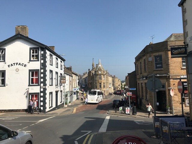
Went to Clitheroe today. Ofc I found a brewery.
- 371 replies
-
- 10
-

-
Happy Hour. Planning a 2 day trip to the Lake District. Looks like the mini "heat wave" here will give way to more typical UK weather.

-
The glass half full view of last winter is to imagine a +AO/NAO with the Pac pattern the same. Might have seen little to no frozen for the coastal plain for the second year in a row instead of somewhat respectable median snowfall.
-
It has 'some' influence on the AO/NAO state, and possible development of HL blocking. Trending negative heading into Fall and winter is considered favorable. How much of a correlation there is seems debatable from what I have read, and some forecasters don't pay much attention to it.
-
A few shots from Castleton in Derbyshire.
- 371 replies
-
- 16
-
-
QBO 30 mb zonal wind index continues to trend negative heading into Fall. May 0.31 June -6.93 July -13.17 August -13.82
-
57 this morning in Cheadle. Sunny and 72 today. Should be around 80 by Tues and Wed.
-
54. Glorious. Just as I am set to leave for 2+ weeks. Hopefully it wont be back to tropical when I return.
-
64 here this morning.
-
Unless something else rolls through overnight, the total will be 1.12" here. Didn't need anymore than that. The skeeters are out and biting over the last week or so for the first time all summer.
-
Mattie was right. I am a drama queen. It was gusty and brought down some dead branches, and got me over the 1" mark. And here comes the next line. Rumbling.
-
Not liking the look of that radar heading this way right now.
-
Well that post got a decent haul.
-
Both the latest CanSIPS and CFS have a pretty classic crapola Nina look for the winter months. Ofc none of these climate models are very good, but based on historic Nina climo and recent history, tough to bet against a predominant PAC ridge.
-
Detailed and good read as usual. Hope it ends up mostly being wrong. Ofc with the primary rain shield well NW, any significant rain here is tied to the convection later today, and it has gotten a tad dry.
-
Don't get me wrong...love to capture a shot of a tornado in the field over yonder, as it rips up the feed corn and passes harmlessly to the NE, west of my house.
-
We enhanced risk. Luckily, we always fail. Ofc this one time... watch it happen.
-
Well this sounds a tad scary. Would be nice to not have trees falling on the house just as I prepare to leave the country for a much needed vacation. Synoptically, this will be an impressive evolution as tropical and mid-latitude meteorology collide. The remnants of Ida are tracking steadily northeastward through the Tennessee Valley, and its cloud pattern remains well-defined on satellite. The most prominent feature of this setup is the strong (140 kt) upper jet streak which will build into northern New England on Wednesday. Ida`s remnants will track straight into its right entrance region, where large scale upper divergence is maximized. The system will begin to interact with the upper jet and the lingering frontal boundary currently over our area. After days of weakening over land as a tropical system, Ida`s remnants will reintensify as a highly dynamic, baroclinic low, but still with tropical moisture. Strong increases in low and mid level winds, frontogenetic forces, and low level convergence will allow a dramatic increase in the coverage and intensity of the rain shield as it moves in. Meanwhile, as the system takes on traditional frontal characteristics, an unstable warm sector will likely overspread southern portions of the area, contributing to severe weather potential. Overall, this continues to look like a high impact event. Details... First, a note on timing: The bulk of the impacts are expected to occur throughout the daytime Wednesday, Wednesday night, and early (mainly predawn) Thursday. This represents a slight earlier shift in timing. Severe weather concerns will peak from about mid afternoon to late evening Wednesday, around 2-10PM. Hydro concerns will focus more on the later afternoon through the overnight, with residual impacts into Thursday especially on slower responding rivers. Today`s guidance overall showed a small but definite trend northward with the highest QPF. However, that followed a small southward shift last night. So again, noise level changes. Our rainfall forecast was changed little, with a slight northward shift in the axis of heavier QPF and a slight trend upward overall in rainfall amounts as CAM guidance certainly supports the potential for a widespread swath of 4 to 6", with locally over 6" possible. This will be more than sufficient to bring both widespread flash/urban flooding and widespread main stem river flooding, discussed more in the hydrology section. One area where concern has increased today is severe weather potential. With the more amplified trend, wind fields are looking robust across the area from Wednesday afternoon into Wednesday night. As mentioned, the warm sector of the system will overspread approximately the southern half of the area, and that is where severe weather concerns are maximized. Southeasterly surface flow will veer to to southwest with height, with good speed shear and directional shear in the lowest levels especially strong. There are some very concerning 31.12z CAM runs such as the 3km NAM, ARW, and HRRR. Soundings from those models over southern New Jersey and Delmarva show long, clockwise curved hodographs reflective of 0-1km SRH in the 200-300 range and 0-3km SRH in the 300-400 range, and 40 to 50 kt southwesterly bulk shear vectors. These values on their own are not enough to produce severe weather, but it is looking like they will be paired with 1000 to 1500J of SB CAPE across our southern zones, providing the necessary instability for convection to grow vertically enough to be dangerous. The very high shear and sufficient instability, combined with high moisture and associated low LCLs, would create a highly favorable environment for tornadoes. If these trends hold, several tornadoes, including a chance for a strong tornado, would be possible especially over southern New Jersey and Delmarva, with the risk decreasing to the north. Some convectively enhanced damaging straight line wind gusts are also possible.
-
Leaving Friday, as long as I get a negative pcr test result lol.
-
England. Should be cool yes. Hopefully dry at times.
-
Just as I am leaving the country. I am sure it will be warm and humid again when I return.
-
SPC AC 310554 Day 2 Convective Outlook NWS Storm Prediction Center Norman OK 1254 AM CDT Tue Aug 31 2021 Valid 011200Z - 021200Z ...THERE IS A SLIGHT RISK OF SEVERE THUNDERSTORMS ACROSS THE MID-ATLANTIC... ...SUMMARY... A few tornadoes could occur across the Mid-Atlantic States as the remnants of Ida move through the region on Wednesday. Isolated severe thunderstorms are also possible across the northern Plains Wednesday afternoon through Wednesday evening. ...Mid-Atlantic... Tropical Depression Ida is forecast to be centered near the KY/TN/VA border intersection early Wednesday morning. Continued northeastward motion of the system is anticipated, taking it off the Mid-Atlantic Coast Wednesday night. Moist low-level southerly flow ahead of this system will likely bring mid 70s dewpoints into the Mid-Atlantic region, helping to increase instability. Additionally, a more banded storm structure is probable by this stage in its life cycle, result in the potential for modest diurnal heating between the bands. Current guidance suggest afternoon temperatures across much of NC and VA will be in the 80s, with dewpoints in the low to mid 70s. These conditions are expected to result in sufficient instability for deeper, more persistent updrafts. In addition to the favorable thermodynamics, strong low to mid-level flow will persist around the remnants of Ida. In fact, some guidance suggests the system may slightly deepen as it encounters increased baroclinicity and undergoes the transition to an extra-tropical system. All of these factors indicate a tornado threat will persist throughout the eastern quadrant of the system as it moves through the Mid-Atlantic. A few convectively augmented wind gusts are possible as well.