CAPE
-
Posts
36,289 -
Joined
-
Last visited
Content Type
Profiles
Blogs
Forums
American Weather
Media Demo
Store
Gallery
Everything posted by CAPE
-
Light rain with temps in the 40s wont take it all, with more cold right on the heels. I just felt like being dramatic and depressing for Ji.
-
Tomorrow is gonna wreck my deep winter look, and it may never snow again.
-
It was probably closer to 10 days, but we were in a total shit pattern then, and the tendency was to look too far out for something better. Same thing can happen now when we have a more favorable/ colder pattern. Find the warts! Overall it looks dry, but like Bob said threats often pop up in the mid range, esp in the advertised regime.
-
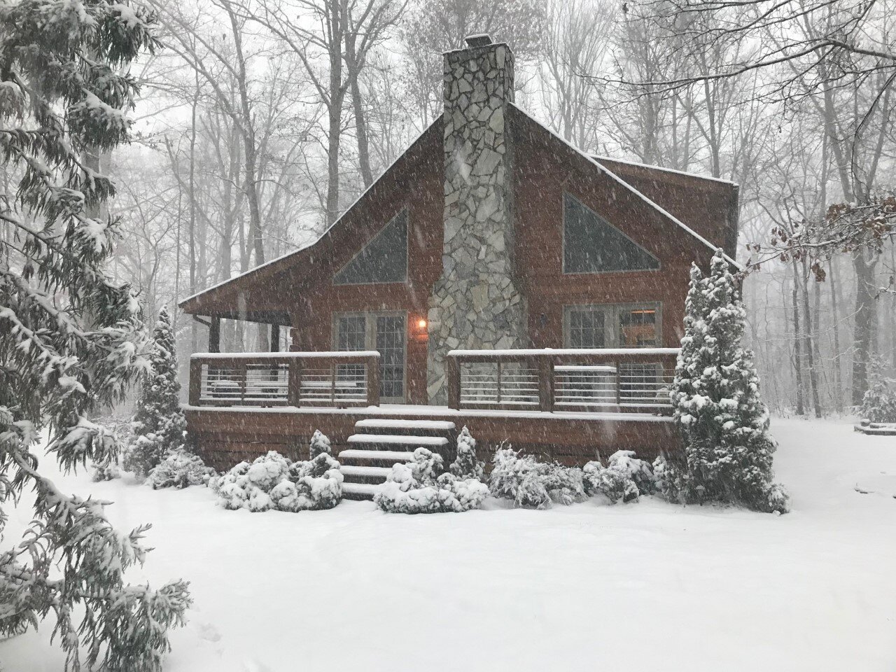
Low of 16. Thought it would be closer to 10 given how well it radiates here with snow cover, but maybe the wind didn't diminish as fast as forecast.
-
We have a cold look now, so we are in the game. Without cold in place it rains in my yard 9 times out of 10. The period around MLK day still looks interesting. Beyond that who knows.
-
The advertised pattern in the LR is generally a cold and dry look on the means. Spilt flow with a hint of a southern stream underneath the ridge out west, but it looks suppressed with the southward displacement of the TPV.
-

Mid-Atlantic forum winter 2021/22 snow totals thread
CAPE replied to North Balti Zen's topic in Mid Atlantic
1/3/22- 9.5" 1/7/22- 3.2" Total: 12.7" -
3.2" Solid 5 days of winter here, with 12.7" of snow. That just about equals the total for the last 2 winters combined.
-
Yeah, decent with some big, fluffy dendrites, but as advertised the best banding is east over DE and into SNJ.
-
The back end band looks pretty decent on radar as it approaches. Lets see what it do.
-
28.5 with moderate snow here currently. I'm guessing it started after 1am. Decided not to lose sleep over this one after the big storm earlier in the week lol. Pretty out there, looks like 2" so far just eyeballing. The 2-4" forecast looks good for here unless I get in on some meso banding, but that looks like it will be east of here per most guidance.
-
Just got back home from the snowless mountains. Temp is 38. Snowpack needs a refresh.
-
Outside of the western highlands this is still probably a 2-4 deal for most. Any banding that develops would be pretty brief given the relatively short duration of this event overall. Those areas would probably see an additional inch or 2.
-
-
About to pop this open.
-
You have a place near Canaan now right? Pretty good bet if you wake up there on Friday lol.
-
What, you had doubts that it would trend towards the new King?
-
Look at h7 and h85 vorticity and you can see where the potential is for a bit of a heavier stripe but this thing is a fast mover so probably advisory level event for the majority if not all of the region.
-
Have not paid much attention but looks like a quick hitting 2-4, with a bit of banding potential probably closer to the coast as indicated on the GFS and the 6z Euro. Skinny jack zone of up to 6 somewhere maybe.
-
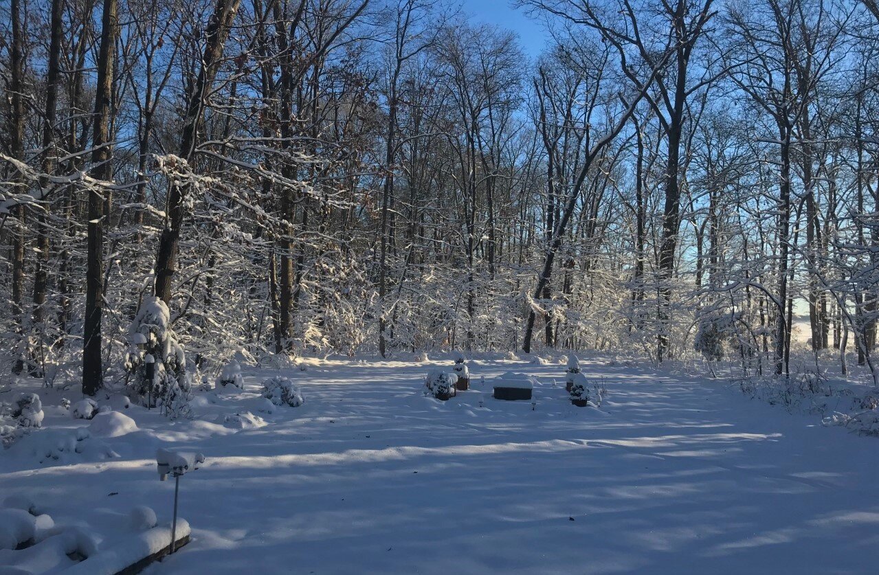
7.2 at 7am, so a low of 7. Don't think it will drop more lol.
-
Temps drop like a rock here with snow cover and clear skies. Zero UHI influence and not near the water.
-
Nice to know we can still drop below 20 with ideal radiational cooling conditions and a nice snowpack. Wasn't sure after last winter.
-
Mount Holly's take on late week- The main focus is on the Thursday night into Friday time period. A potent but fast moving low pressure system should develop in the southeastern U.S. and progress off the coast around NC/VA. With this track, our region is in the favored location for mostly snow (though depending on how close the center of the low stays to our coast, there may be a brief period of rain or sleet at the start of precipitation. Models came into better agreement with the track of this low (as compared to yesterday when some models were still showing a weak/surpressed system), however there remain some timing differences. Most guidance seems to be in agreement that this will be a quick impact (no more than 12 hours of precip), but there is question if it will be from late Thursday night through mid day Friday, or be primarily during the day Friday. The storm system is not yet fully within the period for our snow amount forecast, so we will have more details on that later today.