CAPE
-
Posts
36,855 -
Joined
-
Last visited
Content Type
Profiles
Blogs
Forums
American Weather
Media Demo
Store
Gallery
Everything posted by CAPE
-

Late February will be rocking. February Long range Discussion thread
CAPE replied to Ji's topic in Mid Atlantic
-
January/February Mid/Long Range Disco IV: A New Hope
CAPE replied to stormtracker's topic in Mid Atlantic
The gloom and doom is pervasive. It will just engulf the new thread lol. -
Southern MD / Lower Eastern Shore weather discussion
CAPE replied to AnEndlessMaze's topic in Mid Atlantic
6Z Euro finally came around a bit. Looks like a chance for an inch in a fairly small area where a bit of an enhanced band may set up. You might be in a good spot. Overall the forecast for a half inch or less seems reasonable. -
Southern MD / Lower Eastern Shore weather discussion
CAPE replied to AnEndlessMaze's topic in Mid Atlantic
6z GFS -
Jan 31 - Feb 1 Snow/Sleet/Misery Obs & Disco
CAPE replied to NorthArlington101's topic in Mid Atlantic
Chuckled a little at this from Mount Holly this morning- That brings us to the more interesting portion of this forecast period, but still not necessarily exciting. Given we have not seen measurable snowfall in significant portions of our forecast area thus far this winter, any snow might be exciting to some. As the cold and dry airmass behind the cold front continues to sink southward tonight, a wave of low pressure will track eastward across North Carolina and eventually off the coast Wednesday morning. As a shortwave trough approaches from the west, some low and mid-level frontogenesis may be just enough to act upon some limited moisture to produce light snow across portions of the forecast area tonight, especially to the southeast of I-95. -
January/February Mid/Long Range Disco IV: A New Hope
CAPE replied to stormtracker's topic in Mid Atlantic
Rolling the currently advertised pattern on the EPS forward, the latest edition of the weeklies brings this look for the last week of Feb. -
January/February Mid/Long Range Disco IV: A New Hope
CAPE replied to stormtracker's topic in Mid Atlantic
Enjoy the winter we have and 3 weeks of Spring. Our 6 months of Summer will be here before you know it. -
January/February Mid/Long Range Disco IV: A New Hope
CAPE replied to stormtracker's topic in Mid Atlantic
Snippet from Mount Holly morning AFD- Accumulation wise, potential exists for a coating up to a couple inches or so with the best chances for accumulating snow being over interior portions of Delmarva and interior southern NJ (S/SE of Philly). Again, it needs to be stressed that forecast confidence is lower than average and if the wave is weaker and farther south there will be little to no snow accumulation while if it`s farther north much of eastern PA, NJ and central/northern Delmarva could get 1-3 inches of snow. SO, 0-3 inches. I'm pretty sure it will be closer to the zero. -
January/February Mid/Long Range Disco IV: A New Hope
CAPE replied to stormtracker's topic in Mid Atlantic
Someone should start a thread for the puny midweek wave. Looks like a decent chance for an inch or so across some of the area, ignoring the Euro ofc. -
January/February Mid/Long Range Disco IV: A New Hope
CAPE replied to stormtracker's topic in Mid Atlantic
Yeah it's the retreating TPV lobe, and the cold HP associated with it is off the NE coast at that point. Still a bit of damming left behind, but with the flow around the backside of that high and the low to the NW, the airmass is quickly modifying. A well timed phase between the NS energy and developing coastal low would probably work for the interior (Canadian is close to this) but the progressive flow favors that occurring too late for the MA. The EPS has the southern wave sliding off the SE coast. Still far enough out for timing/placement of features to change. -
Not sure he had the look to determine it wasn't a catch in time, however he should have thrown it seeing how the Eagles were rushing to the line to snap the ball. Ultimately it was bad officiating.
-
Eagles dominated. If Purdy didn't get injured it would have been closer, but not sure the outcome would have been different.
-
January/February Mid/Long Range Disco IV: A New Hope
CAPE replied to stormtracker's topic in Mid Atlantic
That's another issue- the "PNA" ridge is progressing east as the next trough digs out west. Would probably need (an early) full phase with the NS energy to keep the developing low from being shoved too far east. That might get us a big storm but not sure it would end well either. -
January/February Mid/Long Range Disco IV: A New Hope
CAPE replied to stormtracker's topic in Mid Atlantic
Not a great look with LP moving across the GLs and HP off of Atlantic Canada in the wake of the exiting Arctic air mass. This look is inverted from what we want lol. -
Southern MD / Lower Eastern Shore weather discussion
CAPE replied to AnEndlessMaze's topic in Mid Atlantic
If there is a chance for an inch or 2 in Rehoboth I'm there. -
January/February Mid/Long Range Disco IV: A New Hope
CAPE replied to stormtracker's topic in Mid Atlantic
When you build your dream house....in the wrong place lol Work lol. -
Rooting for the Eagles here so the Ravens can interview and hopefully hire 49ers passing game coordinator Slowik as their new OC.
-
It was Snyder, as always.
-
Haloti Ngata hit ruined RG3 unfortunately.
-
Impressive opening drive.
-
January/February Mid/Long Range Disco IV: A New Hope
CAPE replied to stormtracker's topic in Mid Atlantic
Thanks. Makes it hard to leave though. Might have to get another place out in the western highlands. -
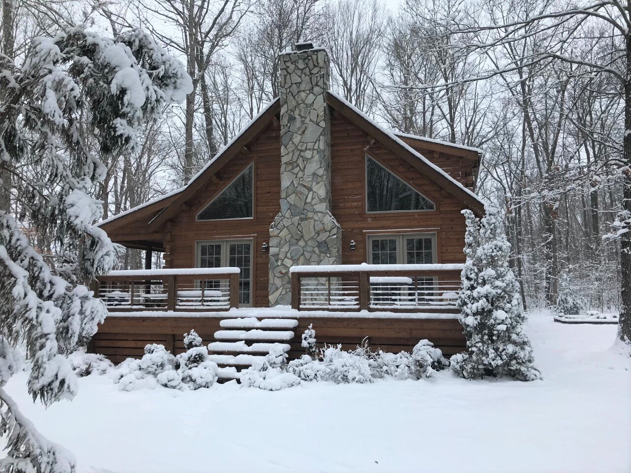
January/February Mid/Long Range Disco IV: A New Hope
CAPE replied to stormtracker's topic in Mid Atlantic
Feels like that house belongs in Garrett county lol I would love to move it. I look, but just cant find anything close. I built this exactly the way I wanted it.
-
January/February Mid/Long Range Disco IV: A New Hope
CAPE replied to stormtracker's topic in Mid Atlantic
Quite a contrast. That storm put me over 19" here. A tenth from a flizzard so far this winter lol.
-
January/February Mid/Long Range Disco IV: A New Hope
CAPE replied to stormtracker's topic in Mid Atlantic
Several GEFS members suggest a more significant wave Friday into Saturday. With the depicted tightening thermal gradient it makes some sense. -
January/February Mid/Long Range Disco IV: A New Hope
CAPE replied to stormtracker's topic in Mid Atlantic
If nothing else it looks like a shot of Arctic air with wind-chills by Saturday. Check out the ocean effect snow on the Euro lol. Who has a boat?