All Activity
- Past hour
-
NHC had it at 105mph when it came ashore, so it wasn't major.
-
 top-rated online pharmacies: Seroquel - online pharmacy
 -
BS and prove it... give me one reporting station on land that had major sustain wind speed.
-
It didn't make landfall as a major.
-
Per this chaser who was right in the eye, the lowest SLP was 976.2 mb: https://twitter.com/JustonStrmRider/status/2108736015250702614?
-
I am with Coach... weakest major hurricane to hit the US. Yes the name will not be removed from the cycle.
-
What is this F*** double front Bull*** next weekend... all weekend. Another weekend ruin when I have a baseball tournament.
-
http://neuroreliefdirect.com/# can i buy fluoxetine
-
In other news, 2026 has now surpassed 1983. Now, 2026 is the season that has produced the second least ACE in the satellite era. We'll see if that holds or if some late season storm ups the ACE further. In an interesting parallel, the EPAC is to date at its second highest ACE recorded in the season, but it should soon reach #1.
-
At the risk of contributing further to a pointless argument: Maximum sustained winds should be the most intense (sustained) winds measured anywhere in the hurricane. The strongest winds are probably going to be offshore or right on the beach. What are the odds that there's an anemometer at that exact location? Then, there's the issue that the power could be out when the highest winds hit, and of course, winds of this intensity aren't exactly gentle to meteorological equipment. The maximum sustained winds I've seen recorded with this storm on land is 92.8 mph, which is 88% of NHC's max sustained winds at landfall and is nearly Category 2 strength. That's about as good as you're gonna get since we don't have recon over land to drop a sonde over the exact point with the most intense winds. Anyways, I'm now seeing nearly 700k customers without power in the region, I hope the recovery goes smoothly
-
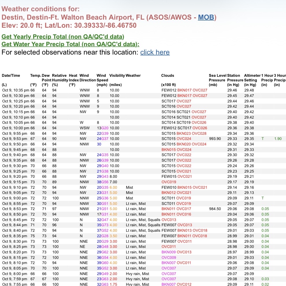
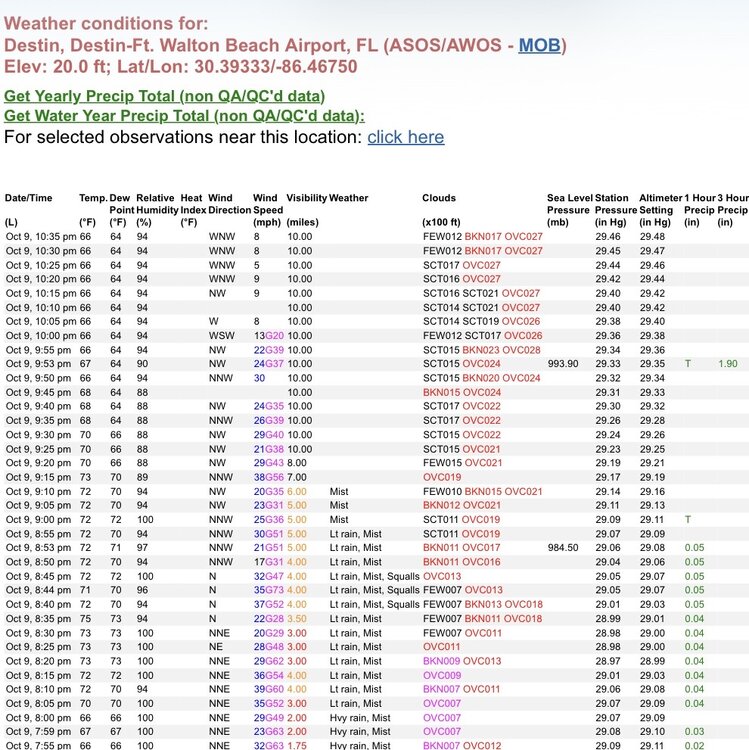
What was the actual lowest SLP at landfall ? -Lowest Destin SLP was at 8:20PM CDT per this link at ~982 mb (28.99” altimeter setting): -As this shows, winds were NNE at landfall time at Destin. That says landfall was just E of Destin. -Per Dr. Knabb per Cantore’s report of winds shifting to S off the Gulf at Miramar Beach before and during landfall time says landfall was just W of Miramar Beach. -There are 8 miles between those 2 locales. Thus, a good estimate is that landfall was 4 miles E of Destin. -How much lower than Destin’s 982 mb would SLP be 4 miles to the E? Anyone have a guess as to the gradient over those 4 miles W of the center?
- Today
-
-
-
Plenty of rain coming for N VA and the DMV! Its truckin!
-
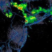
Rain is picking up here a little. Watching radar closely because I'm sure there's plenty of tornado potential heading this way. We're still a little ways out from the remnants of the first feeder band that came ashore, but that thing had some nasty vorticities in it, and there's plenty of cold air aloft for mixing. Granted I'm sure we won't be seeing insane wind maxima, but there should be enough to see some fallen trees tomorrow AM.
-
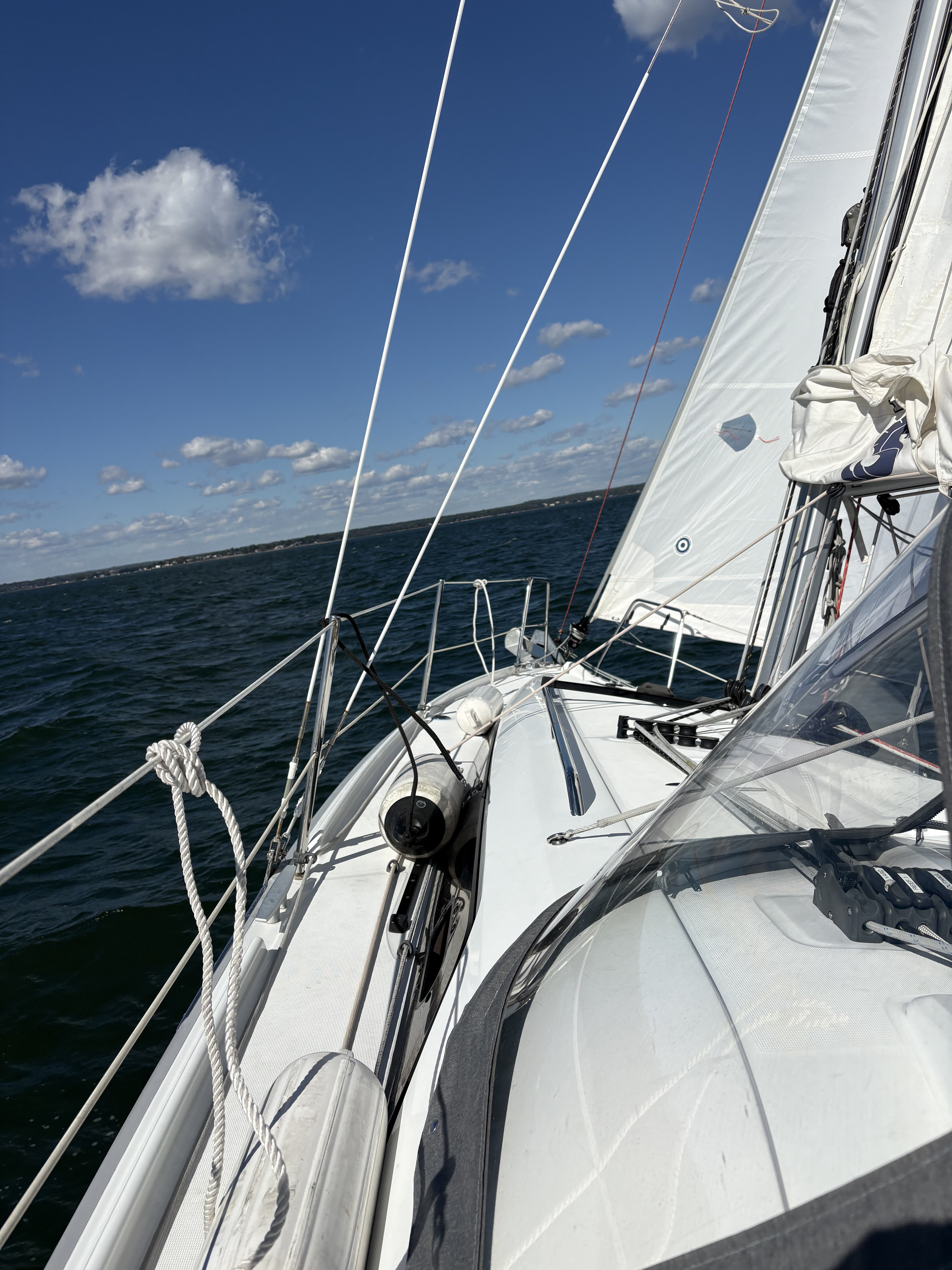
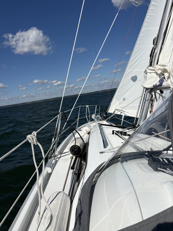
73 today. was on the sound sailing when that cold front came through. Winds gusted to around 25 and it was a spectacular day for a sail.
-
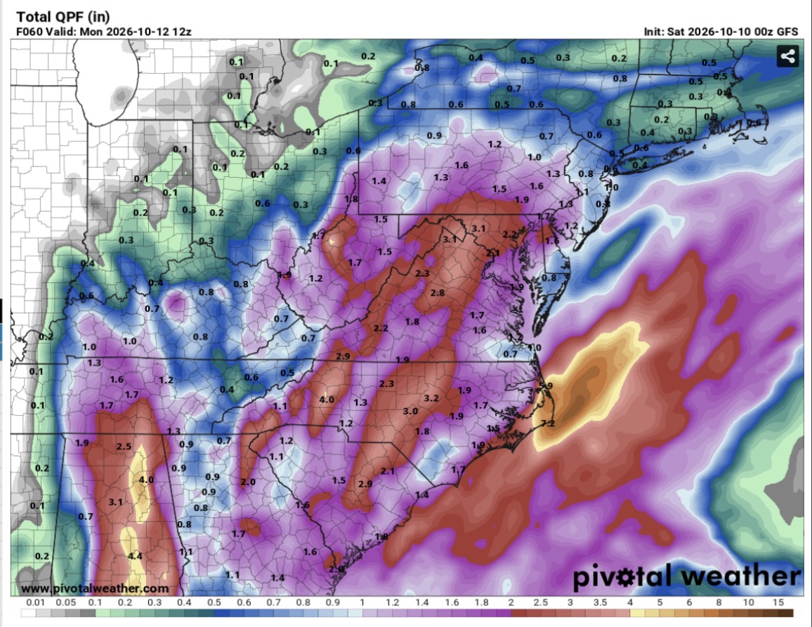
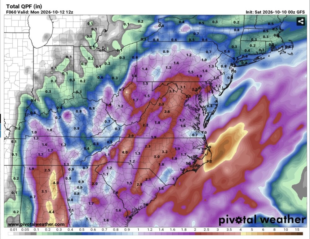
00Z GFS just upped the ante for west of I-95
-
I have been here the whole time.
-
No, the risk is not properly conveying an adequate sense of urgency concerning a landfalling hurricane. No one but we weather dorks cares if max sustained winds occur a mile off of the beaches, but the much larger deal is if significantly higher winds and surge than anticipated were to occur.
-
Notice how the people now agitating the thread with anti-hurricane center posts are the same ones who were absent till landfall. They’re not worth the time to debunk.
-
But it does... Since the NHC puts out the advisories the media outlets run with them... This what the general public is expecting... and when it doesn't happen... it gives the general public a false sense of security with the next storm.
-
Catskills should do well.
-
Strong forecast. https://forecastmaven.com/forecasts/easternmassweather/hurricane-isaias-landfall-accurately-forecast/ Hurricane Isaias Landfall Accurately Forecast Timing Slightly too Slow The center of the rapidly degrading eye of Hurricane Isaias crossed the coast near Destin, FL with 105MPH maximum sustained winds at about 930PM EDT. This was precisely as forecast in the Final Call issued this afternoon in terms of landfall locale and intensity, but the timing was about 1.5 hours faster than 11PM EDT forecast. Although the landfall intensity needed to be adjusted upwards slightly in the Final Call issued earlier today, the Destin, FL locale was consistent since First Call on Wednesday. Final Grade: A
-
-
Check out Rogers Pass in Montana at 6700 feet. They might pile up about 33 inches of snow! https://forecast.weather.gov/MapClick.php?x=99&y=149&site=tfx&zmx=&zmy=&map_x=98&map_y=149