All Activity
- Past hour
-
I got sleet here earlier in the evening that covered the deck pretty good. Now getting very light snow, like others nearby are saying. I hope it does continue til 5 am! Edit: There's a nice area of precip down near Rutherfordton NC headed towards Winston-Salem. Hope it holds together...
-

February 2026 Medium/ Long Range Discussion: Buckle Up!
Weather Will replied to Weather Will's topic in Mid Atlantic
It is showing a storm, relax. What model is going to nail storm track 10 days out? -
Light snow continues. Looks like .1 to .2 accumulation. Based on future radar it could continue to snow until 5 am.
-

February 2026 Medium/ Long Range Discussion: Buckle Up!
Ji replied to Weather Will's topic in Mid Atlantic
Euro Ai too cold for snow [emoji23] -
GFS can't decide if Valentine's day is going to be a CAD ice storm, Miller A snow, or 70s and thunderstorms. 90% of the time I would bet on thunderstorms, but not this winter.
-

February 2026 Medium/ Long Range Discussion: Buckle Up!
bncho replied to Weather Will's topic in Mid Atlantic
Euro AI south (NC storm), but with this setup it's probably where we want it -
0.0 and 32.5
-
February 2026 Medium/ Long Range Discussion: Buckle Up!
Weather Will replied to Weather Will's topic in Mid Atlantic
0Z AI GFS is a much weaker and far southern version of the Can. -
February 2026 Medium/ Long Range Discussion: Buckle Up!
Ji replied to Weather Will's topic in Mid Atlantic
The 10:1 map had more than kutchera map lol -
It's another night where there's no coherent direction of travel for the snow. It's just dancing around it looks like.
-
Up to around an inch now. 25 degrees. Also somewhat foggy. So some freezing fog may be happening.
-
A nice dusting on the grass and wet roads would be ideal for my drive to work tomorrow, especially since I'm sure the rain washed away the salt they put down for the last storm
-

February 2026 Medium/ Long Range Discussion: Buckle Up!
stormtracker replied to Weather Will's topic in Mid Atlantic
You realize there would have been more to come, right? -
February 2026 Medium/ Long Range Discussion: Buckle Up!
stormtracker replied to Weather Will's topic in Mid Atlantic
I'd take what the cmc is throwing down. Gonna be more after that last panel -
Light snow in Newton. 32.4
-
I just went out and took a walk around my block. The Roads are mostly wet but are starting to get white on the slopes that are shaded from the sun. It is coming down the hardest of the night, but I still don't think we are going to have road problems unless it does what it is doing now for about 2 to 3 more hours.
-
26F and coming down at a decent clip! Got a half inch of new snow at the stroke of midnight atop of what I could only describe as a few inches of concrete. Edit: Main roads are mostly white.
-
Maybe that band of more steady snow that's currently in N Knox County/S Anderson County can get down here before dissipating
-
February 2026 Medium/ Long Range Discussion: Buckle Up!
Ji replied to Weather Will's topic in Mid Atlantic
Must be like 5:1 ratio. Is this an April event ? -
February 2026 Medium/ Long Range Discussion: Buckle Up!
Weather Will replied to Weather Will's topic in Mid Atlantic
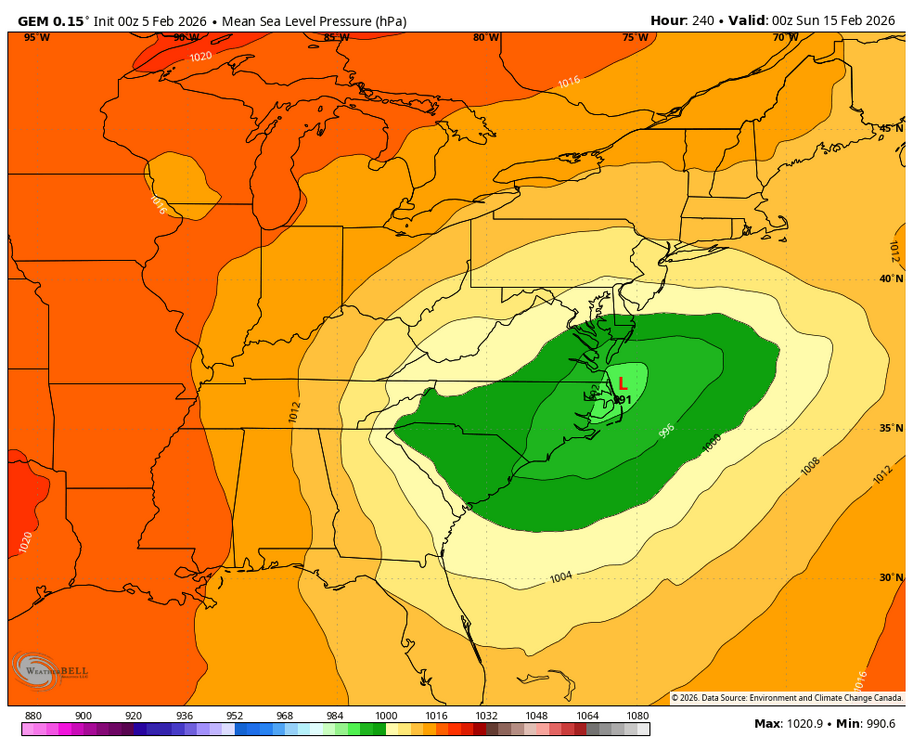
Yes, but the key takeaway again is another global model showing an east coast threat in about 10 days. -
February 2026 Medium/ Long Range Discussion: Buckle Up!
bncho replied to Weather Will's topic in Mid Atlantic
That would've been an easy regionwide 6-12" IMO -
February 2026 Medium/ Long Range Discussion: Buckle Up!
Weather Will replied to Weather Will's topic in Mid Atlantic
WB 0Z Can. should prevent cliff jumping for another run.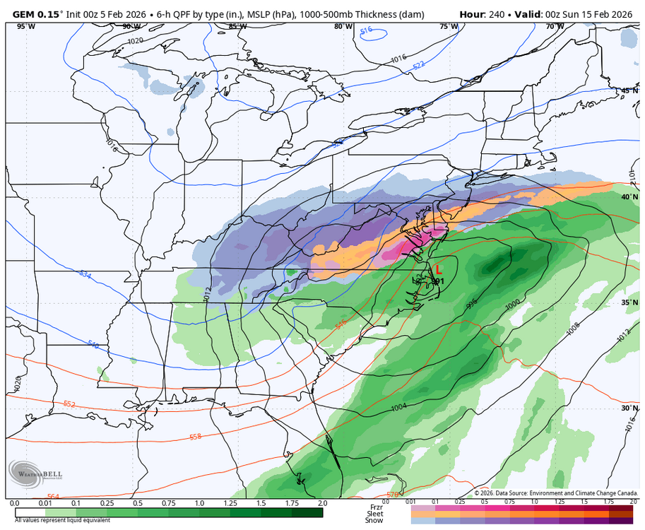

-
February 2026 Medium/ Long Range Discussion: Buckle Up!
stormtracker replied to Weather Will's topic in Mid Atlantic
That’s about all we can take away from this -
February 2026 Medium/ Long Range Discussion: Buckle Up!
bncho replied to Weather Will's topic in Mid Atlantic
CMC is great
-
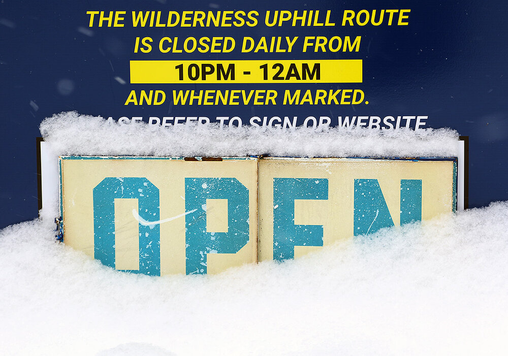
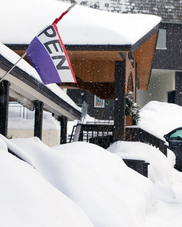
Yesterday was the first day that we hadn’t reported new snow at our site in over a week, and only the third day without snowfall since back before Christmas. So indeed, it’s been quite a snowy stretch around here over the past several weeks. In typical Northern Greens style, the period without new snow abruptly ended at just one day because this morning I awoke to moderately heavy snowfall made up of large flakes in the 5-20 mm range. We picked up 2 to 3 inches of champagne snow at the house by the time it was starting to taper down, and along with much more seasonable temperatures, it got me thinking about a morning ski tour to check out the new powder. Today being a Wednesday, the Timberline Quad was running instead of the Wilderness Lift, so touring via the Wilderness Uphill Route was an obvious play. It was still snowing moderately when I arrived up in the Bolton Valley Village, and I could immediately tell that the mountain had picked up substantially more snow than we had at our house – accumulations in the Village were about double the amount we’d received in the valley. I toured in the 2,000’ to 2,700’ elevation range, and new accumulations I found as of late morning were as follows: 2,000’: 4-6” 2,500’: 6-7” 2,700’: 6-7” The only way to assess the depth of the snow from this event was to check on groomed terrain, because off piste, the unconsolidated snow is very deep and it’s a long way to the subsurface. I didn’t get up above 3,000’ today, but it didn’t look like there was much of an increase in depths above the 2,500’ level. The new powder was very dry – right around 2% H2O based on my analyses from this morning and this evening. So it skied really well, but I certainly wasn’t setting up bottomless turns or providing a resurfacing on groomed terrain – there just wasn’t enough liquid equivalent in there. Thankfully, there isn’t a huge need for a resurfacing at the moment - the quality of the subsurface out there right now is excellent because of all the snow and cold temperatures we’ve had over the past few weeks.