All Activity
- Past hour
-

First Legit Storm Potential of the Season Upon Us
weathafella replied to 40/70 Benchmark's topic in New England
That’s a huge uncle shift! -
First Legit Storm Potential of the Season Upon Us
weathafella replied to 40/70 Benchmark's topic in New England
Brett’s sweating… -
Just a motherload of cold over us
-
I just like seeing an actual wave in the south. If it gets suppressed, so be it, but it’s at least something fruitful to track beyond the leftover scraps we’re getting from the northern tier.
-
King Euro is going to cave!
-
Both systems on the ukie
.thumb.png.ff2ec4e58eb11ccda49e3f193319a237.png)
-
Coming out at 228, but that s.w over us and the east gonna beat it down
-

-
Ukie also west
.thumb.png.60e3dd9beeb1230b820b6721bd2fa0a5.png)
-

First Legit Storm Potential of the Season Upon Us
MJO812 replied to 40/70 Benchmark's topic in New England
Ukie also west Nice trends -
Just sitting back there chillin and goonin
-
Nevermind
-

January 2026 regional war/obs/disco thread
Torch Tiger replied to Baroclinic Zone's topic in New England
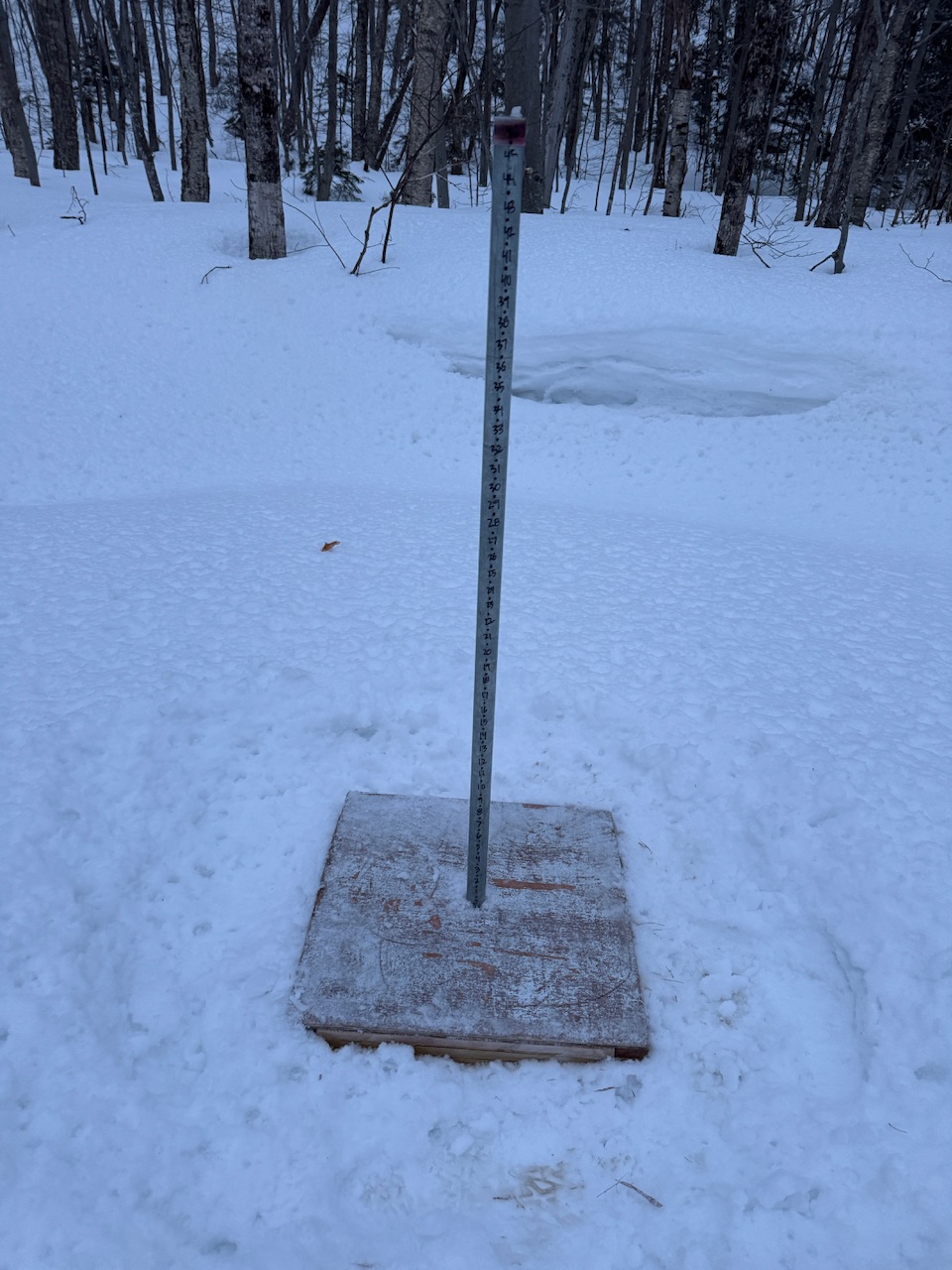
Is that roughly on point with climo average depth? -
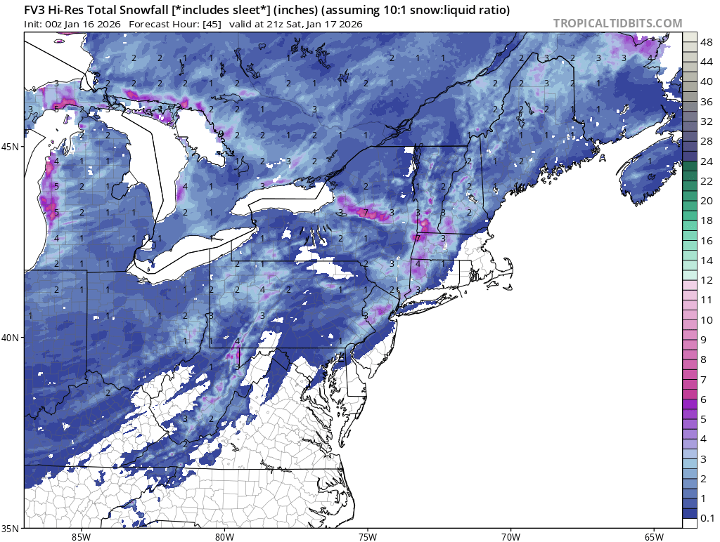
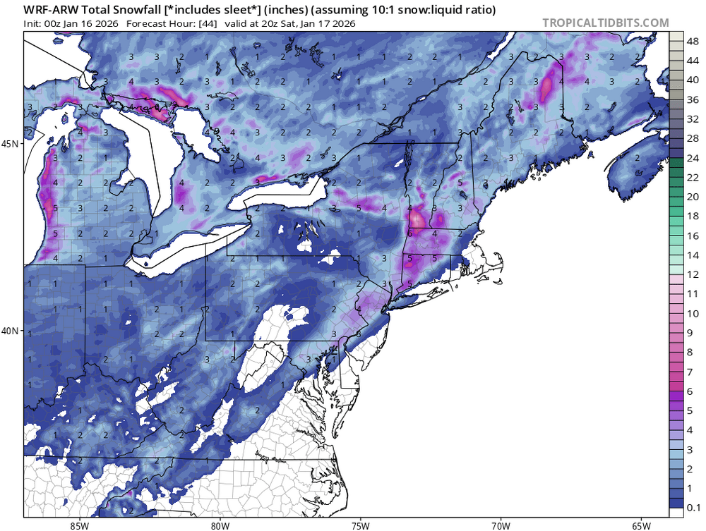
Saturday only (10:1)
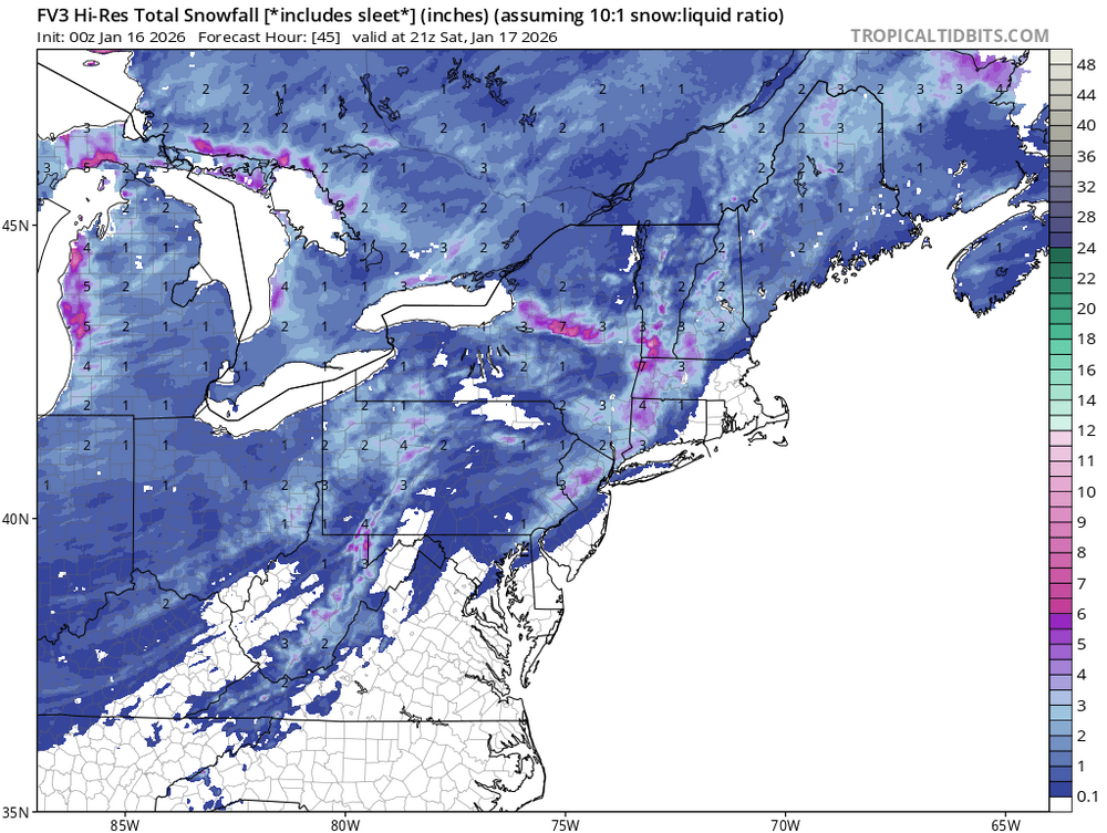
-
Doing that stuck stupid thing again in the sw. The model should be retired. It’s another one of many national embarrassments
-
204 might try something.....maybe some low development off of SC let's see
-

Winter 2025-26 Short Range Discussion
TheClimateChanger replied to SchaumburgStormer's topic in Lakes/Ohio Valley
Both of these pale in comparison to South Bend, which saw 12.6" yesterday - the most in nearly 11 years (February 1, 2015; 14.7 inches). To put the amount of snow that fell in South Bend in perspective, Detroit has only observed two days with more snow than that since 1908 (18.4" on 12/1/1974 & 13.7" on 2/1/2015). -
Just awful compared to 18z
-
Do you have access to the GFS? Correct. Not looking good at 192
-
Winter 2025-26 Short Range Discussion
TheClimateChanger replied to SchaumburgStormer's topic in Lakes/Ohio Valley
Incredible! The 5.1" calendar day snowfall at Detroit yesterday was the most in a single calendar day in nearly three years! The last time more snow fell in one day was March 10, 2023 (5.2"). Even more impressive, the 7.2" calendar day snowfall at Cleveland today was the most in almost four years! The last time more snow fell in one day at Cleveland was February 3, 2022 (8.0"). I'm sure many have been waiting for days like these for a LONG time! -
The recent AIGFS cycles have more of the longer-range consistency (and overall favorable pattern look) that y'all are craving.
-
GFS went from cutter to slider in one model run. Classic
-
from this to this
-
like wtf type changes lol
-

January 2026 regional war/obs/disco thread
powderfreak replied to Baroclinic Zone's topic in New England
28” snowpack at 1500ft this evening. This is a QPF heavy, frozen snowpack too. I scraped an additional inch off the Barnes Camp board. The snowpack is respectable in both depth and frozen water at the Stowe base area.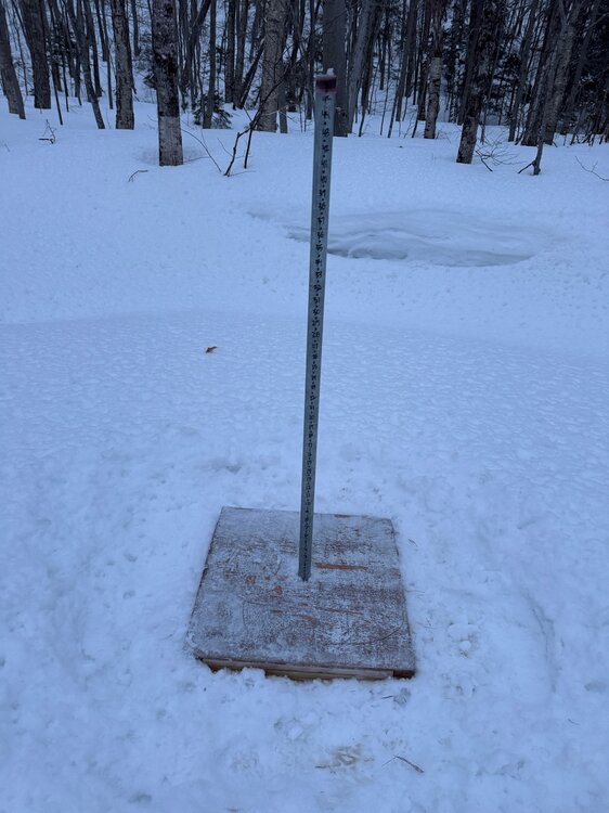


.png.cbcd255d6e572e12f7a40ef09aa6d3dd.png)


.png.e5f5ad8e52c4fdc7308e6d248e862fd7.png)