All Activity
- Past hour
-
 NWS Fairbanks on X: "Through August 30th, Fairbanks has experienced its coldest year to date in 54 years (since 1972), with an avg temp of 28.7°F ranking as the 11th coldest year to date. The warmest temp recorded this year was 81°F, the 2nd coldest maximum ever. Here's a look at the numbers. #akwx" / X I don't know how to embed, but the lowest Summer maxes in Fairbanks since 1980.. 3 of them roll forward to a good +EPO signal for the following Winter
 -
 https://quickph.shop/# reputable overseas online pharmacies
 -
https://quickph.shop/# reputable overseas online pharmacies
-
Good point. We’ll see if there’s a convective burst over the center in the coming hours. Like your post earlier stated, models are going to struggle forecasting intensity here. The environment as it stands tells us a lot, and we’ll see how close to the ceiling Edouard gets.
-
https://quickph.shop/# reputable overseas online pharmacies
-
That was a quick .35 edit: Make that .65
-
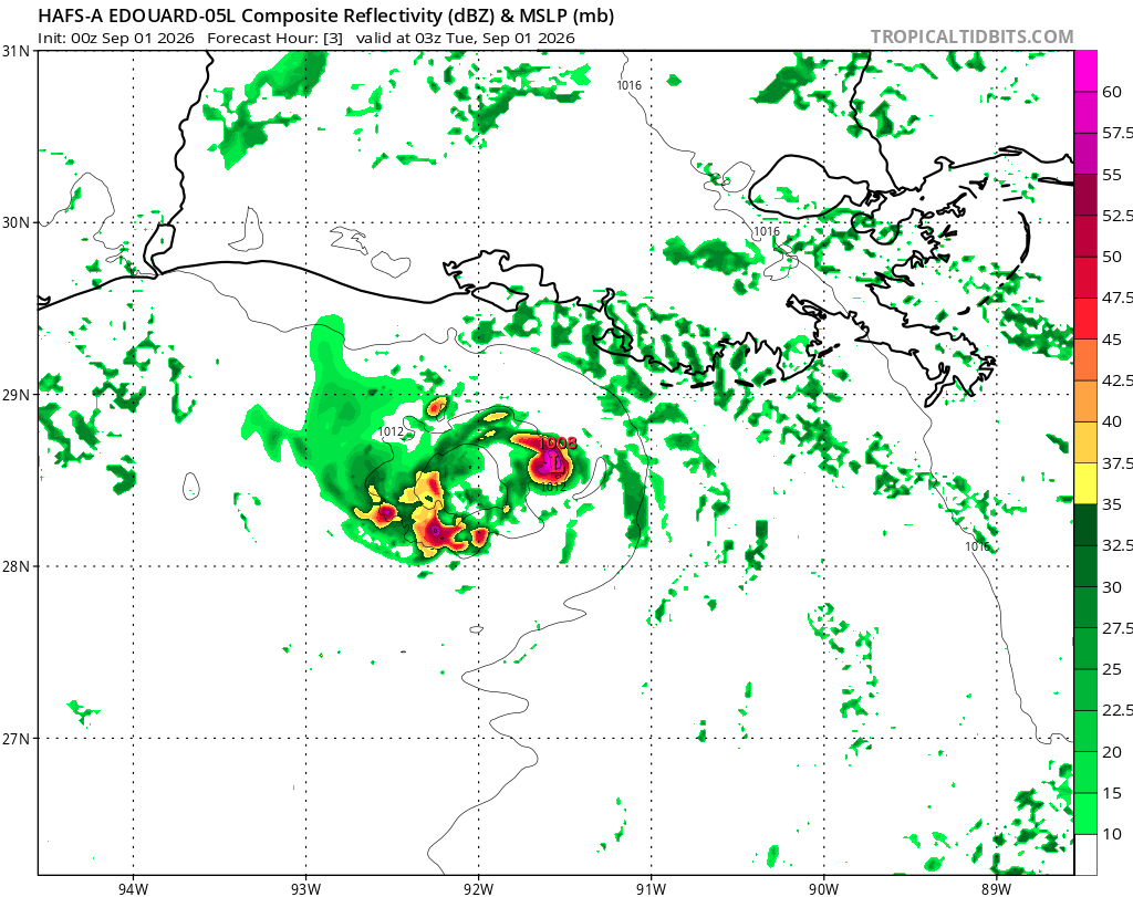
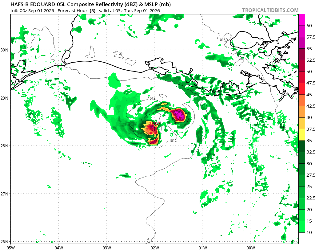
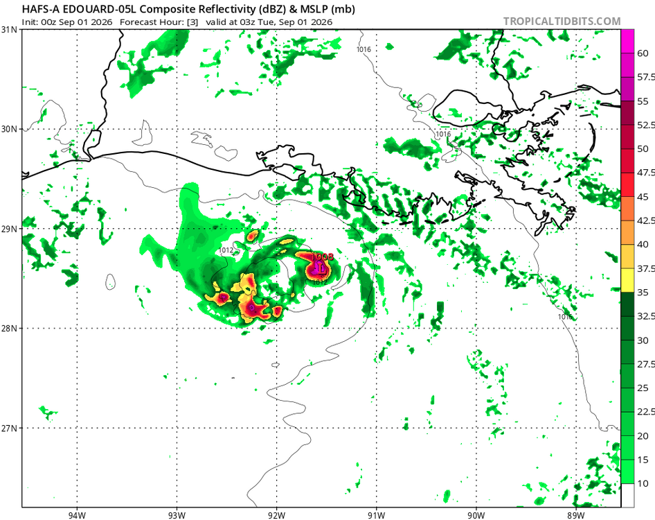
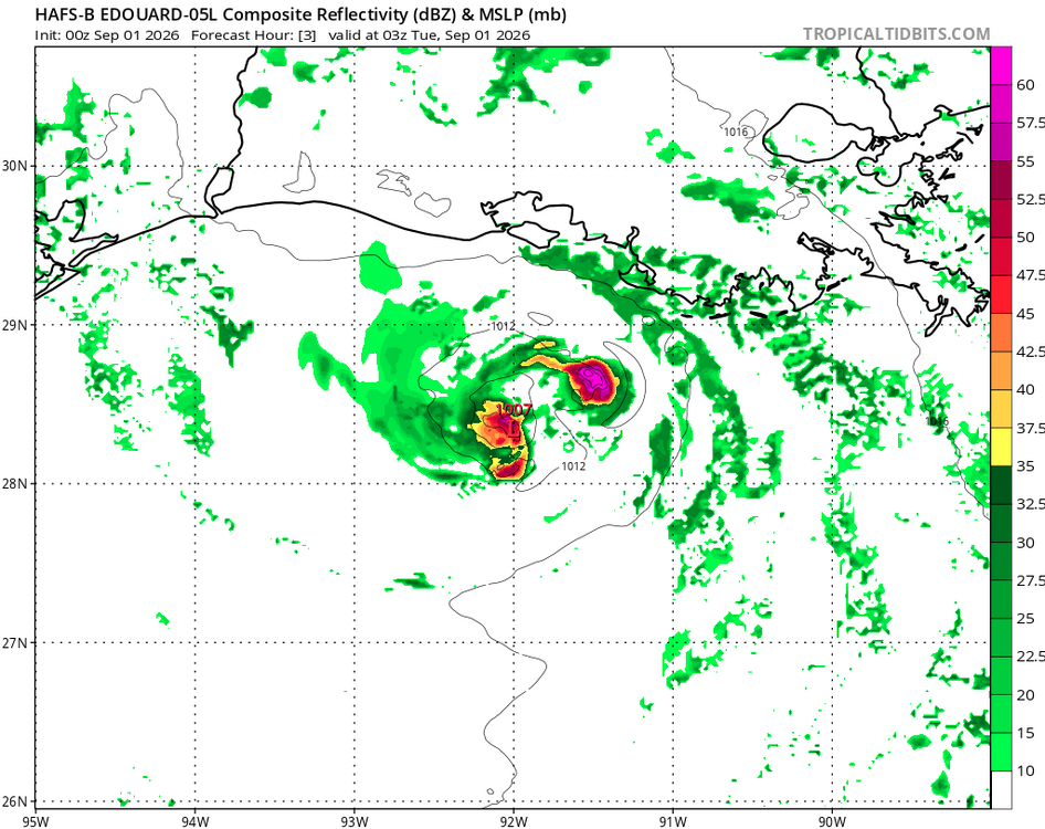
It appears HAFS-A/B are in error b/c they both show strong convection right over the LLCC 03 and 06z, and this is resulting in feedback. I attached the fcst hr 3 valid 03z from the HAFS-A/B. That did not verify. Also, the strong N side convective band on sat we see now is not handled well. So their later fcst hours are questionable. These small differences in initialization when dealing w/ convection and structure can result in large errors. The HAFS is known to do a great job, but tiny TCs like that are not common, and I don't have a feel for their performance in such cases. It is tempting to be impressed by the hires models now, but they can give very realistic and precise-looking output that can be precisely wrong. No change in in winds or pressure last recon pass 0444z. So I and hesitant on RI still. Sometimes, I go to myself, "prove it to me!" that X can happen, and sometimes I am proven wrong! But I try to not let "just b/c the models say so" or "NHC says this" influence independent judgement and gut in forecasting. Doing very short-term "what has happened up until now and trends" and what is current -- that I put more weight towards. Edouard's case is almost like what convection will do during a big svr day fcst, and you know how fickle and uncertain that can be!
-
Yep. And we’ll see it happening on radar. Homebrew systems are interesting more often than not imo. Here’s another one.
-
In marginal or so-so conditions, a system can get organized quickly when it comes to a LLCC and the TD/weak TS stage, but true RI going 25-30 kt in 18 hr is a significantly more of a challenge or unsure. I'd more concerned about RI here if the environment was marginal due to mdt shear and surrounding environment was sufficiently most as that can lead to RI in some cases. See here: https://journals.ametsoc.org/view/journals/mwre/146/11/mwr-d-18-0020.1.xml
-
If it starts deepening into daybreak then it may be onto something...
-
I swear I just peeked at it and was going to post. Very interesting. HAFS-B is more muted but gets it close to hurricane strength.
-
HAFS-A goes NAM into landfall. 14 mb drop the last 3 hrs....
- Today
-
 DCA: +2.5 NYC: +1.0 BOS: +1.0 ORD: +4.0 ATL: +3.0 IAH: +2.5 DEN: +1.5 PHX: +2.0 SEA: +1.0
 -
https://x.com/tropicaltidbits/status/2094626737204466099?s=46&t=0ZvB_AF2VfA6c0SDxf53yA .
-
Gains in organization got us a TS and some slight increase in inflow and wind, but Edouard needs deeper cells to wrap the nascent core. A moist environment was sampled, but some pesky pockets of stable mid-level air mass may be inhibiting deeper growth. The forecast discussion anticipates convection in the preceding hours to landfall, which could quickly spin up such a tiny vortex. Otherwise, Edouard will have maxed out its potential here. I wouldn't say the system has outperformed yet. I think we suspected the system to get named. With the forecast calling for additional strengthening now, however, I dare say it will underperform if convection doesn't take off prior to landfall. Which I find amusing now, given where we were 24 hours ago.
-
Yes, you can get mid-level eyes appear even in the TD stage. In this case, since there is no deep convection over the center, it is lower-level feature w/ shallow convection around it that makes it look like an eye. Look at the platform obs to the SW. NE winds? Talk about a small circulation! The small TC for rapid intensity changes is tricky. A small TC is more sensitive to dry air intrusions or shear than a larger one, but at the same time, having a small RMW promotes RI easier. Mesoscale factors in the inner core come into play, and are very tough to fcst. Recall HU Oscar a few years ago? That had one of the smallest RMW for a Atlantic HU on record and models had no clue!
-
The tar spots are just ugly. I feel like a lot of trees last year were not able to be brilliant orange, red, or yellow last fall, because there was so much black coloring on each leaf. I believe the red maple (sugar maple?) small trees in my neighborhood have almost none of this problem.
-
small feature that looks like an eye, but of course a true eye should come with a hurricane
-
mexican pharmacy near me: the purple pharmacy mexico - mexican farmacia
-
canadian pharmacy store: my canadian pharmacy review or best canadian online pharmacy reviews
-
Yea, pretty generous for a super nino. I'd be estatic if that occurred.
-
Yes and the newest run continues with the AN precip anomalies up and down the east coast.
-
https://www.youtube.com/watch?v=2i4xnjcMme0
-

2026-2027 Record-breaking El Nino
Jebman replied to Stormchaserchuck1's topic in Weather Forecasting and Discussion
This is primarily the reason I now expect normal precipitation for Austin thru September in 2027. For this autumn and winter, maybe a couple of inches, and some drizzle. All of my hopes for at least replenishing rains in Austin are utterly DASHED. Texas WILL run out of water. We will run out of the water because of a catastrophically dry Record El Nino, then we get a catastrophically strong Nina. That strong Nina, in 2027 or in 2028, is why Texas will break so many high temperature records and get so damned DRY that the groundwaters WILL run out and the Colorado River will get lower than anyone in living memory can ever recall. At the same time, the tech buildup in Austin will cause many many many people to move here accelerating the water uptake with nothing to replenish the water reserves. By 2029 water will be so expensive many will move east into the mid South where there is much more rain. There is a reason all the trees down here are a third of the height of trees in N Virginia. It's dry. We are so forsaken by life-giving rains, that even during the 40 day rain event of deep antiquity, we probably got 40 days of light drizzle. We are used to this. It is NO surprise. Of course we got missed by the strongest El Nino in history! I have always wanted to be caught right in the middle of a record 489 billion year flood for the Ages. Of course, I am shyte out of luck and always will be. This is a very east-based Nino, moisture plume will orient very far east,(well-away from south central Texas of course) record Nino or not. If you like sunshine, no floods ever, and east based Ninos, come live in Austin. We will have plenty of sun all winter and the average high temperature in January in Austin is 60 degrees! We have the best weather in the entire world, especially if you don't mind perpetual drought and rapidly diminishing water reserves! Damn I have got to get out of this place! I wanna spend a few years in Cherrapunji, India. Trust me, that place gets plenty of rain! Nepal stole our flood event. Damn! -
Using a web hosting site like Imgur would help. You would upload there and just post the image links in one post here. I’d roll the dice with that temperature outlook all day, as long as we get plenty of systems passing through.