All Activity
- Past hour
-
Leaving a restaurant today and it was pouring. I guess at least an inch, Newport News International Airport says .67 inches. GFS sucks too. There is no rain for the next 2 weeks.
-

2026-2027 El Nino
40/70 Benchmark replied to Stormchaserchuck1's topic in Weather Forecasting and Discussion
Makes sense with descending solar....probably more to come next several years. -
Im thinking you guys will have snow on the ground (Canadian side as well) into May this year.
-

2026-2027 El Nino
Stormchaserchuck1 replied to Stormchaserchuck1's topic in Weather Forecasting and Discussion
Some big +NAO's lately. This is based around the day DC hit 80 mid Winter.. it had never gone 80 Dec-Feb before that. +3.5 NAO Now we had a March +NAO that broke monthly records going back 75 years by +0.84! The end result? The most extreme anomalous ridge the US has ever seen. Big +NAO spikes are correlating with some warm extremes the last 3 years. -
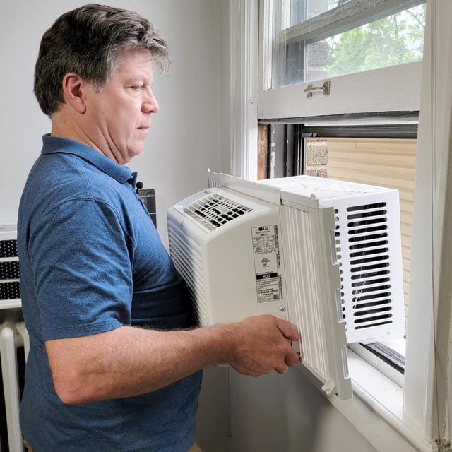
Yup,that time of year is upon us where everyone installs and gets em up .. and in.
-
Legitimately missed out on the rain today, 0.01” total. Everything this evening evaporated moving in and then reformed east of here
-
2026-2027 El Nino
40/70 Benchmark replied to Stormchaserchuck1's topic in Weather Forecasting and Discussion
I'll bet we can salvage that...we just ended an incredible decade of predominately +WPO....it just flipped this past season, so probably due for continued regression there. -
2026-2027 El Nino
40/70 Benchmark replied to Stormchaserchuck1's topic in Weather Forecasting and Discussion
I hope so. -
2026-2027 El Nino
Stormchaserchuck1 replied to Stormchaserchuck1's topic in Weather Forecasting and Discussion
Luckily we can track that way ahead of time as Global SSTAs have a huge correlation with following season WPO -
2026-2027 El Nino
40/70 Benchmark replied to Stormchaserchuck1's topic in Weather Forecasting and Discussion
Yea, looks like WPO is going to be key to salvage a decent northeast snowfall season...only 1982 wasn't a disaster, which has a -WPO. -
2026-2027 El Nino
Stormchaserchuck1 replied to Stormchaserchuck1's topic in Weather Forecasting and Discussion
El Nino/+QBO December's: 6/6 months were warm in the Great Lakes/NE -

2026-2027 El Nino
roardog replied to Stormchaserchuck1's topic in Weather Forecasting and Discussion
I always associated El Niño with a cool summer, a cold fall that turns mild in December and then can go either way after that depending on strength, location, etc. 2014 did that(at least over here), 2009 had the cold October after a very cool summer and 2006 seemed to follow the Nino script also. But the 15-16 Nino did not and they haven’t since. - Today
-
Pass. That’d be brutal.
-
2026-2027 El Nino
Stormchaserchuck1 replied to Stormchaserchuck1's topic in Weather Forecasting and Discussion
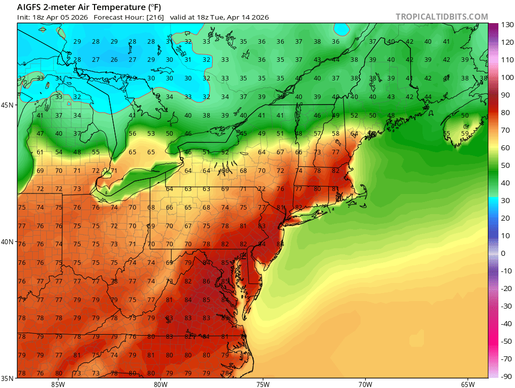
It certainly seems like it, some places around here were in the 90s yesterday. We had mid to upper 80s in early March. Jan 26, 2024 DC hit 80 degrees. A lot of very impressive spikes in the past few years. Summer is a season where wavelengths relax so the general pattern (warming) is more prevalent. Not to mention 3 of the mostly anomalously warm months on record for CONUS happened this Winter -
2026-2027 El Nino
roardog replied to Stormchaserchuck1's topic in Weather Forecasting and Discussion
I feel like the changes in the Pacific after the mid 2010s also took away the cooler summers. -
2026-2027 El Nino
Stormchaserchuck1 replied to Stormchaserchuck1's topic in Weather Forecasting and Discussion
March monthly NAO crushed it.. +2.69 for the month. Number 2 highest March NAO on record was +1.85 It also beat the most negative month of March on record, 1962, -2.47. -
.thumb.jpg.6a4895b2a43f87359e4e7d04a6fa0d14.jpg)
Central PA Spring 2026 Discussion/Obs Thread
Yardstickgozinya replied to Voyager's topic in Upstate New York/Pennsylvania
Not trying to be a jerk here.but he forgot a lot. That said, i'm sure as we get closer, Dt will be quite informative. -
2026-2027 El Nino
Stormchaserchuck1 replied to Stormchaserchuck1's topic in Weather Forecasting and Discussion
Will this be a cooler Summer?? -
perfect!
-
Central PA Spring 2026 Discussion/Obs Thread
Yardstickgozinya replied to Voyager's topic in Upstate New York/Pennsylvania
I always appreciate what Dt has to say, but im not exactly feeling this one. It seems like he's only included worst case scenarios. What if it's a meduki or central based moderate /strong among many other questions. A lot of possibilities he didn't include while making uncertainties seem certain. -

Central PA Spring 2026 Discussion/Obs Thread
mahantango#1 replied to Voyager's topic in Upstate New York/Pennsylvania
Totally worth it! -
2026-2027 El Nino
40/70 Benchmark replied to Stormchaserchuck1's topic in Weather Forecasting and Discussion
Probably, so I am willing to bet it will stink, aside from maybe one great storm. I don't feel as optimistic after seeing that RONI vs ONI relationship, as I was already leery of that after 2023.. Still plenty of time to and data to consider, though. I do wonder if we see that gap begin to close, though with the changes underway in the Pacific..that maybe what we need. -
0.55” here
-
Enjoy!