HurricaneJosh Posted September 18, 2013 Share Posted September 18, 2013 Manuel is pulling a Kiko 89 IMO. I have a feeling this will become a major before it's all sudden done. Call me crazy if you want Look at radar and IR. Center is already almost at the coast, and the convection over land is weaker. It'll be a 'cane, but not much more than that. Link to comment Share on other sites More sharing options...
wxmx Posted September 18, 2013 Share Posted September 18, 2013 Eye is probably going over Culiacan at the current heading. Link to comment Share on other sites More sharing options...
HurricaneJosh Posted September 18, 2013 Share Posted September 18, 2013 Eye is probably going over Culiacan at the current heading. That would be cool, in the sense that we'll get some quality-controlled airport obs, hopefully. Link to comment Share on other sites More sharing options...
HurricaneJosh Posted September 18, 2013 Share Posted September 18, 2013 I bet they upgrade in the upcoming 5 pm PDT intermediate advisory. Link to comment Share on other sites More sharing options...
wxmx Posted September 18, 2013 Share Posted September 18, 2013 They did...it's a hurricane Link to comment Share on other sites More sharing options...
Amped Posted September 18, 2013 Share Posted September 18, 2013 Eye is probably going over Culiacan at the current heading. it was hawt while it lasted. Link to comment Share on other sites More sharing options...
wxmx Posted September 18, 2013 Share Posted September 18, 2013 That will take people around Culiacan by surprise. About the stations...the one in the coast stopped reporting 1.5 hours ago, about the same problem in the airport...everybody fled home Link to comment Share on other sites More sharing options...
HurricaneJosh Posted September 18, 2013 Share Posted September 18, 2013 That will take people around Culiacan by surprise. About the stations...the one in the coast stopped reporting 1.5 hours ago, about the same problem in the airport...everybody fled home Ugh, lame! Don't those workers have any curiosity about the obs?? I just checked the NHC position-- it seems way W of Culiacan and moving N-- so I don't think it's going to pass over that city. Link to comment Share on other sites More sharing options...
Yellow Evan Posted September 19, 2013 Share Posted September 19, 2013 It'll likely move ashore near Navolato. Link to comment Share on other sites More sharing options...
HurricaneJosh Posted September 19, 2013 Share Posted September 19, 2013 Jorge (wxmx) predicted this exact scenario very early this morning, before anyone else was even mentioning it. Pretty cool. (I hate to say this, cuz it's gonna get to his head. ) Link to comment Share on other sites More sharing options...
wxmx Posted September 19, 2013 Share Posted September 19, 2013 Jorge (wxmx) predicted this exact scenario very ealry this morning, before anyone else was even mentioning it. Pretty cool. (I hate to say this, cuz it's gonna get to his head. ) I wouldnt BTW, Manuel's eye is getting warmer...intensification isn't still over, although the convection over land isn't that impressive. Link to comment Share on other sites More sharing options...
HurricaneJosh Posted September 19, 2013 Share Posted September 19, 2013 The 8 pm PDT position is very near the coast-- at a town called Nuevo Altata. Must be fun there right now. Link to comment Share on other sites More sharing options...
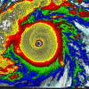
HurricaneJosh Posted September 19, 2013 Share Posted September 19, 2013 Manuel made landfall W of Culiacan around 8 am PDT with an intensity of 65 kt/987 mb. I would have guessed earlier-- like ~4 am PDT-- based on this radar shot which shows the center of the eye over the coast: Link to comment Share on other sites More sharing options...
Yellow Evan Posted September 20, 2013 Share Posted September 20, 2013 Pretty much gone. Giving TX rain though. Link to comment Share on other sites More sharing options...
Yellow Evan Posted September 20, 2013 Share Posted September 20, 2013 Last adv written. Link to comment Share on other sites More sharing options...
Ed Lizard Posted September 28, 2013 Share Posted September 28, 2013 East Pacific action is important in October because 1) I still remember being in Austin in October 1994 and the heavy rain when the mid level remnants of East Pacific Hurricane Rosa moved over a shallow cold dome at the surface. Flooding in the San Jacinto East of Houston scoured out the sub-river oil, gasoline and diesel pipelines, and the TV was stupendous and 2) Josh has that whole 'Whip of St. Francis' thing, and the Atlantic basin looks sure to disappoint. GFS ensemble action, Euro ensembles getting towards Phase 8... USGS 78 - October 15, 1994 Burning oil from breached pipeline caused by Oct. 1994 flood on the San Jacinto River at IH-10 in Houston. Some structures were flooded and burned. Link to comment Share on other sites More sharing options...
HurricaneJosh Posted September 28, 2013 Share Posted September 28, 2013 Well, you know I wubz me some EPAC Oct action, so I hope you're right. Adam says the MJO is gonna move over the EPAC in a week or so, so I'm optimistic for a big, Cat-3 boomerang! P.S. What's the "whip of St. Francis"? I had to Google it and still couldn't figure it out. Link to comment Share on other sites More sharing options...
Ed Lizard Posted September 28, 2013 Share Posted September 28, 2013 Well, you know I wubz me some EPAC Oct action, so I hope you're right. Adam says the MJO is gonna move over the EPAC in a week or so, so I'm optimistic for a big, Cat-3 boomerang! P.S. What's the "whip of St. Francis"? I had to Google it and still couldn't figure it out. Lash of St Joseph? Cat'O'Nine Tails of St. Anthony? I don't know. I saw you use it in a post once. Or I thought I did. Maybe I didn't... Link to comment Share on other sites More sharing options...
HurricaneJosh Posted September 29, 2013 Share Posted September 29, 2013 Lash of St Joseph? Cat'O'Nine Tails of St. Anthony? I don't know. I saw you use it in a post once. Or I thought I did. Maybe I didn't... I definitely didn't use those references. I have no clue about Catholic saints or what they mean. Link to comment Share on other sites More sharing options...
Ed Lizard Posted September 29, 2013 Share Posted September 29, 2013 I definitely didn't use those references. I have no clue about Catholic saints or what they mean. I sense I offended you. Didn't mean to. I heard, or maybe read, something, somewhere, sometime, and I confused it. It happens. I was trying to be cheerful with GEFS potential cyclones and ECMWF ensembles heading into Octant 8. I'll delete the original post if you're that offended. Link to comment Share on other sites More sharing options...
HurricaneJosh Posted September 29, 2013 Share Posted September 29, 2013 I sense I offended you. Didn't mean to. I heard, or maybe read, something, somewhere, sometime, and I confused it. It happens. I was trying to be cheerful with GEFS potential cyclones and ECMWF ensembles heading into Octant 8. I'll delete the original post if you're that offended. Hush-- I'm not offended at all. Totally cool. Nothing to delete. Hopefully they're right Re: Oct 8ish. Adam was hinting to me that there could be EPAC action around then. Link to comment Share on other sites More sharing options...
Ed Lizard Posted September 29, 2013 Share Posted September 29, 2013 Hush-- I'm not offended at all. Totally cool. Nothing to delete. Hopefully they're right Re: Oct 8ish. Adam was hinting to me that there could be EPAC action around then. Just irritated. At least the West Pac is finally alive. Link to comment Share on other sites More sharing options...
Ed Lizard Posted October 6, 2013 Share Posted October 6, 2013 Still holding out hope for mid to late month EPAC action, as I mentioned in Atlantic thread, I wish the op was higher amplitude and the EC ensembles aren't tremendous, but as I mention ad nauseum on the KHOU-TV 11 weather forum, I remember 1994 and East Pac Rosa, and if people chased Pacific Mexico hurricanes then, that would have been having cake and icing, although the heavy rain in Texas, to me, would be the cake, even if it happened after a chaser intercept. If that makes sense. Note, the GFS ensembles seem to be supporting my Atlantic Caribbean optimism from that thread, but based on previous talk that the GFS is usually too fast in progressing whatever factors (which I need to ask, do MJO maps work off of some kind of algorithm based on where the model or ensemble shows OLR anomalies, or heights and winds at some level, or what) that the MJO phase diagrams are derived from, perhaps the ensemble storms are actually occurring in the East Pac. Water oak wise, that is cake, if the GEFS liking the Caribbean is right, that is more like icing. Link to comment Share on other sites More sharing options...
Superstorm93 Posted October 6, 2013 Share Posted October 6, 2013 SATELLITE IMAGERY INDICATES THAT SHOWERS AND THUNDERSTORMS ASSOCIATED WITH A BROAD AREA OF LOW PRESSURE...LOCATED ABOUT 900MILES SOUTH-SOUTHWEST OF THE SOUTHERN TIP OF THE BAJA CALIFORNIAPENINSULA...HAVE CONTINUED TO BECOME BETTER ORGANIZED OVER THE PASTFEW HOURS. ADDITIONAL DEVELOPMENT OF THIS LOW IS POSSIBLE...AND ATROPICAL DEPRESSION COULD FORM DURING THE NEXT DAY OR SO. THISSYSTEM HAS A HIGH CHANCE...60 PERCENT...OF BECOMING A TROPICALCYCLONE DURING THE NEXT 48 HOURS...AND A HIGH CHANCE...70PERCENT...OF BECOMING A TROPICAL CYCLONE DURING THE NEXT 5 DAYSWHILE THE LOW MOVES WESTWARD AND THEN WEST-NORTHWESTWARD ORNORTHWESTWARD AT ABOUT 10 MPH. Link to comment Share on other sites More sharing options...
wxtrackercody Posted October 6, 2013 Share Posted October 6, 2013 Should become Narda tomorrow -- probably peak as a strong tropical storm mid-week. No threat to anything. Link to comment Share on other sites More sharing options...
Ed Lizard Posted October 8, 2013 Share Posted October 8, 2013 And Narda does what every Western Hemisphere TC this year has done, unperformed. Link to comment Share on other sites More sharing options...
Amped Posted October 8, 2013 Share Posted October 8, 2013 And Narda does what every Western Hemisphere TC this year has done, unperformed. I am only still following this season because I need a good laugh. This storm certainly provided one. Link to comment Share on other sites More sharing options...
icebreaker5221 Posted October 9, 2013 Author Share Posted October 9, 2013 Stout southwesterly shear (courtesy an active subtropical jet) along with dry mid-latitude air diving in from the north look to be major inhibiting factors down the road, but the track of 94E is at least mildly interesting. Link to comment Share on other sites More sharing options...
wxtrackercody Posted October 13, 2013 Share Posted October 13, 2013 New depression. Should become a tropical storm but degenerate prior to reaching Baja California Sur. EP, 15, 2013101300, , BEST, 0, 157N, 1098W, 30, 1005, TD, 34, NEQ, 0, 0, 0, 0, 1008, 150, 50, 0, 0, E, 0, , 0, 0, FIFTEEN, M, Link to comment Share on other sites More sharing options...
GaWx Posted October 13, 2013 Share Posted October 13, 2013 Let's see if late Oct. provides a classic EPAC hooker into Mexico. The GFS has been suggesting this on some runs. However, that is still pretty far out in lala land. Also, I haven't forgotten the false alerts shown by many GFS runs last year for late Oct and the fact that the Euro didn't have them. Actually, I think Sandy may have had an indirect negative effect on the EPAC. Link to comment Share on other sites More sharing options...


Recommended Posts
Archived
This topic is now archived and is closed to further replies.