icebreaker5221 Posted August 31, 2013 Author Share Posted August 31, 2013 That eye-like feature has disappeared just as abruptly as it appeared. Let's see if it returns this evening. Link to comment Share on other sites More sharing options...
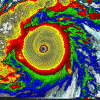
HurricaneJosh Posted August 31, 2013 Share Posted August 31, 2013 Nice looking TD Hottest TD ever? Lolz wtf just happened Very weird. Link to comment Share on other sites More sharing options...
Superstorm93 Posted September 1, 2013 Share Posted September 1, 2013 Eyewall was the real deal apparently... Link to comment Share on other sites More sharing options...
wxtrackercody Posted September 1, 2013 Share Posted September 1, 2013 Am I the only one that doesn't thing this thing went gangbusters in the matter of a few hours? If we take a look at the CIMSS ADT, the final T# reached tropical storm strength around 12z and steadily intensified to T3.1/47 kt by the time NHC upgraded at 21z. I'd venture to say it attained tropical storm strength even before that though. 09z seems like a good starting point: If not then, certainly by 11z. Link to comment Share on other sites More sharing options...
phil882 Posted September 1, 2013 Share Posted September 1, 2013 Am I the only one that doesn't thing this thing went gangbusters in the matter of a few hours? If we take a look at the CIMSS ADT, the final T# reached tropical storm strength around 12z and steadily intensified to T3.1/47 kt by the time NHC upgraded at 21z. I'd venture to say it attained tropical storm strength even before that though. 09z seems like a good starting point: If not then, certainly by 11z. Yes, and that's probably something that will be corrected for the best track by the time the TCR is released. Link to comment Share on other sites More sharing options...
Yellow Evan Posted September 1, 2013 Share Posted September 1, 2013 Kiko may not a hurricane after all. Looks kinda dead IMO. Link to comment Share on other sites More sharing options...
HurricaneJosh Posted September 1, 2013 Share Posted September 1, 2013 Yeah, I'm wondering if they'll upgrade today's intensities in postanalysis. That MW shot really screams "65 kt". Link to comment Share on other sites More sharing options...
Yellow Evan Posted September 1, 2013 Share Posted September 1, 2013 Yeah, I'm wondering if they'll upgrade today's intensities in postanalysis. That MW shot really screams "65 kt". It probaly briefly was one. Link to comment Share on other sites More sharing options...
Mike.Ventrice Posted September 1, 2013 Share Posted September 1, 2013 How is this not a hurricane???? Link to comment Share on other sites More sharing options...
phil882 Posted September 1, 2013 Share Posted September 1, 2013 How is this not a hurricane???? To my knowledge the 85GHz only captures the middle and upper level portions of the deeper convection. So its possible it was only a well defined mid-level eye. The 37GHz microwave is said to capture the low-level convective structure better, and that imagery shows a less organized system. Still though, I think a case can be made to upgrade this to a hurricane post-analysis. Link to comment Share on other sites More sharing options...
HurricaneFrances04 Posted September 1, 2013 Share Posted September 1, 2013 Tropical storm for SoCal? Link to comment Share on other sites More sharing options...
Yellow Evan Posted September 1, 2013 Share Posted September 1, 2013 Doubt that will happen. Link to comment Share on other sites More sharing options...
HurricaneJosh Posted September 1, 2013 Share Posted September 1, 2013 Tropical storm for SoCal? I noticed that, too. It has happened, most-recently in 1939: http://en.wikipedia.org/wiki/1939_California_tropical_storm An interesting thing about this summer in SoCal has been the humidity, which has been much higher than usual. We're getting a lot of moisture from these tropical systems down in Baja California, and it's been muggy and gross. I was in the Desert yesterday, and the air was thick and tropical. Link to comment Share on other sites More sharing options...
jordanwx Posted September 2, 2013 Share Posted September 2, 2013 I noticed that, too. It has happened, most-recently in 1939: http://en.wikipedia.org/wiki/1939_California_tropical_storm An interesting thing about this summer in SoCal has been the humidity, which has been much higher than usual. We're getting a lot of moisture from these tropical systems down in Baja California, and it's been muggy and gross. I was in the Desert yesterday, and the air was thick and tropical. You make it sound like a bad thing. We get a tropical airmass in coastal SoCal so freaking rarely it drives me insane. Bring on the moisture. Link to comment Share on other sites More sharing options...
HurricaneJosh Posted September 2, 2013 Share Posted September 2, 2013 You make it sound like a bad thing. We get a tropical airmass in coastal SoCal so freaking rarely it drives me insane. Bring on the moisture. It's an annoyance during the week, when I'm dressed nicely for business and sweating constantly. I live in L.A., not Baton Rouge, and I expect the weather to be reliably boring and comfortable. Link to comment Share on other sites More sharing options...
wxtrackercody Posted September 3, 2013 Share Posted September 3, 2013 The EPAC has seen several hurricanes which has helped drive the ACE index to ~60% of normal, but man, even it's boring in this basin w/o any major hurricanes. Even freakier considering conditions seem to be pretty favorable overall. 2013: the year without a 100kt cyclone Link to comment Share on other sites More sharing options...
Yellow Evan Posted September 4, 2013 Share Posted September 4, 2013 I noticed that, too. It has happened, most-recently in 1939: http://en.wikipedia.org/wiki/1939_California_tropical_storm An interesting thing about this summer in SoCal has been the humidity, which has been much higher than usual. We're getting a lot of moisture from these tropical systems down in Baja California, and it's been muggy and gross. I was in the Desert yesterday, and the air was thick and tropical. As a NV resident, I like it. as a mix up. Though most of the rain is moonsoon related. BTW, Norman 78 hit as a TD. Link to comment Share on other sites More sharing options...
icebreaker5221 Posted September 4, 2013 Author Share Posted September 4, 2013 Ivo, Juliette, and Kiko all propagated much more to the north than to the west, all either directly affecting or at least coming close to land. Although still not completely unusual for this time of year, this is more typical of early or late season systems in the E Pac. Looks like 99E, should it develop, will follow the trend. Link to comment Share on other sites More sharing options...
HurricaneJosh Posted September 4, 2013 Share Posted September 4, 2013 Ivo, Juliette, and Kiko all propagated much more to the north than to the west, all either directly affecting or at least coming close to land. Although still not completely unusual for this time of year, this is more typical of early or late season systems in the E Pac. Looks like 99E, should it develop, will follow the trend. I feel the classic late-season track is a wide, boomeranging motion-- initially heading away from (or parallel to) the coast, then turning back sharply and accelerating toward the coast at a right angle (a la Kenna 2002-- below). While the cyclones have been closer to land than usual this August, the track trajectories-- the way they're basically moving parallel to the coast-- are pretty typical for this time of year, I think. Link to comment Share on other sites More sharing options...
icebreaker5221 Posted September 6, 2013 Author Share Posted September 6, 2013 I feel the classic late-season track is a wide, boomeranging motion-- initially heading away from (or parallel to) the coast, then turning back sharply and accelerating toward the coast at a right angle (a la Kenna 2002-- below). While the cyclones have been closer to land than usual this August, the track trajectories-- the way they're basically moving parallel to the coast-- are pretty typical for this time of year, I think. Yes, certainly the boomerang path is classic late season and is extremely rare before late Sep / Oct. The NNW motion we've seen this Aug/Sep isn't in itself unusual, but I think the fact that: we've seen quite a few of them in a row, they're all close to land, and we haven't seen the classic east-west movers except for ones that are developing unusually far west, all adds up to an unusual couple of months. P.S. TS Lorena is currently approaching the southern tip of Baja from the south. Link to comment Share on other sites More sharing options...
Ed Lizard Posted September 7, 2013 Share Posted September 7, 2013 28storms.com Another record just broke today: This is now the latest we've gone without a major hurricane in the Western Hemisphere since reliable records for the East Pacific began in 1971. Link to comment Share on other sites More sharing options...
Yellow Evan Posted September 8, 2013 Share Posted September 8, 2013 I feel the classic late-season track is a wide, boomeranging motion-- initially heading away from (or parallel to) the coast, then turning back sharply and accelerating toward the coast at a right angle (a la Kenna 2002-- below). While the cyclones have been closer to land than usual this August, the track trajectories-- the way they're basically moving parallel to the coast-- are pretty typical for this time of year, I think. kenna2002.gif For mainland MX, yes. For Baja landfalls, less so. Argubaly the most important EPAC storm of all time took a NNNW track: https://en.wikipedia.org/wiki/File:Liza_1976_track.png 28storms.com Another record just broke today: This is now the latest we've gone without a major hurricane in the Western Hemisphere since reliable records for the East Pacific began in 1971. Does this include the SPAC? Yes, certainly the boomerang path is classic late season and is extremely rare before late Sep / Oct. The NNW motion we've seen this Aug/Sep isn't in itself unusual, but I think the fact that: we've seen quite a few of them in a row, they're all close to land, and we haven't seen the classic east-west movers except for ones that are developing unusually far west, all adds up to an unusual couple of months. P.S. TS Lorena is currently approaching the southern tip of Baja from the south. Eh, I think Josh got it right on the head at least for the mainalnd classic mainland EPAC landfall is something like Tico 83/Waldo 85/Paine 85 or for southern strikes, Winifred 92 Link to comment Share on other sites More sharing options...
Ed Lizard Posted September 8, 2013 Share Posted September 8, 2013 Does this include the SPAC? Probably Link to comment Share on other sites More sharing options...
Yellow Evan Posted September 8, 2013 Share Posted September 8, 2013 Probably Makes sense since 80-81 SPAC went majorless since the calender year of 1981 began. 1981 was likely the previous reccord holder. Link to comment Share on other sites More sharing options...
HurricaneJosh Posted September 8, 2013 Share Posted September 8, 2013 For mainland MX, yes. For Baja landfalls, less so. Argualy the most important EPAC storm of all time took a NNNW track: The Great Mexico Hurricane of 1959 outranks Liza in terms of intensity, damage, and fatalities. (It had the October-boomerang track.) With only a couple of exceptions, all major (Cat-3+) landfalls in the EPAC have been October boomerangs. Baja Califoria Sur is sort of like our North Carolina: it's hurricane-prone, but it mostly gets a lot of crap (Cat 1s/2s). It rarely gets majors-- thus I tend not to focus on it when I'm thinking about where to get the big game. (That having been said, I chased a great Cat 2 there a few years ago, Jimena 2009.) classic mainland EPAC landfall is something like Tico 83/Waldo 85/Paine 85 or for southern strikes, Winifred 92 What do you mean by a "classic" landfall? Tico is a good example, but Waldo wasn't a major, and Paine was only a Cat 1. (Paine was in 1986, by the way.) There've been much better mainland specimens-- including: Lane 1006 (Cat 3) Kenna 2002 (Cat 4) Madeline 1976 (Cat 4) Liza 1976 (Cat 3) Olivia 1975 (Cat 3) Great Mexico 1959 (Cat 5) No. 10 1957 (Cat 4) Link to comment Share on other sites More sharing options...
Amped Posted September 8, 2013 Share Posted September 8, 2013 Probably And the 10 day forecast show no sign to that streak ending. Link to comment Share on other sites More sharing options...
GaWx Posted September 8, 2013 Share Posted September 8, 2013 The Great Mexico Hurricane of 1959 outranks Liza in terms of intensity, damage, and fatalities. (It had the October-boomerang track.) With only a couple of exceptions, all major (Cat-3+) landfalls in the EPAC have been October boomerangs. Baja Califoria Sur is sort of like our North Carolina: it's hurricane-prone, but it mostly gets a lot of crap (Cat 1s/2s). It rarely gets majors-- thus I tend not to focus on it when I'm thinking about where to get the big game. (That having been said, I chased a great Cat 2 there a few years ago, Jimena 2009.) What do you mean by a "classic" landfall? Tico is a good example, but Waldo wasn't a major, and Paine was only a Cat 1. (Paine was in 1986, by the way.) There've been much better mainland specimens-- including: Lane 1006 (Cat 3) Kenna 2002 (Cat 4) Madeline 1976 (Cat 4) Liza 1976 (Cat 3) Olivia 1975 (Cat 3) Great Mexico 1959 (Cat 5) No. 10 1957 (Cat 4) From Josh last year: "Following are all Cat-3+ landfalls on Mexico's Pacific coast since 1949-- showing year, name, date, state (where the center crossed the coast), and intensity. Note that only Kiko 1989 and Lane 2006 were not in October. Also notice that most of the really intense ones hit quite late in the month: 1957 No. 10 (22 Oct) - Sinaloa - Cat 4 (120 kt) 1959 Great Mexico Hurricane (27 Oct) - Jalisco - Cat 5 (140 kt) 1967 Olivia (14 Oct) - Baja California Sur - Cat 3 (110 kt) 1975 Olivia (25 Oct) - Sinaloa - Cat 3 (100 kt) 1976 Liza (01 Oct) - Sinaloa - Cat 3 (100 kt***) 1976 Madeline (08 Oct) - Guerrero - Cat 4 (125 kt) 1983 Tico (19 Oct) - Sinaloa - Cat 3 (110 kt) 1989 Kiko (27 Aug) - Baja California Sur - Cat 3 (960 mb/100 kt) 2002 Kenna (25 Oct) - Nayarit - Cat 4 (950 mb/120 kt) 2006 Lane (16 Sep) - Sinaloa - Cat 3 (954 mb/110 kt)" So hit dates were as follows: 8/27, 9/16, 10/1, 10/8, 10/14, 10/19, 10/22, 10/25, 10/25, 10/27 As Josh mentioned, the real strongest (cat. 4-5) hit mainly in late Oct.: 10/8, 10/22, 10/25, 10/27 Oncoming weak to moderate Ninos actually are the ENSO state since 1949 that has been the most favorable for the major MX hits (Liza, Madeline, Kenna, and Lane). 1957's #10 hit during an oncoming strong El Nino. -------------------------------- From me last year: "Also, I've found per Wiki three sig. hurricanes (any of which could have been a major at landfall) during the 1800's hitting between 10/27 and 11/1 on the MX coast anywhere from Mazatian to Manzanillo: Nov. 1, 1839: Mazatlan, Sinaloa Nov. 1, 1840: San Blas, Nayarit Oct. 27, 1881: Manzanillo, Colima; 950 mb/110 knots..so this was a major; Per Wiki, 'This hurricane totally destroyed the city.'" So, lateness is key!! Also, Mazatlan in Sinaloa seems to be a magnet for late season major hits! Link to comment Share on other sites More sharing options...
Yellow Evan Posted September 8, 2013 Share Posted September 8, 2013 The Great Mexico Hurricane of 1959 outranks Liza in terms of intensity, damage, and fatalities. (It had the October-boomerang track.) With only a couple of exceptions, all major (Cat-3+) landfalls in the EPAC have been October boomerangs. Baja Califoria Sur is sort of like our North Carolina: it's hurricane-prone, but it mostly gets a lot of crap (Cat 1s/2s). It rarely gets majors-- thus I tend not to focus on it when I'm thinking about where to get the big game. (That having been said, I chased a great Cat 2 there a few years ago, Jimena 2009.) What do you mean by a "classic" landfall? Tico is a good example, but Waldo wasn't a major, and Paine was only a Cat 1. (Paine was in 1986, by the way.) There've been much better mainland specimens-- including: Lane 1006 (Cat 3) Kenna 2002 (Cat 4) Madeline 1976 (Cat 4) Liza 1976 (Cat 3) Olivia 1975 (Cat 3) Great Mexico 1959 (Cat 5) No. 10 1957 (Cat 4) Regarding 59 Mexico vs. Liza, that's quite debateable. As for Baja, I like the track most of the Baja systems, I love how it sticks out but is narrow. Yea, Jimena 09 is up there as of my favorite EPAC systems. As for a "classic" landfall, I meant storm's that formed south of MX and then hooked west and moved inland. Yea, Paine was in 1986 not 1985 just a typo. Link to comment Share on other sites More sharing options...
HurricaneJosh Posted September 8, 2013 Share Posted September 8, 2013 Regarding 59 Mexico vs. Liza, that's quite debateable. As for Baja, I like the track most of the Baja systems, I love how it sticks out but is narrow. Yea, Jimena 09 is up there as of my favorite EPAC systems. As for a "classic" landfall, I meant storm's that formed south of MX and then hooked west and moved inland. Yea, Paine was in 1986 not 1985 just a typo. How is 1959 vs. Liza debatable? Based on what metric? 1959 wins on intensity, fatalities, and damage. I dread Baja systems-- it's tough chase turf. But I dug Jimena, too-- I agree with you, it was a cool storm. Link to comment Share on other sites More sharing options...
Yellow Evan Posted September 8, 2013 Share Posted September 8, 2013 From Josh last year: "Following are all Cat-3+ landfalls on Mexico's Pacific coast since 1949-- showing year, name, date, state (where the center crossed the coast), and intensity. Note that only Kiko 1989 and Lane 2006 were not in October. Also notice that most of the really intense ones hit quite late in the month: 1957 No. 10 (22 Oct) - Sinaloa - Cat 4 (120 kt) 1959 Great Mexico Hurricane (27 Oct) - Jalisco - Cat 5 (140 kt) 1967 Olivia (14 Oct) - Baja California Sur - Cat 3 (110 kt) 1975 Olivia (25 Oct) - Sinaloa - Cat 3 (100 kt) 1976 Liza (01 Oct) - Sinaloa - Cat 3 (100 kt***) 1976 Madeline (08 Oct) - Guerrero - Cat 4 (125 kt) 1983 Tico (19 Oct) - Sinaloa - Cat 3 (110 kt) 1989 Kiko (27 Aug) - Baja California Sur - Cat 3 (960 mb/100 kt) 2002 Kenna (25 Oct) - Nayarit - Cat 4 (950 mb/120 kt) 2006 Lane (16 Sep) - Sinaloa - Cat 3 (954 mb/110 kt)" So hit dates were as follows: 8/27, 9/16, 10/1, 10/8, 10/14, 10/19, 10/22, 10/25, 10/25, 10/27 As Josh mentioned, the real strongest (cat. 4-5) hit mainly in late Oct.: 10/8, 10/22, 10/25, 10/27 Oncoming weak to moderate Ninos actually are the ENSO state since 1949 that has been the most favorable for the major MX hits (Liza, Madeline, Kenna, and Lane). 1957's #10 hit during an oncoming strong El Nino. -------------------------------- From me last year: "Also, I've found per Wiki three sig. hurricanes (any of which could have been a major at landfall) during the 1800's hitting between 10/27 and 11/1 on the MX coast anywhere from Mazatian to Manzanillo: Nov. 1, 1839: Mazatlan, Sinaloa Nov. 1, 1840: San Blas, Nayarit Oct. 27, 1881: Manzanillo, Colima; 950 mb/110 knots..so this was a major; Per Wiki, 'This hurricane totally destroyed the city.'" So, lateness is key!! Also, Mazatlan in Sinaloa seems to be a magnet for late season major hits! during July and into part of August, troughs rarely dig deep, hecne killing the chances of a recurve. In October, trough did much depper, so more recurves. They happened more often in El Nino since 1) storm's are stronger 2) troughs dig deeper but to be honest, wheather or not a storm hits as a major really does not matter, it is the affects of human lifes and property that does. Olivia 67 did not do much damage even though it was a near-Cat 4 and Virgil 92 did very little damage as a strong Cat 2. On the other hand, the second most deadly EPAC system of all time (Paul 82) did most of its damage as a TD (though it was almost major at its landfall in Baja Califonria Sur and Sinaloa) znd did a moderate amount of impact there. If you wanna be technical, Iselle 90 hit Soccoro Island as a major, the only storm to make landfall on the island itself as a major. FYI, Iniki 92 hit Hawaii as a mager. Though Keli 84, John 94, and Kenoi 93 all came close, no major hurricane has made landfall on Jonhston Atoll. Link to comment Share on other sites More sharing options...


Recommended Posts
Archived
This topic is now archived and is closed to further replies.