ezweather Posted July 29, 2013 Share Posted July 29, 2013 Would not be surprised if a new warning is issued, because the DBZs are like up to 60+.. Good grief.. Link to comment Share on other sites More sharing options...
greg ralls Posted July 29, 2013 Share Posted July 29, 2013 Hearing thunder all the way up here in Collegeville. Link to comment Share on other sites More sharing options...
NaoPos Posted July 29, 2013 Share Posted July 29, 2013 Mean looking storm, tons of lightning. Taking a little ride Link to comment Share on other sites More sharing options...
cast4 Posted July 29, 2013 Share Posted July 29, 2013 Crazy rainfall rates with that thing. Link to comment Share on other sites More sharing options...
cast4 Posted July 29, 2013 Share Posted July 29, 2013 Hearing thunder all the way up here in Collegeville. I'm hearing thunder here as well. Link to comment Share on other sites More sharing options...
weathergeek5 Posted July 29, 2013 Share Posted July 29, 2013 I live in downtown Wilmington this storm is unreal, Hail is battering the windows. Link to comment Share on other sites More sharing options...
ezweather Posted July 29, 2013 Share Posted July 29, 2013 That is some storm.. Interesting no warning.. But GR Level 3 showing 1 Inch hail likely. Echo tops about 40,000 feet. Link to comment Share on other sites More sharing options...
ezweather Posted July 29, 2013 Share Posted July 29, 2013 Got the warning.. 944 WUUS51 KPHI 290518 SVRPHI DEC003-NJC015-033-PAC045-290600- /O.NEW.KPHI.SV.W.0084.130729T0518Z-130729T0600Z/ BULLETIN - EAS ACTIVATION REQUESTED SEVERE THUNDERSTORM WARNING NATIONAL WEATHER SERVICE MOUNT HOLLY NJ 118 AM EDT MON JUL 29 2013 THE NATIONAL WEATHER SERVICE IN MOUNT HOLLY NJ HAS ISSUED A * SEVERE THUNDERSTORM WARNING FOR... SOUTHERN DELAWARE COUNTY IN SOUTHEAST PENNSYLVANIA... NORTHWESTERN GLOUCESTER COUNTY IN SOUTHERN NEW JERSEY... NORTHEASTERN NEW CASTLE COUNTY IN NORTHERN DELAWARE... NORTHWESTERN SALEM COUNTY IN SOUTHERN NEW JERSEY... * UNTIL 200 AM EDT * AT 116 AM EDT...NATIONAL WEATHER SERVICE DOPPLER RADAR INDICATED A SEVERE THUNDERSTORM. THE STORM WAS NEAR EDGEMOOR...MOVING EAST AT 30 MPH. THIS STORM IS CAPABLE OF PRODUCING DAMAGING WINDS IN EXCESS OF 60 MPH. * THE SEVERE THUNDERSTORM WILL BE NEAR... ARDEN AND CHELSEA AROUND 125 AM EDT... BECKETT AND CHESTER AROUND 135 AM EDT... SWEDESBORO AND SWARTHMORE AROUND 140 AM EDT... GIBBSTOWN AND PHILADELPHIA INTERNATIONAL ARPT AROUND 145 AM EDT... PAULSBORO AND MULLICA HILL AROUND 150 AM EDT... WEST DEPTFORD AROUND 155 AM EDT... PRECAUTIONARY/PREPAREDNESS ACTIONS... SEVERE THUNDERSTORMS PRODUCE WINDS OF MORE THAN 57 MPH...OR HAIL ONE INCH OR LARGER. && LAT...LON 3984 7560 3987 7559 3992 7525 3988 7526 3987 7520 3969 7513 3965 7554 3969 7552 3969 7553 3965 7557 3968 7560 3983 7564 TIME...MOT...LOC 0518Z 257DEG 24KT 3975 7551 $$ IOVINO Link to comment Share on other sites More sharing options...
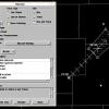
ezweather Posted July 29, 2013 Share Posted July 29, 2013 Watching this storm now with GRAnalyst 2.. There is some rotation with this storm. Anyone in the path of these storms, would not be surprised if an tornado could from these storms. That rotation would be over Wilmington and western Salem county. Link to comment Share on other sites More sharing options...
wolfie09 Posted July 29, 2013 Share Posted July 29, 2013 .23" last night here in freehold..6.20" for the month I'mby.. Link to comment Share on other sites More sharing options...
NJHurricane Posted July 29, 2013 Share Posted July 29, 2013 Lightning increasing here in National Park nj Link to comment Share on other sites More sharing options...
ezweather Posted July 29, 2013 Share Posted July 29, 2013 Already hearing thunder at my location. Just add a little to this post here. The lightning looks very impressive. Wonder if I'll lost power with these storms. Had some issues later today with the power flickering off and on and then out. But back on. Link to comment Share on other sites More sharing options...
NaoPos Posted July 29, 2013 Share Posted July 29, 2013 Went over the commodore Barry bridge during the initial storm passage.. Big mistake. Scary as $hite. Link to comment Share on other sites More sharing options...
SmokeEater Posted July 29, 2013 Share Posted July 29, 2013 Coming out of Williamstown, going to Woodbury, structure looks awesome with this thing during lightning flashes. Sent from my iPhone using Tapatalk 2 Link to comment Share on other sites More sharing options...
NJHurricane Posted July 29, 2013 Share Posted July 29, 2013 Fizzled....warning cancelled Link to comment Share on other sites More sharing options...
Thunder Road Posted July 29, 2013 Share Posted July 29, 2013 Storm now moving into New Castle Co. just keeps looking better and better. Let's see if it finally collapses when it hits the over-turned atmosphere closer to Philly. Fizzled....warning cancelled Yup. Link to comment Share on other sites More sharing options...
LMolineuxLM1 Posted July 29, 2013 Share Posted July 29, 2013 There really wasn't much wind with that cell but lightning was very nice and the rain was extremely heavy it sounded like it was trying to get inside you couldn't see far at all during it. Link to comment Share on other sites More sharing options...
MGorse Posted July 29, 2013 Share Posted July 29, 2013 I live in downtown Wilmington this storm is unreal, Hail is battering the windows. Do you happen to know or have an estimate on the size of the hail? Link to comment Share on other sites More sharing options...
HM Posted July 29, 2013 Share Posted July 29, 2013 Coming out of Williamstown, going to Woodbury, structure looks awesome with this thing during lightning flashes. Sent from my iPhone 2 I'll tell you what, this year I have witnessed 3 different mesocyclones with pretty decent structure. After witnessing pretty strong inflow associated with the meso last Monday in the Mount Laurel area around 8pm, I got another opportunity yesterday in Mercer County. A decent transient supercell structure maxed out right over the county and we were heading south. There was a very well defined W.E.R/clear slot (like last Monday) with observed inflow and rotation. The inflow yesterday wasn't as strong as Monday's inflow but the structure yesterday was amazing (a lot of twisting scud / lowerings but no well defined wall cloud). Very strange convective season for sure...a sign of our very warm/wet summers as of late. Link to comment Share on other sites More sharing options...
weathergeek5 Posted July 29, 2013 Share Posted July 29, 2013 Do you happen to know or have an estimate on the size of the hail? Not sure on that. I live on the 11th floor of a apartment building. Small twigs littered the streets when I walked to work. Link to comment Share on other sites More sharing options...
MGorse Posted July 29, 2013 Share Posted July 29, 2013 Not sure on that. I live on the 11th floor of a apartment building. Small twigs littered the streets when I walked to work. Not a problem. Thanks for the follow up. Link to comment Share on other sites More sharing options...
greg ralls Posted July 29, 2013 Share Posted July 29, 2013 Unless things slow down dramatically, we're going to need a Convection Thread Part 2 before summer's end. Link to comment Share on other sites More sharing options...
SouthernNJ Posted July 30, 2013 Author Share Posted July 30, 2013 Only 84 Severe Thunderstorm Warnings so far heading into August. The lowest total to that point since 1999, which had that horrific drought. We have had very few organized threats this year, far different to the last couple which had numerous MCS-type features crossing the CWA. There have been an abundant amount of thunderstorms, but mostly pulse nature and slow moving, which in turn has led to an unusually high amount of Flash Flooding. Tornadoes have also been missing, with just 1 so far and only 20 since 2005. From 2002 to 2004, by contrast, there were 18 tornadoes in the CWA. In fact, it was 4 years ago today that our most recent tornado to track more than 5 miles occurred (as well as the most recent to be rated above EF-1), up in Sussex County NJ. Link to comment Share on other sites More sharing options...
NJHurricane Posted July 31, 2013 Share Posted July 31, 2013 Not surprised if we get more flash flood watches come thursday...summer of localized and urban flooding rolls on Link to comment Share on other sites More sharing options...
Thunder Road Posted July 31, 2013 Share Posted July 31, 2013 Not surprised if we get more flash flood watches come thursday...summer of localized and urban flooding rolls on 1.75" in the NW burbs on the 0z NAM Might want to watch out for naders too (if the NAM's helicity progs verify, AND we end up with pockets of enough instability): Link to comment Share on other sites More sharing options...
easternsnowman Posted July 31, 2013 Share Posted July 31, 2013 Why would anyone want a tornado! Link to comment Share on other sites More sharing options...
NaoPos Posted July 31, 2013 Share Posted July 31, 2013 Why would anyone want a tornado! No One asked for one, he was merlely mentioning that they were a possibility. Link to comment Share on other sites More sharing options...
easternsnowman Posted July 31, 2013 Share Posted July 31, 2013 No One asked for one, he was merlely mentioning that they were a possibility. I guess there is a possiblity, but let's all hope it does not happen! Link to comment Share on other sites More sharing options...
greg ralls Posted July 31, 2013 Share Posted July 31, 2013 We'd probably all be quite interested if a legitimate tornado threat visited the region. Doesn't mean anyone is saying, "I hope a tornado wreaks havoc somewhere in the Delaware Valley." Link to comment Share on other sites More sharing options...
Thunder Road Posted August 1, 2013 Share Posted August 1, 2013 The usually-conservative ARW is spitting out 3-4" for SE PA tomorrow. Meanwhile, the NAM has backed down to less than an inch. Go figure. Link to comment Share on other sites More sharing options...

Recommended Posts
Archived
This topic is now archived and is closed to further replies.