

MillvilleWx
-
Posts
4,422 -
Joined
-
Last visited
Content Type
Profiles
Blogs
Forums
American Weather
Media Demo
Store
Gallery
Posts posted by MillvilleWx
-
-
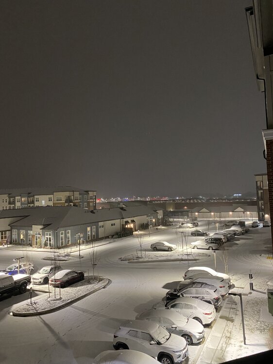
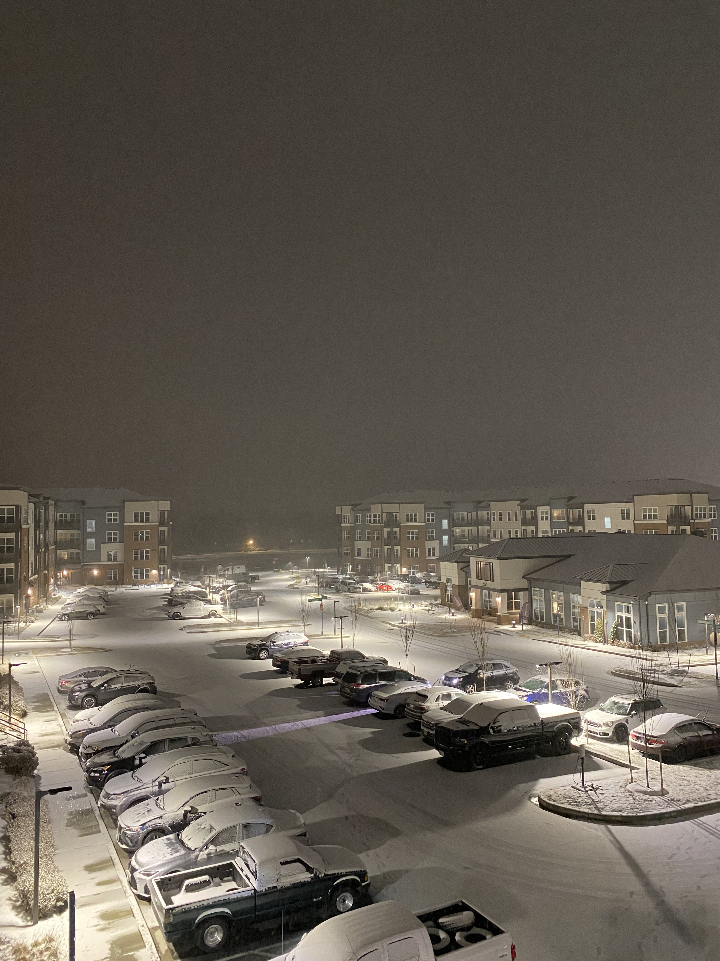
Absolutely amazing Jebwak out tonight. Wife and I were out for about 30 minutes just enjoying the amazing scenery and taking a few pictures.
Measured 2.4” awhile back and it’s coming down at a moderate clip (0.5-0.75”/hr). We’re going over 4” for sure in these parts and 5” is very well in play. Amazing little storm. It feels so good to be back

https://x.com/isothermalwx/status/1747104448374018437?s=46&t=doLb6tkQiomu4dgufikV1Q
-
 11
11
-
-
Legit moderate snow in 5N Frederick. Solid dendrites as well. It is a winter wonderland out now and this will continue for a while. We might push to 5” in these parts at this rate.
Wife and I are going for a Jebwalk very shortly. Will take an official measurement for the area and relay to Sterling.
-
11
-
-
Just now, WxMan1 said:
Very happy to work with these guys at WPC. And to you Scott and Pete: Perfect timing for 3 days off! Yeah baby!
")
Yessir! I’m off till next week lol. I picked one hell of a time for a staycation. Hope all is well at the office! Glad we are all cashing in. Long time coming

-
5
-
-
5 minutes ago, Eskimo Joe said:
Yup. I went to MU as well with him, but he was going through the met program after I transferred out to Geography & Emergency Management. Pretty sure he was my lead forecaster for a semester. Solid dude.
Awesome! We’ll have to get together at some point. Millersville reunion. Especially now that I’m not 1700 miles away!
-
3
-
-
3 minutes ago, EB89 said:
Sounds good to me. Yeah, right on the other side of the Rt. 15 bridge. North crossing/willowbrook near the sheetz.
Oh yeah. You are close. Right down the hill off Christopher Crossing. That Sheetz is my morning stop and gas fill up station. I’m right up the hill from you. I’ll wave next time
-
2 minutes ago, EB89 said:
Where do you feel like we end up? Just down the road from you.
3-6” is a solid bar right now. We are over 2” currently and the good stuff is really just starting. NAM has been steady 4.5-6” for several runs. Sounds right for what’s transpiring. You in North FDK?
-
15 minutes ago, Eskimo Joe said:
So happy for all the mets that post here, you, @MillvilleWx, @WxMan1, @WxUSAF, @Terpeast and so forth!
I ran out of reactions to give, but I appreciate the sentiment. Include @wxmvpetefrom now on. He’s an incredible Met and a great friend. Went to Millersville together for a time and work together at WPC. Amazing mind for winter weather and analysis. We’ve been looking forward to a day like this for a long time. It’s been a nice storm so far and will only continue to crank overnight.
-
10
-
 3
3
-
-
13 minutes ago, wxmvpete said:
Really starting to see returns filling in at higher radar tilts in western VA. What originally featured drier returns around 4,800ft out near the I-66/I-81 merger (around 850mb) is showing brighter returns. For those who have patiently waited in Northern MD, those heavier rates will be realized soon.
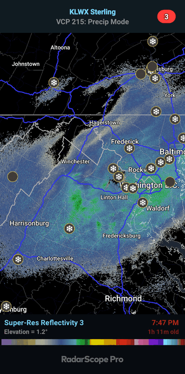
Was noticing this as well. The evolution is going as expected from what has been depicted by most guidance. Should see some 5-7” totals out of this one at this rate. Combo of 85H frontogen coupled with the mid-level ascent pattern should yield periods of 0.75-1.5”/hr rates for a time overnight into the early morning hrs.
-
7
-
3
-
 1
1
-
-
First solid snow since moving back east. Absolutely awesome. Can’t complain one bit

-
16
-
-
2 minutes ago, Eskimo Joe said:
Well well well. It looks like I might know what I’m talking about. It’s time to let my spouse know so I can chalk up one on my side.
The tally would now be:
Wife: 174
Me: 6
Happy to be on the board
-
1
-
 11
11
-
-
10 minutes ago, Deck Pic said:
0z HRRR is encouraging. Starting to sniff out backbuilding that would keep most of us snowing until 1-2 am....N/NW for longer
Only took the entire day but it is finally catching on to the fact that there’s a storm. Happy for it
-
1
-
3
-
-
4 minutes ago, North Balti Zen said:
Oh! That answers it - thanks Millville - been kinda disappointing really so far up this way
Yeah. Up your way is more delayed, not denied. Southern folks were bound to be better through today. Tonight and into the early morning looks decent for Baltimore Co where you and @mappyare located.
-
1
-
1
-
-
Just now, jnis said:
1 inch!
Mt Damascus coming through!
-
For those of us north of I-70, our good snow is not for later. Enjoy all the stuff now but the show for us has a bit before it takes effect.
Widespread 3-5” with local to 6” is a very solid call right now from Sterling. Things materializing well and on time. A beautiful day
-
15
-
-
1 hour ago, WxUSAF said:
WBAL still going with 1-3” for the whole area.

That is beyond embarrassing. I’m over 1” in north Frederick now. It’s light to borderline moderate and stacking fairly easily
-
3
-
-
7 minutes ago, understudyhero said:
When I got almost two gallons, the kid asked “do you need a spoon?” Like I was going to eat it in the parking lot.
Well…did you get the spoon?

-
1
-
1
-
-
5 minutes ago, high risk said:
The NAM struggles with synoptics for sure, but once it figures those out, it's pretty damn good with winter event details. And to be clear, I'm focused on the 3 km NAM Nest, as the 12 km parent is meh. There is no model better than the NAM Nest for resolving cold air damming, and while it sometimes runs too cold in the low levels when sorting out precip details, it's also really good at capturing warm layers that screw up a snow profile. The RRFS has yet to prove competence in these areas, and the HRRR isn't great either, so we will miss the NAM on some days when it's gone.
This ^
The NAM has its faults, but when it has the right setup in line, it can be very useful. This seems like one of those times it has a good handle on the synoptic evolution and handling the thermals properly. It’s been fairly rock steady for a long succession of runs. Great to see considering the HRRR isn’t just out to lunch, I think it’s on vacation…
-
5
-
-
Hey guys. Looks like a nice high end advisory type event for part of the subforum. There’s a shot for low end warning criteria if the dynamics at play set up just right. 3-5” with as much as 7” max for almost everyone here. Enjoy!
-
5
-
4
-
-
1 minute ago, NorthArlington101 said:
What did you think of the latest NAM Nest, if you don’t mind me asking? Looked to be a decent (and sorta dramatic, at range) shift towards getting us impacts from the coastal.
Do you buy that it would be FRZA for the metro if we get any coastal sloppy seconds?It’s been fairly steady so far with the handling of everything, so it might have some merit. Areas along and SE of 95 would have a shot at mixing if the coastal formed close to the coast. Just a nature of the flow between 925-800mb advecting warm air. Ocean temps are above normal right now as should be the case, so it would promote better warm component being ushered in within the BL. Those NW of 95 should be fine. It’ll be close imo for the district and surrounds, that’s if the guidance has the handle of the coastal enhancement correctly.
-
3
-
1
-
-
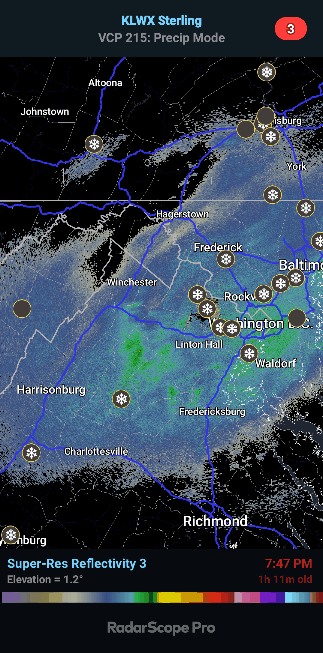
This is a reminder to pay zero attention to the HRRR for this storm unless it really gains a clue. It is off immensely at this point to where a certified meteorologist is not following it at all. It has been wrong the entire event so far. It had ZERO snow north of the Potomac for much of last night and didn’t have any until late runs as it was already happening. It has no snow in the area right now and we know for a fact it is dead wrong.
Don’t bother. NBM is also too low on snow right now and it is because of the HRRR factor into the forecast. NAM Nest is doing a formidable job at the moment. Obs show a nice start and the best ascent is still to our south. Good stuff not till later. Enjoy and just watch it fall. Models be damned.
-
21
-
3
-
-
36 minutes ago, clskinsfan said:
Where is Ji to tell us about the back edge on radar?
He moved on to the next storm
-
1
-
5
-
-
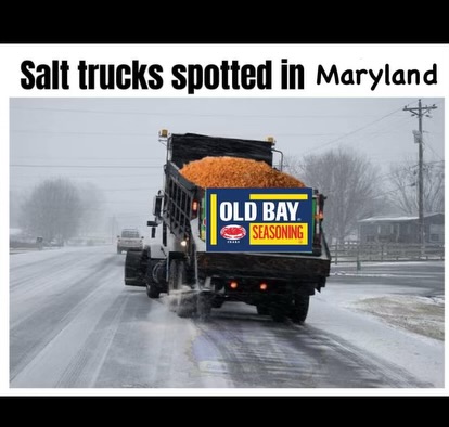
Wife sent this to me

-
3
-
12
-
-
Btw, we picked up my wife’s car from dealership after getting some work done down in Gaithersburg off Watkins Mill. She had 1” on her car pretty easily when we got it (Body shop so was sitting in the lot). I think MoCo up through Howard and Carroll/Baltimore Co’s should do well with this one. Baltimore and Carroll will get theirs later.
-
2
-
-
2 minutes ago, 87storms said:
Legitimate light snow in Frederick with visible flakes out the window. Might have to sneak in a hike soon.
Just came in here to say this. It is a legit light snow that’s accumulating on everything. Radar looks great for this early. It’s beautiful out
-
10
-

Jan 15-16 Storm Thread 3: Obs and Disco
in Mid Atlantic
Posted
I am NEVER leaving this forum