

WxWatcher007
-
Posts
35,667 -
Joined
-
Last visited
Content Type
Profiles
Blogs
Forums
American Weather
Media Demo
Store
Gallery
Everything posted by WxWatcher007
-

"Don’t do it" 2026 Blizzard obs, updates and pictures.
WxWatcher007 replied to Ginx snewx's topic in New England
Someone posted about the pressure earlier? -
"Don’t do it" 2026 Blizzard obs, updates and pictures.
WxWatcher007 replied to Ginx snewx's topic in New England
16 will be tough. I'm just glad I should be able to go over 12". HFD has been gusting good. Might fall just short of blizzard criteria with that 9:50am report. -
"Don’t do it" 2026 Blizzard obs, updates and pictures.
WxWatcher007 replied to Ginx snewx's topic in New England
Haven't seen you post all winter. Glad to see you posting and hope all is well. Yeah, hard to imagine that MA action coming too far west at this point, but the stuff in western CT still looks solid to me. Hopefully that can migrate east later and give us a few more inches of backside fluff. I'm in a minimum, but as I thought it's not as bad as it could be. Did a couple mile walk around the neighborhood in the last hour or so. I'm at 11" here as of 9:15. Drifts between 18-24". Good gusts, low viz, great storm. -
"Don’t do it" 2026 Blizzard obs, updates and pictures.
WxWatcher007 replied to Ginx snewx's topic in New England
What do you think of hi res like the HRRR trying to eject a band west back this way later in the morning/afternoon? -
"Don’t do it" 2026 Blizzard obs, updates and pictures.
WxWatcher007 replied to Ginx snewx's topic in New England
We knew the risks here, though it seems like my area is just enough south to escape the worst of it. Let's see what this jebwalk looks like though. -
"Don’t do it" 2026 Blizzard obs, updates and pictures.
WxWatcher007 replied to Ginx snewx's topic in New England
21G40 at HFD--SN, blowing snow, and FZFG -
"Don’t do it" 2026 Blizzard obs, updates and pictures.
WxWatcher007 replied to Ginx snewx's topic in New England
Not that I'm a fan of the high res right now, but the HRRR continues this idea of another mod/heavy band ejecting west into CT in the early afternoon. -
"Don’t do it" 2026 Blizzard obs, updates and pictures.
WxWatcher007 replied to Ginx snewx's topic in New England
Not as prolific as it sounds like it is for Kev but we're probably doing a little better than we otherwise would due to that.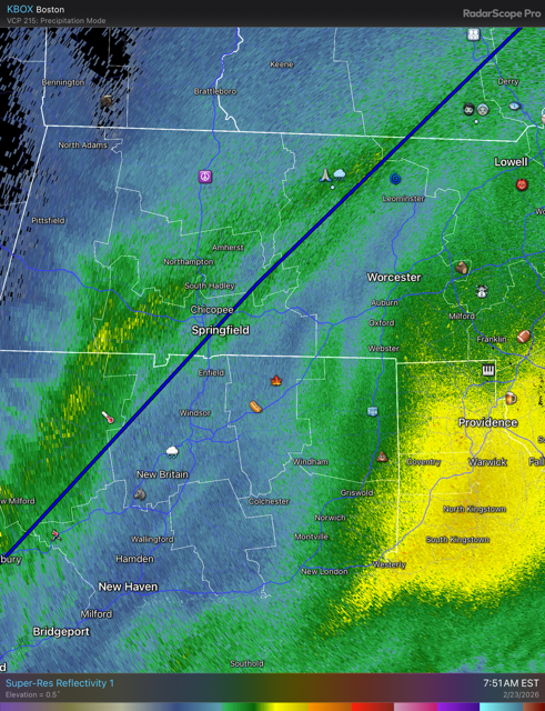
-
"Don’t do it" 2026 Blizzard obs, updates and pictures.
WxWatcher007 replied to Ginx snewx's topic in New England
Feel good about it except here. But need to head back out and measure. -
"Don’t do it" 2026 Blizzard obs, updates and pictures.
WxWatcher007 replied to Ginx snewx's topic in New England
Yassss LFG -
"Don’t do it" 2026 Blizzard obs, updates and pictures.
WxWatcher007 replied to Ginx snewx's topic in New England
Will easily top those numbers in much of CT. Closer call here in the CTRV. -
"Don’t do it" 2026 Blizzard obs, updates and pictures.
WxWatcher007 replied to Ginx snewx's topic in New England
Worst conditions of the storm ironically despite the radar. HFD also reporting under 1/4 viz. Frequent strong gusts. -
"Don’t do it" 2026 Blizzard obs, updates and pictures.
WxWatcher007 replied to Ginx snewx's topic in New England
There it is. First light. -
"Don’t do it" 2026 Blizzard obs, updates and pictures.
WxWatcher007 replied to Ginx snewx's topic in New England
Because that's just how people are. -
"Don’t do it" 2026 Blizzard obs, updates and pictures.
WxWatcher007 replied to Ginx snewx's topic in New England
Jim Cantore basically said he was naked outside with arms open begging for TSSN -
"Don’t do it" 2026 Blizzard obs, updates and pictures.
WxWatcher007 replied to Ginx snewx's topic in New England
You and me both. The wind is really ripping here now. Very low visibility. -
"Don’t do it" 2026 Blizzard obs, updates and pictures.
WxWatcher007 replied to Ginx snewx's topic in New England
Deeply skeptical of HRRR but that would be good for much of CT. -
"Don’t do it" 2026 Blizzard obs, updates and pictures.
WxWatcher007 replied to Ginx snewx's topic in New England
HFD putting up a 51 is insane to me. -
"Don’t do it" 2026 Blizzard obs, updates and pictures.
WxWatcher007 replied to Ginx snewx's topic in New England
Wow BDL G54 -
"Don’t do it" 2026 Blizzard obs, updates and pictures.
WxWatcher007 replied to Ginx snewx's topic in New England
I need something to rot here. We're ripping, but snow growth is just ok. HFD 28G51 FZFG .25 viz Now that's impressive. -
"Don’t do it" 2026 Blizzard obs, updates and pictures.
WxWatcher007 replied to Ginx snewx's topic in New England
Looks like a gravity wave rolled right through there before it opened up. -
"Don’t do it" 2026 Blizzard obs, updates and pictures.
WxWatcher007 replied to Ginx snewx's topic in New England
Cantore got TSSN live in Plymouth lol Twice -
"Don’t do it" 2026 Blizzard obs, updates and pictures.
WxWatcher007 replied to Ginx snewx's topic in New England
Follower in Bozrah reports 17.5" -
"Don’t do it" 2026 Blizzard obs, updates and pictures.
WxWatcher007 replied to Ginx snewx's topic in New England
It's beautiful -
"Don’t do it" 2026 Blizzard obs, updates and pictures.
WxWatcher007 replied to Ginx snewx's topic in New England
Wind is impressive here. Tree tops swaying.
