-
Posts
2,085 -
Joined
-
Last visited
Content Type
Profiles
Blogs
Forums
American Weather
Media Demo
Store
Gallery
Everything posted by bristolri_wx
-
Congrats on the baby. Nice to see someone else on the board interested in Fantasy Baseball as well, which is the real fantasy sport IMO. The snow will come when we're least expecting it or paying attention. That's how it works. I think Feb and March will be better than Dec and Jan, not because we're due, but because there is a pattern change going on that could work in our favor much more so than what we've been seeing the last two months...
-
Queue the Blizzard of 2023 on Feb 17th, or whenever your trip begins. LOL!
-
I’m still optimistic we get some snow between now and April 1. All the lovely maps that show the west cold show cold in Canada as well. That’s a definite pattern shift. We fight the SE ridge in mid Feb but it seems to cool down afterwards heading into March. We shall see.
-
Head Meteorologist Vernon Wermer with the forecasted final snowfall totals for Southern RI and SE MA for tomorrow:
-
We don’t need anything from Siberia, they can keep their cold. All we really need is for Canada to stop averaging +10-20 anomalies for weeks at a time. The air masses in place every time we get an event have literally been hot garbage. There’s nothing to tap into to generate snow… Siberia and Canada can be cold at the same time, it doesn’t have to be an either/or scenario.
-
I'm still optimistic about the next 6 weeks. One thing that continues to be shown is that Canada is finally going to cool off. Yes, the little below normal stretch in late Jen/early Feb is not sustained in the US, but it does seem to be in most of Canada, based on the CFS weeklies and the 35 day GEFS, and even when eastern Canada warms a little, its not torched like it has been. While it might not be good for sustained snow pack, we're going to have our chances with storms, especially as the SE ridge modulates - when it fades a little we might get our chances at some coastals with some cold air to feed them, even if its a positive anomaly overall for the month. I may still be S-O-L in the coastal plain for most of the upcoming chances, but, overall for New England it's a much better pattern for potential snow. I do like the colder trend at the end of the month as well. Just my two cents... We'll see how I feel about this prognostication on March 1!
-
-
Pingers here, 32.
-
-
I will do my formal observation here that we have a nice coating on the grassy areas, and bands have been moving in then getting shredded by that dry air. I’m really on the edge here… but some nice January weather regardless. 32 here.
-
Perhaps my sarcasm was too understated for the recent weather pattern. The overall vibe here lately is we will never see snow again. Thought I could spice things up here… considering the dire conversation. That being said it was probably posted in the wrong thread…
-
Hey it’s doing something funny outside. Not sure what it is. White stuff flying out of the sky and sticking to the ground. Crazy stuff!
-
Wow I thought I had deleted that post quickly! I mistakenly thought you posted a CFS v2 output map, which usually tends to run warm. (As others mentioned, “Climate Forecast System) The extended 00z GEFS is relatively new since the upgrade to the GFS last year…
-
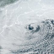
That's quite an autumn nor'easter out there tonight!
-
-
I have an electric one and rarely use it. Since I've purchased it 5 years ago I think I've used it 6 times. Usually it's not enough to bother (I have a small 2 car driveway), or, too wet to use it efficiently. At the same time, no way I'm spending money on a fancy two stage for the two or three sloppy storms per year I might get some use out of it. It's worked fine on the big storms we have had where the snow was 8:1 or higher. I voted no because if there's anywhere that's probably gonna get screwed this year, it's the coastal plain down here near Narragansett Bay, with warm SST's and warm tounge's at 900mb on the NAM.
-
It's hard to give up on an entire winter in early Jan. I still feel confident that the pattern breaks to something more favorable for winter enthusiasts in late January into February. As many have said, Canada is warm too right now so every storm is a threading the needle situation until that reverses. The ensembles and long term climate models are still pointing to a change in that scenario. Once Canada cools off it's easier to get SWFE events and other storms that develop when the upper air pattern is more favorable. That being said, we may still end up with a below normal winter for snow because of all the missed time, so if that's your definition of a ratter, then it's a high probability it will occur. But overall patience is the key the next couple of weeks...
- 203 replies
-
- 1
-

-
- ratter
- regression
-
(and 1 more)
Tagged with:
-

New England Met Winter 2022-2023 Banter
bristolri_wx replied to HoarfrostHubb's topic in New England
Totally confused today checking in on threads. There's a small snow storm in the forecast, and med/long range is improving as well. I thought it was gonna be 60 degrees the rest of January with anomalies so high they need to invent new colors on the model maps? /s -
The CFS weeklies give a better representation to what causes that map. The above normal temps are front loaded, while the second half is AN but to a much lesser extent. Not sure I see the full value in a monthly map being posted for Jan when there are weeklies from the CFS, GEFS, and EPS available that provide better context for the actual weather.
-
It's going to be tough for anywhere other than NNE to pickup any snow next two weeks unfortunately. Canada just doesn't have any real cold for us, so it's gonna be the "lucky nickel and dime" stuff next few weeks. Thankfully as others have mentioned mid January into Feb looking good for at least having the right conditions for snow in all of New England. And if you are looking at long term models Feb and March look cold. Hopefully not suppressed. Maybe another back-loaded winter? EDIT: Snow Depth Loop for the same GEFS run - again just showing that we are looking good mid-January forward.
-

New England Met Winter 2022-2023 Banter
bristolri_wx replied to HoarfrostHubb's topic in New England
Agreed. I've done the same as well. And to be honest it doesn't have to be super-strict moderation. Directly responding to someone with a meme or a "beer" is fine, IMO, as long as the original post is on topic. But we have 57 pages of January Obs/Discussion on 1/2/23? How is that even possible, without a storm in the forecast. Some self moderation is probably the key going forward... -

New England Met Winter 2022-2023 Banter
bristolri_wx replied to HoarfrostHubb's topic in New England
First - I hope Damar Hamlin is okay. Looks like the game is done for this evening... That being said. Addressing some of the "whining" and such on some of the other threads. I think we just need a return to the moderation we had a few years ago. Right now there's a bunch of discussion going on in the Obs/Discussion thread that should be in banter. The "panic" can be in banter too. I can remember seeing stuff moved in the past, perhaps that's all that's needed to get the Obs/Discussion thread more focused again. The "whining" used to be done in banter. Now banter seems to be treated as an off-topic thread, when it doesn't have to be. Look in Obs/Discussion now, there's a post about a boulder falling on the highway, and discussion about Hamlin there as well. Just my two cents. I fully acknowledge that it's easier said than done, and moderation can be a pain since it's volunteer based... -
Yup. Whole household has been dealing with waves of colds/viruses for couple of months. We have been all sick since after Christmas. Worst cold/flu season in a long time.
-
Personally, it's nice to have it cold around the holidays, even if it isn't snowy. However, once New Year's passes, as much as I enjoy the interesting weather, if it's torching so-be-it. I'm sure I'm in the minority...


