FallsLake
-
Posts
6,318 -
Joined
-
Last visited
Content Type
Profiles
Blogs
Forums
American Weather
Media Demo
Store
Gallery
Everything posted by FallsLake
-
Surface temps are cold as well. I don't think the rain/frozen view shows ice. RDU down towards Charlotte stays at or below freezing for a good portion of the storm.
-
yep, much better:
-
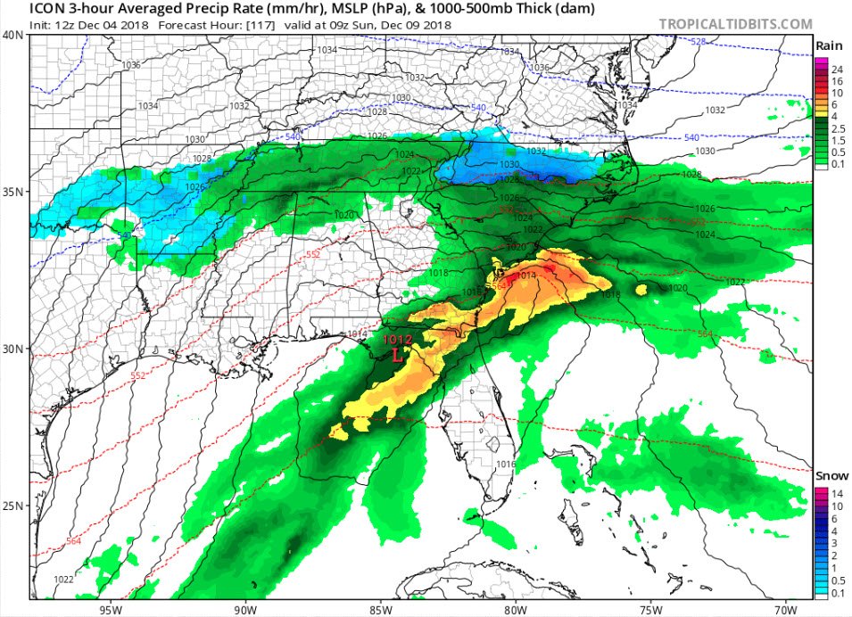
Sure is. 540 line is more south (in S. VA).
-
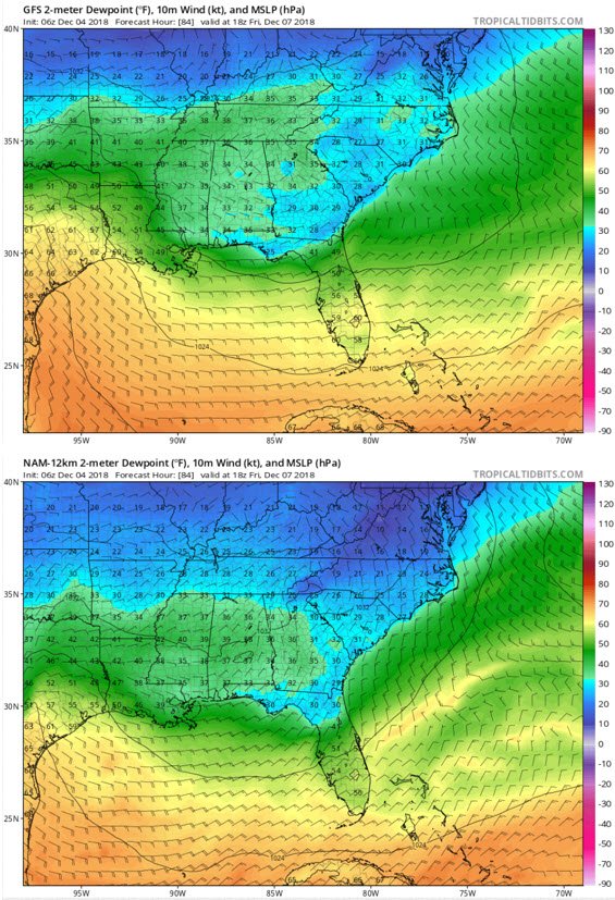
With all the model outcomes you have to like this look for a major SE winter storm (..with temps in the 30s and dew points in the teens). 12z NAM hr84:
-
That was a hurtful storm for myself. Started as a beautiful snow and laid down a couple of inches, but then went to rain and washed everything away.
-
If the current runs are correct, it would probably end up like that.
-
As currently modeled, this storm does look like that 2017 storm. Miller A with a sharp cut off. I'm not sold that this will play out the same. I'm thinking CAD is going to be depicted stronger in the coming days and we end up with something more like the 2002 storm (snow to the west and a big ice storm on the east edge). Now where that east edge sets up is anybody's guess.
-
We need the surface temps colder. 32/33 with heavy snow will provide 5/6 to 1 ratios.
-
Lol..I was sweating it the whole time. See that orange at the top of wake County, that's where I'm at. Lots of snow and sleet. I could smell the rain.
-
Still days away. Models still need to get a handle on the details (like CAD and dew points). GFS(FV3 similar) Vs NAM at hour 84:

-
For what it's worth, the 6z NAM is much colder then the 0z/6z GFS (at hour 84) with the push of surface dew points. CAD being under-modeled?
-
We still have days of model runs. I personally think the high will be stronger and a stronger CAD will materialize (in the models). RAH even discussed their thoughts that there would be wide zones of precip types. The last few model runs have not shown much ice (mostly snow/rain). I think that will change in the models in the coming days.
-
We haven't heard from him since the hurricanes. I think he's on another site.
-
I like RAH's afternoon discussion: Sat-Mon: A strengthening mid-upper trough/low will cross the S Plains, Gulf States, and Southeast during this period. Models are fairly uniform in showing some polar stream interaction such that the system should slow and deepen as it crosses the Southeast. This will allow for cyclogenesis over the NW Gulf (where so many of our wintertime storms are born) and foster further intensification as it crosses the Gulf Coast / N FL and off the Southeast coast by Sun night or Mon. The ECMWF remains significantly slower than the GFS (by 6-12 hrs) and takes a farther-north path, such that it is generally a bit warmer but with greater QPF as its slower movement allows for greater deepening near the coast with a long-lived deformation back extending well inland through Mon. While confidence is rising that we`ll get a decent precip event and that a single dominant low is the most likely pattern of cyclogenesis, there is still too much model spread for much specificity. This model spread is not surprising considering the mid level feature in question is still currently well out over the Pacific. Will maintain high chance to likely pops, higher across the S and SE, starting early Sat but peaking Sun. Climatology for immature (still-developing) Miller A patterns supports broad corridors of mixed precip type, and the deterministic forecast will indicate this. It`s far too early to speculate about amounts of wintry precip, but we could be looking at a few inches of liquid (or liquid equivalent) before all is said and done. Highs each day will generally range from the upper 30s to mid 40s NW to SE, with nightly lows in the 30s. -GIH
-
You're sitting pretty right now, most model solutions give you a nice event.
-
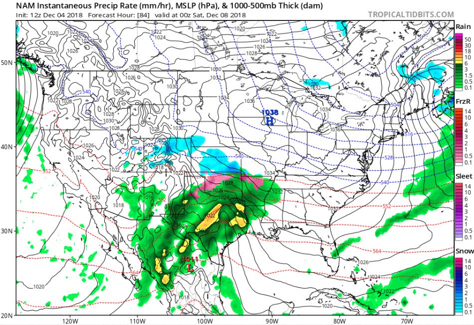
Stronger CAD signal then the 0z at the same time.
-
This run of the FV3-GFS sucked from the standpoint that all it can do now is show a worse solution in future runs. Don't get me wrong, I love seeing 2 feet forecasted for my location, but it's all downhill from this point (or maybe downhill, uphill, ….).
-
Kind of pissed. I only get 20" while folks west of me get 29.
-
I hate how the model just stops updating. And then also misses hours. I guess that will be fixed once it takes over.
-
Lol it just scoots right out to sea. Still some decent wintery precip totals for southern parts of SW/central NC and NW SC.
-
Yeah at 120 its slightly SE of the 6z run
-
With that 2000 storm there were some high rates as well. I'm with you, for impact is was huge.
-
That was in November. Most mets stated the fact that this was a problem. RAH even said that it was a classic winter setup for the upper SE, but most would just get rain because of the time of year. Not saying this storm will produce but it's not mid November any more.
-
The strength of the CAD / supporting high is crucial. Hopefully there is more transition zones. When this occurs our area does well with wintery precip. If there is a sharp snow/rain line somebody in our area (to Charlotte to the SC up state) is going to be unhappy. I still think the December 2009 storm is a possibility. Miller A with good snow totals in the western piedmont but a messy snow to rain event for RDU.
-
If a strong CAD is in the cards for this storm, the models will progressively show a colder solution as we get closer. **usually