FallsLake
-
Posts
6,318 -
Joined
-
Last visited
Content Type
Profiles
Blogs
Forums
American Weather
Media Demo
Store
Gallery
Everything posted by FallsLake
-
Lol...yep we need to cash that out now and run.
-
Nice run for so far (hr 96) for our area. We will want to see this transfer to the SE to the coast for us to stay wintery.
-
I agree, as long as it didn't have any "erroneous" issues it's another possible outcome.
-
It would be nice sometime to get a winter storm that drops similar (large)amounts of snow across the whole county.
-
For RDU folks, this was a better run. As currently modeled, the farther west and north from Raleigh the better. **If it's right I barely stay all snow through the event. I've seen this too many time.
-
12z ICON was slightly better (at least for RDU) then 6z. ~3 to 4" in the Triangle before a switch over.
-
12z NAM seems to be catching back up to strength (1041) at hour 75. But the push of cold has backed slightly off.
-
As Grit just stated, if there is more ice then I think we get a big storm. If this is a miller a snow/rain storm we may only get that 1" (...then it will wash away).
-
Lol...I'll take my >1" and be happy. Kidding aside, I would expect a little more then 1" but that is a possibility.
-
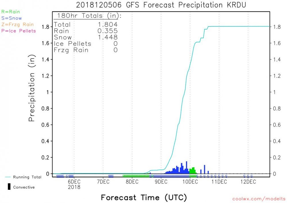
Here's RDU:
-
We always live on the edge. As always there's going to be transition lines running through Wake County. I think if the GFS(s)/euro are right, we're looking at some front end snow changing to rain, and then back to a little snow. Honestly I would think a few inches at best (messy). If the NAMs depiction of the CAD is right, I think we still mix but it wont be plain rain. More sleet and freezing rain, which would end up a significant storm for us.
-
True. I'm hoping the next model runs start to lean towards it's depiction.
-
With that look it's still perfect. I dare say anything stronger would suppress the storm way south.
-
I need it to shift north a little.....
-
Yep, this is our hobby. It's like playing a board game where you roll the dice every 6 hours.
-
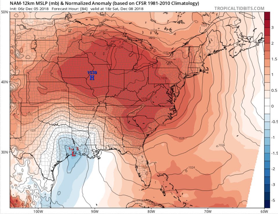
The 6z NAM is beautiful. Very pronounced CAD with an ideal high and low setup:
-
Sure did. So we had some models shift north while the GEFS ensemble shifted south. Just tells us we have more model watching to do...
-
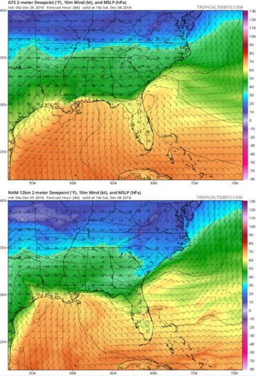
The 6z ICON (compared to 0z) shifted the heaviest snow totals from western NC into SW VA.
-
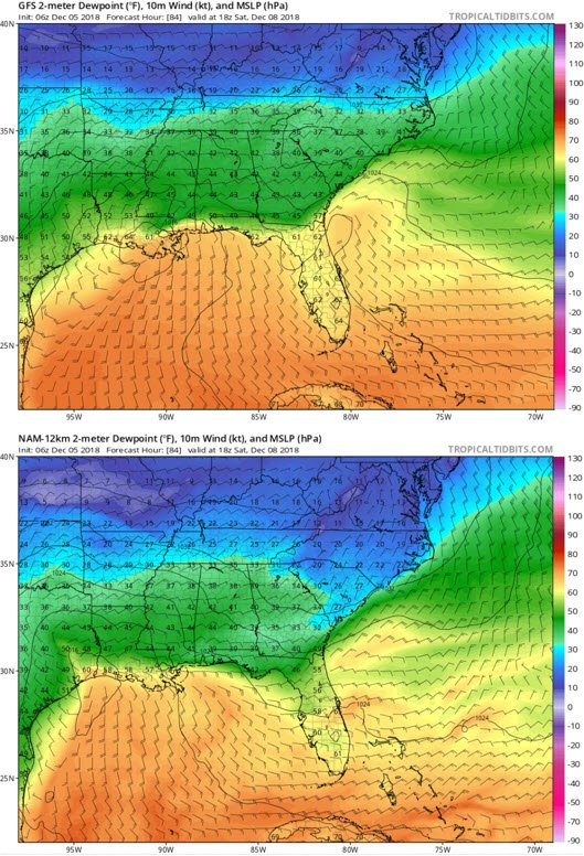
To his point, here's the comparison of the GFS and NAM at hour 84:
-
Hey Brick it's nice to see you post man! Lets see if we can get some snow for our area.
-
If the NAM is on to the colder temps (better CAD setup), I think we can get a significant storm. The question is do we get a 2009 storm (miss for us) or a 2002 storm (major ice storm).
-
Slightly colder dew points; especially into north central SC.
-
For RDU and charlotte folks, the 12z GFS was definitely a better run. It shifted the cold slightly to the SE. We need all the slight shifts SE we can get.
-
At least it's better than its last run.
-
Just looking at the panels for RDU, it looks like snow or ice for 12 hours before any change over.