SouthCoastMA
-
Posts
8,571 -
Joined
-
Last visited
Content Type
Profiles
Blogs
Forums
American Weather
Media Demo
Store
Gallery
Everything posted by SouthCoastMA
-

"Don’t do it" 2026 Blizzard obs, updates and pictures.
SouthCoastMA replied to Ginx snewx's topic in New England
Yeah, still out here -
"Don’t do it" 2026 Blizzard obs, updates and pictures.
SouthCoastMA replied to Ginx snewx's topic in New England
This looks much worse than Jan 22 here, despite my complaining about being just east of the 3ft band. Gotta be at least 20"..drifts are gigantic. Unfortunately I can't measure -
"Don’t do it" 2026 Blizzard obs, updates and pictures.
SouthCoastMA replied to Ginx snewx's topic in New England
I only see my old locale on the PNS Acushnet: 31" Fall River likely had close to 3ft -
"Don’t do it" 2026 Blizzard obs, updates and pictures.
SouthCoastMA replied to Ginx snewx's topic in New England
I have relatives in Warren RI and they are saying at least 3ft -
"Don’t do it" 2026 Blizzard obs, updates and pictures.
SouthCoastMA replied to Ginx snewx's topic in New England
New Bedford 32" fml. I'm guessing my old house had around that -
"Don’t do it" 2026 Blizzard obs, updates and pictures.
SouthCoastMA replied to Ginx snewx's topic in New England
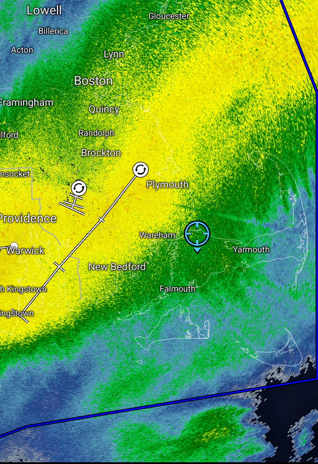
Heavy attm. those echoes might finally be reaching me downstream from radar -
"Don’t do it" 2026 Blizzard obs, updates and pictures.
SouthCoastMA replied to Ginx snewx's topic in New England
Getting close to its annual average with one storm is impressive. -
"Don’t do it" 2026 Blizzard obs, updates and pictures.
SouthCoastMA replied to Ginx snewx's topic in New England
Might actually be pivoting a bit now. -
"Don’t do it" 2026 Blizzard obs, updates and pictures.
SouthCoastMA replied to Ginx snewx's topic in New England
That whole area is like 24-30 -
"Don’t do it" 2026 Blizzard obs, updates and pictures.
SouthCoastMA replied to Ginx snewx's topic in New England
Yeah it's still snowing but light to mod. need that to shift a bit more. once winds go due North I guess, but then it will start drying up -
"Don’t do it" 2026 Blizzard obs, updates and pictures.
SouthCoastMA replied to Ginx snewx's topic in New England
Brutal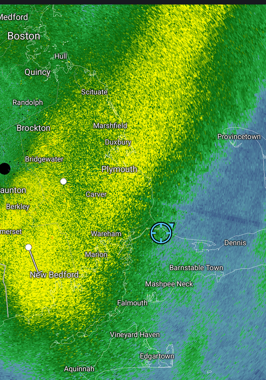
-
"Don’t do it" 2026 Blizzard obs, updates and pictures.
SouthCoastMA replied to Ginx snewx's topic in New England
Just lost power. I'm must've been one of the few left on the Cape to lose it this late -
"Don’t do it" 2026 Blizzard obs, updates and pictures.
SouthCoastMA replied to Ginx snewx's topic in New England
It's been decent the last hour, hopefully can add a few this afternoon to make it respectable, relatively speaking. The wind has been super impressive -
"Don’t do it" 2026 Blizzard obs, updates and pictures.
SouthCoastMA replied to Ginx snewx's topic in New England
what a cocktease here. just stalled 10 miles to my west and not budging -
"Don’t do it" 2026 Blizzard obs, updates and pictures.
SouthCoastMA replied to Ginx snewx's topic in New England
wtf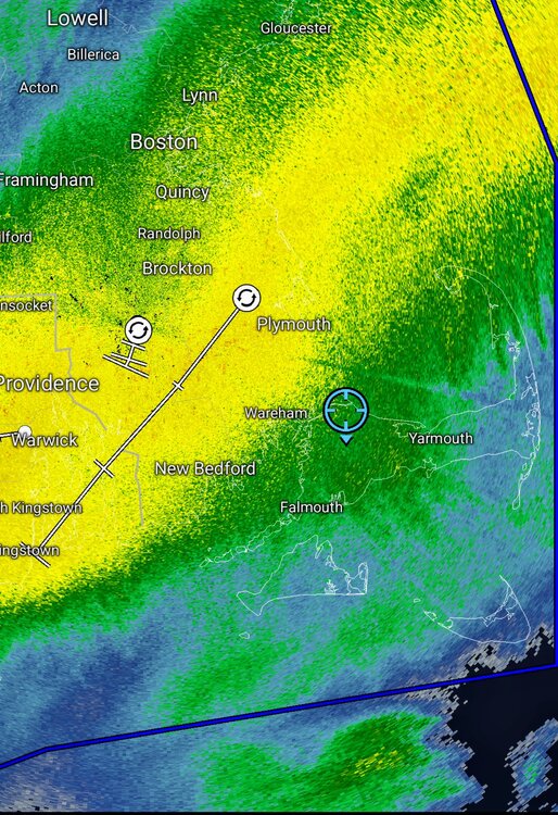
-
"Don’t do it" 2026 Blizzard obs, updates and pictures.
SouthCoastMA replied to Ginx snewx's topic in New England
Best has definitely been to west of me..but gotta be somewhere in 10-12" range. Wonder if that fronto pushes east a bit -
"Don’t do it" 2026 Blizzard obs, updates and pictures.
SouthCoastMA replied to Ginx snewx's topic in New England
gust to 72 close by winds are really amping up now -
"Don’t do it" 2026 Blizzard obs, updates and pictures.
SouthCoastMA replied to Ginx snewx's topic in New England
Kingstown RI will end up between 30-36" if this continues -
“Cory’s in NYC! Let’s HECS!” Feb. 22-24 Disco
SouthCoastMA replied to TheSnowman's topic in New England
NAMs are still 1.7"+ for you -
“Cory’s in NYC! Let’s HECS!” Feb. 22-24 Disco
SouthCoastMA replied to TheSnowman's topic in New England
you'll get 15-18". enjoy -
“Cory’s in NYC! Let’s HECS!” Feb. 22-24 Disco
SouthCoastMA replied to TheSnowman's topic in New England
maybe WeatherGeek can filter that through AI to get a more futuristic aesthetic -
"Don’t do it" 2026 Blizzard obs, updates and pictures.
SouthCoastMA replied to Ginx snewx's topic in New England
Be careful with transport -
“Cory’s in NYC! Let’s HECS!” Feb. 22-24 Disco
SouthCoastMA replied to TheSnowman's topic in New England
In an email, Eversource setting the bar super low, saying 3-5 days for power restoration . im effed -
“Cory’s in NYC! Let’s HECS!” Feb. 22-24 Disco
SouthCoastMA replied to TheSnowman's topic in New England
Me too. I'll get weenied for that though -
“Cory’s in NYC! Let’s HECS!” Feb. 22-24 Disco
SouthCoastMA replied to TheSnowman's topic in New England
3.2"+ at my old house in Acushnet on 3k NAM