

olafminesaw
-
Posts
3,052 -
Joined
-
Last visited
Content Type
Profiles
Blogs
Forums
American Weather
Media Demo
Store
Gallery
Posts posted by olafminesaw
-
-
FWIW the RGEM absolutely nailed the temps for the prior event at similar lead time:

Here is what it is currently showing for the Thursday system:

-
Also of note, the timing of the heaviest icing seems to be in the early morning hours
-
-
4 minutes ago, ILMRoss said:
Just going to throw this out there- there's a razor thin margin between sleet and ice that a lot of models won't be able to resolve. I think often what a model resolves as ice often verifies as sleet. In my opinion, I wouldn't necessarily take raw model outputs as gospel until the hours leading up to an event and there's a whole treasure trove of short range models (including hrrr) taking a crack at where each boundary will set up.
Yeah, this is definitely a sleet sounding

-
When we can't help but root for an ice storm, because it's all we've got:

-
 2
2
-
 2
2
-
-
-
1 hour ago, WXNewton said:
18z ICON just laid the smack down for freezing rain on Thursday. Would be a devastating ice storm for many if that model is even remotely close.
Although, it has actually overdone the wedge at times, with this past ice storm. It had us in the mid-20s during the heavy precip, I believe
-
Meanwhile, all of texas is covered in winter storm watch/warning or advisory. Salt in wound
-
1
-
-
Could be a bit of a re-freeze tonight

-
Slug of heavier precip incoming. Looks like it may contain some sleet or such.
-
-
Pretty significant changes


-
2 minutes ago, chapelhillwx said:
Lolz. I know what both of you mean though.
Yeah, I mean, for the Triad every half degree is going to account, especially as the precip is going to be pretty heavy. At 31 degrees, I don't see more than .1-.2" accreation. At 29 I could see .3-.4"
-
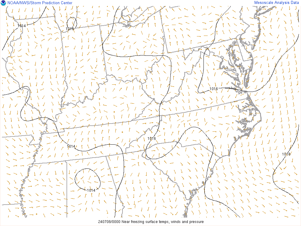
Interestingly, if anything the HRRR has backed off somewhat the past couple runs on how cold it gets. Minor differences, but now it seems to hold temps pretty steady throughout the night, instead of dropping further.
-
You can see precise temp (.1 degree increments readings here for different mesonet sites :https://mesonet.agron.iastate.edu/sites/current.php?station=GSO&network=NC_ASOS
-
1
-
-
1 minute ago, CaryWx said:
30* might do some light work on us but those 28s* are going to be grim for a few folks
Yeah, it's a huge difference between 32 and 30 and between 30 and 28. At 28, everything will freeze solid.
-
Question, does 32 count as a sub-freezing high?
-
This may genuinely be the most miserable 3 day stretch of weather I've experienced. At this point I'm embracing it's extreme suckyness. This kind of pattern only comes around every 5 years or so after all!
-
Light glaze on trees, some residual sleet on elevated surfaces and mulch, roads are just fine in Greensboro (including overpasses)
-
1
-
-
I've been burned by the HRRR too many times, but it's has a much deeper cold pool
.thumb.png.284675b00a060df85d9e3fd25bb045b8.png)
-
RGEM runs cold but....


-
Probably too cold, but I could definitely see a decent glaze on trees happening early Saturday

-
1
-
-
5 minutes ago, wncsnow said:
Euro appears to be slightly quicker with the cold push so far after Saturdays rain
Still the slowest out of all the major models
-
ICON straight up doesn't make sense. A strong low low passing just to our north, and temps never rise above 25 for many?
-
1
-


.png.6621c0d59aa9589ac5e433af9bf307fe.png)


Mid to Long Term Discussion 2021
in Southeastern States
Posted