

olafminesaw
-
Posts
3,052 -
Joined
-
Last visited
Content Type
Profiles
Blogs
Forums
American Weather
Media Demo
Store
Gallery
Posts posted by olafminesaw
-
-
GFS looks, warm, but just glad it didn't jump north. Time to start relying on hires models.
-
Loooong range HRRR looks nice. An initial thump like this would go a long way towards dropping surface temps (even factoring in the HRRR's cold bias) may get sleetier than expected.

-
 1
1
-
-
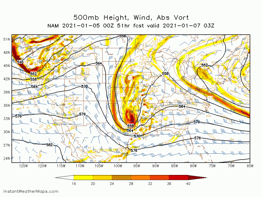
6z models bring the moisture but seem pretty warm
-
NAM looking north at 45
-
Much different system but:
-
1
-
-
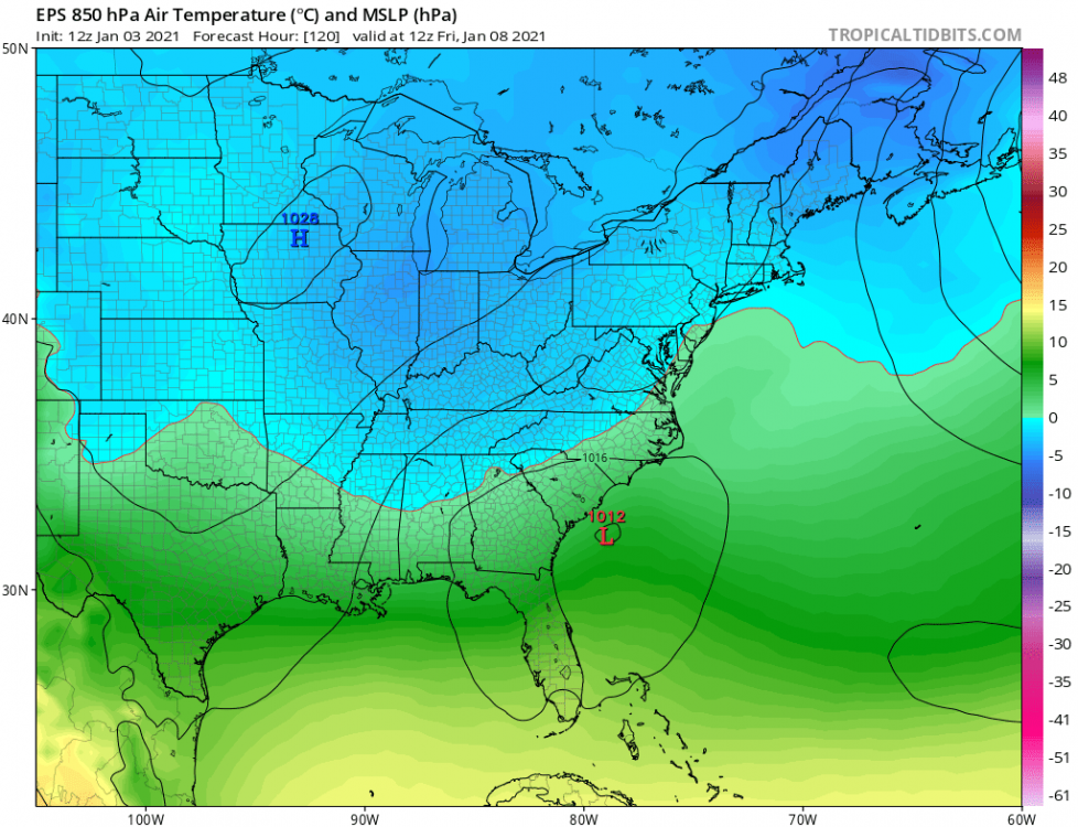
I feel like the Euro likes to overdo precip in the medium range sometimes, but wowzers. Lock that puppy in
-
24 minutes ago, TARHEELPROGRAMMER88 said:
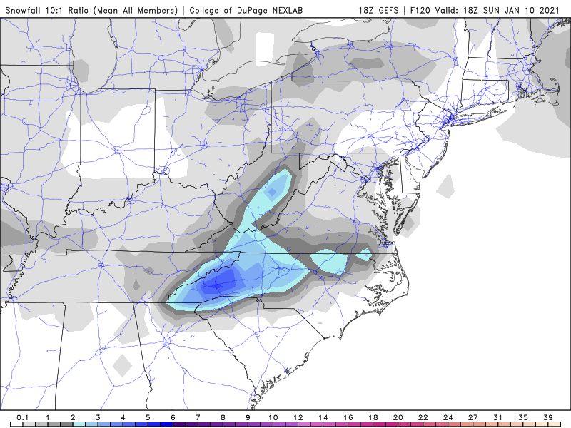
Anyone have GEFS snow totals in NC?
Becoming a lot less relevant, but:
-
1
-
-
14 minutes ago, Jonathan said:
Jamey Singleton on Twitter: "This doesn't make sense to me. But it's off the same model (GFS). The Euro does it, too. Brings the moisture and dynamics in, with nothing to show as a result. I'm not buying those snow amounts. #vawx #ncwx https://t.co/hvbZNI3dcP" / Twitter
Interesting tweet from a local met here in southern VA.If he's correct, we'll see a response in the models by 0z. May have to do with convective feedback. Definitely a storm where the hires models will be super helpful.
-
2
-
-
6 minutes ago, Jonathan said:
Is it me or has this thing shifted from overnight Thursday into Friday to mid-day Friday into Friday night? THAT'S definitely not a good trend.
Yeah, it seems do be drier with the initial surge of moisture, but then the low kinda backs in towards the coast, allowing moisture to back-build. Could be good for ensuring some snowfall across the board, with less WAA and more consistent banding (after a potential initial thump)
-
1
-
-
RGEM looks really good for the piedmont/mountains. Slower than the rest of guidance, but pretty wet
-
Exactly what I like to see 3 days out

-
Bowling ball incoming
-
I'm not liking the borderline temp profiles. Seems pretty rate dependent. But, a good chance we see some snow for some of the storm at least, but has that miller-B screw-job kind of look, where the moisture dries up and the cold air never really gets established.
Chance of an inch in Greensboro: 50%
-
Not bad
-
1
-
-
16 minutes ago, BornAgain13 said:
12z EURO

Sent from my SM-N981U using Tapatalk
Mostly sleet south of the VA border
-
29 minutes ago, BornAgain13 said:
Eric Webb tweeted that he's not real excited about this setup.
Yeah, not too thrilled about a thread the needle setup at the front end of a pattern change. And yet, the best chance of the year. Mountains and central VA, a different story though.
-
-
GSO has now surpassed 2003 to become the second wettest year on record. 1.76" is necessary to surpass 2018. Feels like a much more tame year than 2018, but consistent rainfall had pulled us close. The GEFS has ~1.2" through the end of the year
-
3 minutes ago, calculus1 said:
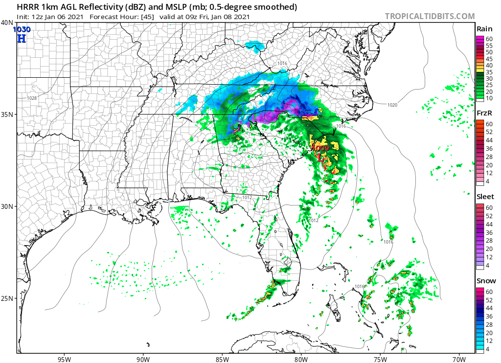
The HiRes NAM has much lower ice totals than these lower resolution models (e.g., NAM and RGEM). I would tend to give it greater credence and doubt those high totals will realize.
Sent from my moto e5 supra using Tapatalk
Also seems like the models spitting out high ice totals, like the RGEM, do wonky things with convection.
-
18 minutes ago, jjwxman said:
The 18z Euro wants to develop are narrow band of dynamic cooling aloft over the Piedmont Wednesday afternoon. Actually supports a brief period of snow. What is going on??
.The HRRR is picking up on this is well... Could be interesting, with some pretty wild dynamics. Short lived window though, just before going into a dry slot

-
FWIW, the hires nam was 3-5 degrees too warm this morning
-
Dewpoints on the HRRR are about 6 degrees (mid 20s) colder on the HRRR than the hires nam (low 30s) after sunset Tuesday
-
 1
1
-
-
The biggest detractors from significant icing are temps near or above freezing prior to arrival of precip and heavy precip reducing efficient accreation. Factors in favor are, of course our healthy CAD and also fairly respectably low dewpoints. I would say more than .1-.2" is pretty unlikely outside some isolated spots closer to the mountains.
-
3 minutes ago, WinterWxLuvr said:
Yes. If you think ground temps don’t matter than I don’t know what to say. As warm as it s now, it will take half the storm to just get the ground cold enough for the snow to stick.
Right up there with radar attenuation...
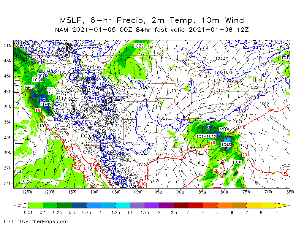


January 8th-9th threat
in Southeastern States
Posted
The Euro definitely moves quicker and hugs the coast less than the NAM, which is one reason for the discrepancy. I think the hires NAM works as a decent middle ground (although I'd definitely think less than it depicts Is likely)