

Typhoon Tip
-
Posts
43,440 -
Joined
-
Last visited
Content Type
Profiles
Blogs
Forums
American Weather
Media Demo
Store
Gallery
Everything posted by Typhoon Tip
-
Fwiw - that was a comment on the NAM... The hard numbers on the NAM grid were in fact the hottest of the stretch, for Tuesday, over Logan. Whether that materializes 2-m to 37 or not..I wasn't ready to render an opinion - it's the NAM ...still 42 hours out at the time, which isn't in that particular guidance' wheelhouse of never. The 850s were closer to 20C on the 00z run
-
Hottest day of the stretch is Tuesday by this NAM solution. Heat burst look too that 18z interval. Surge to 581dm over perfect wind trajectory and T1 to 32C serves up a 2m of 37C
-
It's a good question ... Shy of emailing these oceanographic institutions/science orgs, the Internet seems to have trouble finding that data. For me, I want the 'record breaking ssts' Just anecdotally I recall some fantastically balmy waters between 1998 and 2000's summers in there. Off and on 76 a down near Narraganset/ L.I. Sound, since. But, I don't recall ever seeing a circumvallate that large NE of Boston over the lower GOM that is engulfing 72 to 75 F SSTs. That's nuts. There's that typical upwelling core near ACK with that chilly node - or ...it's a perennial buoy malfunction - which ever. heh. But otherwise, between the GOM warm pool and the 26C isotherm packed in so tight in the Shelf ...uh, that's pushing it in the aggregate. The other aspect - the thermocline is not extraordinarily deep N of the mid Jersey. Those warm waters really are quite surface. 10 or 20 foot down and it's testicle ache under that disk of warm water NNE of Cape Ann, no doubt.
-
Bingo! ...big personal fan of "anomalies in competition" In fact, the one's that seem to be "winning" tend to even hide their competitor when they are in the lead. CC/GW is uniquely qualified to take a back seat to any ... 2-decade warm stint(cold stint) depending. That said, LOL ...umm, I don't really believe cold winters are a thing of the past. That was snark to poke the hornet's nest during a torrid summer, such that those that want winter might be ( hopefully) particularly offended that we could conceivably move from this paradigm into an uninspired winter that offers 0 pay back. ... No takers though ..
-
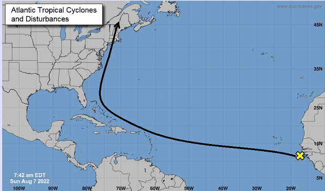
With the MDR out in the Atlantic more active with an invest... some of the Euro ens members carry a TC along... Most probable outcome, considering all natural physics thought to effect these destinies ... this is going to effect the EC like this, ....with the greatest amazement in dramatic historical implications, ever in history, the week I am in Michigan
-
Yeah...that sea ice engagement over there in the climate sub-forum ? This'll probably irk folk, oh well... I'm not sure that stuff has much use for me. The arctic ice is holding up better ...okay - within a realm of totally f'ed implications. (I'm not shading you here...just using it as statement catalyst). Yet, there's this kind of comfort seeking ( I suspect) aspect, evinced by the quickness in which posting happens where the weekly numbers expose were above x-y-z years within the group f'ed implications. When in reality, we are also behind a lot in that same group since 2000, all which are dire. It seems that's a hope support group.
-
mm... I dunno about this subjective stuff - mainly because by nature of it, one does not ever 'really' influence folks with their pearls of wisdom and arresting powers of speech .. lol Shakespeare would surely fail, amid this vitriolic hoi polloi, so ...heh, the attempt may not work too well. That said, still, the number of days in June that were of that chamber ilk, I'm pretty sure exceeds the total any summer typically allots. Check this, but it 'seems' like 20 out of 30 of those days were competitive for 'top 10' ranking, and considering there are only 12 weeks of summer, and ... there was still decent days in July adding to the bliss total, I'm not sure we really have room here for much complaint. It's certainly not timely ... And since, getting two back to back, week long heat waves certainly becomes erosive to patience. It just means that the distribution of the nice days vs ones that are subjectively not so nice ( for whatever personal druthers), was not as agreeable. I don't personally think the characterization this morning survives the statistical test, frankly. But we do this... we could be flirting with above normal snow fall for the winter, and then miss too coastals in row, and we're comparing to 2012. This is an emotional engagement - probably could just say that. haha
-
Late to the party this morning ... but cursory evaluation suggest the BD has trended up the coast - ~ PWM by 21z Monday. I'm sure everyone knows this ..blah blah. However, convection is a wild-card. With all this ginormous CAPE things get a bit touchy, and that may not be handled well. That would be very short-term/now-cast correction if need be, but if the boundary has modest momentum toward PSM by 21 Z Monday, then... a cluster of boomers runs out along it, it will push that boundary farther SW of guidance. That said, ... not likely to happen - no. I see that as best and only hope for salvation. Otherwise, the NAM doesn't like a BD anymore, and being between 36 and 60 hours ... is not a good sign for BD. Only mentioning it because the 3km to 32 km versions were pretty horny on that idea in yesterday's runs, as was being highlighted. Yes the models a p.o.s. for synoptic... but it's also got the finite BL resolution...etc. Anyway, it's actually surging the hydrostatic heights over Logan to 580!! I'm not sure I've ever seen 580 get breached after the first week of Aug ... T1 is 30 C, but I've noticed with the FOUS grid, that particular metric is just about invariably and always initializing 1 or even 2 C above the previous runs. So... if say 32C at T1, given no interference from clouds or wind direction, should produce a 36 to 37C 2-meter... I don't want any part of that with DPs above 60 let alone 73.
-
Looks like 2-m 35.. 36C as a general SNE potential
-
NAM is an inferno on this run straight thru Tuesday
-
Imho June coming in legit negative for the month at all climate sites was extraordinary. But for warm summer enthusiasts it unfortunately ruined this year.
-
I’m not part of your conversation but just be careful using the significance of Logan … particularly comparing years. That site can flip the wind SE and 89 a whole week when it’s 95 on the Cambridge side of the river
-
Also I’m wondering about so many days above 95 … not just Logan but all sites combined. I don’t recall seeing so many 96.8 to 99.4s But it’s been dry. Been having difficulty keeping DPs above 65 on a lot of those days. The nights haven’t been terrible because of that. It’s been as much a story about large diurnal swings. … I mean it’s dewy now but thru July etc. So sites are “only” running +5 or 6 thru these first five days of August but likely that goes up by this mid week, barring BD i just wonder if a 70DP string like in 1988 woulda meant more 93 instead of all these 97s either way … the longevity has been impressive. Lol in-spite of the GFS model
-
UK Met Office Forecasts 40C for the First Time
Typhoon Tip replied to donsutherland1's topic in Climate Change
Right...but the trend may not be finished. It's a rapid trend onset. ..I'm not sure as a Meteorologist, 'they new by 5 days out' really means that much to me personally. These things can manifest at different rates. It doesn't preclude this becoming that. They have a history of this sort of thing in recent years and this season already ... seeing this same thing with a closed low near the Azores and that big 500 mb non-hydrostatic ridge in the region is too similar in the broader scope to gloss over for me. - just nuanced and it is very risky to rely on that. Morph that in 5 days into something more? not hard to do at all.. But honestly.. I'm really more interested in the recurrent nature of that general set up... being one reproducible, and apparently...increasing in frequency the deeper we get into CC future. That may be the deeper point to make. -
One 'cane, two nor'easters and a thunderstorm oughta do the trick
-
that was actually a good film
-
Looks like the NAM-o-romma ding-dong model backed off the BD for Monday afternoon. Looks like SNE makes it to 00z Tuesday unscathed by a pube. Not sure I trust that... but, the Euro not having it either... tough call.
-
Oh oh...well, that's fine then - HAHA no I was referring to Kevin's 1980s "Risky Business" lawn
-
That type of single species grass coverage is appallingly unsound to ecology as a whole. It's become outmoded this era - in fact ... - with new and growing fad ( no doubt in part motivated because green 'awareness' is gaining popularity ...pretty much because it has to or we're ordering up ours and other species extinctions... but that's a digression for another ignoring session) that is taking on multi-genera layouts.
-
Much better! thanks - geez the 5 minutes were annoying.
-
Figured it was a later arrival.. man...it is just f'n hot as hell along this end of Rt 2. We got an impressive CB head with conjoining dark towers punching into it, visible to my south - buddy says constant thunder in that...but we can't buy anything overhead in this incinerating gap in the sky. It's 96 at all home stations within a mile or two of town's center, with DPs 70 to 73.. . This may be the tallest HI we've had here - brutal!!
-
LOL ... even with a historic fantasy bomb ...the models must respect the Methuen nadir -
-
Actually Logan's METAR -fwiw - at 17:54 KBOS 061754Z 19009KT 10SM SCT060 BKN070 35/21 A3014 RMK AO2 SLP207 T03500206 10361 20261 56015 36.1 max works out to 96.98 ...so excluding Meso west book keeping technique ... looks like 97 to me.
-
Oh. Wait. Wrong anomaly … sorry


