

Typhoon Tip
-
Posts
43,417 -
Joined
-
Last visited
Content Type
Profiles
Blogs
Forums
American Weather
Media Demo
Store
Gallery
Everything posted by Typhoon Tip
-
Not sure what the big deal is... It's only annoying if you bother to read it. Here's an idea, ... how modular is this software? Can it be added to?? There could be a three button selections added, where the post won't post unless one of the buttons/ ( use radio buttons) is selected. The options are, constructive comment, commiseration/bitching, ...I think my trolling is subversive enough and no one sees what I'm up to... No but something like that. Then, each post has a green, yellow and red small bar, where green is constructive, yellow is bitch session. Then a user can go into their profile settings and select, "only read green posts" ...and on and so on. I mean, obviously ...no troll is going to openly admit their a douche so that button's more a gag. But that way, the person is personally holding themselves accountable for their contribution. If they then get 5 pp'ed, and or suspended for a time, or banned, you can hand them their statistics. Every person is afforded one bitch session a day ...week, whatever. I have a feeling that engineering "solutions" won't work. With all the advertising this site tries to expose, it's obviously adding up hits on the site. So we can't really get into the habit of shutting hits down. Humanity IS in fact big trolling douchebag of dysfunctional assholes, in a jejune act of constructivism only when aspects are feeding their psychotropic addiction to 'blue light' dystopian cinema, ...so, successfully limiting would make this no longer economically viable. L O L, but I'm not a cynical at all -
-
Provides a learning op, to explore why one 'needs' them to look like anything at all, other than what they are - tools in a tool chest. Heh, imagine someone that once saw a screw driver turn a screw, and they were so enamored by the screw's turning that they have to look at their tool chest and the screw driver every 6 hours..."weather" there are any screws to turn or not. Kind of a 'screwy' metaphor but hey. Seriously though...these were tools invented ...I guess the rudiments of them were mid last Century, but computing power was advancing in tandem. But in modernity, the liquid access to them, in loops and so forth, and varying dimensions ..et al. It really is like a cinema, a new movie, telling "meta" verse version, every 6 hours. There's a difference in this kind of cinema, though. Very big one. This one has a chance to become real - that gives it a personal connection to people, obviously that would be the case. Doesn't take a psycho dissertation to advance that hypothesis. I dunno. Maybe thinking about this stuff, even if only half on point and true, is enough to mitigate some of the model 'd-drip' reliance. It's kind of a guilty pleasure to engage in it to be 'triggered' in that way, anyway. Hopefully, it doesn't affect one's mood outside of the engagement - but I suspect it kinda does...
-
Just stating the obvious but yeah ..that signal's been there for a week or more. It's ranged from the 12th to 16th actually, moving to and fro within that range. It's interesting that it's still there, despite having very little numerical teleconnection support. The PNA spike you are talking about - I think that is more expression in the PNAP ( or perennial north american pattern )? The numerical -based curve at CPC does not flag index-scaled event, at all. So that's probably what that is, in that time range. A sub-index event ...well, sub "main" index perhaps.
-
It does kind of make one wonder if this is all prologue to some kind of fluke February heat burst ridge. We had something similar to that ... at least 3 times in the last 7 year's worth of winters. I recall each one, where nestled in a week of general excessive positive anomalies both in surface and aloft with the synoptic metrics, ...we put up temperatures close to if not exceeding 80 F ...in February. Those happened in both ENSO states, btw Plus currently what's happening in midriff latitudes of Europe... To mention, C-fuckum-C. Also, La Nina climatology has a precedence of early springs. Some of the more notable NE U.S. SE Canadian warm springs in history were preceded by La Ninas... we weren't coupled very well last year or the year before, either. Assuming we do couple with that base-line ENSO state ...these current model projections that completely and utterly took the rug out from under the erstwhile +PNA look out there in time we had been following hmm. You know, they may not happen and it may prove hiccup cycle, but if we end up in another one of these February premature tulip pushing warm blasts, could we really say the writing wasn't on the wall?
-
Ah ..hell, it's not so bad. Every group needs to have someone in it that demonstrates their overt desire to point out the patently obvious ... ...of the plight and times we are all, already aware. It's probably even an evolutionary advantage, that a nay nogger is in the group/community ...tribe,..etc. Because the group "psychosis" phenomenon could (maybe) guide them off the proverbial cliff, believing the imagined state of euphoria were actually real. Heh, now that I think about it...there's probably something to this. Humans are inherently social critters - there are those that have fear of intimacy...ranging to anxiety or anti social disorders. However, in general, we are compelled to seek audience or show in either direction, influencing company in both directions. It's how decisions are made that guide the "community" in the best direction. It's just that now we have iPhones giving the instruction, ...which results in a whole host of zombie-isms...but that's another story. Even in stricter autocratic, or your more heavily "totem"-based sociodynamic society types, there is that input device. So thinking about that...if everyone is sipping the 'everything is awesome' unicorn and rainbow cool aide, you need the NARCAN offsets, too. BUT...here is the interesting: it means that both sides are full of shit - it's just a matter of amounts on either side for the scale. You'd have the whole groups as partially full of shit ( then..), which = some quotient of full-of-shitness, balanced by one complete and utter hyper veiny dong for the dystopia of the times, in order to bring the tone of the whole back to normal. hahaha. Trying to be a little funny - a little.
-
I saw an Instagram or Twitter feed ... it was a seen from chair at elevation of a slope near Mt Washington/Tuckerman's Revene, ....with 0z snow on the ground? Obviously as Gram of coke and intellect of "Twits," ...one cannot take that a face value. But the pic was not taken at the summit of Mt Washington. I've hiked that before; I know that layout. I just am wondering if there are really any regions up there that are really in such a dearth. I guess with snow making, in an atrocious year ...they can pick slopes to focus on and sacrifice the others.
-
This has model bust on leading frontal position, underscored and "!" big time. I suspect the higher res/meso, resolved BL solution types will begin to "see" that. The GGEM sees it already - which is interesting... Climate is changing ( lol )... but I don't believe that is too far gone to start assuming New England's unique ability to suck boundaries back S-/SW east of the App chain for/whence +PP building across N Maine ... is a pridefully owned attribute that is suddenly preventative.
-
The ice potential was there all along. There's not a lot of appeal in the discussion/conjecture for minoring ice/mix, understood. But the GGEM notion of an impressive tuck cold surge should really be built in/assumed in our climo for arriving 1035 polar highs N of Maine. The last 4 cycles of that guidance has trended 300 miles S with the leading warm frontal arm, starting near N VT/NH and ending up in N NJ latitudes. That model has a boundary layer warm bias that I've noticed in the mid range, too. Just a-priori synoptic foreknowledge, argues correcting ice into discussion. Down perhaps to the Pike given that GGEM look, by dawn on Thurs. I think the other models start to catch onto this typical BL error handling for these synoptic players/scenarios. Not sure why GGEM sees that first, but it does ( unfortunately for the court of public opinion), better fit climatology. Nothing major... But perhaps a moral victory. Someone also mentioned... this event's profile is emerged as more of two.. There is a primary to N IN with (failing) warm front extending E.. That boundary probably doesn't get through NYC's latitude and collapses S... Moderate cold liquid QPF ongoing starts pinging and glazing as it's ending. That's a GGEM.. .We lull, then there's a burst of steady light snow possibility Friday as the residual U/A features then to smear out underneath. This is all minoring stuff, but we've found ourselves in a dearth so it has it's morality value.
-
That loss is not just La Nina ... I realize you're just being sort of tongue-in-cheek frustrated. As winter enthusiasts, it's hard to be completely disconnected that way. We're human beings. Lol. Still, I keep seeing these subtle aspects in the daily synoptic monitoring, that seem out of sorts comparing the 1950 to 2010 model ( and actually, ...some of those idiosyncrasies started in the last 1990s). Meanwhile, we have to rely upon trapping mantras, to oft used as divisive sowers of denial, like 'too small of a sample size' and shit that'll get us all climate whacked.... I keep reading para phrased articles at Phys.org. There more so now attribution findings, as opposed to general theory. I guess attribution sells, but that might be a good thing, actually. Furthering op ed: See, (..oh god hopefully I can keep this brief ) human beings will politely respond to any threat they cannot see, hear, touch, smell, or taste. Global warming, considering the previous hundred years of slow logarithmic rise, really did not appeal to these "USB ports" that connect human beings to reality. It had no such advocate. That's changing now... ? One could certainly 'feel' a Synergistic Heatwave, and see body counts therein. There's also measured increases in global rain rates and event totals. You get into HC expansion... ENSO decoupling. Circulation folding during transition seasons... etc. There are observable traits, increasingly evincing and mathematically connectable. But you see now how that works? Now, GW DOES appeal to either sight, sound, touch, smell or taste ... Polite acknowledgement turns to (at least) the rudiments of action. All of Humanity has stood upon a proverbial train track to the future while the train of CC has been coming all along, arguing about style of shoes walking these engagement, but they don't move off the tracks until they actually feel the iron begin to whir beneath their feet.
-
I refer to these a 'sub-index' events. They do exist and occur, but the d(index) may offer limited or no suggestion. This one is a signal that was entirely 1/2 to 2/3rds GEF members playing hot potato with... taking turns. Meanwhile, as you say... there is suggestion for a more systemically realized +PNA/-AO afterward.
-
It's got the 32F 2 meter isotherm down to ORH, with 29 at ASH centered on 12z Thursday... Rain Nope...sorry. Too much high pressure N, and a hydroscopic sink already in CNE with low pressure just S of LI. Typical GGEM way too warm boundary layer BS The GGEM sort of reminds me of a warmer version of the 30 hour pancake wave event back in 2015. It was like an weak wave/overrunning hybrid, with terrific snow growth for a full day of constancy. Just dream worthy for winter enthusiasts...
-
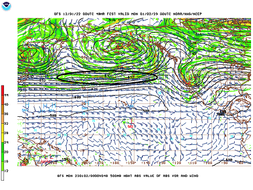
The GGEM was in fact significantly improved over the previous run cycles, wrt the general 500 mb centering on 00z Friday... Toggling shows a 2-cycle cyclonic rotation around an Ohio axis, and that's the 2ndary/emergent correction vector telling where the future guidance at least has a chance to move. I'd call this run almost as important as a direct strike solution, for the value of that trend alone. Also, we're talking about at most a moderate event - still want to be clear. At least for my contribution to analytic conjecture. It could evolve more? sure. Again again again...emphasize the relay off the Pacific ocean of wind mechanics, doing so along an impressively straight zonal delivery - not necessarily the best performing circumstance for models. Plus... there's also just all kinds of stream interplay and that can cause 'fractal' results/high complexity. But likewise and to be fair, it could smear again. I don't think it will... but we'll see. For SNE, this is the best 'looking' set up for D5 we've seen this season, for at least getting snow in the air... crazy
-
"bender" ...what does that mean?
-
Not personally too concerned about marginality after ~ 12z Thursday. Not even a little. Sorry. With the main baroclinic axis/boundary aligned S of LI by then, and a 1035 mb high pressure sprawling and well-established N ... with exertion S-E, and DPs in the upper teens as far S as interior S Maine by 18z that day? Forget it. It is vastly more likely given those synoptic inputs ...assuming the actually set in with the general cinema of this particular GFS run, would easily flop marginal into the colder side. Both in 2-meter, but there's quite likely to be 925 to 850 mb layer "barrier jet" anyway. But that's the thing...it's not really barrier to anything - as in holding warming back. The mid level wind max/DPVA are both S of LGA-BOS line, while a strong +PP/ high pressure N exerts. That should be all that's needed to be said. Models are not likely to get that at this range and/or do so with questionable accuracy at best.
-
-
same assessment over here. adding ... 00z GEFs ( fwiw) were a significant 'tick' ( as you guys call it) improved. Perhaps two or three ticks. There's spread only around the NW arc of the 132-144 hour position off the 00z. That "only" in that context is said deliberately. I've noticed in the past, if the spread is all directions, the entire envelope's value is lower in skill. This way, we argue at least a presence and go from there. But several of those members in that smear are below 995 mb, which is a new circumstance among GEF cluster. Prior cycles were unanimously weaker. The morphology of the 500 mb in the OV was also rotated more neutral. It's seemingly petty to focus, but this is threading the needle on mechanics. If the aft/trailing mechanics come off the Pacific weak vs just that much stronger has been clearly dictating whether we get .2" to .5" QPF in a marginal therm, vs the whiff. We said all along,...well, I did, that this was the first opportunity "at all" - which in spirit and fairness of what that means, no grousing if a minor appetizer isn't delivered. There's also a more of a telecon -scaled signal out there between 270 and 300 or so hours. I think we mentioned yesterday. No changes on that.
-
850mb holding in +2 to +5 (NW-SE) through SNE with a light NW flow and full sun ... If only in April. Immersion into ecstatic euphorium
-
We're punching the clock probably until 60 .. 72 hours from now. Every time that aft S/W comes off the Pacific attenuated over the previous run cycle, this happens. The straight longitudinal flow across the span of the Pac Basin is clearly causing continuity issues with the handling of that crucial contribution to that mess along the EC - it's no certainty that denser/physically realized sampling of that would make a difference, but would lean toward more confidence once that starts nosing over the land.
-
Sneaky fun aspect there ... helluva long fetch coming in by way of a impressive +PP situated ideally N of Maine. It's more impressive actually that the ensemble mean has 1038 contour... I mean we focus on the cyclonic regions but that's big. Granted the SSTs are just now into the 40s, but the synoptic air mass sourcing isn't coming from N. Atlantic. It's coming from the Canadian archipelago. That comes with other interesting value. OES being one... But but that could end up with saturated inversion flurries everywhere.
-
GGEM looks tasty for D9, too - but, actually...there's a proper telecon signal out between 250 and 300 hours. Already, 1/3 of the GEF members carry an important system through the eastern mid latitude/coastal. The EPS at 00z was also decently closing mean isobaric layouts in that range. The numeric telecon converging on 1/3 membership is a decent signal. I like that one as an early look. Maybe we can notch the bed posts with a couple sub -index scaled event before than...
-
This head cold is insane... It's just unrelenting misery. I had f'um Covid last April. I'd take that over this any day of the week. My god
-
I've been noticing that too. Interesting. It's like the data assimilation runs want to pull a Pac wave with more power dynamics, but the measured/realized sounding version don't. That's just just purely speculation based on the run differentials, mind you. Could be science fiction. Lol. But yeah, when see a better cyclone materialize and bring low/moderate goods, it's been the 06 or 18z versions.
-
It's threading in both ways. It's very marginally strong enough. And then suppose it turns out that way, it's marginal whether it is close enough. If those two were not enough, it marginal in the thermodynamics. We have to thread three needles there. lol
-
that's just about precisely where the sensitivity for this thing has been situated out there in space/time. Yup. From what I've been observing, anyway... The zonal careen of the Pacific jet is not an inherently good model performance circumstance - at least that was always the case. Distribution of wave mechanics that are entirely expressed in velocity deltas, much less in curved geometry... tends to lose features and wrongly emphasize others... I realize assimilation techniques and sat soundings have improved in the last 10 years. This modeled look across the Pac seems to be uniquely challenging, however - or I suspect it its. As you say, the trailing short wave...that's somewhere in here....good luck! There's several local maxims in there, and when looping this, it's almost impossible to tell which agglomerate into 'how much' and then gets delivered. Sort of looks like the model interpolation must estimate. And the problem with that is this is sensitive to as little as 10 or 15kts of jet momentum - could mean that trailer bends the boundary like an 06z GFS -type solution. Lol, all this writing over an event with a minor ceiling.
-
Few quick comments on the 5th-7th.. Modest support in the GEF/EPS. Not enough for thread at this time, tho get the feeling we'll likely want to watch the period intently. It's a 'relaxed flow' ordeal, not a lot of potency - it's sort of 'threading the needle' on whether it is even powerful enough to deliver. But, by circumstance ...its physical presence in the models will tend to get mottled sooner, perhaps even lost altogether by D6's - implicitly, that means it may reshow in the 72 hour window. There a several jet "maxes" moving along with the ill-defined progressive L/W. I.e., noisy. There may be room to wonder about sampling proficiency out over the Pacific -which is the focus? All of which coming off the Pac in a somewhat unusual straight W-E inject... With minor differences in spacial-temporal place within that noise, it's been varying between a mere ANA-like bulge back along the boundary (in which case QPF is likely not reaching the ground), to a 06z GFS version, which shows some more modest cyclogen and mechanics making use of a marginal atmosphere..etc. This is the bread/olive oil before the 270-300 hr lasagna.


