

Typhoon Tip
-
Posts
44,236 -
Joined
-
Last visited
Content Type
Profiles
Blogs
Forums
American Weather
Media Demo
Store
Gallery
Everything posted by Typhoon Tip
-
May obs/discussion thread - Welcome to Severe Season!!
Typhoon Tip replied to weatherwiz's topic in New England
Lol, bit more than a light shower, huh - Yeah, there was a couple of glaciated toes sticking up over that mass as it evac SE of here and I wondered if there were some cores there. Not surprised. I'm wondering if this morning spuge might leave some theta-e in 850 to 700 mb to help seed towers later? When the sun comes out - if sat is right - it will burst out with intensity because that looks like a pristine air mass immediately behind. I imagine that setting as 'summer RH b.o.' melded with lilacs and maple blossoms, and crispy tower or two. I love that phase of summer development time of year. -
May obs/discussion thread - Welcome to Severe Season!!
Typhoon Tip replied to weatherwiz's topic in New England
This happened yesterday too, or something like it... A band of what looks like an MCS only it isn't? comes racing down. It put down some light showers in the area around 2:30 to 5 pm ... and left us cleared out for a smoky sun set. Temps here went from 82 to 71 back to 76... This one is just timed earlier in the day. Looks like it'll clear pretty abruptly and go sun sear sans the smoke on the back side. That's one thing that sticks out on sat.. the smoke seems to be scoured out by that series of weak impulses perhaps. So we may rebound rather quickly if/when the bright bursts forth in an hour. But then ... does that small amount of moisture input towers later -
May obs/discussion thread - Welcome to Severe Season!!
Typhoon Tip replied to weatherwiz's topic in New England
Right now we cloudy with light rain ... heh, at least on radar. But it is sun stumped cloudy and stuck at 57 - which is above normal for this particular hour, ironically. Sat loop wants it to blow through in an hour ... but it will retard things. May have bring 'em down a few clicks if this hangs around much later -
May obs/discussion thread - Welcome to Severe Season!!
Typhoon Tip replied to weatherwiz's topic in New England
Unsure ... I'm not very familiar with the climatology in that region of the continent. Just in sketch it does seem a bit early to put up 850's in the 22 C range... However, that area has a pretty high surface sigma so ... it may not translate to the same as a 22 C would over BDL or HFD? -
May obs/discussion thread - Welcome to Severe Season!!
Typhoon Tip replied to weatherwiz's topic in New England
Yeah I’ve been watching that … wondering if another hot burst might be suggested but the antecedent leading circumstance may or may not be like 2021 i feel that anomaly is the result of the signal heat we were originally tracking for ‘after the first week of May’ back in April. Just ended up materializing there… Presently the PNA is negative. -
May obs/discussion thread - Welcome to Severe Season!!
Typhoon Tip replied to weatherwiz's topic in New England
Right ..I joked about it, '..any takers?' when that came out. as in sarcastically - all these models seem to do this... they try to take the seasonal change out of the models and end up regressing a couple ... three weeks back in climatology time ... sometimes all the way back to late winter, the deeper they are allowed to process. By day 10? spring has no hope of competing - haha. -
May obs/discussion thread - Welcome to Severe Season!!
Typhoon Tip replied to weatherwiz's topic in New England
Wiz' et al ... ..regional LIs have snuck into the margin instability range. West wind under NW at 500 mb is modestly unstable too, and upstream there are mid lvl shower clusters moving suspiciously like an MCS already.. There's also QPF dappled around the charts. -
May obs/discussion thread - Welcome to Severe Season!!
Typhoon Tip replied to weatherwiz's topic in New England
Up here along Rt 2 in N-central Ma ... It should have read 74, not 75 - didn't see that when submitting but, warm either way. Enough local home sites on Wunder all in the 72 to 75 range at 9:40 to question the machine numbers at that hour, seeing as they've been capped at 79s... We're 80 to 82 at most local sites now, including KFIT. -
May obs/discussion thread - Welcome to Severe Season!!
Typhoon Tip replied to weatherwiz's topic in New England
I mean it’s 75 now .. at 9:40, and MAV/MET cap at 79 .. 80 heh. -
May obs/discussion thread - Welcome to Severe Season!!
Typhoon Tip replied to weatherwiz's topic in New England
I would plan also on machine numbers being 2-3? shy of maxes too across all sites, today. -
May obs/discussion thread - Welcome to Severe Season!!
Typhoon Tip replied to weatherwiz's topic in New England
50 to 73 so far. -
May obs/discussion thread - Welcome to Severe Season!!
Typhoon Tip replied to weatherwiz's topic in New England
We're gonna have to hear from the robust +PNA slated to occur between this weekend and next weekend ... It's not fully committed to a summer regime - this two or three-day warm stint is kind of the synoptic/symbolic equivalent of 'fake warmth' - a nimrod expression as it is ... We're in a kind of large scale COL between a back exerting (albeit weakening) -NAO flow construct, compressing against Pacific jet. We happened to end up in a good space between. Then, May/solar processed air that despite being NW in origin ... has been sans CAA. But that stasis is ending ... it's kind of counter intuitive but the neutralization of the NAO structure ...then, the onset amplitude in the +PNAP associated with said +PNA will likely resume cold air masses passing through SE Canada. The models have been onto this for a long while. I suspect "summer" that isn't synoptic fake may be on the far side of that week's long last hurrah winter pattern trying to resist seasonal change. And it is a winter look ... it just won't mean winter cold. The other aspect is that the trough over eastern N/A is likely to be mainly chilly N of the 40th parallel. It's prooobabkly going to shallow some, not atypical for the models to back off those as they tend to be over amped anyway. -
May obs/discussion thread - Welcome to Severe Season!!
Typhoon Tip replied to weatherwiz's topic in New England
Solid 40 F diurnal spread today. Nice! 36 --> 76 boom... And, that busted MOS by 4 to 5 deg. If that's any indicator for potential, tomorrow may be sneaky quite warm. MET/MAV are both 77 to 81 between BDL and BED sites ... I think that's going to be 81 to 84's and maybe favoring the higher end. -
May obs/discussion thread - Welcome to Severe Season!!
Typhoon Tip replied to weatherwiz's topic in New England
I was surprised at the low temperatures frankly. I mean I figured it was going to be a negative (relative to climo) night across the multi-region sub-forum, but I was bit dismissive when seeing the Frost Advisory headline over eastern sections and out near Springfield, MA last evening. I was thinking that after a long May day of sun soaked Earth, and early vegetation now exploding ... and nights being short in length, that combination would offset the idealized radiative cooling ... But .... we bottomed out 36 here at 6am. That's usually good enough for car top sparkles ... but by the time I was up and about, this incredible bottle rocket rise had already commenced. It's 66 here ..so 30 F in 3.5 hrs. -
May obs/discussion thread - Welcome to Severe Season!!
Typhoon Tip replied to weatherwiz's topic in New England
By the way ... I was reading a reprint about how an unrelated experiment to sample stratosphere by researchers launching over the Tibet Plateau inadvertently discovered Tsunga volcanic Sulfur aerosols - -
May obs/discussion thread - Welcome to Severe Season!!
Typhoon Tip replied to weatherwiz's topic in New England
The increased frequency of autumn and spring seasonal lapsing is part of the CC signal. -
May obs/discussion thread - Welcome to Severe Season!!
Typhoon Tip replied to weatherwiz's topic in New England
Today is an interesting 12 hour cool snap, one that happened to coincide with this smoke ribbon aloft to perhaps limit further. Tomorrow we 70 to 73 ... I'm just wondering if this smoke ribbon is a factor - Thursday looks sneaky very warm for much of SNE ... MET's up over 80 already in the interior, and looking at the synoptic metrics ( smoke permitting ? ), I could see that more likely 84 .. 85. 850s have been rising about quarter to a half a point per cycle the last couple of days, now nearing +10C, through which there is full sun and WNW wind of 8 -12 mph (which is d-slope). EURO and GFS are bit dicey with elevated RH fields, but they were similar heading into last weekend's deep layer NW flow warm up, and how did that turn out - zip cloud periwinkle blue skies. 900 to 300 mb deep layer light flow coming over the terrain and heading down slope will tend to evolve more optimistic. -
May obs/discussion thread - Welcome to Severe Season!!
Typhoon Tip replied to weatherwiz's topic in New England
Yeah, not that you asked me personally for this but ... I'm not sure it reaches the extremeness of those GFS operational runs. There's two "model correction vectors" I bear in mind, and they are both formulated from personal observation stemming the last 10 or so years of transition season guidance performance - and also...admittedly a soupcon of climate change may be involved in that but won't get into that aspect ... The first is that the models tend to seasonal regression beyond D7's ... It gives me the impression they don't "move the chains" ? It's like the season is changing ... but they try to correct it out of the runs, out in time, and end up two weeks to a month behind climatology by the end. This seems to be the case more so in the GFS... The second is that the models tend to have an amplitude bias out in time, regardless of season ... -
May obs/discussion thread - Welcome to Severe Season!!
Typhoon Tip replied to weatherwiz's topic in New England
Any takers on the D10 Euro blue bomb -
May obs/discussion thread - Welcome to Severe Season!!
Typhoon Tip replied to weatherwiz's topic in New England
Uh oh ....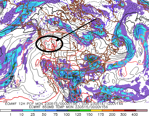
-
Occasional Thoughts on Climate Change
Typhoon Tip replied to donsutherland1's topic in Climate Change
https://www.nature.com/articles/s41467-023-37554-1 "...This suggests that everywhere needs to be prepared for a heatwave so extreme it is deemed implausible based on the current observational record..." -
Occasional Thoughts on Climate Change
Typhoon Tip replied to donsutherland1's topic in Climate Change
There are early 'winds' of El Nino claims already. However, I'm not sure the dots can be connected so easily. As I recently brought to the attention of the forums ( https://climatereanalyzer.org/clim/sst_daily/ ) ...there is a separate global-scaled phenomenon that has recently taken place with regard to oceanic surface temperatures. And so as usual ... since site above was published the skeptic bugs have been scurrying around for kernels and crumbs of instrumentation suspicion for a variety of usual motivations, ranging from personally seeking an audience, to an agenda to offset the implications as an ongoing effort to evade the truth - Let's hope they are right this time, because as an aside, ... in order to thermally move the Terrain oceanic en masse upward by 2/10ths of even a single deg C, is something on the order of incomprehensibly large. Incomprehensibly large usually doesn't end well regardless the type of competition. The scales are not really tenable to the average Humanity. ... Not wanting to go down the rabbit whole of denial reasons, the most common one is because the tenability of concepts isn't there. Minds cannot occupy that which is too far beyond dimensionalizing in most cases. Anyway, I suspect it is likely to be misconstrued and blamed on El Nino. But of interest to me is that this phenomenon will likely pose challenges to furthering deeper analysis efforts. The entire arc of ENSO monitoring --> relates to the climate forcing, cannot be so readily presumed. We can spend 10 years gathering data ... formulating hypothesis, testing said hypothesis, and then writing papers to expose the results proving what we already suspect to be true up front: if the oceans verify as indeed having risen temperature unilaterally like that ... the El Nino physics are concomitantly going to be less effective in forcing the climate. Something like arithmetic thinking immediately would argue that El Nino is going to be subsumed by that phenomenon - a concept I was just warning about elsewhere on the forum ... So, seeing you muse above ( bold ) ...well? Yeah. But it wouldn't be (likely) completely subsumed either. It's a matter of budgeting gradients in the system. If the El Nino occurs, but the mid latitude oceans are so warm already ... it does not create the same amount of gradient. The simplest mechanism that starts the whole ball of wax is how much of A --> B If B is already large, ... less A --> B. If less A --> B, that is expressed by less impact. That's everything ... air moves on this planet because A --> B. If A = B... A no longer moves to B, and there's nothin' -
May obs/discussion thread - Welcome to Severe Season!!
Typhoon Tip replied to weatherwiz's topic in New England
Look at the difference between the 0z euro and the 12, and they are completely diametric at the end of the respective runs. I mean it’s not saying much of day 89 and 10 no - there’s a lot of volatility … more so than normal, even for the extended 0Z threatens an over the top classic northwest scorching heat conveyor. The 12 Z? Deep freeze coming in the back door. -
May obs/discussion thread - Welcome to Severe Season!!
Typhoon Tip replied to weatherwiz's topic in New England
Not sure ... Ensembles were ugly after mid month. I've seen noodles as late as circa May 20 - once while living in Waltham back in ... 2001 I think it was. -
May obs/discussion thread - Welcome to Severe Season!!
Typhoon Tip replied to weatherwiz's topic in New England
.. I guess to each his own... today is like the perfect soothing swimming pool. It's slutty nice... We'll end up around 75 over DPs and air quality that challenges a Svendsen for purity. I also admit to a subtle bias re last month. I knew that it would likely ... inexorably ( if not even cause ) the last 2.5 weeks of Labrador anal inconitnents. The whole time that week I was not appreciating it because of that foresight, probably one of my most spectacular long range visions actually . The nights were also annoyingly chilly back then. You know what really stood out for me about that was the extraordinary diurnal recovery - it was a bona fide phenomenon. Sort of a loosely defined personal record. I mean I've seen 55 F deltas over 24 hours from crazy synoptic scenarios. But in terms of straight up sun over a nocturnal start, going from 35 to 92 that one day there was ... something I do not recall ever witnessing.


