

Typhoon Tip
-
Posts
44,236 -
Joined
-
Last visited
Content Type
Profiles
Blogs
Forums
American Weather
Media Demo
Store
Gallery
Everything posted by Typhoon Tip
-
Heh...just glanced over the Premmie cimo sheets and most sites are well above normal for June so far. lol. certain to change once today's poison gets in the punch. Yesterday's bootlegged midnight high made the neggies seem almost manageable. It's like this whole ordeal's trying to hide while it rapes
-
You may be right about him ... .however, he is also right about you. You're taking a sky light shot then posting as though it defines 'the day' when the satellite and other data sources do no support that, which thus comes off as mmm a 'little' disingenuous honestly. By the way, there are bands of showers pressing SW and may be there before the end of the afternoon.
-
Yup - monitoring that... Very tentatively so far but that has the look of a hemispheric sea-saw into a regime that hosts more in the way of 'big heat' type. Not these 91/48 kind of "fake" heat bursts. That's wholesale change, and is also statistically rooted in a coherent index mode change. The daily model grind seem oblivious to it - perhaps only for the time being. Fits the compensation model to get us back to (climo+ cc)/2 ... in more of a spatial sense. The "synergistic heat wave" are another level above, but they come along with that suggestion as a wild-card, however utterly invisible at this range.
-
Hmm ... nah, prefer "hence, not eating all the Labrador anus vomit, just some of it" lol
-
Tough call... It's subjective, I know - even if the day sucks, some denial and spin will take place ... But, I do see a little hope from about HFD-EEN west related to the intense June sun modulating the atmosphere and blurring the boundary between this cut-off stalled coastal cyclone vs the better airs west of New England. What you'll have to overcome is that this is retrograding - literally.. It's moving W, en masse. That may compensate for some of that 'erosion' aspect I just described above. Either way, everyone is till in the grips of this unusual winter like not summer and no reason to claim it is pattern - just to be clear. It's a matter of how much or how little. The real freedom is west of Albany.
-
Not entirely sure what the boreal summer AMO correlation is to pattern tendencies... In the winter, theAtlantic tripole is correlated pretty brightly to the -NAO bias. That layout up there is pretty clearly in dipole, and is actually correlated to the +NAO, which is the warm phase ( obviously...). With the wave lengths shorted/ R-wave order a bit less coherent in summer, not sure if either (-) or (+) phase biases in the NAO have the same correlation to eastern N/A escape latitude of the westerly main axis. That all said ... I tend to lean in favor of significant heat ( above the back ground climate signal) this summer east of 100W Most folks in here care more so how this shit correlates to winter...understood. Aging this summer into autumn through a +NAO bias is interesting if/when a warm ENSO erupts. For one thing, +NAO is correlated well with recurving hurricanes (Lance Bozart et al.), which warm ENSO ... don't exactly deny the hurricane season on the Atlantic side but it doesn't correlate very well. There's also a QBO consideration there that's important not to miss. Anyway, it seems the polar index year might be positive as it gets involved into the cold season. The space weather factor, good ole sol, is ultra-violet hot. That and the QBO, they are out of phase with -AO... ( the causal link is the W phase of the QBO vs E modulates the spatial orientation of the AO domain space ..geometrically enhancing(reducing) the mode.) Wait..check that with the QBO - we might be heading toward a phase reversal? It would not be a treat for many over eastern N/A mid latitudes if we end up with a +AO winter whilst a STJ starts pushing tulip shoots 10 minutes ( sarcasm) after the winter solstice. The other aspect I'm playing with ( for good reason) is that the El Nino's physical forcing on the mid latitude R-wave distribution is different now due to climate change - it is best perceived - hence why increased spans of time of apparent resonance disconnect/decoupling wrt to R-wave. In some respects, we have to leave more room open to the possibility of winters just simply not behaving like the climate/statistical history inferences argue it should - those historic climates did not have climate and change happening when they occurred, so the correlations can't be the same. That's just rudimentary logic -
-
Point is ... you either accept our climatology/get real, and therefore considering where we've been ... figure we're batting in all-star range right now. Or, you're unrealistic and your expectations are full of crap. ...up to you... I realize I'm finger wagging at the straw-man, just sayn'. I've seen it worse in June though, btw - It's barely June. It's like blaming the child prodigy because they can't play sports with the other college kids. I bet this month ends up above normal - any takers?
-
I mean in terms of quota ? we're not fairly hurting - no way. That was like a 9.8 Mem Day Weekend ... The return rate on having all 3 days rate -able so high, unperturbed like that is probably 30 years or something... Pretty sure no one thought of that statistical oddity there. And the week since only had the modest cool shot on Tuesday but we quickly recovered and nary missed a heat wave by a day - at least here. Thur and Frid were both 92 and 93 respectively. So it's shitty today. Wahhhhhh ... cry me a river.
-
The models have come a long way ... seein' as they now can detect the actual Labrador anus
-
Fairly significant heat signal materializing beyond next week.
-
I was wondering about that this morning.. .how it compares to the 2021 4th of July weekend of the damned ... Wasn't that Saturday, July 2nd in the upper 40s ? I was thinking that 2021 scenario was actually closer to the sun's perennial zenith. I wonder what the coldest solstice high low /diurnal mean actually is. I recall ... 2001 I think it was ( so I guess I don't recall very well ha!). I was peering out the 3rd floor of my apartment window over Chestnut street below, living in Waltham .... that May 19th or 22nd ... it was like literally a month from the solstice, and there were white rain globs going passed embedded in the sheets of upper 30s rain. It was mixing with bow-tie pasta
-
Yeah, and I'm being deliberately mocked by the models. LOL ... soon as the post happens, the new run goes out of its way. I was being somewhat sarcastic in that last missive ... but, it was based upon actual model depictions - like I said though, maybe they'll be wrong? The 12z NAM is hugely different for Monday now. Suggests clearing with the onshore flow cut all but completely off. ...seems to parlay into a warmer Tuesday in that cinema. Meanwhile, the cyclonic flow structure aloft persists ... maybe. heh...NAM beyond 24 hours doesn't inspire much confidence either way I suppose.
-
mm... provided we raise the hydrostatic medium below the ~ 750 mb level. This thing the models are structuring isn't a cold pool towers by 11:30 am type of look - at least not to me. It's a perpetuating NE flow of uber stable cold Labradorian ejecta. The ocean/Maritime source is a problem for that 'cold pool convection' idea. For obvious reasons... But .. the models could too pessimistic and/or just wrong about how the lower tropospheric vectors lay in. We'll have to see.. but for now, this has sort of a mock 2005 May appeal to it ...at least for the next 5 days ( yikes! ) The present severing 500 mb attempts to move away, but we dump in a fresh new N-stream turd over the next day, and that plunks down in to capture the lead. The whole thing deepens and retrogrades... In 2005 that exchange happened in perpetuity for 3 weeks and gobbled nearly the entire month. it was literally between 39 and 50 that entire span as a back carving retro 'great blue spot' locked in. Not saying it's the same scenario this week, but it can be "too much" to allow a cold pool with a lower level underneath that is very capable of becoming diurnally unstable like your imagining there . lol... nope. No convective salvage. Just enjoy the Labrador butt bang
-
yeah... this oughta send 'im up to at minimum, the lower 60s but quite possibly even 70, huh
-
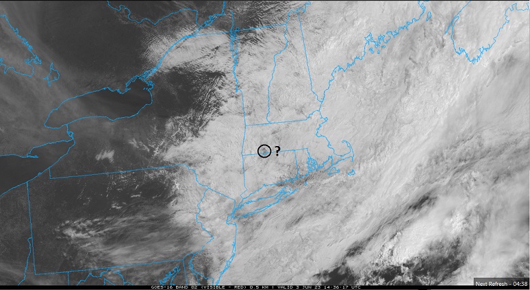
Not to be too priggish but ... it was really more of a 'hybrid front.' More of a backdoor phenomenon down the coast S of here - if that makes any sense. Typically ( for the general reader ... ) the S/W cuts SE out of E Quebec ... more often times, barely denting the non-hydrostatic gradient over us ... as it sweeps past up there. The front that results beneath really doesn't look physically like it should even be there. But that's when/where our local geography dooms us... Typically there is a NW flow type at mid levels as the above S/W slips past. That is flow is lifted over the Dacks/Greens/Whites general massif ... and than passes as an elevated wind max that becomes slightly imbalanced in the lower elevation nadir east of said elevations ... as that lower eastern region fades to sea level (where cold Labradorian water mass and cool dense slab of air is just aching for a reason to move west ...) That induces a vector pointing back SW or W ... Now imagine if the above S/W in our example triggered a front to move back SW. That happens everywhere, anyway ... These fronts have a backward wash momentum - it's just a matter of how much so. Just look at the current sfc layout from WPC this hour, and it's trying to move SW toward Michigan ( the main frontal axis). But if we superimpose that type of momentum over the top of the above geographic/geo restoring tendency, that's what drills the "real" BD scenario. It's really more of a "meso beta scaled" event, as the synoptics are smaller then continental and confined to just our region ..etc ... where the "pure" BD mechanics create the momentum. This thing is tied into a wholesale mass-field jolt retrograde - actually one of the faster I can recall - different conversation. This was more a straight N-S cold front that would have overwhelmed all those other mechanics. But I think of it as a hybrid, because it is shallowing out ... and will end up being a BD down toward the mid Atlantic. Either way... 93 to 53 is a straight 40 point correction in 24 hours. It's a whopper synopstic ordeal. Evidence of this latter can be seen in guidance, where this thing isn't a one an done thing. They're trying set up a 10 days pattern with this cold local hemisphere anomaly.
-
Haha. Scott trying to lure Kevin out of cover …
-
heh ... the NAM's last couple of cycles buckin' for 60+ straight hours of 0 deviation from 53 F and 0 deviation in cloud cover and 0 deviation of wind direction.
-
yeah..it's sort of why I've been hedging... among other reasons, but that 'correction climate' is there. But as Scott nicely pointed out there ... this is higher end anomalous hemisphere so we have to unfortunately reconsider the lesser likely results, too.
-
may sound kinda to suggest but ... I kinda like the NAM's idea on this 12z. in simpler respects it's kind of a compromise. The upshot is that it's not the whole weekend ... it's shitty tomorrow, but sunnier on Sunday. Oddly chilly on the coast/shore exposed ... with wind.. but it may make the upper 60s to near 70 out by 495 ...etc that day. Doesn't help sore thumb SE zones, no - just sayn' I mean if the models are going to be right about bullying in that new N stream raging boner idea next week, it's gotta bump the weekend's thing right along. I don't buy the Euro's notion of stalling the lead and waiting for the latter ... to phase and destroy the rest of the entire summer straight through to Thanks Giving before finally switching to a ridge -out pattern that last through next April... and ... oh, wait. heh. No but I'm also wondering if next week's thing starts to normalize some.
-
93 here … But I live kitty corner to a brick and mortar town center
-
I bet that other trough dive next week does the same damn thing too
-
Wouldn’t be shocked personally… I’ve been an advocate for trending that whole mess east. It may not do that, but I’m just sayn’ Actually, the 18 Z NAM has clearing RH levels by early Sunday and Sunday afternoon probably gets up into the low 70s out by 495 in middle Massachusetts. Watch this end up just being a standard BD piece of shit boring uninspired waste of a journey. I mean it would’ve been an interesting up shot if all that other anomalous crap happened. Lol
-
It appears to be alone with as much impact …
-
Heh Id call that a move toward a June nor’easter jesus
-
Occasional Thoughts on Climate Change
Typhoon Tip replied to donsutherland1's topic in Climate Change
This is an interesting paraphrase/study... https://phys.org/news/2023-05-emissions-pandemic-climate-reveals.html It's in deference to an actual article written in "npj Climate and Atmospheric Science" , which is contained ... The gist covers the effectiveness of 'greenhouse effect masking,' caused by in situ aerosols. The 2.x year reduction in global industrial emissions during the Pandemic, exposed a reality that without aerosol, the heating potential is greater. It quickly generates an argument in my mind that ( among others...) about the dangers of "shock reduction" ... You know, as a metaphor ( and 'think' we've brought this up in here many many songs ago, anyway - ) it reminds me of an alcoholic checking into a rehab. Detox can't happen all at once, because the shock can kill.


