Typhoon Tip
-
Posts
44,835 -
Joined
-
Last visited
Content Type
Profiles
Blogs
Forums
American Weather
Media Demo
Store
Gallery
Everything posted by Typhoon Tip
-
May 2024 Discussion - Welcome to Severe Season!!!!
Typhoon Tip replied to weatherwiz's topic in New England
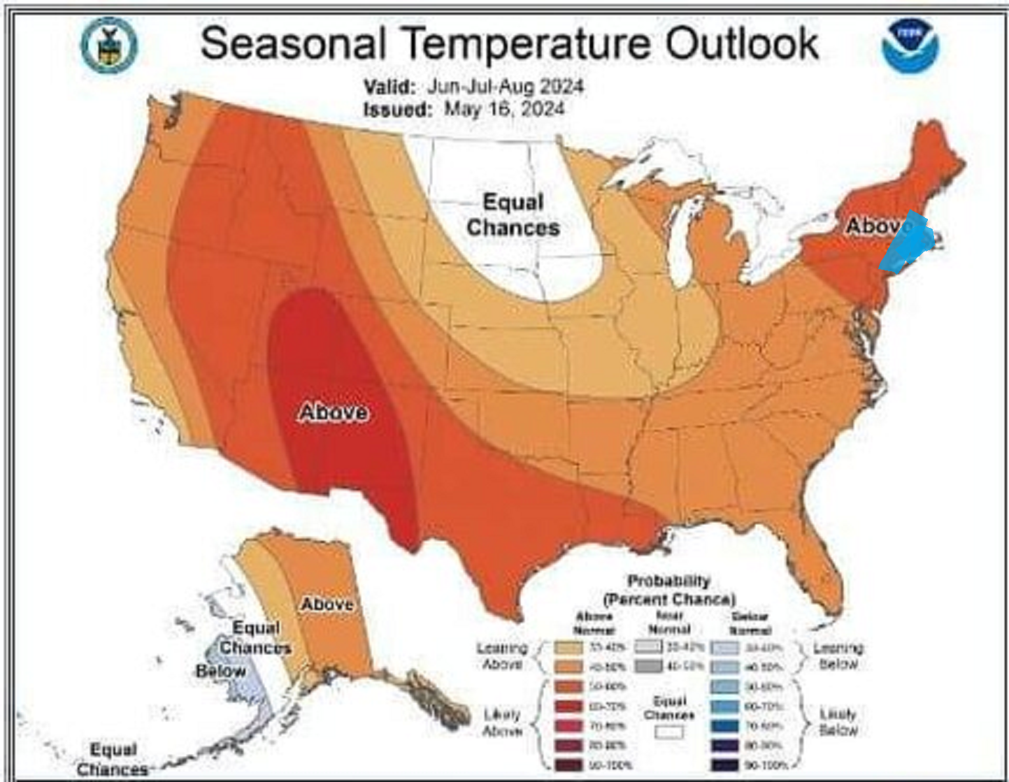
Fixed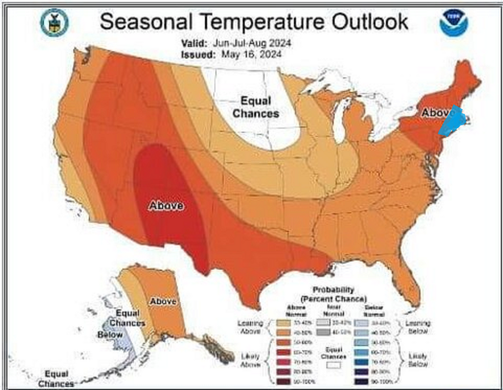
-
May 2024 Discussion - Welcome to Severe Season!!!!
Typhoon Tip replied to weatherwiz's topic in New England
It's almost like the GFS' physics cause these analogous 'Jovian' like fixed spots. Vortex modes, and the rest of the atmosphere just starts moving around them. We happen to be stuck with one SE of L.I. ... Not saying its even wrong, necessarily. There's currently a festering llv gunk low there this morning, helping to send <700mb slab back west into the region. It seems to be all but entirely uncoupled to the mid and upper air synoptics. Something about the llv mass field circulation medium is forcing that interesting -
May 2024 Discussion - Welcome to Severe Season!!!!
Typhoon Tip replied to weatherwiz's topic in New England
That's a bit different circumstance, though. The Euro I was using to commiserate was D8.5 This above is typical of the GFS at that range. ... just humoring a 372 hour chart for a moment... It seems like a transfixed result of the model, where out around further ranges it (perhaps) loses all other driving forcing ... allowing the underlying Labrodorian cold climate sink as an actual atmospheric footprint. I mean really, just imagine for a moment we remove the land from the map, that's indistinguishable from a the Labrador current's cold SST termination waters. Which by the way, that depiction is colder than the current, too. It would have a cold offset regardless of its own rancid low. ( That latter fact sometimes makes me wonder if it is exposing some of the modeling strategy at NCEP where they may in fact be initializing grids based on climate. The Lab current has been notably getting warmer in the last 10 years in particular ...etc. ) Not just with that aspect. I've noticed the GFS is the wrong model - always - to ever detect heat at extended leads. It's like they templated the model to hide CC LOL ( little sarcasm there..) -
May 2024 Discussion - Welcome to Severe Season!!!!
Typhoon Tip replied to weatherwiz's topic in New England
Nothing like a deep coastal nor'easter while the rest of the planet undoubtedly puts up another hottest month ever - -
May 2024 Discussion - Welcome to Severe Season!!!!
Typhoon Tip replied to weatherwiz's topic in New England
Frankly it looks like all models were festering that low level grunge low E of NJ, while S of modest +PP layout over NS - hold just enough differential static for 2 days it sends pulses of low level Labradorian ass vomit all weekend long. I'm like ... really - They weren't ever ideal for the weekend in prior runs, but they're coalescing around that idea now doesn't seem like physics. LOL. And this is infuriating looking ... because it's hard to find any kind of mid and upper support for that "anchor" low. And it's not even deep. It's like 1009 mb ... barely lower than standard sea-level, yet it keeps us in the 50s ... I gotta say though, we were supposed to be locked in the 50s in the 2-meter progs from the Euro, yesterday, yet we had a gorgeous sunny mid to late afternoon into early evening and temps recovered to 70 for a high. It's probably grasping for hope to say so but it could be a prelude to these models over doing it. It's really sensitive around here.... the ocean being 44 F while the 850s over land support 72 makes for some whiplash error potential. All depends which 10 minutes of W or E wind is in place. -
May 2024 Discussion - Welcome to Severe Season!!!!
Typhoon Tip replied to weatherwiz's topic in New England
I'm getting an estimate at the end of the month. It's not just about the installation. That too, but mostly it's about a fraction of the per annum energy cost to heat and cool the edifice of the home. Plus the sound controls. Jesus. Install A.C.s that don't sound like an emissions control test at an aeronautical proving ground cost a lot, plus are less efficient to even run. In the winter, my house has electric base board heaters. redic -
May 2024 Discussion - Welcome to Severe Season!!!!
Typhoon Tip replied to weatherwiz's topic in New England
low/non-zero probability for 89.5 type heat wave -
May 2024 Discussion - Welcome to Severe Season!!!!
Typhoon Tip replied to weatherwiz's topic in New England
Sky's lightened some here... looks like dim sun is cleaving through the easterly anomaly across southern NH just to my N. Probably that opens up as the initiation of this thing breaking down. It'll take the day down near the Pike and S.. but maybe some improvements along Rt 2 and N during the afternoon -
May 2024 Discussion - Welcome to Severe Season!!!!
Typhoon Tip replied to weatherwiz's topic in New England
Oh no way. I grew up meteorologically in the 1990s, when the models were amazing compared to the 1980s... By present era standards? the 1990s are neolithic. We were taught in advancing dynamics ....back when the dinosaurs roamed ... that there is a 'predictive horizon' to this modeling tech. It's basically just where the statistical results fall below significance to the purpose. It was, at the time... still beyond the technology of the 1990s, which really couldn't see very well enough to matter beyond 5 or 6 days ( although there were rare times when extraordinary events would show up at D10 and stick ). By today's standards, that horizon has been pushed out D8 or 9 ('m not sure what these horizon values are in use-case; I'm just using these numbers as examples). These D8 .. 9 are somewhat more reliability when combining huge advancements of computing speeds, increased input data density, with other key metrics - to mention also experience. You can increase the odds of success in that range by some 20 or 30% - where in 1995 D7 had 5% ... now has a 25% ..etc There is however a kind of 'absolute predictive horizon,' a temporal boundary whence the inevitable collection of random permutations aggregates too much reciprocating influence, and the system's coherency gets irrecoverably effected. It's an unintended consequence of all complex systems in nature - systems are ultimately not allowed by nature to remain in stasis. There is always drift - just a matter of how much so, and when... I mean, where do we think cancer comes from ? You know, it's an arresting momentum to be informed by ones doctor, 'Did you know that all human males WILL end up with prostate cancer, period. It's just a matter of whether they out live the inevitability.' This is really true for all cancers - more generic to say ... true for all complex systems to flounder. In the context of cancer, genetic mutation from billions of RNA sequencing and re-combinatory mechanics. It's a matter of time. Chaos as a product of time and opportunity cannot be avoided. In weather modeling, it's two process of spontaneous emergence: the models have to deal with their own, yet the atmosphere they model is also emergent. Those emergence' are mutually exclusive. That widens the gap further. Ultimately it doesn't matter how dense the input grid and the speed that is available in order to crunch all that data - emergence of randomness in time is a factor that will always corrupt an outlook. We're probably still not quite there even in 2024. But we are more than a hair better than we were in 1994. We ultimately can't sample every quantum state of every quantum point, simultaneously, with exacting precision - that is intrinsically impossible, as Heisenberg ..et al showed us both mathematically, and empirically that is demonstrated to be the case. You know, the more precise the measurement, you start gaining uncertainty - it's not altogether very intuitive for most. But really, all of nature and reality itself is a result of probabilities. Imagine where we'll be when AI ( and there's a new coining expression called Super AI - think next gen(s) ) is sistered to practicum quantum computing cores? I think the absolute horizon is "probably" found there. -
May 2024 Discussion - Welcome to Severe Season!!!!
Typhoon Tip replied to weatherwiz's topic in New England
It kinda 'suggests' that the GFS, with its apparent hypersensitivity in creating/emerging all these gnats and rogue perforations that undermine ridging ... yeah, it's probably too sensitive, but the physics 'sensing' this sort of oddities - this is one of those perforations. It's not completely useless in that sense. -
May 2024 Discussion - Welcome to Severe Season!!!!
Typhoon Tip replied to weatherwiz's topic in New England
yeah I've getting some some of that too. Open a window, breeze rolls in, cough cough - the response is that quick. -
May 2024 Discussion - Welcome to Severe Season!!!!
Typhoon Tip replied to weatherwiz's topic in New England
Yeah... it's probably more fortunate for a lot of the children than the children are grown up enough to understand, that it actually rains after a stretch of fair weather and lower DPs. haha -
May 2024 Discussion - Welcome to Severe Season!!!!
Typhoon Tip replied to weatherwiz's topic in New England
this system is actually rather unusual. there's almost no support above low levels for it's mechanical existence. the strongest winds are associated with the 850mb parked just S of LI, with an easterly anomaly tube running straight over S zones... meanwhile, the velocities get progressively weaker as you go to the 700 then 500 ...etc. In fact, 5 to 10 kts at 500 mb. It's odd that this thing is so basement loaded like that, while still being a cold core system associated with the westerlies. Where's the mid and upper level divergence/q-g forcing..? etc.. -
May 2024 Discussion - Welcome to Severe Season!!!!
Typhoon Tip replied to weatherwiz's topic in New England
Rain is not a bad thing after 2 consecutive days of AN and low DPs -
May 2024 Discussion - Welcome to Severe Season!!!!
Typhoon Tip replied to weatherwiz's topic in New England
you can sense the models are trying desperately to f it all up though. they'll probably fail ... but they have 850 mb temperatures capable of 80 from really Saturday through next Friday, but limit highs to the mid 70s on a lot of those days. From what I can tell, it's all cloud production/RH at 700 thru 300 mb being perfectly wrongly timed. Sunday, the Euro and Icon have all of a scant 1 to 2mb of +discontinuity between GOM and NYC and use it to keep it 62 F clear to Albany. It's probably the earliest hints of the new summer steam bath, capped high Ts, but super elevated low, black mold paradigm we've been getting as a repeating theme in recent summers. just waiting for the canonical western heat bulge of summer to cause a permanent nadir/theta-e cess pool over the east - -
May 2024 Discussion - Welcome to Severe Season!!!!
Typhoon Tip replied to weatherwiz's topic in New England
Right right ... now all we have to do is actually get it to be warm - or at least keep things that way long enough to not be gipped -
May 2024 Discussion - Welcome to Severe Season!!!!
Typhoon Tip replied to weatherwiz's topic in New England
18z GFS… if we’re going by the 500 mb geopotential height cinema alone that looks like a very warm pattern but as usual the model smatters all kinds gunk that keeps the temperatures muted and the hydrostatic hgts from expanding. Some of that is undoubtedly error, but how much- even half of that gets cleaned up we’re gonna sore into the 80s -
May 2024 Discussion - Welcome to Severe Season!!!!
Typhoon Tip replied to weatherwiz's topic in New England
That ‘ bouncing around ‘ kinda makes me wonder if it even happens. Sometimes the model’s trigger when there’s potential, but the triggers themselves are erroneous. A clue when that is going on is that spraying solutions all over the board with poor continuity -
Occasional Thoughts on Climate Change
Typhoon Tip replied to donsutherland1's topic in Climate Change
Yeah... "alarmist" seems to be becoming a term by 'people of a certain perspective' that allows them to automatically assess dismissibility. There are certainly times when 'cry-wolf' tactics are counter to protection and incomparable. CC as an agent of harm, is not one of those. If even one failed study out of the ginormous (and growing ) compendium of empirically based, objective science, occurs, the example is cited with jackhammer repetition as like - The only thing it does is expose a bias to not agree with the science without any willingness to to be objective about it. -
May 2024 Discussion - Welcome to Severe Season!!!!
Typhoon Tip replied to weatherwiz's topic in New England
This is good... We appear to be slated to receiving an inch or so of beneficial rains - whether the models are doing so or not. After a couple of warm days with relatively lower DPs, it's value add. Mid week, too ... when it is by and large less important to salvage outdoor time. Question is, do we end up more optimistic for the weekend? -
May 2024 Discussion - Welcome to Severe Season!!!!
Typhoon Tip replied to weatherwiz's topic in New England
Your breaks have moved NW - or repositioned. We have some dull sun eyeballin' thru. It's sent the 65 to 71 in the last half hour. Today shows that this isn't a 'cold' airmass. It's really still quite mild in the vertical. It'll be like that through this scunge patter we're in for the next couple of days. Any sun here or there and the T's pop. 10 days ago, this would be 44. -
Occasional Thoughts on Climate Change
Typhoon Tip replied to donsutherland1's topic in Climate Change
heh.... humans as dogs - tongue in cheek analog that offends some people. I actually read an article that outlined why ours differential, coming off as more important. Just sounded like 'prominence righteous' ultimately rationalized bullshit, missing the bigger point Cocker Spaniels to Dobermanns, to Poodles, the Boxers, Terriers ... Retrievers Caucasian, Mongoloid, Negroid, and Australoid, within which there are no doubt sub-classes that our species' (also) charming ability for hyper-classification gets all offended if you don't give credit to - proving their own 'racism' for reacting ... But they are ultimately just subtle genotypic and phenotypic variations, like that which makes a Poodle look different than a Retriever. -
Occasional Thoughts on Climate Change
Typhoon Tip replied to donsutherland1's topic in Climate Change
Folks should curl up with a cup of coffee and a slow and discerned reading of Yuval Noah Harari's wonder-history, "Sapiens" The book is fantastically simplified for proletariat consumption -ha, meaning, it's not in PHD verse, but is in a language that's accessible to most. it about 450 pages, starting some 700,000 years ago ... it spans the entire spectrum of our evolution, elaborating both explicitly and implicitly how feed backs from innovation along the course of evolution changed our destiny - qualitatively, the verdict still not settled seems tongue-in-cheek, too. Among a spectrum of aspects, one will take away a pretty strong intuitive understanding, and of the fact, that economics is not indigenous to nature. It is merely endemic to humanity - it is ( at this point ...as we all know ) but a social construct with no intrinsic value or physical connection to those forces that construct reality - i.e, physics..., like E-MC2, PV=NRT, Quantum Field Theory, nor the principale of the greater overall Mathematical compendium used to describe reality. It is, for lack of better phrase, a fantastic delusion. Harari uses the invention of religion as a means to demonstrate how/why economics actually can exist, such that humans 'successfully' carry on with it. The 'faith in the dollar' is the same in California, as it is in Massachusetts, and all interstices activities in between, binds the entirety of the 300,000,000+ souls considered to be a part of the America dream and census; thus, all may function in relative cooperation. But it is, in end, all based upon an arbitrary agreement of value. And most importantly, an ability among all humans to do so that came about really just inside the last 10,000 of evolution. Oh the rudiments of capacity to do so ... probably had arrived on the genetic road map long before; as those things go ... circumstance would come about that favored tapping into the ability. He goes on about the Sumerian civilization and the first cuneiform ledgers, the earliest known physical recordings of economic transactions - hugely primitive compared to AI -driven triggers on Wall Street some 4,500 years later, no doubt. My point to all this is that, economics is a very, very recent innovation in human evolution. Whenever the rudiments of that capacity to engage in the necessary group psychology of economic values came about, that is less important to the innovation of systemic codification. Driving ultimately the mechanization of profligate extraction of natural resources. Not until almost immediately aft of present day Sapiens existence did that take place - For that... despite al conceits, from pleb hardship to country court yard lilac blossoms and everything in between that we afflict on our selves in the name of it, economics is an experiment. not when considering that human paleo leap that began 700,000 years ago, and would take 99% of that time just to get us to Sumeria ... and .0009% of that time to get us to the Industrial Revolution ... ultimately, today's ways and means. There's no way any feed back from the innovation of anything, let along the invention of economics, has been sent through the crucible of evolution. Mind you ... light skin variants of SLC24A5 and SLC45A2, roots of caucasoid, were only present in Anatolia by ~ 10,000 years ago. Part of the so-called Neolithic Revolution. And we're still struggling with race to this day. -
May 2024 Discussion - Welcome to Severe Season!!!!
Typhoon Tip replied to weatherwiz's topic in New England
Actually the 00z ICON looks like the Euro for the weekend, fwiw. basically, the GGEM/GFS are smudge happy for days. The Euro and ICON are at least dry. It actually wouldn't be a bad thing to get some beneficial rains tomorrow, but it looks like light showers to me. The NAM's 00z/06z trended S ...now just grazing the region with what probably amounts to not completely even wetting the streets type sprinkles. -
May 2024 Discussion - Welcome to Severe Season!!!!
Typhoon Tip replied to weatherwiz's topic in New England
SE zones enjoying a meso-beta scaled sun hole. Surrounded be a rampart of clouds, but looping shows it's holding out. Ha. Can't imagine that's ultimately very sustainable - it's like the General Custard morning